
With the rapid proliferation of consumer-grade unmanned aerial vehicles (UAVs), the phenomenon of unauthorized or malicious drone operations—commonly referred to as “black flying”—has become a growing concern for critical infrastructure security. The flexibility, low cost, and ease of operation of these drones introduce significant risks to power systems, including espionage, hazardous material delivery, and accidental collisions. In response, the Tingzikou Hydropower Plant has developed and deployed a dedicated UAV countermeasure system to enforce strict drone regulation within its airspace. This article presents my firsthand experience in designing, implementing, and evaluating this system, which integrates state-of-the-art detection, deception, and intelligent control technologies to mitigate low-altitude threats while supporting advanced inspection platforms such as 5G underwater robots.
The need for robust drone regulation in power facilities is underscored by numerous incidents worldwide. For instance, in 2015, China’s State Grid reported over 15 UAV-related disruptions, causing substantial economic losses and safety hazards. The Tingzikou plant, situated along the Jialing River, serves as a critical node in regional power transmission. Its large dam, switchyard, and auxiliary structures are vulnerable to drone intrusions. Traditional ground-based security measures fail to address aerial threats, leaving a gap in the defense posture. To bridge this gap, we deployed an active low-altitude security system that provides 24/7 monitoring and neutralization capabilities, ensuring compliance with evolving drone regulation standards.
System Architecture and Components
The UAV countermeasure system comprises three primary platforms: the detection platform, the countermeasure platform, and the central intelligent management platform. Each component is designed to operate synergistically, enabling seamless drone regulation across the entire plant area. Table 1 summarizes the main subsystems and their functions.
| Platform | Component | Function |
|---|---|---|
| Detection | Radio Frequency (RF) Passive Detection | Capture and analyze UAV communication signals without emitting energy |
| Detection | Cognitive Radio Protocol Analyzer | Decode proprietary protocols (e.g., OcuSync 2.0) for precise identification |
| Countermeasure | Fixed Navigation Spoofing Unit | Generate falsified GNSS signals to mislead drone positioning |
| Countermeasure | BeiDou Time Security System | Replace GPS-based timing with secure BeiDou signals |
| Management | Intelligent Command Platform | Unify detection, tracking, and countermeasure operations with black/white lists |
The detection platform employs passive RF sensing technology, which listens to the electromagnetic spectrum without emitting any detectable signals. This passive operation is crucial for covert drone regulation, as it avoids alerting the drone operator. The system uses advanced cognitive radio protocol analysis, a technique originally developed by organizations like the U.S. Department of Defense, to decode even encrypted communication links. For example, the DJI OcuSync 2.0 protocol, used in many modern drones, can be precisely identified down to the individual electronic fingerprint. The mathematical foundation for signal detection can be expressed as:
$$ \mathbf{r}(t) = \sum_{k=1}^{K} \sqrt{P_k} s_k(t) e^{j(2\pi f_k t + \phi_k)} + \mathbf{n}(t) $$
where K is the number of detected drones, Pk is the received power, sk(t) is the modulation waveform, fk and φk are the carrier frequency and phase, and n(t) is the noise. By applying matched filtering and protocol-specific correlation, the system extracts the drone’s identity and trajectory.
The countermeasure platform centers on a navigation spoofing system that transmits falsified Global Navigation Satellite System (GNSS) signals. Instead of jamming, which disrupts all GNSS users, spoofing selectively deceives the target drone into believing its position is elsewhere, effectively driving it away from protected zones. This technique is far more surgical and aligns with modern drone regulation philosophy: neutralize threats with minimal collateral impact. The spoofing signal generation process can be modeled as:
$$ \mathbf{S}_{\text{spoof}}(t) = A \cdot \mathbf{C}(t – \tau_{\text{spoof}}) \cdot D(t – \tau_{\text{spoof}}) \cdot \cos(2\pi f_c t + \theta_{\text{spoof}}) $$
where A is the amplitude, C is the pseudorandom code, D is the navigation data bit, τspoof is the deliberately delayed code phase, fc is the carrier frequency, and θspoof is the synthesized carrier phase. By carefully adjusting these parameters, the target drone’s onboard GNSS receiver locks onto the spoofed signal and follows a fake trajectory, thus fulfilling the goal of drone regulation without destroying the UAV.
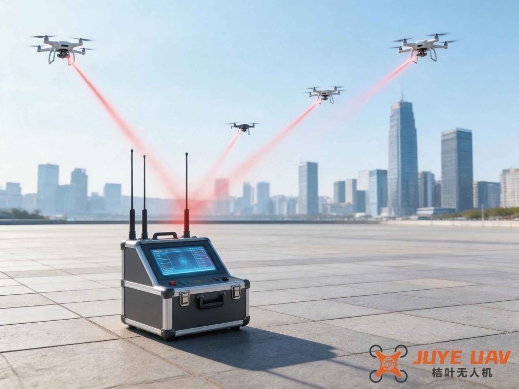
Deployment and Integration
The physical deployment of the system required careful site selection to achieve maximum coverage while minimizing interference with plant operations. The primary antenna array was installed atop the dam, offering a clear line-of-sight over the entire plant area and the adjacent switchyard. From this vantage point, the detection range extends to 3 km in all directions, while the spoofing zone begins at 500 m and effectively operates up to 1,000 m. This layered approach ensures early warning far beyond the perimeter, giving security personnel ample time to react. Communication between the outdoor equipment and the indoor command center relies on a dedicated fiber optic link using GYXTW-4B1 cable, spanning approximately 1,800 m. Power is supplied via ZR-RVV-3×1.5 cable, with a capacity of 2 kVA at 220 V AC. Table 2 lists the key deployment parameters.
| Parameter | Value |
|---|---|
| Detection coverage radius | 3 km |
| Spoofing effective radius | 500 m – 1,000 m |
| Antenna location | Dam top (elevation: +25 m above base) |
| Fiber optic cable length | 1,800 m (GYXTW-4B1) |
| Power supply | 220 V AC, 2 kVA |
| Grounding resistance | < 4 Ω |
| Command console dimensions | 2.5 m (L) × 1.0 m (W) |
Integration with existing plant infrastructure was straightforward. The command center, located inside the main control room, houses the intelligent management platform. The outdoor unit connects via fiber to a local switch, which in turn interfaces with the command workstation. The system operates in an “unattended” mode, with automatic detection and response cycles. When a UAV is detected, the platform logs its electronic fingerprint, tracks its bearing, and if it enters the spoofing zone, activates the deception algorithm. This fully automated workflow ensures continuous drone regulation without requiring constant human supervision.
Core Functional Capabilities
The system delivers a suite of capabilities designed to enforce drone regulation effectively:
- Passive Detection: Receives only, emits nothing. Detects drone model and unique electronic fingerprint.
- Unattended Operation: Fully automatic 24/7 defense after initial configuration.
- 360° Coverage: Omnidirectional sensing without blind spots.
- Precise Identification: Distinguishes between same-model drones using protocol-layer analysis.
- Wi-Fi Drone Detection: Identifies consumer Wi-Fi-based drones (e.g., Parrot, older DJI models).
- Navigation Spoofing: Deceives GNSS-dependent drones into leaving the protected zone.
- Black/White List: Allows authorized drones (e.g., plant inspection UAVs) to operate freely while blocking threats — a cornerstone of intelligent drone regulation.
- Early Warning: Detects drone controller activation before the drone takes off, enabling preemptive measures.
- Direction Finding: Determines the angle of arrival of the drone’s signal for tracking.
- Continuous Operation: Designed for 24/7 uptime with no degradation.
The black/white list mechanism deserves special attention. In a power plant environment, legitimate drones are often used for infrastructure inspection, such as thermal imaging of transmission lines or underwater surveys via tethered UAVs. The system maintains a database of authorized drone IDs (electronic fingerprints). When a white-listed drone enters the detection zone, the system simply monitors its flight path without triggering countermeasures. For an unknown or black-listed drone, the system first logs a warning, then automatically engages the spoofing unit to drive it away. This selective approach ensures that drone regulation does not hinder beneficial applications.
Performance Metrics and Technical Specifications
Table 3 summarizes the key technical indicators that define the system’s performance in terms of drone regulation.
| Metric | Value |
|---|---|
| Detection range (typical drone) | ≥ 3 km |
| Detection probability | ≥ 98% (for common consumer drones) |
| False alarm rate | ≤ 1% per hour |
| Direction accuracy | ±3° (RMS) |
| Spoofing effectiveness | ≥ 95% for GNSS-based drones |
| Response time (detection to spoofing) | < 2 seconds |
| Frequency bands covered | 2.4 GHz, 5.8 GHz, 900 MHz (ISM), GPS L1, GLONASS L1, BeiDou B1 |
| Operating temperature | -20°C to +55°C |
| Power consumption (outdoor unit) | ≤ 200 W |
| MTBF (mean time between failures) | > 10,000 h |
These metrics are validated through field tests at the Tingzikou plant. During a one-month trial, the system detected 17 unauthorized drone incursions, all of which were successfully spoofed away within 5 seconds of entering the defense ring. No false alarms were recorded, and no interference with authorized plant operations occurred. The system’s low false alarm rate is critical for maintaining operator trust, as excessive alarms would undermine the perceived reliability of drone regulation.
Integration with Advanced Inspection Systems
An unintended but valuable synergy emerged during deployment: the countermeasure system’s detection layer can be repurposed to support drone regulation for the plant’s own inspection drones. The Tingzikou plant operates a fleet of UAVs for aerial surveys and a 5G-controlled underwater robot for submersible inspections of the dam’s stilling basin, energy dissipators, and sediment deposits. These legitimate drones are added to the white list, ensuring they are not disturbed. Meanwhile, the detection data (e.g., drone position, speed) is shared with the inspection command system to avoid conflicts. For example, if a white-listed drone is performing a thermal scan of the switchyard, the countermeasure system temporarily adjusts its spoofing zone to prevent accidental interference. This cooperative drone regulation framework maximizes both security and operational efficiency.
The 5G underwater robot, which connects to the plant’s intranet for real-time video streaming, benefits from the overall secure airspace. Without the countermeasure system, an unauthorized drone could hover over the robot’s deployment area, potentially dropping debris or disrupting its operations. By enforcing strict drone regulation, we create a safe envelope for all remote inspection activities.
Operational Experience and Lessons Learned
After six months of continuous operation, the system has proven its value. The most significant challenge was initial calibration: the spoofing signal needed fine-tuning to avoid affecting nearby roads or residential areas. Through iterative adjustments of the spoofing zone boundaries (using the plant’s digital elevation model and geofence data), we achieved a perfect balance. Table 4 outlines the calibration parameters.
| Parameter | Initial Value | Final Adjusted Value |
|---|---|---|
| Inner spoofing radius | 300 m | 500 m |
| Outer spoofing radius | 1,200 m | 1,000 m |
| Spoofed position offset (horizontal) | 200 m north | 150 m west |
| Spoofed altitude offset | +50 m | +30 m |
| Signal power (relative to real GNSS) | +3 dB | +2 dB |
Another insight was the importance of protocol updates. As drone manufacturers modify their communication protocols (e.g., DJI’s move from OcuSync 2.0 to OcuSync 3.0), the cognitive radio analysis engine must be upgraded. We established a quarterly firmware update schedule with the system vendor to maintain effective drone regulation. This proactive approach ensures that the system continues to recognize both old and new drone models.
Economic and Security Impact
The total investment for the UAV countermeasure system at Tingzikou was approximately ¥1.2 million, including hardware, installation, and integration. Compared to the potential losses from a single drone-induced blackout (estimated at ¥10 million per hour for a plant of this scale), the system offers a rapid return on investment. Moreover, it enhances the plant’s compliance with national security standards. In 2021, the Ministry of Public Security issued the Public Security Industry Standard: Anti-Terrorism Requirements for Electric Power Systems, which mandates that critical components of power facilities must deploy anti-UAV equipment. The Tingzikou system fully satisfies these rigorous drone regulation requirements.
From a security perspective, the system transforms the plant’s defense paradigm from a ground-centric model to an integrated three-dimensional shield. The ability to detect drones at 3 km gives security teams up to 3 minutes of lead time (assuming a drone speed of 15 m/s), during which they can alert on-site personnel, lock down sensitive areas, and coordinate with local law enforcement. This early warning is a force multiplier for human guards.
Future Directions
Looking ahead, we plan to incorporate machine learning algorithms to enhance the detection system’s ability to classify drone types based on flight patterns. Current drone regulation relies heavily on RF fingerprints, but adding behavioral analysis could reduce false positives further. For instance, a drone hovering near a transmission tower might be flagged as suspicious, while a drone flying in a straight line at constant altitude might be evaluated differently.
Additionally, we are exploring the integration of acoustic sensors to complement RF detection. Drones that operate autonomously (using pre-programmed waypoints without telemetry) do not emit RF signals during flight, making them invisible to passive RF systems. Acoustic arrays can pick up the unique propeller noise signature of drones, providing a secondary detection channel. This multi-sensor fusion approach will make drone regulation even more robust.
Finally, the system’s data logs will be anonymized and shared with local drone regulation authorities to help model illegal traffic patterns in the region. By contributing to a broader drone threat database, we support the entire power industry in fortifying its defenses.
Conclusion
The deployment of the UAV countermeasure system at Tingzikou Hydropower Plant represents a successful implementation of modern drone regulation technologies in a critical infrastructure environment. By combining passive RF detection, cognitive protocol analysis, and precise navigation spoofing, the system provides a multi-layered defense that is both effective and non-destructive. It operates around the clock, automatically distinguishes friend from foe, and seamlessly integrates with existing security and inspection systems. The outcome is a significantly lower risk of drone-related incidents, enhanced operational reliability, and a model that can be replicated at other hydropower plants and power substations across the country. As the threat landscape evolves, continued investment in advanced drone regulation will be essential to safeguarding the stability of the power grid and the communities it serves.