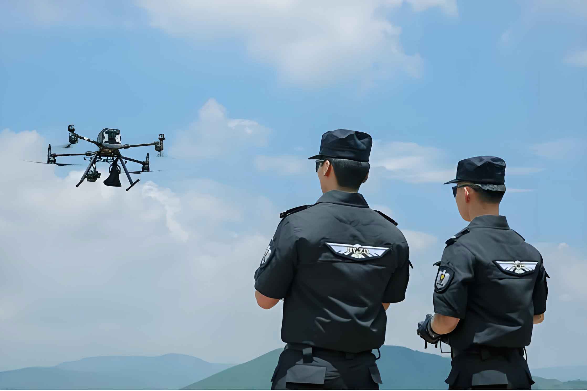
As a practitioner deeply embedded in the fields of automation and public safety technology, I have observed a convergent evolution. The principles driving the modernization of industrial systems, such as automated storage yards, are finding profound and critical applications in the high-stakes realm of security and defense. The core tenets of modularity, remote operation, data integration, and predictive intelligence are no longer confined to factories and ports; they are being actively deployed to protect lives and maintain order. At the forefront of this transformation is the police drone, an aerial platform that epitomizes the shift from manual, hazardous intervention to intelligent, standoff management of threats.
The development trajectory of fully automated intelligent yard management systems offers a compelling parallel. These systems are transitioning from rudimentary automation to sophisticated, data-driven command centers. Their future is marked by two dominant trends: modular diversification and the deep integration of Digital Twin technology. In the former, a core system is adapted through bespoke functional modules to meet specific operational needs, creating a versatile toolkit. The latter involves creating a high-fidelity digital replica of the physical yard, fed by real-time sensor data. This model allows for simulation, analysis, and prediction, enabling proactive management rather than reactive response. The governing equation for such a Digital Twin’s state update can be conceptualized as:
$$ S_{digital}(t+1) = f(S_{digital}(t), \Theta_{sensor}(t), M_{AI}) $$
Where \( S_{digital} \) is the state vector of the digital model, \( \Theta_{sensor} \) is the real-time data stream from physical sensors, and \( M_{AI} \) represents the artificial intelligence algorithms that map sensor data to model updates and predict future states \( S_{digital}(t+1) \).
This paradigm of remote sensing, intelligent analysis, and minimal physical risk is precisely what defines the next generation of public safety tools. In the critical domain of Explosive Ordnance Disposal (EOD) and security screening, the imperative is clear: maximize distance from the threat while maximizing information acquisition and operational capability. The police drone has emerged as the quintessential solution, a versatile platform that addresses the limitations of traditional methods, such as ground robots with constrained mobility or personnel exposed to direct danger.
The application advantages of a police drone in EOD and security screening are multifaceted, fundamentally altering operational tactics. The following table contrasts key capabilities of advanced police drone systems against traditional EOD robots:
| Capability Feature | Advanced Police Drone (with attachments) | Traditional EOD Ground Robot |
|---|---|---|
| Mobility & Access | Full 3D aerial mobility; access to rooftops, pipes, rough terrain, soft ground. | Limited to ground plane; challenged by stairs, large gaps, and soft terrain. |
| Observation Perspective | Dynamic, multi-angle, overhead, and immersive views via pan-tilt-zoom cameras. | Fixed, low-angle perspective limited by the robot’s height and chassis. |
| Deployment Speed | Rapid deployment, airborne in minutes, covering large areas quickly. | Slower setup and deployment, speed limited by ground obstacles. |
| Operational Cost (Acquisition & Maintenance) | Relatively low; modular design with widely available standardized parts. | Very high; proprietary systems with expensive specialized components. |
| Payload Flexibility | High; can be equipped with various modules: grippers, disruptors, CBRN sensors. | Moderate; payloads are often heavy and integrated into a single platform. |
The mathematical advantage in reconnaissance efficiency is significant. A ground-based observer’s field of view (FOV) is severely limited by obstacles. An aerial police drone effectively eliminates ground-level occlusions. The total information \( I_{total} \) gathered about a scene can be modeled as an integral over the accessible volume \( V \):
$$ I_{total} = \int_{V} \rho(x,y,z) \cdot C_{sensor}(x,y,z) \, dV $$
For a ground unit, \( V \) is a complex, occluded space near ground level. For a police drone, \( V \) expands to a large, unobstructed aerial hemisphere above the target, and \( C_{sensor} \) (the sensor’s coverage function) can sweep this volume efficiently, leading to a much higher \( I_{total} \).
Furthermore, mission precision is revolutionized by technologies like Real-Time Kinematic (RTK) GPS, which provides centimeter-level positioning. The positional error \( \epsilon_{RTK} \) is orders of magnitude smaller than standard GPS error \( \epsilon_{GPS} \):
$$ \epsilon_{RTK} \approx 0.01 – 0.02 \text{ m}, \quad \epsilon_{GPS} \approx 2 – 5 \text{ m} $$
This precision is critical for tasks like mapping blast fragmentation fields, positioning disruptors, or creating accurate 3D models of suspicious items for remote analysis. The data from a police drone equipped with photogrammetry or LiDAR sensors feeds directly into the creation of a localized, real-time Digital Twin of the threat scene, allowing command staff to analyze and plan interventions from complete safety.
Despite these transformative advantages, the operational integration of the police drone faces distinct challenges that must be addressed to unlock its full potential. The primary constraints form a triad of technical, regulatory, and human resource issues.
First, technical performance limitations persist. The most universal is energy density, dictating flight endurance. The operational flight time \( T_{flight} \) is a function of battery capacity \( C \), vehicle power draw \( P_{vehicle} \), and payload power \( P_{payload} \):
$$ T_{flight} = \frac{\eta \cdot C}{P_{vehicle} + P_{payload}} $$
where \( \eta \) is the system efficiency. Current battery technology places a firm ceiling on \( C \), limiting \( T_{flight} \) to typically 20-30 minutes for multi-rotor drones with meaningful payloads, necessitating complex logistics for extended missions. Secondly, communication reliability in crowded urban spectrums remains a vulnerability. The signal-to-interference-plus-noise ratio (SINR) for the police drone control link must be maintained above a critical threshold \( \gamma_{min} \) for stable operation:
$$ SINR = \frac{P_{tx} \cdot G_{path}}{N_0 + I_{other}} > \gamma_{min} $$
Where \( P_{tx} \) is transmission power, \( G_{path} \) is path gain, \( N_0 \) is noise, and \( I_{other} \) is interference from other civilian signals. Ensuring this in all environments is non-trivial.
Second, regulatory and procedural frameworks are often underdeveloped or fragmented. The lack of standardized nationwide protocols for deployment authorization, airspace coordination, and public communication can lead to operational delays or public misunderstanding. A clear, streamlined governance model is as crucial as the technology itself.
Third, and perhaps most critically, is the human element: a severe shortage of systematically trained professionals. Expertise is required not only in manual piloting (B-level certification) but also in advanced mission planning, data analysis, platform maintenance, and tactical integration (A-level certification). The current distribution of such expertise is highly uneven, concentrating in major metropolitan areas and leaving vast regions without this capability. The talent pipeline from academies is thin, with few institutions offering dedicated, in-depth programs on unmanned systems in law enforcement.
The future development path for the police drone in security and EOD must be holistic, addressing technology, training, and doctrine simultaneously. The following table outlines a proposed multi-tiered training and development ecosystem necessary for scalable adoption:
| Tier | Focus | Skill Outcome | Key Stakeholders |
|---|---|---|---|
| Tier 1: Operator | Basic to advanced flight proficiency, standard payload operation, and regulatory compliance. | Certified Pilots (B-level, A-level). Ability to execute pre-planned missions safely. | Police Academies, Certified Flight Trainers, Equipment Vendors. |
| Tier 2: Tactician & Integrator | Mission planning, data analysis (e.g., photogrammetry, thermal), “man-machine” teaming protocols, and inter-unit coordination. | Tactical Controllers & Analysts. Ability to integrate drone-derived data into operational command decisions. | Advanced Police Training Colleges, University Partnerships, Cross-Departmental Exercises. |
| Tier 3: Developer & Specialist | Platform customization, software/hardware troubleshooting, development of bespoke solutions for unique operational needs. | Unmanned Systems Specialists. Ability to adapt technology to evolving threats and bridge gaps with industry R&D. | Technical Universities, National R&D Labs, Strategic Industry Partnerships, Graduate Programs. |
From a technological standpoint, the future lies in increased autonomy and intelligent networking. The goal is to transition from remotely piloted vehicles to truly intelligent partners. This involves developing robust autonomous navigation in GPS-denied environments, automated threat recognition algorithms, and multi-agent collaboration. A swarm of police drone units could collaboratively map a large, complex incident scene, with their collective behavior optimized by a shared objective function. For instance, a search task could be formulated as maximizing the probability of detection \( P_{detect} \) over an area \( A \) within time \( T \):
$$ \text{Maximize: } \int_{0}^{T} \int_{A} p_{detect}(x,y,t) \, dA \, dt $$
$$ \text{Subject to: } \sum_i E_i(t) \leq E_{total}, \quad \text{Collision Avoidance Constraints} $$
where \( p_{detect} \) depends on the sensor coverage of all drones in the swarm, and \( E_i(t) \) is the energy consumption of the i-th police drone.
On a strategic level, national coordination is essential. Government-backed research initiatives and funding programs should target the specific challenges of high-risk profession intelligent platforms. Dedicated projects could focus on next-generation batteries, secure and resilient communication networks (leveraging 5G and beyond), and standardized open architecture for payload integration. This would ensure that innovation is directed by operational necessity rather than purely commercial interests.
In conclusion, the evolution of automated systems, exemplified by smart yards and decisively embodied by the police drone, represents a fundamental shift towards proactive, intelligence-driven, and risk-averse management of complex environments—be they logistical hubs or public threat scenarios. The police drone is more than just a flying camera; it is a mobile sensor node, a remote manipulator, and a data collection platform that feeds the “Digital Twin” of an unfolding incident. Its value proposition—unmatched access, superior situational awareness, precision, and cost-effectiveness—is irrefutable. However, its full integration into the public safety fabric hinges on overcoming the triad of endurance/communication limits, regulatory clarity, and most importantly, the cultivation of deep, systematic human expertise. By pursuing a coordinated path of technological refinement, standardized training, and national strategic support, the police drone will mature from a valuable tool into an indispensable, intelligent guardian, dramatically enhancing the safety of personnel and the public while ensuring societal stability in an increasingly complex world.