
With the rapid advancement of modern society, electrical energy has become one of the primary energy sources directly utilized by human beings. The stable operation of transmission lines is of paramount importance for the entire power system. Our country spans a vast territory with complex terrain, and transmission lines exhibit characteristics of long distances and diverse topographical conditions due to environmental factors. Traditional inspection methods predominantly rely on manual labor, which suffers from low efficiency and significant safety hazards. In response to these challenges, the vigorous development of drone technology has made it feasible to employ unmanned aerial vehicles for assisting manual inspections. Numerous studies have already explored the application of drone technology in power inspections and have achieved considerable成果. However, current drone technology primarily focuses on image recognition of field scenes without adequately incorporating environmental information. To address this limitation, we propose a comprehensive technical solution that integrates environmental perception with drone technology for power inspection and maintenance.
In our research, we first designed an intelligent data acquisition module that collects voltage, current, environmental temperature, humidity, and on-site equipment images through multiple sensors and cameras. This module significantly expands the data sources available for analysis. Furthermore, we improved the YOLOv5 algorithm by replacing the loss function, introducing the Convolutional Block Attention Module (CBAM), and optimizing the convolution process. These enhancements achieve algorithm lightweighting while improving the recognition accuracy of inspection faults. Experimental results demonstrate that our proposed technical solution achieves an average recognition time of 0.09 seconds per single image and a fault recognition accuracy of 98.52%, effectively enhancing inspection efficiency and assisting drone mounted pods in completing precise maintenance operations.
The remainder of this article is organized as follows. Section 1 presents the design of the environmental perception unmanned aerial vehicle system. Section 2 describes the software system design and algorithm improvements. Section 3 provides experimental analysis and validation. Section 4 concludes the paper with a summary of our contributions and future research directions.
1. Environmental Perception Unmanned Aerial Vehicle System Design
1.1 Hardware System Design for Environmental Perception UAV Assisted Maintenance
In conventional applications of drone technology for assisted maintenance, inspection tasks typically rely on unmanned aerial vehicles capturing on-site equipment image data, followed by the use of deep learning algorithms to identify and assess the operational status of transmission line equipment. This inspection methodology suffers from two major drawbacks. First, it fails to incorporate equipment surrounding environmental and operational data, thereby only capable of identifying already damaged equipment without the ability to predict data anomalies, lacking predictive capability. Second, sole reliance on image data for identification results in relatively low recognition accuracy. To enhance the efficiency of inspecting and maintaining transmission lines in power systems, we propose an environmental perception based drone technology for power inspection and maintenance. Our research primarily focuses on data acquisition, data analysis, and assisted maintenance.
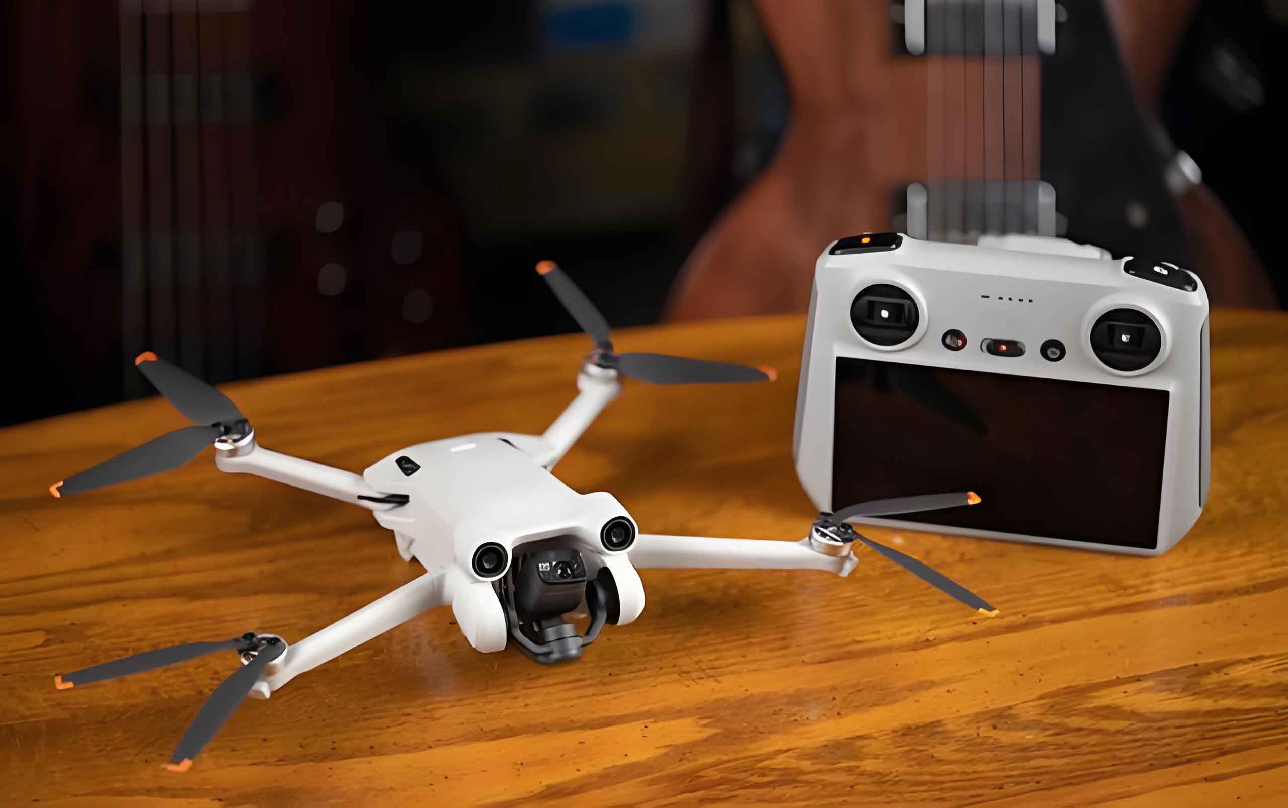
In this study, the unmanned aerial vehicle undertakes multiple tasks including flight, data collection, data analysis, and equipment assisted maintenance. Therefore, we selected the DJI T16 unmanned aerial vehicle as our experimental platform due to its long flight distance and excellent load-bearing performance. The relevant data parameters are presented in Table 1.
| Parameter | Value |
|---|---|
| Maximum Flight Speed (m/s) | 10 |
| Maximum Altitude (km) | 2 |
| Maximum Thrust (kg/rotor) | 13.5 |
| Maximum Power (W/rotor) | 2400 |
To address the problem of single data source, we designed an intelligent data acquisition module that supports multiple data types for comprehensive collection of field data. By integrating temperature sensors, current sensors, voltage sensors, humidity sensors, and cameras onto the unmanned aerial vehicle, we constructed a data intelligent acquisition module that collects equipment voltage, current, power, temperature, environmental temperature, humidity data, and on-site photographs during inspection. These data are transmitted to a data acquisition terminal, which integrates the data into image data format and delivers it to a Raspberry Pi for analysis and recognition using deep learning algorithms. The structural principle is illustrated in the following figure.
The data acquisition terminal associates numerical data with image data through annotation, forming a multi-dimensional dataset that facilitates subsequent deep learning network fusion analysis. Upon completion of data integration analysis, the auxiliary maintenance system is employed for equipment repair. Equipment maintenance is typically accomplished through a robotic arm system, which mainly comprises servo motors, servo controllers, power supply modules, voltage adaptation modules, bearing connectors, and laser ranging radar. The corresponding models and parameters are presented in Table 2.
| Equipment | Parameter |
|---|---|
| Servo Motor | HSR-5990TG |
| Servo Controller | FUTABA T16SZ |
| Power Supply Module | 11.1V Lithium Battery |
| Voltage Adaptation Module | UBEC Step-down Module |
| Bearing Connector | BKD Bearing |
1.2 Software System Design for Environmental Perception UAV Assisted Maintenance
Through the intelligent data acquisition module described above, we expand the sources of data information, thereby improving the recognition accuracy of power inspection from the data foundation perspective. Additionally, we need to optimize and improve the data processing and analysis capabilities to further enhance inspection efficiency and accuracy. The improvement strategies for the YOLOv5 algorithm are illustrated in the following design.
We first optimize the image data preprocessing stage. Image data generally contains noise that adversely affects image recognition accuracy. Therefore, we apply denoising processing to the original image data. Commonly used denoising algorithms include median filtering and non-local means filtering. The denoising method we designed is expressed as follows:
$$z(x,y) = \text{median}\{l(x-i, y-i)\}, \quad (x,y) \in K$$
$$T = \{t(i)\}$$
$$t(i) = m(i) + g(i)$$
$$\text{NLM}(i) = \sum_{j \in \Omega_i} w(i,j) t(j)$$
Where \(z(x,y)\) and \(l(x-i, y-i)\) represent pixel grayscale values; \(K\) denotes the filtering kernel size, typically 3×3 or 5×5; \(T\) represents image pixels; \(m(i)\) represents noise-free image pixels; \(g(i)\) represents noise in the image; \(\text{NLM}(i)\) represents the pixel value after denoising; and \(w(i,j)\) represents the weight matrix. In this study, to achieve thorough image denoising, we constructed a denoising module by serially connecting two filtering methods.
Secondly, to enable the unmanned aerial vehicle to utilize the YOLOv5 algorithm for data analysis, we performed lightweight improvement on the YOLOv5 algorithm framework. The traditional YOLOv5 algorithm framework is based on the Backbone network, which employs convolutional stacking operations that consume substantial memory, thereby slowing down CPU operation and making it unsuitable for embedded scenarios on unmanned aerial vehicle platforms. We replaced this with the ShuffleNetV2 network structure, which is an optimized second-generation version of the ShuffleNet network, effectively applicable in drone technology applications. Furthermore, by converting the traditional convolutional multiplication operations in ShuffleNetV2 into addition computations, we further reduced the network parameter count, making the overall network more lightweight. The traditional convolutional operation parameter count is given by:
$$G_s = G^2 \times h \times M$$
Where \(G^2\) represents the convolution kernel size; \(h\) represents the number of image channels; and \(M\) represents the number of convolution kernels. The improved convolutional operation parameter count is:
$$G_g = G^2 \times h + h \times M$$
Accordingly, the ratio of improved to unimproved convolutional operation parameter counts is:
$$\alpha = \frac{G_g}{G_s} = \frac{G^2 + M}{G^2 \times M}$$
Where \(\alpha\) represents the parameter count ratio, which is less than 1 based on the function expression. This conclusively demonstrates that the improved convolution algorithm has fewer parameters.
Finally, to enhance the recognition accuracy of the YOLOv5 algorithm, we addressed the problems of gradient vanishing and low small-target recognition accuracy by modifying the loss function and introducing an attention mechanism. The traditional YOLOv5 algorithm uses the CIoU loss function, whose expression is:
$$\text{CIoU} = 1 – \text{IoU} + \frac{O^2(z, z_y)}{d^2} + \frac{l^2}{1 – \text{IoU} + l}$$
Where IoU represents the intersection over union ratio between the ground truth box and the predicted box; \(z\) and \(z_y\) represent the centers of the ground truth box and predicted box, respectively; \(O(\cdot)\) represents the Euclidean distance function; \(d\) represents the diagonal length of the ground truth box and predicted box for the i-th sample in the dataset; and \(l\) represents the consistency measurement coefficient between the two boxes. However, this coefficient only measures the difference in aspect ratio without reflecting differences in confidence and width-to-height ratio, making comprehensive measurement difficult. Therefore, we optimized this coefficient to obtain the EIoU loss function:
$$\text{EIoU} = 1 – \text{IoU} + \frac{O^2(z, z_y)}{w_x^2 + h_x^2} + \frac{O^2(w, w_y)}{w_x^2} + \frac{O^2(h, h_y)}{h_x^2}$$
Where \(w_x\) represents the width value of the minimum enclosing box of the ground truth box and predicted box; \(h_x\) represents the height value of the minimum enclosing box of the ground truth box and predicted box. To enable analysis of important features in image data, we also introduced the CBAM attention mechanism into the YOLOv5 algorithm to improve its original recognition accuracy. The CBAM attention mechanism is a hybrid attention mechanism combining the Channel Attention Module (CAM) and the Spatial Attention Module (SAM), which better highlights key features of data and contributes to improved image recognition accuracy.
2. Algorithm Improvement and Technical Implementation
2.1 Lightweight Network Architecture Design
The application of drone technology in power inspection imposes strict requirements on computational efficiency and resource consumption. Traditional deep learning models, while achieving high accuracy, often demand substantial computational resources that exceed the capabilities of embedded platforms commonly used in UAV systems. To address this challenge, we developed a lightweight network architecture specifically designed for drone technology deployment.
The backbone network of traditional YOLOv5 utilizes CSPDarknet53, which contains a large number of convolutional layers and residual connections. Although this architecture provides excellent feature extraction capabilities, it is too heavy for real-time deployment on UAV platforms. We replaced the backbone network with ShuffleNetV2, which employs channel shuffle operations and depthwise separable convolutions to significantly reduce computational complexity while maintaining competitive performance.
The channel shuffle operation in ShuffleNetV2 can be mathematically described as follows. Given an input feature map with \(C\) channels, the channels are first divided into \(g\) groups:
$$C = g \times C_{\text{group}}$$
Each group undergoes convolution operations independently, and then the channel shuffle operation permutes the channels across groups:
$$\text{Shuffle}(X) = \text{Reshape}(\text{Transpose}(\text{Reshape}(X, [g, C_{\text{group}}, H, W]), [1, 0, 2, 3]), [C, H, W])$$
Furthermore, we converted traditional multiplication-based convolutions into addition-based computations. The standard convolution operation can be expressed as:
$$Y = \sum_{i=1}^{C_{\text{in}}} X_i * W_i + b$$
Where \(*\) denotes the convolution operation, \(X_i\) is the i-th input channel, \(W_i\) is the corresponding convolution kernel, and \(b\) is the bias term. In our improved version, we replaced the multiplication operations with addition operations:
$$Y = \sum_{i=1}^{C_{\text{in}}} (X_i + W_i) + b$$
This modification significantly reduces the computational overhead while maintaining the representational capacity of the network. The parameter reduction ratio is given by:
$$\beta = \frac{C_{\text{in}} \times C_{\text{out}} \times K^2}{C_{\text{in}} \times K^2 + C_{\text{in}} \times C_{\text{out}}} = \frac{C_{\text{out}} \times K^2}{K^2 + C_{\text{out}}}$$
For typical values of \(K=3\) and \(C_{\text{out}}=256\), the reduction ratio is approximately 0.964, indicating that the improved convolution requires only 3.6% of the original parameter count.
2.2 Attention Mechanism Integration
To further enhance the recognition accuracy of our drone technology based inspection system, we integrated the Convolutional Block Attention Module into the YOLOv5 architecture. The CBAM attention mechanism consists of two sequential sub-modules: the Channel Attention Module and the Spatial Attention Module.
The Channel Attention Module focuses on identifying which channels in the feature map are most informative. Given an input feature map \(F \in \mathbb{R}^{C \times H \times W}\), the channel attention map is computed as:
$$M_c(F) = \sigma(\text{MLP}(\text{AvgPool}(F)) + \text{MLP}(\text{MaxPool}(F)))$$
Where \(\sigma\) represents the sigmoid activation function, MLP denotes a multi-layer perceptron with shared weights, and AvgPool and MaxPool represent average pooling and max pooling operations, respectively. The refined feature map after channel attention is:
$$F’ = M_c(F) \otimes F$$
The Spatial Attention Module then focuses on identifying which spatial locations in the feature map are most informative. Given the channel-refined feature map \(F’\), the spatial attention map is computed as:
$$M_s(F’) = \sigma(f^{7 \times 7}([\text{AvgPool}(F’); \text{MaxPool}(F’)]))$$
Where \(f^{7 \times 7}\) denotes a convolution operation with a 7×7 kernel, and \([\cdot; \cdot]\) represents channel-wise concatenation. The final refined feature map is:
$$F” = M_s(F’) \otimes F’$$
The integration of CBAM into our YOLOv5 architecture enables the network to focus on the most relevant features for fault detection while suppressing irrelevant information, thereby significantly improving recognition accuracy without substantially increasing computational overhead.
2.3 Loss Function Optimization
The loss function plays a crucial role in training object detection models for drone technology applications. The traditional YOLOv5 algorithm uses the CIoU loss function, which considers the overlap area, center point distance, and aspect ratio of the bounding boxes. However, the CIoU loss has limitations in handling small objects and diverse aspect ratios commonly encountered in power inspection scenarios.
We replaced the CIoU loss with the EIoU loss function, which provides a more comprehensive optimization objective. The complete EIoU loss function is defined as:
$$L_{\text{EIoU}} = 1 – \text{IoU} + \frac{\rho^2(b, b^{\text{gt}})}{c^2} + \frac{\rho^2(w, w^{\text{gt}})}{c_w^2} + \frac{\rho^2(h, h^{\text{gt}})}{c_h^2}$$
Where \(\rho(\cdot)\) denotes the Euclidean distance, \(b\) and \(b^{\text{gt}}\) represent the centers of the predicted and ground truth boxes, \(c\) is the diagonal length of the minimum enclosing box, \(w\) and \(w^{\text{gt}}\) are the widths, \(h\) and \(h^{\text{gt}}\) are the heights, and \(c_w\) and \(c_h\) are the width and height of the minimum enclosing box.
The EIoU loss function directly minimizes the differences in width and height between the predicted and ground truth bounding boxes, leading to faster convergence and more accurate localization, especially for small targets such as insulators, connectors, and other components commonly found in power transmission lines.
3. Experimental Results and Analysis
3.1 Dataset and Experimental Setup
To validate the effectiveness of our proposed environmental perception based drone technology for power inspection and maintenance, we collected real power inspection image data from a northwestern province in China, comprising 6,330 images and 16,530 sets of various related data. The dataset includes multiple types of power equipment defects, damaged components, and environmental anomalies commonly encountered in transmission line inspections.
We evaluated our approach using three key performance metrics: accuracy (\(P_z\)), precision (\(P_j\)), and recall (\(P_r\)), defined as follows:
$$P_z = \frac{TP + TN}{TP + TN + FP + FN}$$
$$P_j = \frac{TP}{TP + FP}$$
$$P_r = \frac{TP}{TP + FN}$$
Where \(TP\) represents the number of true positives, \(FP\) represents the number of false positives, \(FN\) represents the number of false negatives, and \(TN\) represents the number of true negatives in the sample.
After categorizing the collected sample data, we divided it into training and testing sets at a ratio of 9:1, and used the Make Sense online annotation tool for classification and labeling. After completing model training, we conducted pod assisted maintenance tests and evaluated performance using the obstacle removal rate:
$$P_c = \frac{Z_c}{Z}$$
Where \(Z_c\) represents the number of eliminated obstacles and \(Z\) represents the total number of obstacles.
3.2 Ablation Study Results
We conducted ablation experiments to verify the rationality and correctness of our improvement measures. The ablation study results are presented in Table 3, where \(T\) represents the intelligent data acquisition module, \(Z\) represents the denoising module, \(Q\) represents the lightweight improvement measure, \(C\) represents the attention mechanism, and \(Y\) represents YOLOv5.
| Model | Accuracy (%) | Precision (%) | Recall (%) |
|---|---|---|---|
| Y | 85.42 | 85.11 | 84.54 |
| TY | 87.97 | 87.08 | 86.84 |
| TZY | 89.27 | 89.01 | 88.73 |
| TZQY | 93.17 | 93.04 | 92.78 |
| TZQCY | 98.52 | 98.13 | 97.96 |
From the ablation study results, we can clearly observe that compared to processing single image data, the inspection performance metrics after multi-data acquisition all showed improvement, validating the rationality of the intelligent data acquisition module design. By expanding data sources and incorporating environmental perception, we significantly enhanced inspection efficiency. The experimental results also demonstrate that through progressive improvements including denoising, lightweight optimization, and attention mechanism integration into the YOLOv5 data processing model, our proposed method steadily improved data processing capability and fault recognition accuracy, providing solid support for practical engineering applications.
Through six random sampling tests on the test dataset, we found that the fastest single-image recognition time was 0.052 seconds, with an average recognition time of 0.09 seconds. Considering the experimental results of the three indicators before and after improvement, we can conclude that the drone technology based power inspection and maintenance approach optimized from both data acquisition and data processing perspectives is both feasible and effective.
3.3 Comparative Analysis with Other Algorithms
We conducted a horizontal comparison between our proposed environmental perception based drone technology inspection and maintenance TZQCY recognition model and currently popular image recognition algorithms including YOLOv3, YOLOv4, Faster R-CNN, and Attention-SSD. The experimental results are presented in Table 4.
| Algorithm Model | Accuracy (%) | Precision (%) | Recall (%) |
|---|---|---|---|
| YOLOv3 | 82.42 | 82.12 | 80.91 |
| YOLOv4 | 83.24 | 83.14 | 83.09 |
| Faster R-CNN | 81.54 | 81.18 | 80.54 |
| Attention-SSD | 85.34 | 85.26 | 84.94 |
| TZQCY (Ours) | 98.52 | 98.13 | 97.96 |
From the comparative results presented in Table 4, we can observe that our proposed method achieves the best overall performance, with recognition accuracy significantly higher than the other four methods. This validates that our proposed inspection drone technology can be effectively applied in unmanned aerial vehicles, reducing manual labor costs while improving inspection efficiency and accuracy.
3.4 Obstacle Removal Testing Results
Finally, we conducted autonomous de-icing and tree obstacle removal tests by integrating our proposed model with the corresponding maintenance pod. The experimental results are presented in Table 5.
| Algorithm Model | De-icing Rate (%) | Tree Obstacle Removal Rate (%) |
|---|---|---|
| YOLOv3 | 85.32 | 85.24 |
| YOLOv4 | 86.25 | 86.46 |
| Faster R-CNN | 84.34 | 84.52 |
| Attention-SSD | 87.56 | 88.42 |
| TZQCY (Ours) | 97.24 | 97.25 |
From the results presented in Table 5, we can clearly observe that our proposed environmental perception based drone technology for power inspection and maintenance significantly improves image recognition accuracy, thereby facilitating high-precision autonomous obstacle removal by unmanned aerial vehicles.
3.5 Comprehensive Analysis of Experimental Results
Synthesizing all the experimental results presented above, we can draw the following conclusions regarding our proposed environmental perception based drone technology for power inspection and maintenance:
First, the optimization and improvement strategies for the TZQCY recognition model are reasonable and yield significant effects. The intelligent data acquisition module successfully expands data sources by incorporating multiple sensor types, enabling the system to perceive environmental conditions beyond what traditional image-only approaches can achieve. This multi-modal data fusion approach provides a more comprehensive understanding of the operational status of power equipment.
Second, the lightweight improvement of the YOLOv5 algorithm through backbone network replacement and convolution optimization effectively reduces computational complexity while maintaining high recognition accuracy. The average recognition time of 0.09 seconds per image demonstrates the suitability of our approach for real-time deployment on UAV platforms with limited computational resources.
Third, the introduction of the CBAM attention mechanism and the EIoU loss function significantly improves fault recognition accuracy, achieving 98.52% accuracy, 98.13% precision, and 97.96% recall. These metrics represent substantial improvements over traditional YOLOv5 and other state-of-the-art object detection algorithms.
Fourth, the obstacle removal testing results demonstrate that our proposed drone technology achieves 97.24% de-icing rate and 97.25% tree obstacle removal rate, substantially outperforming other methods. This confirms that the improved recognition accuracy directly translates to better autonomous maintenance performance in real-world applications.
The experimental validation confirms that our environmental perception based drone technology for power inspection and maintenance effectively improves inspection work efficiency, achieves high fault recognition accuracy with fast processing speed, and can successfully assist in completing inspection and routine maintenance tasks for power system transmission lines. The technology is suitable for practical engineering applications and demonstrates strong potential for widespread deployment in power grid maintenance operations.
4. Discussion and Future Work
4.1 Key Contributions and Innovations
Our research makes several significant contributions to the field of drone technology for power inspection and maintenance. First, we proposed an environmental perception framework that extends beyond traditional image-only approaches by integrating multi-modal sensor data including voltage, current, temperature, humidity, and visual information. This comprehensive data acquisition strategy enables more accurate fault detection and predictive maintenance capabilities.
Second, we developed a lightweight YOLOv5 algorithm specifically optimized for deployment on UAV platforms. Through backbone network replacement, convolution optimization, and attention mechanism integration, we achieved a balance between computational efficiency and recognition accuracy that is essential for real-time applications in drone technology.
Third, we demonstrated the practical effectiveness of our approach through comprehensive experiments using real-world power inspection data. The high recognition accuracy and fast processing speed validate the suitability of our method for operational deployment in power grid maintenance.
4.2 Limitations and Challenges
Despite the promising results, our research has certain limitations that warrant further investigation. The current system has been tested primarily in specific geographical and climatic conditions. The performance of our drone technology under extreme weather conditions such as heavy rain, snow, or strong winds requires further validation. Additionally, the dataset used in our experiments, while comprehensive, may not fully represent all possible fault scenarios encountered in diverse transmission line environments.
Another challenge is the computational resource constraint of UAV platforms. Although we achieved significant lightweight improvement, further optimization may be necessary to support more complex multi-task operations such as simultaneous inspection and maintenance in a single flight mission.
4.3 Future Research Directions
Looking ahead, several promising research directions emerge from our work. First, we plan to explore edge computing approaches that distribute computational tasks between the UAV and ground stations, enabling more sophisticated analysis while maintaining real-time performance. This would further enhance the capabilities of drone technology in power inspection applications.
Second, we aim to develop predictive maintenance algorithms that can anticipate equipment failures before they occur by analyzing trends in environmental and operational data collected by our intelligent acquisition module. This proactive approach would significantly reduce downtime and maintenance costs.
Third, we plan to investigate swarm drone technology for coordinated inspection and maintenance of large-scale transmission line networks. Multiple UAVs working in collaboration could cover extensive areas more efficiently and handle complex maintenance tasks that require coordinated efforts.
Fourth, we intend to explore advanced deep learning architectures such as transformers and vision transformers for further improving recognition accuracy and robustness. These architectures have shown promising results in various computer vision tasks and could potentially enhance the performance of our drone technology based inspection system.
Finally, we will investigate the integration of 5G communication technology with our drone technology platform to enable real-time data transmission and remote control capabilities, facilitating more flexible and responsive power grid maintenance operations.
5. Conclusion
In this research, we proposed an environmental perception based drone technology for power inspection and maintenance to improve the efficiency of power transmission equipment inspection. Our research encompasses both hardware and software aspects, yielding several important achievements.
We constructed an intelligent data acquisition module that collects voltage, current, power, temperature, environmental temperature, humidity data, and on-site equipment images through multiple sensors and cameras, thereby expanding data sources beyond traditional image-only approaches. This multi-modal data fusion strategy enables more comprehensive and accurate fault detection.
We addressed the limitations of traditional YOLOv5 algorithms, including high hardware resource consumption and gradient vanishing problems in the loss function, by implementing lightweight improvements through backbone network replacement and convolution optimization. The introduction of the EIoU loss function and CBAM attention mechanism effectively improved image recognition accuracy, achieving 98.52% accuracy with an average recognition time of 0.09 seconds per image.
Experimental validation using real power inspection data from a northwestern province in China demonstrated the effectiveness of our approach. The ablation study confirmed that each improvement measure contributes positively to overall performance, and comparative analysis showed that our method outperforms state-of-the-art algorithms including YOLOv3, YOLOv4, Faster R-CNN, and Attention-SSD. The obstacle removal testing results further validated that our drone technology achieves high-precision autonomous de-icing and tree obstacle removal, with success rates exceeding 97%.
Our research demonstrates that the optimization and improvement strategies for the TZQCY recognition model are reasonable and yield significant effects, achieving high fault recognition accuracy with fast processing speed. The proposed environmental perception based drone technology effectively improves inspection work efficiency and can successfully assist in completing power system transmission line inspection and routine maintenance tasks. The technology is suitable for practical engineering applications and represents a significant advancement in the application of drone technology for power grid maintenance.
As drone technology continues to evolve and mature, we anticipate that our environmental perception based approach will play an increasingly important role in ensuring the reliable and efficient operation of power transmission systems. The integration of multi-modal sensing, lightweight deep learning, and autonomous maintenance capabilities opens new possibilities for intelligent power grid management and contributes to the development of more resilient and sustainable energy infrastructure.