
From my perspective as a practitioner and researcher in the field of emergency response technology, the integration of Unmanned Aerial Vehicles (UAVs) into fire and rescue operations represents a paradigm shift. The specific application of fire UAV systems for communication purposes has moved beyond a novel concept to a critical operational backbone. This article delves into my analysis and experience regarding the transformative role of fire UAV technology in enhancing situational awareness, command efficacy, and overall mission success in complex disaster environments.
The modern disaster scene is characterized by chaos, rapidly evolving threats, and severe communication challenges. Traditional ground-based communication relays often fail due to structural collapse, intense heat, or simply the sheer scale and inaccessibility of the area. Herein lies the primary value proposition of the fire UAV: to serve as a dynamic, aerial node in the communication network. My focus is to elaborate on the technical advantages, concrete applications, systematic implementation pathways, and practical case considerations of employing fire UAV platforms, supported by quantitative models and structural frameworks.
Operational Advantages of Fire UAVs in Communication Networks
The efficacy of a fire UAV in communication roles is not accidental but stems from a confluence of inherent design characteristics. These advantages can be systematically categorized as follows:
| Advantage Category | Technical & Operational Manifestation | Impact on Communication |
|---|---|---|
| Mobility & Flexibility | Lightweight (often < 25 kg), Vertical Take-Off and Landing (VTOL) capability, small operational footprint. Rapid deployment by 1-2 personnel. | Enables immediate overwatch of inaccessible areas (collapsed structures, chemical plumes, wildfire fronts). Establishes line-of-sight links faster than ground units. |
| Comprehensive Situational Awareness | Integration of high-resolution EO/IR cameras, thermal imagers, gas sensors, and LiDAR. 360-degree gimbal stabilization for persistent gaze. | Provides real-time visual, thermal, and environmental data feeds. Creates a common operational picture (COP) for all command echelons, reducing information asymmetry. |
| Resilience & Endurance | Ability to operate in hazardous conditions (high heat, toxic smoke, low visibility). Redundant flight control systems and robust communication datalinks. | Ensures communication relay continuity when ground personnel must withdraw. Provides a stable aerial platform for sensors and transmitters amidst turbulent environments. |
| Cost-Effectiveness & Scalability | Lower operational risk compared to manned aircraft. Ability to deploy swarms for wide-area coverage or persistent surveillance. | Allows for dedicated communication nodes over multiple sectors simultaneously. Facilitates mesh networking for robust, decentralized communication. |
The mathematical essence of the mobility advantage can be framed in terms of coverage. The effective communication coverage area A_cov provided by an aerial relay compared to a ground-based unit at height h_ground is significantly greater due to the extended radio horizon. For a fire UAV at altitude h_uav, the line-of-sight distance d_los to a ground unit is approximated by:
$$ d_{los} \approx \sqrt{2R} \left( \sqrt{h_{uav}} + \sqrt{h_{ground}} \right) $$
where R is the Earth’s radius. This quadratic relationship means that even a modest increase in UAV altitude dramatically expands the potential communication footprint, a critical factor in urban canyons or mountainous terrain.
Core Functional Applications in the Fire Communication Ecosystem
The application of fire UAV technology manifests through several core functions, each addressing a specific gap in traditional fireground communication.
1. Autonomous Pre-Scene Reconnaissance and Path Planning
Prior to or concurrent with the arrival of first responders, a fire UAV can be dispatched to perform an initial assessment. The goal is to autonomously gather critical data—fire location, intensity, spread vectors, potential hazards, and visible victims. This requires sophisticated onboard intelligence for path planning in uncertain environments.
From my implementation viewpoint, this involves a fusion of algorithms. We model the airspace using a 3D probabilistic occupancy grid. The path planning problem is then solved using an optimized heuristic search. Let the mission space be discretized into nodes. The cost function f(n) for the A* algorithm can be enhanced for a fire UAV to account for thermal updrafts, wind vectors (\vec{w}), and no-fly zones (NFZs):
$$ f(n) = g(n) + h(n) + \lambda_T \cdot T(n) + \lambda_w \cdot |\vec{v}_{uav} + \vec{w}(n)| $$
where g(n) is the cost from start to node n, h(n) is the heuristic estimate to goal, T(n) is the estimated thermal risk, and the wind term penalizes paths requiring high relative velocity. This generates an efficient, hazard-aware reconnaissance path, providing the first vital data stream to incident command.
2. High-Bandwidth, Low-Latency Image and Data Transmission
The primary communication payload of a fire UAV is its sensor data, predominantly high-definition video. The choice of transmission technology directly impacts operational effectiveness. Two dominant paradigms exist, each with its place in the toolkit.
| Transmission Mode | Architecture | Key Performance Metrics | Best Use Case |
|---|---|---|---|
| 5G/Cellular-Based | UAV → Onboard Modem → 5G NR → Public Core Network → Cloud/Command Server | High potential bandwidth (Gbps), Range limited by cell coverage, Latency: 10-50ms. Subject to network congestion. | Urban environments with robust 5G, operations requiring massive data offload (3D mapping). |
| Point-to-Point Microwave/RF | UAV → Airborne Radio → Direct LOS to Ground Receiver Unit (on Vehicle or Tripod) | Bandwidth: 10-100 Mbps, Latency: < 10ms, Secure & dedicated link. Range: 5-50 km (LOS). | Tactical operations in remote areas, secure command links, high-reliability real-time piloting. |
The channel capacity C for these links, following Shannon’s theorem, dictates the quality of service:
$$ C = B \cdot \log_2\left(1 + \frac{S}{N}\right) $$
where B is bandwidth and S/N is the signal-to-noise ratio. A fire UAV system must be designed to maximize C by selecting appropriate B and ensuring a strong S through directional antennas and optimal altitude, often battling against noise N from fireground equipment.
3. Aerial Public Address and Direct-to-Victim Communication
In high-rise incidents or large-scale disasters, ground-based loudspeakers are ineffective. A fire UAV equipped with a directional loudspeaker and potentially a two-way radio droppod becomes a mobile communication tower. The system can broadcast evacuation instructions, provide calming guidance to trapped victims, or even establish a temporary voice link. The audio intensity I at a distance r from the UAV-mounted speaker with power P is:
$$ I(r) = \frac{P \cdot \Gamma}{4\pi r^2} $$
where \Gamma is the speaker’s directivity gain. This allows commanders to strategically position the fire UAV to ensure audibility over the disaster’s acoustic noise floor, a crucial tool for crowd management and life-saving guidance.
Systematic Application Pathways: Integrating UAVs into the Incident Command System
Deploying a fire UAV effectively requires more than just flight skills; it demands integration into standard operating procedures. Based on my observations, successful integration follows four key pathways, which can be summarized as a continuous cycle of information enhancement.
| Application Pathway | Operational Process | Communication Output |
|---|---|---|
| Real-Time Command & Control Visualization | UAV provides a persistent overhead live feed directly into the Incident Command Post (ICP) and to sector commanders via tablets. | A shared, dynamic Common Operational Picture (COP). Enables synchronized decision-making based on identical real-time visual data. |
| Comprehensive Environmental & Hazard Detection | UAV sensors (thermal, multispectral, gas) scan the area. Data is fused and analyzed in near-real-time. | Communicated intelligence on heat signatures (victims, hot spots), structural integrity via thermal differentials, and toxic gas plumes. |
| Dynamic Change Detection & Predictive Analysis | Onboard software compares successive image frames or sensor readings to detect movement, spread, or new hazards. | Alerts and predictive warnings communicated to forces in the field (e.g., “West wall temperature increasing by 15% per minute”). |
| Resilient Communication Network Extension | UAV acts as a repeater or mesh node, carrying 800MHz land mobile radio (LMR), Wi-Fi, or ad-hoc LTE payloads. | Restores or extends radio coverage for handheld devices in blind spots (basements, dense structures, wide-area incidents). |
This pathways framework ensures the fire UAV transitions from a simple camera platform to an intelligent node in the C4ISR (Command, Control, Communications, Computers, Intelligence, Surveillance, and Reconnaissance) system.
Technical Deep Dive: A Case Study on a Hexacopter Platform
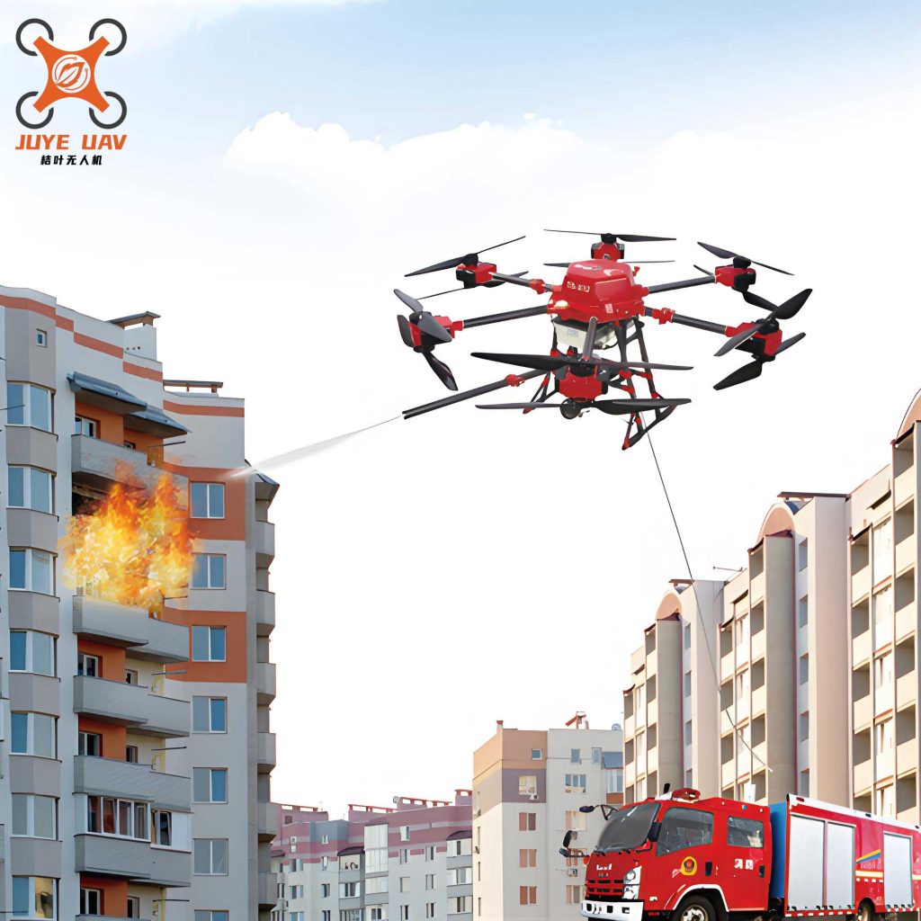
To ground the discussion, let’s consider a specific platform: a carbon-fiber hexacopter fire UAV. Its six-rotor configuration provides superior fault tolerance—it can lose one rotor and maintain controlled flight, a critical safety feature. In a modeled high-rise fire scenario, its application unfolds as follows.
Phase 1: Rapid Ascent and 360-Degree Assessment. Launched from the command vehicle, the fire UAV ascends to a vantage point. Its gimbal-stabilized 30x optical zoom and thermal camera immediately begin streaming. The thermal feed is processed using a simple thresholding algorithm to identify human-signature heat blobs H(x,y) within the structure:
$$ H(x,y) = \begin{cases} 1 & \text{if } T(x,y) \in [T_{min}, T_{max}] \text{ and } \text{ContourSize}(x,y) \approx \text{HumanScale}\\ 0 & \text{otherwise} \end{cases} $$
This processed data, overlaid on the visual feed, is the first actionable intelligence communicated: “Multiple thermal signatures, floors 12-14, northwest corner.”
Phase 2: Dual-Mode Data Link Sustainment. Throughout the operation, both communication links are active. The primary, low-latency microwave link feeds the live video to the mobile command center. Simultaneously, a secondary 4G/5G link streams a lower-bitrate version to a cloud server for archive and access by remote specialists. The system’s reliability R_sys with two independent links of reliability R_rf and R_cell is:
$$ R_{sys} = 1 – (1 – R_{rf})(1 – R_{cell}) $$
This parallel architecture ensures the communication channel remains open even if one technology fails.
Phase 3: Directed Communication and Monitoring. Once firefighting crews enter the building, the fire UAV is tasked to hover near a specific window where victims are located. The onboard loudspeaker broadcasts instructions in the local language. Concurrently, its camera monitors the window for signs of distress or change, with the video feed isolated on a dedicated monitor for the Rescue Group Supervisor. This direct, visual-and-audible link to a specific problem set exemplifies the precision a fire UAV brings to communication.
Conclusion: Toward an Autonomous Communication Wing
In my assessment, the journey of fire UAV integration is evolving from manual reconnaissance tools toward autonomous, networked communication systems. The future lies in swarms of heterogeneous UAVs—some for long-endurance high-altitude relays, others for close-in inspection and broadcasting—all communicating via mesh networks to create a resilient, aerial information grid over the disaster zone. The technical challenges in autonomy, spectrum management, and human-UAV teaming are significant, but the operational imperative is clear. The fire UAV is no longer just an eye in the sky; it is rapidly becoming the central nervous system of the modern fireground, ensuring that critical information flows freely when and where it is needed most, ultimately saving lives and protecting property with unprecedented efficiency.