
In my research and experience within the field of unmanned aerial systems, I have observed a significant transformation in how police drones are utilized for maintaining public safety and national security. As an integral armed force for safeguarding national stability, the continuous advancement of information technology has propelled police drones to the forefront of modern operations. These drones provide a robust platform for ultra-low-altitude or close-range reconnaissance, surveillance, and engagement, serving as a powerful investigative tool in complex ground environments. Consequently, police drones are playing an increasingly pivotal role in mission execution. Historically, drone operations relied on pre-calculated, fixed trajectories based on ground requirements. However, real-time path planning for police drones forms the technological foundation for autonomous flight, enabling drone swarm coordination, tactical re-planning, and dynamic objective reassignment. This capability is one of the most effective methods for enhancing the survival probability of police drones during missions.
Path planning, in essence, involves charting a flight trajectory that satisfies specific constraints to achieve mission objectives. It is an inseparable component of autonomous systems, addressing the fundamental problem of navigating from one location to another. The primary goal is to compute an optimal or shortest flight path within a reasonable timeframe, utilizing pre-set digital maps and GPS/INS integrated navigation systems. Given the inherent errors in digital maps and the influence of stochastic environmental factors—such as dynamic obstacles—police drones must possess the ability to dynamically adjust their trajectories in flight. This allows them to evade environments threatened by criminal elements and safely accomplish predefined tasks. The architecture of police drone path planning encompasses several core elements: environmental information (including obstacles, threat zones from criminal activity, and terrain features), police drone system constraints, the path planner itself, and the drone’s autopilot system. The police drone system typically operates with two control loops: an inner loop managed by the autopilot and an outer guidance loop. The guidance system generates lateral acceleration commands to ensure the police drone tracks the planned path, while the autopilot controls the elevator, ailerons, and rudder to achieve the required lateral acceleration.
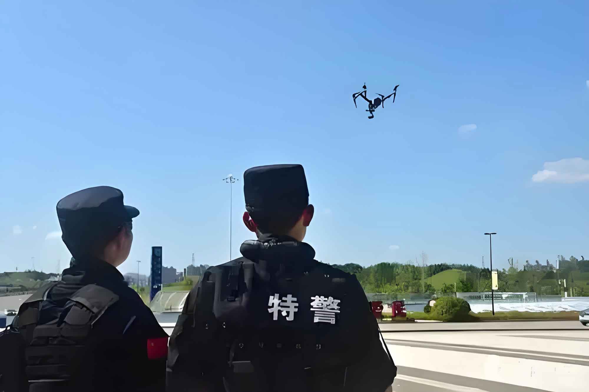
The objectives and methodologies for path planning vary significantly depending on the application domain of police drones within law enforcement. These applications include persistent surveillance, search and tracking operations, rescue missions, and disaster monitoring. A simplified framework representing the core approach to path planning for police drones can be conceptualized, integrating sensing, modeling, planning, and execution stages. In my analysis, I will delve into the critical constraints, modeling techniques, and algorithms that underpin effective path planning for police drones.
System Performance Constraints for Police Drones
Every police drone is bound by its inherent机动性能和物理限制, which must be rigorously accounted for during path planning. I have identified several key performance constraints that directly influence the feasibility and safety of a generated path for a police drone.
1. Minimum Path Segment Length: Due to the police drone’s maneuverability, it must travel a minimum straight-line distance before transitioning to a new flight attitude. This distance, denoted as $L_{min}$, is a fundamental constraint. If a path requires a turn at a point, the preceding and succeeding straight segments must each be at least $L_{min}$ in length to allow the police drone to stabilize its attitude. This can be expressed for a path segment vector $\vec{s_i}$ as:
$$|\vec{s_i}| \geq L_{min} \quad \forall i$$
2. Maximum Turning Angle: This constraint limits the maximum allowable change in heading between consecutive path segments in the horizontal plane. For a police drone, exceeding this angle may lead to loss of control or structural stress. Let the maximum turning angle be $\phi_{max}$. For two consecutive path segment vectors $\vec{v_i}$ and $\vec{v_{i+1}}$, the turning angle $\phi_i$ must satisfy:
$$\phi_i = \arccos\left(\frac{\vec{v_i} \cdot \vec{v_{i+1}}}{|\vec{v_i}| |\vec{v_{i+1}}|}\right) \leq \phi_{max}$$
This ensures all planned turns for the police drone are within its mechanical limits.
3. Maximum Climb/Dive Angle: In the vertical plane, a police drone cannot ascend or descend at arbitrary angles due to performance limits. The maximum climb angle $\gamma_{climb}^{max}$ and maximum dive angle $\gamma_{dive}^{max}$ constrain the path’s slope. For a path segment with a vertical displacement $\Delta z$ and horizontal displacement $\Delta d$, the flight path angle $\gamma$ must satisfy:
$$\gamma_{dive}^{max} \leq \gamma = \arctan\left(\frac{\Delta z}{\Delta d}\right) \leq \gamma_{climb}^{max}$$
4. Maximum Range: The total length of the flight path for a police drone is constrained by its fuel capacity or battery life. The police drone must safely return to base, imposing a maximum allowable航程 $R_{max}$. If a path consists of $n$ segments, the constraint is:
$$\sum_{i=1}^{n} |\vec{s_i}| \leq R_{max}$$
To summarize these constraints for police drones clearly, I present the following table:
| Constraint Type | Symbol | Mathematical Expression | Physical Implication for Police Drone |
|---|---|---|---|
| Minimum Path Segment Length | $L_{min}$ | $|\vec{s_i}| \geq L_{min}$ | Ensures stable attitude transition for the police drone. |
| Maximum Turning Angle | $\phi_{max}$ | $\phi_i = \arccos\left(\frac{\vec{v_i} \cdot \vec{v_{i+1}}}{|\vec{v_i}| |\vec{v_{i+1}}|}\right) \leq \phi_{max}$ | Limits horizontal maneuver sharpness to prevent control loss. |
| Maximum Climb Angle | $\gamma_{climb}^{max}$ | $\gamma \leq \gamma_{climb}^{max}$ | Restricts the steepness of ascent for the police drone. |
| Maximum Dive Angle | $\gamma_{dive}^{max}$ | $\gamma \geq \gamma_{dive}^{max}$ | Restricts the steepness of descent for the police drone. |
| Maximum Range | $R_{max}$ | $\sum |\vec{s_i}| \leq R_{max}$ | Guarantees the police drone can complete the mission and return. |
Threat Field Constraints in Police Drone Operations
Beyond intrinsic performance limits, a police drone must navigate operational environments laden with threats. These threats, which I categorize as natural obstacles, adverse weather phenomena, and areas controlled by hostile entities, create dynamic no-fly zones. In my modeling approach, a threat source is typically characterized by its spatial location and a threat radius. Assume a threat located at coordinates $(x_t, y_t, z_t)$ with a威胁半径 $r_t$. The region defined by all points $(x, y, z)$ satisfying the following inequality becomes a prohibited zone for the police drone:
$$(x – x_t)^2 + (y – y_t)^2 + (z – z_t)^2 \leq r_t^2$$
The path planning process for a police drone must therefore incorporate steps to identify and circumvent these zones. This involves:
- Threat Field Partitioning: Dividing the operational airspace into regions based on threat influence and other factors.
- Feasible Route Identification and Network Establishment: Determining all possible safe corridors for the police drone and constructing a connected graph of these routes.
- Threat Field Envelope Recognition and Integrated Network Synthesis: Defining the boundaries of threat zones and building a comprehensive navigation network that maximizes the police drone’s distance from threats where possible.
The following table outlines key elements of threat field constraints for police drone path planning:
| Threat Element | Description | Impact on Police Drone Path |
|---|---|---|
| Spatial Location | Coordinates $(x_t, y_t, z_t)$ of the threat center (e.g., hostile position). | Defines the center of the avoidance zone for the police drone. |
| Threat Radius ($r_t$) | The effective range within which the police drone is considered vulnerable. | Determines the size of the spherical or cylindrical no-fly zone. |
| Threat Type | Nature of threat (e.g., jamming, physical attack, detection). | Influences the weighting or hard/soft constraint nature in the police drone’s planning algorithm. |
| Temporal Dynamics | Whether the threat is static or moving. | Requires dynamic re-planning for the police drone to avoid predicted threat locations. |
Geometric Modeling for Police Drone Path Planning
To computationally solve the path planning problem for a police drone, the environment must be represented in a discrete or structured form. I have extensively studied two principal families of geometric modeling techniques: grid-based and graph-based representations.
Grid-Based Geometric Modeling
A grid, or mesh, decomposes the two-dimensional or three-dimensional operational space into cells. This discretization simplifies the environment for algorithmic processing. For police drone applications, grids can be uniform or non-uniform. Uniform grids, composed of regular polygons like squares, triangles, or hexagons, are common. Square grids are widely used due to their intuitive representation and ease of implementation. Hexagonal grids offer superior geometric properties, such as consistent adjacency and distance metrics, which can be beneficial for smooth path generation for a police drone. Non-uniform grids, like quadtrees or octrees, recursively subdivide space, providing higher resolution near obstacles or threats relevant to the police drone’s path, thereby optimizing memory and computational efficiency.
The cell state (free or occupied) can be represented with an occupancy grid. For a cell $c_{ij}$, its occupancy value $o_{ij} \in [0,1]$ might be used in probabilistic planning for a police drone. A simple binary model for a police drone’s navigable space can be:
$$
o_{ij} = \begin{cases}
0 & \text{if cell is free for police drone} \\
1 & \text{if cell is occupied/under threat}
\end{cases}
$$
Graph-Based Environment Representation
Graph-based models represent the environment as a network of nodes and edges, where nodes denote waypoints and edges denote feasible paths for the police drone. I categorize these into three main types based on their construction methodology.
Visibility Graph and Tangent Graph: The visibility graph method generates a network where nodes are the vertices of polygonal obstacles, and edges are straight-line segments connecting nodes that are mutually “visible” (i.e., the line does not intersect any obstacle). This creates a set of potential shortest paths around obstacles. For a police drone, if threats are modeled as circles or sectors, the visibility graph evolves into a tangent graph, where edges are tangent lines to the威胁 circles. This graph inherently contains the shortest safe path for the police drone, though it may graze threat boundaries. The construction involves checking line-of-sight for all pairs of vertices from the start point $S$, threat polygons, and goal point $D$ for the police drone.
Voronoi Diagram: This diagram partitions the space into regions based on distance to a set of seed points (e.g., threat locations). Each region consists of points closer to one seed than to any other. The edges of the Voronoi diagram are equidistant from the nearest two seeds. For police drone path planning, using threat centers as seeds means the Voronoi edges represent paths that maximize the distance from known threats, favoring stealth and safety for the police drone. The diagram is constructed using algorithms like Fortune’s plane-sweep. The weight of an edge $e$ in the Voronoi graph for a police drone can be a function of the minimum distance to threats, denoted for edge $e$ associated with seeds $s_i$ and $s_j$: $w(e) = f(d_{min}(e))$, where $d_{min}(e)$ is the distance from any point on $e$ to the nearest threat. A police drone path can then be found by searching this weighted graph.
Probabilistic Roadmap (PRM): This is a sampling-based method. It randomly samples points in the free space (feasible for the police drone) and connects nearby points if the connecting path is collision-free, thus building a graph called the probabilistic roadmap. This method is highly effective for high-dimensional configuration spaces. For a police drone operating in 3D with complex constraints, PRM can efficiently explore the space. The algorithm involves: 1) Random sampling of node $q_{rand}$ in free space. 2) Finding existing nodes $Q_{near}$ within a radius $r$. 3) Attempting to connect $q_{rand}$ to each $q \in Q_{near}$ with a local planner (checking police drone constraints). 4) Adding $q_{rand}$ and successful edges to the graph. This process builds a network that the police drone can later query for a path between start and goal.
I summarize the comparison of these geometric modeling techniques for police drone applications in the table below:
| Modeling Technique | Basis of Construction | Advantages for Police Drone | Disadvantages for Police Drone | Typical Use Case |
|---|---|---|---|---|
| Uniform Grid (e.g., Square) | Regular decomposition of space into cells. | Simple implementation, easy integration with sensor data for police drone. | Memory intensive for large areas, path discretization artifacts. | Real-time navigation in known, structured environments for police drone. |
| Voronoi Diagram | Geometric partitioning based on distance to threat points. | Maximizes stand-off distance from threats, naturally生成 safe corridors for police drone. | Computationally expensive to update dynamically, may generate longer paths. | Off-line planning for police drone in environments with known static threats. |
| Probabilistic Roadmap (PRM) | Random sampling and connection in free space. | Scalable to high dimensions (3D+), effective for complex police drone constraints. | Probabilistic completeness, may miss narrow passages. | Path planning for police drone in cluttered, unknown, or dynamic 3D environments. |
| Visibility/Tangent Graph | Connecting visible vertices of obstacles/threats. | Guarantees finding the shortest path if it exists, good for polygonal threats. | Paths may be too close to threats for police drone safety, graph size grows with obstacle vertices. | Shortest-path planning for police drone when threat proximity is secondary to speed. |
Path Planning Algorithms for Police Drones
The core intelligence of autonomous police drone navigation lies in the path planning algorithms. Based on my study, these algorithms can be broadly classified into traditional classical algorithms and modern intelligent algorithms. Each class has its merits and is suited for different scenarios involving police drones.
Traditional Classical Algorithms
Dynamic Programming (DP): This is a powerful method for solving multi-stage decision-making problems by breaking them down into simpler sub-problems. In the context of police drone path planning, the environment can be discretized into states (e.g., grid cells), and DP finds the optimal sequence of state transitions that minimizes a cost function (e.g., path length + threat exposure) from start to goal. Let $J(i)$ be the optimal cost-to-go from state $i$ to the goal. The Bellman equation for a police drone’s path planning can be formulated as:
$$J(i) = \min_{a \in A(i)} \left[ c(i, a) + J(j) \right]$$
where $A(i)$ is the set of admissible actions (movements) from state $i$ for the police drone, $c(i, a)$ is the immediate cost of taking action $a$ (which may incorporate police drone constraints and threat cost), and $j$ is the resulting state. DP guarantees a globally optimal solution but suffers from the “curse of dimensionality,” making it less practical for complex, high-resolution police drone environments with many states.
Modern Intelligent Algorithms
A* Search Algorithm: This is arguably the most widely used heuristic search algorithm for police drone path planning. It combines the strengths of uniform-cost search (Dijkstra’s) and greedy best-first search. A* evaluates nodes using a cost function $f(n) = g(n) + h(n)$, where $g(n)$ is the actual cost from the start node to node $n$ for the police drone, and $h(n)$ is a heuristic estimate of the cost from $n$ to the goal. For the police drone to find an optimal path, $h(n)$ must be admissible (never overestimates the true cost) and consistent. Common heuristics for a police drone in a grid include the Euclidean or Manhattan distance. The algorithm efficiently prunes the search space, making it suitable for real-time or near-real-time applications for police drones.
Genetic Algorithm (GA): Inspired by natural evolution, GA is a population-based metaheuristic optimization algorithm. It is particularly effective for solving complex, non-linear, and multi-objective optimization problems, such as finding a Pareto-optimal path for a police drone that balances distance, threat exposure, and energy consumption. A candidate solution (path for the police drone) is encoded as a chromosome (e.g., a sequence of waypoints). The algorithm operates through selection, crossover, and mutation operations over successive generations to evolve better paths. The fitness function $F$ for a police drone path chromosome $P$ might be defined as a weighted sum of objectives:
$$F(P) = w_1 \cdot \text{Length}(P) + w_2 \cdot \text{ThreatCost}(P) + w_3 \cdot \text{FuelCost}(P)$$
where $w_i$ are weights reflecting mission priorities for the police drone. GAs are robust and can handle non-differentiable cost landscapes but may require significant computation time and parameter tuning for police drone applications.
Other Notable Algorithms: In my research on police drones, I have also explored algorithms like Particle Swarm Optimization (PSO), which simulates social behavior, and Ant Colony Optimization (ACO), which mimics pheromone-based foraging of ants. These are also effective for police drone path planning, especially in dynamic environments.
The table below provides a comparative overview of key path planning algorithms relevant to police drone operations:
| Algorithm Category | Specific Algorithm | Key Principle | Strengths for Police Drone | Weaknesses for Police Drone |
|---|---|---|---|---|
| Classical Search | A* | Heuristic-guided graph search minimizing $f(n)=g(n)+h(n)$. | Optimal and complete with admissible heuristic, efficient for many police drone grids. | Performance depends on heuristic quality, memory usage can be high for large graphs. |
| Optimization Metaheuristic | Genetic Algorithm (GA) | Population-based evolution using selection, crossover, mutation. | Can handle complex, multi-objective cost functions for police drone, good for global search. | Computationally intensive, may converge slowly, parameter sensitive. |
| Optimization Metaheuristic | Particle Swarm Optimization (PSO) | Particles move in solution space influenced by personal and global best. | Simple implementation, fast convergence for some police drone problems. | May get stuck in local optima for complex police drone terrain. |
| Dynamic Programming | Value Iteration / Policy Iteration | Solves Bellman optimality equation through iterative updates. | Guarantees global optimality for defined state space for police drone. | Curse of dimensionality limits state space resolution for practical police drone use. |
| Sampling-Based | Rapidly-exploring Random Tree (RRT) | Iteratively builds a tree in free space by expanding towards random samples. | Very efficient for high-dimensional spaces (e.g., 3D police drone planning), probabilistically complete. | Paths are not optimal, can be jerky, requires post-processing for police drone smoothness. |
Mathematical Formulation of Police Drone Path Planning
To solidify understanding, I often frame the police drone path planning problem as a constrained optimization problem. Let the path for a police drone be represented by a sequence of $N$ waypoints in 3D space: $\mathbf{P} = \{\mathbf{p}_1, \mathbf{p}_2, …, \mathbf{p}_N\}$, where $\mathbf{p}_i = (x_i, y_i, z_i)$, with $\mathbf{p}_1$ as the start and $\mathbf{p}_N$ as the goal. The objective is to minimize a total cost function $C_{total}(\mathbf{P})$ subject to the police drone’s performance and threat constraints.
A typical composite cost function for a police drone might be:
$$C_{total}(\mathbf{P}) = \alpha \cdot C_{length}(\mathbf{P}) + \beta \cdot C_{threat}(\mathbf{P}) + \gamma \cdot C_{smoothness}(\mathbf{P})$$
where:
- $C_{length}(\mathbf{P}) = \sum_{i=1}^{N-1} ||\mathbf{p}_{i+1} – \mathbf{p}_i||$ is the total path length for the police drone.
- $C_{threat}(\mathbf{P})$ penalizes proximity to threats. For $M$ threats, one common model for a police drone is: $$C_{threat}(\mathbf{P}) = \sum_{i=1}^{N-1} \int_{0}^{1} \sum_{k=1}^{M} \frac{\kappa_k}{||\mathbf{p}(s) – \mathbf{t}_k||^m} \, ds$$ where $\mathbf{p}(s)$ parameterizes the segment between $\mathbf{p}_i$ and $\mathbf{p}_{i+1}$, $\mathbf{t}_k$ is the location of the $k$-th threat, and $\kappa_k, m$ are constants determining threat intensity and decay. A simpler discrete version sums inverse squared distances at each waypoint.
- $C_{smoothness}(\mathbf{P})$ promotes smooth turns for the police drone, often related to the turning angles: $$C_{smoothness}(\mathbf{P}) = \sum_{i=2}^{N-1} (\phi_i)^2$$ where $\phi_i$ is the turning angle at waypoint $\mathbf{p}_i$.
- $\alpha, \beta, \gamma$ are weighting coefficients tailored to the specific police drone mission.
The constraints for the police drone path are enforced as inequalities:
$$
\begin{aligned}
&||\mathbf{p}_{i+1} – \mathbf{p}_i|| \geq L_{min} \quad \text{(Min segment length)} \\
&\phi_i \leq \phi_{max} \quad \text{(Max turning angle)} \\
&\gamma_{min} \leq \gamma_i \leq \gamma_{max} \quad \text{(Flight path angle bounds)} \\
&\sum_{i=1}^{N-1} ||\mathbf{p}_{i+1} – \mathbf{p}_i|| \leq R_{max} \quad \text{(Max range)} \\
&||\mathbf{p}_i – \mathbf{t}_k|| \geq r_{t,k} + \delta \quad \forall i,k \quad \text{(Threat avoidance with safety margin $\delta$)}
\end{aligned}
$$
Solving this optimization yields a feasible and optimal trajectory for the police drone. Algorithms like GA or A* are employed to search for $\mathbf{P}$ that minimizes $C_{total}$ while satisfying these constraints.
Future Directions and Challenges in Police Drone Path Planning
As police drones are tasked with increasingly complex missions in uncertain environments, the demands on path planning technology escalate. Based on my analysis of current trends, I identify several critical future research directions and challenges specifically for police drone applications.
1. Real-Time Path Planning in Uncertain Environments: Future police drone systems must integrate and fuse multi-sensor data (e.g., LiDAR, radar, visual) under uncertainty. Techniques from probabilistic robotics, such as Bayesian filtering and occupancy grid mapping with uncertainty, will be crucial. The goal is to enable the police drone to autonomously modify its path in real-time based on newly detected obstacles or threats, without human intervention. This involves developing fast algorithms that can replan within the police drone’s control cycle.
2. Tactical-Grade, Strong Real-Time Planning: Missions requiring rapid response, such as hostage situations or pursuit, demand path planning for police drones that operates at tactical timescales—often on the order of milliseconds. This necessitates highly efficient algorithms, possibly running on specialized hardware onboard the police drone, and leveraging simplified but effective environment models.
3. Integrated Planning for Multi-Task Objectives: A single police drone mission may involve multiple phases: low-altitude penetration to avoid detection, area search for a target, and finally a rescue or monitoring loiter. Developing unified planning algorithms that can optimize across these diverse objectives (stealth, coverage, endurance) for the police drone is a significant challenge. Multi-objective optimization frameworks (e.g., Pareto front analysis) will be essential.
4. Cooperative Path Planning for Drone Swarms: The future of police drone operations lies in coordinated swarms. Developing algorithms for decentralized or centralized multi-police-drone path planning that ensures collision avoidance, optimal area coverage, and efficient communication is paramount. This includes研究 formation control, task allocation, and consensus algorithms among police drones.
5. Advanced Terrain and Threat Information Processing: Improving the algorithms that process raw terrain data (DTM/DSM) and threat intelligence to generate accurate, multi-resolution environmental models for the police drone is fundamental. This includes machine learning techniques for classifying terrain traversability and predicting threat behavior from historical data, thereby informing better path planning for the police drone.
The following table encapsulates these future research thrusts for police drone path planning:
| Research Direction | Core Challenge | Potential Technological Enablers for Police Drone | Expected Impact on Police Drone Operations |
|---|---|---|---|
| Uncertainty-Aware Real-Time Planning | Fusing noisy sensor data and dynamic obstacle prediction for reliable police drone navigation. | Bayesian inference, Kalman/粒子 filters, robust model-predictive control. | Enhanced autonomy and safety of police drone in cluttered, changing environments. |
| Tactical Real-Time Planning | Achieving planning latencies << 100ms for high-speed police drone maneuvers. | Lightweight graph representations, heuristic pre-computation, FPGA/GPU acceleration. | Enables police drone use in time-critical interdiction and rapid response scenarios. |
| Multi-Objective Mission Planning | Simultaneously optimizing conflicting goals like stealth, speed, and sensor coverage for police drone. | Multi-objective evolutionary algorithms (MOEA), weighted sum methods with adaptive weights. | More versatile and mission-adaptive police drones capable of complex end-to-end tasks. |
| Swarm Cooperative Planning | Managing path conflicts, communication delays, and shared objectives among multiple police drones. | Distributed optimization (ADMM), auction algorithms, virtual force fields. | Scalable operations with police drone swarms for large-area surveillance or coordinated action. |
| Intelligent Environment Modeling | Automatically extracting navigational features and threat patterns from heterogeneous data for police drone. | Deep learning for semantic segmentation of terrain/obstacles, pattern recognition in threat behavior. | Smarter, context-aware path planning that anticipates challenges for the police drone. |
In conclusion, the field of path planning for police drones is both vast and rapidly evolving. From addressing fundamental constraints and geometric representations to implementing sophisticated search and optimization algorithms, each layer contributes to the autonomy and effectiveness of the police drone. The integration of real-time adaptability, multi-drone coordination, and intelligent environment understanding will define the next generation of police drone capabilities. My ongoing research continues to explore these frontiers, aiming to develop robust and efficient planning systems that empower police drones to fulfill their critical roles in public safety and security operations with greater precision and reliability.