
The proliferation of civilian drones represents one of the most dynamic technological shifts in recent years. As an enthusiast and researcher in aerospace systems, I have witnessed firsthand their transformative potential across sectors like agriculture, logistics, infrastructure inspection, and emergency services. However, this rapid, widespread adoption has critically outpaced the development of robust regulatory frameworks, creating a significant “regulatory gap.” The frequent incidents of drones disrupting airport operations, infringing on privacy, and posing security threats are stark reminders of the urgent need for a cohesive, scalable, and technologically advanced air traffic management system dedicated to civilian drones.
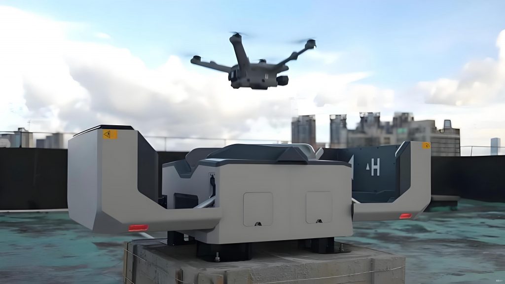
From my perspective, the core challenge lies in the unique characteristics of the civilian drone ecosystem: an immense number of diverse operators, a vast range of vehicle sizes and capabilities (from nano-drones to large cargo carriers), and operations predominantly in very low-level airspace that traditional aviation surveillance systems cannot effectively monitor. A purely legal or punitive approach is insufficient; it must be complemented by a proactive, enabling technological infrastructure that ensures safety, security, and efficiency. This article outlines my comprehensive构想 for a national-scale Civilian Drone Air Traffic Regulatory System, designed from the ground up to integrate these vehicles safely into the shared airspace.
1. The Global Regulatory Landscape and Current Limitations
Before detailing my proposed system, it is instructive to analyze existing approaches to managing civilian drones internationally and domestically. This analysis reveals both valuable paradigms and clear gaps that my design aims to address.
Internationally, regulatory bodies have taken varied paths. The United States Federal Aviation Administration (FAA) has pursued a risk-based, phased integration strategy. Key initiatives include the UAS Integration Roadmap, the development of the Low Altitude Authorization and Notification Capability (LAANC) for automated airspace authorizations, and partnerships with companies like AirMap to provide unified information services. The focus is on creating a digital ecosystem for managing flights, particularly in controlled airspace near airports. Similarly, the European Union Aviation Safety Agency (EASA) promotes a regulatory model proportional to the risk of the operation, emphasizing concepts like geo-awareness and remote identification. These efforts underscore a global trend toward digitalization and service-oriented management.
Within China, the regulatory responsibility is distributed among civil aviation, public security, and military authorities. The implementation of a real-name registration system is a foundational step. Several cloud-based platforms, such as U-Care and U-Cloud, have emerged, offering services like flight plan filing, basic situational awareness, and warnings. However, in my assessment, these existing systems face several limitations. They often operate in silos, lack nationwide interoperability, and their surveillance capabilities are primarily passive or reliant on cooperative drones voluntarily reporting their position. They struggle with non-cooperative or “rogue” civilian drones and lack the hierarchical command and control structure needed for coordinated, large-scale incident response across different administrative regions.
The following table summarizes the key characteristics and perceived gaps in current regulatory approaches:
| Region/System | Core Approach | Key Strengths | Identified Gaps for Scalability |
|---|---|---|---|
| FAA (USA) | Risk-based categorization, UTM development, public-private partnerships. | Promotes innovation, automated airspace access (LAANC), layered regulatory framework. | Fragmented data ecosystems, evolving rules for BVLOS & dense operations, integration with legacy ATC. |
| EASA (EU) | Operation-centric regulation, emphasis on geo-awareness & remote ID. | Harmonized rules across member states, clear safety objectives proportional to risk. | Implementation pace varies, need for continent-wide interoperable U-space services. |
| Current Chinese Platforms (e.g., U-Care) | Cloud-based registration, basic flight plan filing, and data monitoring. | Provides initial user management tools, accessible via mobile apps. | Limited surveillance fusion, reactive incident response, no unified national oversight architecture. |
This landscape analysis motivates the core principles of my proposed system: it must be hierarchical for manageability, network-centric for interoperability, service-oriented for flexibility, and capable of fusing multiple sources of surveillance data to handle both cooperative and non-cooperative civilian drones.
2. Proposed System Architecture: A Three-Tiered, Service-Oriented Design
My构想 for the Civilian Drone Air Traffic Regulatory System is built on a three-tiered organizational structure, mirrored by a flexible, Service-Oriented Architecture (SOA) technical foundation. This design ensures centralized oversight, decentralized execution, and the ability to adapt to evolving technologies and regulatory needs.
2.1. Hierarchical System Composition
The physical and organizational deployment consists of four main components, organized into three logical tiers:
Tier 1: National Civilian Drone Regulatory Center (NCDRC)
This is the apex body responsible for nationwide strategic oversight. Its functions include formulating national policy and technical standards, managing the national registry of civilian drones and operators, orchestrating cross-regional and inter-agency (e.g., with civil aviation and military) coordination, and analyzing macro-level traffic flow and risk trends. It maintains the “big picture” but does not handle real-time tactical control.
Tier 2: Regional Civilian Drone Regulatory Centers (RCDRCs)
Aligned with existing civil aviation regional administration boundaries, RCDRCs handle operational management for large areas. They are responsible for regional airspace resource planning and allocation, approval of cross-district flight plans, monitoring regional drone traffic situational awareness, and coordinating incident response across multiple lower-tier districts. They serve as the critical link between national policy and local execution.
Tier 3: Local Civilian Drone Regulatory Stations (LCDRSs)
These are the frontline units, deployed at the city or major airport level. Their role is tactical and immediate. They provide real-time surveillance over their area of responsibility, handle local flight plan and airspace requests, execute dynamic geo-fencing, generate immediate conflict alerts, and initiate rapid response protocols for rogue or non-compliant civilian drones in coordination with local law enforcement and counter-drone units.
User Access Tier: Multi-Channel Service Portal
This is the interface for all civilian drone operators. Access is provided through web portals and mobile applications, enabling services such as real-name registration, electronic flight plan submission, airspace application, real-time aeronautical and meteorological information queries, and receipt of compliance alerts.
2.2. Technical Architecture: A Service-Oriented Foundation
To interconnect these distributed tiers and components into a cohesive, agile system, I propose an SOA-based technical architecture. This approach packages all functionalities as independent, reusable “services” that communicate over a secure network. This design maximizes flexibility, scalability, and resilience. The architecture can be visualized in five layers:
| Layer | Description & Components |
|---|---|
| 5. Presentation Layer | Web portals, mobile apps, and desktop clients for operators and regulators, providing customized views and interactions. |
| 4. Application Service Layer | Core business logic encapsulated as discrete services (e.g., FlightPlanValidationService, SurveillanceFusionService, ConflictDetectionService, AlertManagementService). |
| 3. Service Platform Layer | SOA runtime environment: Service Registry, Discovery, Orchestration Engine, and API Gateways for managing service lifecycles and interactions. |
| 2. Communication Layer | Secure, high-throughput messaging middleware (e.g., AMQP, MQTT) and data buses enabling reliable, platform-agnostic communication between all services and tiers. |
| 1. Physical & Data Layer | Hardware infrastructure (servers, sensors, network gear) and foundational data sources (drone registry, airspace maps, radar feeds, weather data). |
The power of this SOA design is that a Regional Center or Local Station is not a monolithic software application but a tailored assembly of services drawn from a shared national catalog. This allows for rapid deployment, easy updates, and seamless information sharing across the entire regulatory ecosystem for civilian drones.
3. Core Functional Modules of the Regulatory System
Building upon the hierarchical and SOA foundation, the system delivers a suite of integrated functionalities. Each function is implemented as one or more services within the architecture.
1. Unified Identity and Lifecycle Management: This is the cornerstone of accountability. Every civilian drone and its remote pilot must be registered in the national database. The system maintains a digital “logbook” for each drone, recording its specifications, ownership history, maintenance records, and, crucially, its operational history and any compliance violations. This enables a credit-rating system for operators, where recurrent violations lead to restricted privileges.
2. Dynamic Airspace Management and Geo-fencing: The system maintains a digital model of national airspace, integrating permanent restrictions (airports, military zones) and temporary ones (event venues, disaster areas). A core service is dynamic geo-fencing. When a flight plan is submitted, the system checks it against this model. Furthermore, it can push updated geo-fence data directly to compliant civilian drones in flight, providing a technical barrier to entering prohibited zones. The geo-fence is a 4D volume (latitude, longitude, altitude, time). A simple intrusion check can be formulated as a containment test at time t:
$$ \text{Alert} = \begin{cases}
\text{True}, & \text{if } P_{drone}(t) \in V_{prohibited}(t) \\
\text{False}, & \text{otherwise}
\end{cases} $$
where \( P_{drone}(t) \) is the drone’s 4D position and \( V_{prohibited}(t) \) is the time-varying prohibited volume.
3. Multi-Source Surveillance Data Fusion: This is the “situational awareness engine.” The system ingests data from a wide array of sources:
- Cooperative Surveillance: Direct telemetry from drones via cellular networks (4G/5G), dedicated datalinks, or broadcast protocols like Remote ID.
- Non-Cooperative Surveillance: Radar (primary and secondary), electro-optical/infrared (EO/IR) sensors, acoustic arrays, and RF scanners to detect non-participating civilian drones.
- Crowdsourced Reports: Validated sightings from authorized personnel or the public via the mobile app.
A fusion service correlates tracks from these disparate sources, creating a single, coherent picture of all airborne objects, classifying them as registered civilian drones, unidentified drones, or other aircraft.
4. Intelligent Flight Plan Management and Monitoring: The system facilitates seamless flight plan (FP) submission and provides continuous conformance monitoring. When a FP is filed, services automatically check for airspace conflicts, weather suitability, and operator permissions. Once approved, the planned 4D trajectory becomes a reference for monitoring. The system compares the real-time fused surveillance track \( T_{actual}(t) \) with the planned trajectory \( T_{planned}(t) \). A conformance metric \( C(t) \) can be defined, triggering alerts if a threshold \( \epsilon \) is exceeded:
$$ C(t) = \| T_{actual}(t) – T_{planned}(t) \| $$
$$ \text{Conformance Alert} \iff C(t) > \epsilon $$
5. Conflict Detection and Resolution (CD&R): This critical safety service operates in real-time. It continuously computes the separation between all tracked objects—both between civilian drones and between civilian drones and manned aircraft. It predicts potential losses of separation (LOS) based on projected trajectories. For strategic conflicts, it can suggest adjusted flight plans to operators. For imminent tactical conflicts, it can generate urgent resolution advisories (RAs), which could be direct commands to automated drones or prioritized alerts to human pilots.
6. Emergency Incident Command and Response: When a non-cooperative, rogue, or malfunctioning civilian drone is detected (e.g., in a prohibited zone), the system transitions to response mode. It facilitates coordinated incident management: quickly sharing the target’s location and trajectory with designated Local Stations and law enforcement, suggesting optimal interception points, and even interfacing with authorized counter-drone systems (e.g., jamming, capture) by providing targeting data, all while logging the entire event for post-incident analysis.
The following table maps these core functions to the system tiers and the types of civilian drones they primarily address, illustrating the concept of differentiated, risk-based management:
| Core Function | Primary Tier | Focus by Drone Category |
|---|---|---|
| Identity Management | National | All civilian drones (Micro to Large) |
| Airspace Management & Geo-fencing | Regional / Local | Light & Small civilian drones (low-altitude ops) |
| Surveillance Fusion | Local / Regional | All, but critical for Micro/Small non-cooperative drones |
| Flight Plan Monitoring | Regional / Local | Light, Small, & Large civilian drones (beyond visual line of sight) |
| Conflict Detection & Resolution | Local / Regional | All, especially in dense or mixed-traffic airspace |
| Emergency Response | Local | Non-cooperative or rogue civilian drones of any category |
4. Key Enabling Technologies and Methodologies
The realization of this system hinges on advancing and integrating several key technologies.
4.1. Advanced Multi-Sensor Data Fusion Algorithms
Fusing heterogeneous data (radar plots, intermittent cellular pings, visual detections) with varying accuracy, latency, and confidence levels is complex. My approach employs probabilistic fusion frameworks like Multi-Hypothesis Tracking (MHT) or Distributed Kalman Filters. These algorithms can maintain tracks even with sparse data and correctly associate new detections with existing tracks amidst clutter. A simplified fusion update for a track’s state estimate \( \hat{x}_k \) at time \( k \) using a new measurement \( z_k \) can be represented by the Kalman filter equations:
$$ \hat{x}_{k|k-1} = F_k \hat{x}_{k-1|k-1} \quad \text{(Prediction)} $$
$$ P_{k|k-1} = F_k P_{k-1|k-1} F_k^T + Q_k $$
$$ K_k = P_{k|k-1} H_k^T (H_k P_{k|k-1} H_k^T + R_k)^{-1} \quad \text{(Kalman Gain)} $$
$$ \hat{x}_{k|k} = \hat{x}_{k|k-1} + K_k (z_k – H_k \hat{x}_{k|k-1}) \quad \text{(Update)} $$
$$ P_{k|k} = (I – K_k H_k) P_{k|k-1} $$
Where \( F \) is the state transition model, \( H \) is the observation model, \( Q \) is process noise, \( R \) is measurement noise, and \( P \) is the error covariance. The fusion service runs multiple instances of such filters for different sensor types and performs association logic to decide which measurement \( z_k \) updates which track \( \hat{x} \).
4.2. AI-Powered Command, Control, and Task Scheduling
With potentially millions of civilian drones operating daily, manually monitoring every flight is impossible. AI is essential for automated task scheduling and resource allocation for the regulatory staff. We can model the Local Station’s monitoring task as a dynamic scheduling problem. Let \( T = \{T_1, T_2, …, T_n\} \) be a set of monitoring tasks (e.g., “validate flight path of drone A,” “investigate unidentified track B”). Each task has a priority weight \( w_i \) (based on drone credit, location risk), an estimated processing time \( p_i \), and a deadline \( d_i \). The station has \( m \) available human operators. The objective is to find a schedule \( S \) that maximizes the total weighted completion of tasks before their deadlines or minimizes total tardiness.
A heuristic objective function could be to minimize:
$$ \sum_{i=1}^{n} w_i \cdot \max(0, C_i(S) – d_i) $$
where \( C_i(S) \) is the completion time of task \( T_i \) in schedule \( S \). Genetic algorithms or rule-based heuristic schedulers can optimize this in real-time, directing human attention to the highest-risk incidents involving civilian drones.
4.3. Predictive Risk Assessment for Flight Authorization
Beyond checking static rules, the system should assess dynamic risk. A machine learning model can be trained to assign a risk score \( R_{FP} \) to a flight plan based on multiple features: operator history \( H_{op} \), drone reliability metrics \( M_{drone} \), complexity of airspace \( A_{complex} \), weather conditions \( W \), and time of day \( D \).
$$ R_{FP} = f(H_{op}, M_{drone}, A_{complex}, W, D) $$
This score can determine the level of scrutiny (automatic approval, human review, mandatory equipage) or dictate specific risk mitigations, such as larger separation buffers or required monitoring service levels.
4.4. Secure and Resilient Communication Networks
The entire system depends on secure, low-latency data links. This involves a hybrid network:
- Backbone: High-speed, encrypted fiber/leased lines connecting national, regional, and major local centers.
- Last-Mile Access: Leveraging public 4G/5G networks for drone telemetry and command, augmented by secure VPNs and future dedicated spectrum (e.g., LTE-BASED C2).
- Contingency Protocols: Mechanisms for drones to maintain basic safety (e.g., execute pre-programmed lost-link procedures) and for stations to operate in a degraded communication mode using cached data and local sensor fusion.
The integrity and authentication of all messages, especially remote identification and command signals, must be protected via strong cryptographic protocols to prevent spoofing or hacking of civilian drones.
5. Conclusion: Toward an Integrated and Sustainable Ecosystem
The vision I have laid out is not merely a control system but an enabling infrastructure. The proposed Civilian Drone Air Traffic Regulatory System, with its three-tiered hierarchy, service-oriented architecture, and advanced data fusion core, is designed to transform chaos into order. It moves the regulatory paradigm from one of restriction and reaction to one of management and facilitation.
By implementing such a system, we achieve multiple strategic objectives: enhanced safety through proactive conflict prevention and robust surveillance of all civilian drones; security assurance through identity management and rapid response to threats; airspace efficiency through dynamic resource allocation; and ultimately, economic empowerment by providing a predictable, safe, and scalable environment for the commercial drone industry to innovate and grow.
The path forward requires close collaboration between regulators, air navigation service providers, the aviation industry, technology developers, and academia. Phased implementation, starting with key metropolitan areas and high-risk zones, will allow for iterative testing and refinement. The ultimate goal is a seamless integration where civilian drones operate as a harmonious layer within the broader national airspace system, their movements as visible, predictable, and manageable as those of any other aircraft. This is not just a technical challenge but a necessary evolution in our aviation infrastructure, and the time to build its foundation is now.