
The integration of Unmanned Aerial Vehicle (UAV) technology into public safety operations represents one of the most significant advancements in modern emergency response. From my perspective as a practitioner in the field, the advent of specialized fire drone systems has fundamentally altered the paradigm of incident management, particularly in the critical domain of communication. While traditional methods often falter in complex disaster zones, the deployment of a fire drone offers a resilient, mobile, and intelligent node for data acquisition and relay. This article delves into the technical advantages, concrete applications, and systemic integration pathways of UAV technology in fire and rescue communication networks, supported by analytical models and functional comparisons.
The core value proposition of a fire drone in communication lies in its unique operational triad: mobility, perspective, and resilience. Unlike ground-based units, a fire drone transcends terrestrial obstacles, providing a dynamic aerial platform.
| Advantage | Technical & Operational Implications |
|---|---|
| Mobility & Flexibility | Rapid deployment (often <5 mins), operation in confined spaces, ability to hover and maneuver at varying altitudes. Enables immediate overwatch upon arrival, often before ground forces can safely access the area. |
| Comprehensive Field of View (FOV) | Provides a top-down, synoptic view of the incident. Integrated high-zoom, thermal, and multispectral cameras can penetrate smoke, identify heat signatures, and assess structural integrity, feeding real-time intelligence back to command. |
| Safety & Resilience | Can operate in hazardous environments (toxic smoke, radiological risk, impending structural collapse) without endangering personnel. Acts as a persistent, replaceable asset for situational awareness. |
These advantages converge to create a powerful communication node. The primary function shifts from mere voice relay to rich, georeferenced data streaming. The operational effectiveness can be modeled by a simple utility function, where the value \( V \) of the fire drone communication is a function of data richness \( R \), timeliness \( T \), and coverage area \( A \), mitigated by operational constraints \( C \) (like battery life \( L \) and signal integrity \( S \)):
$$ V_{drone} = \frac{f(R, T, A)}{g(C)} = \frac{\alpha R \cdot \beta T \cdot \gamma A}{\delta \frac{1}{L} \cdot \epsilon \frac{1}{S}} $$
Here, \( \alpha, \beta, \gamma, \delta, \epsilon \) are weighting coefficients specific to the incident type. Maximizing \( V_{drone} \) is the objective of effective fire drone deployment.
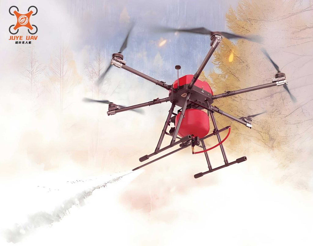
Core Applications: From Reconnaissance to Command & Control
The application of a fire drone spans the entire timeline of an incident response, creating a continuum of information flow.
1. Autonomous Pre-emptive and Primary Reconnaissance
The first and most critical application is scouting. Upon dispatch, a fire drone can be launched en route or immediately on scene to perform an initial assessment. Advanced systems employ autonomous flight path planning algorithms to maximize coverage efficiency. A common approach combines environment mapping with optimized search algorithms.
First, the airspace is discretized using a 3D grid (voxel) map \( M \), where each cell \( c_{i,j,k} \) contains information about occupancy (e.g., from building data or real-time sensors). The objective is to find an optimal flight path \( P \) that visits a set of critical vantage points \( \{v_1, v_2, …, v_n\} \). This can be formulated as a variant of the Traveling Salesman Problem (TSP) with constraints.
We define a cost function \( J(P) \) for a path \( P \) consisting of segments between waypoints:
$$ J(P) = \sum_{m=1}^{n-1} \left( w_d \cdot d(v_m, v_{m+1}) + w_t \cdot t(v_m, v_{m+1}) + w_r \cdot r(v_m, v_{m+1}) \right) $$
where:
- \( d(v_m, v_{m+1}) \): Euclidean distance between waypoints.
- \( t(v_m, v_{m+1}) \): Threat cost (proximity to hazards).
- \( r(v_m, v_{m+1}) \): Resource cost (battery consumption).
- \( w_d, w_t, w_r \): Weighting coefficients.
Algorithms like A* or probabilistic roadmaps (PRM) are used to find a path minimizing \( J(P) \) while ensuring a safe altitude \( h_{safe} \) above the highest obstacle in the operational sector. This autonomous reconnaissance provides commanders with a first look, identifying fire location, spread vectors, and potential victim locations before a single responder enters the hazard zone.
2. High-Fidelity, Multi-Path Image & Data Transmission
The lifeline of the fire drone is its ability to stream data back. Modern systems utilize a hybrid communication model to ensure robustness. The two primary data links are:
| Link Type | Technology | Path | Advantages | Limitations |
|---|---|---|---|---|
| Cellular (4G/5G) | Public Network | Drone → Modem → Public Cell Tower → Cloud Server → Command Center | Long range, leverages existing infrastructure, low-latency for wide-area coverage. | Dependent on network availability/ congestion; potential security concerns. |
| Direct Microwave/RF | Point-to-Point Digital Data Link | Drone → Airborne Transceiver → Ground Station (Vehicle/Portable) → Command Post | Secure, reliable, high-bandwidth, independent of public networks. | Line-of-sight required; limited range (typically 5-10 km). |
The data throughput \( B \) required can be estimated for video streaming. For a high-definition (1080p) thermal video stream with frame rate \( f \), color depth \( b \), and compression ratio \( \rho \):
$$ B_{video} = \frac{(Width \times Height \times b \times f)}{\rho} $$
For example, a 1080p stream (1920×1080), 16-bit depth, at 30 fps with a compression ratio of 50:1 requires approximately:
$$ B_{video} = \frac{(1920 \times 1080 \times 16 \times 30)}{50} \approx 19.9 \text{ Mbps} $$
A modern fire drone payload must support this bandwidth via its links. The hybrid approach ensures redundancy; if the public network fails, the direct link maintains the vital video feed for tactical decisions.
3. Dynamic Situation Monitoring and Predictive Analysis
Beyond initial recon, the fire drone serves as a persistent observation post. By stationing a fire drone at a strategic loiter point, command gains continuous insight into incident dynamics—fire spread, structural deformation, or crowd movement. This real-time data feed allows for predictive modeling. Simple predictive spread models for wildfires, for instance, can be visualized and updated live using drone-fed parameters like wind speed \( u_w \) and direction \( \theta_w \) at different altitudes, and fuel moisture content estimates from spectral sensors.
The rate of spread \( ROS \) in a direction can be approximated (in simplified models) as a function of these variables:
$$ ROS \propto u_w^n \cdot e^{-k \cdot M_c} $$
where \( n \) is an empirical exponent, \( k \) is a constant, and \( M_c \) is moisture content. The fire drone provides \( u_w, \theta_w \) and helps estimate \( M_c \), making the model operational.
4. Integrated Command, Control, and Communication (C3)
The ultimate application is the integration of the fire drone as a node in a broader C3 network. The drone becomes a relay, extending the range of ground personnel’s handheld radios in complex terrain (urban canyons, inside large structures). It can broadcast alerts and instructions via an onboard megaphone, reaching people on multiple floors of a building simultaneously. Most importantly, it enables a “shared situational awareness” picture. Live video, overlaid with GIS data, resource locations, and hazard zones, is distributed to command vehicles, the incident commander, and even to tablets carried by sector leaders on the ground. This creates a coherent, real-time operational picture, drastically improving coordination and safety.
System Integration and Operational Workflow
To realize these applications, the fire drone system must be seamlessly integrated into standard operating procedures. The workflow can be decomposed into phases:
| Phase | Fire Drone Action | Communication Function | Data Output |
|---|---|---|---|
| Dispatch & En Route | Automated pre-flight check, launch from vehicle. | Links established (5G & direct). | Live feed of route and approaching scene. |
| Initial Assessment | Autonomous or manual wide-area scan. | High-bandwidth video streaming (thermal/visual). | 360° panorama, identification of key hazards (H), victims (V), access points (A). |
| Active Operations | Persistent overwatch, targeted inspection. | Relay for ground team comms, data link for sensor payload. | Continuous video, spot thermal readings, gas concentration measurements. |
| Extended Monitoring | Automated orbit/patrol for mop-up or scene preservation. | Low-bandwidth periodic status updates. | Time-lapse imagery, hotspot detection alerts. |
A critical technical consideration is the communication link budget for the direct data link. The received power \( P_r \) at the ground station is given by the Friis transmission equation:
$$ P_r = P_t + G_t + G_r – L_{fs} – L_{other} $$
where:
- \( P_t \): Transmitter power (dBm).
- \( G_t, G_r \): Antenna gains of drone and ground station (dBi).
- \( L_{fs} \): Free-space path loss = \( 20\log_{10}(d) + 20\log_{10}(f) + 92.45 \) (for \( d \) in km, \( f \) in GHz).
- \( L_{other} \): Losses due to atmospheric attenuation, rain, etc.
Ensuring \( P_r \) remains above the receiver’s sensitivity threshold is essential for maintaining the video link, dictating choices for antenna type, frequency band, and operational radius.
Case Analysis: A Tactical Scenario
Consider a reported warehouse fire. The first-arriving unit launches a fire drone. In the first 90 seconds, it performs an automated exterior orbit, streaming thermal video. Command identifies the main fire seat (Section B) and a significant heat anomaly on the roof of Section A, indicating potential truss compromise—a critical safety communication immediately relayed to all crews.
As crews make entry for interior attack, the fire drone is manually flown to monitor the roof of Section A from a safe distance. Its direct data link provides a flawless, low-latency feed to the Safety Officer’s vehicle. Simultaneously, its 5G link broadcasts a lower-resolution overview to the Battalion Chief’s command tablet. Fifteen minutes into operations, the thermal feed shows a rapid temperature increase on the Section A roof. This predictive intelligence allows command to order an immediate evacuation moments before a partial roof collapse occurs. The fire drone then tracks the collapse zone, helping to account for all personnel and reassess the tactical plan.
Challenges and Future Evolution
Despite the clear benefits, challenges remain for ubiquitous fire drone communication integration. These include: stringent BVLOS (Beyond Visual Line of Sight) regulatory hurdles; spectrum management for dense deployments in major incidents; AI-powered automated analysis of drone-collected data to reduce operator cognitive load; and the development of standardized protocols for drone-to-drone (D2D) and drone-to-infrastructure (D2I) communication to form resilient ad-hoc networks.
The future points towards swarming technologies, where multiple fire drone units operate collaboratively. A swarm could self-organize an optimal communication relay network, ensuring coverage in deep urban or subterranean environments. The network’s connectivity \( \Gamma \) for a swarm of \( N \) drones can be modeled using graph theory, where it must maintain a minimum degree \( k \) for redundancy:
$$ \Gamma = \{ G(V,E) : \deg(v_i) \geq k, \forall v_i \in V \} $$
where \( V \) represents drones and \( E \) represents stable communication links between them.
In conclusion, the fire drone is far more than an aerial camera; it is a transformative communication and intelligence platform. By providing unmatched situational awareness, ensuring resilient data links, and enabling informed command decisions, it addresses chronic gaps in traditional fireground communication. The ongoing evolution towards greater autonomy, interoperability, and analytical depth promises to further cement the fire drone as an indispensable node in the life-saving network of modern emergency response.