In my work as a researcher focused on grassland ecosystem management, I have observed the critical challenges posed by pest infestations, particularly the grassland caterpillar (Gynaephora alpherakii), which severely impacts pasture quality and livestock productivity. Traditional control methods, such as manual spraying with large or backpack sprayers, often face limitations in efficiency, pesticide utilization, and adaptability to complex terrains. To address these issues, I embarked on a study to explore the potential of multi-rotor agricultural drones for precision pesticide application in alpine pastoral areas. This research aims to establish technical parameters and evaluate the efficacy of agricultural drone-based control strategies, contributing to modernized and sustainable pest management practices.
The study was conducted in a typical alpine meadow region, characterized by an average altitude of 3,500 meters, with dominant grass species including Poa annua, Elymus dahuricus, and Kobresia humilis. This area is a recurrent hotspot for grassland caterpillar outbreaks, with pre-treatment surveys indicating an average larval density of 64 individuals per square meter, peaking at 120 individuals per square meter, primarily at the 3–4 instar stages. The harsh environmental conditions, including short growing seasons and variable weather, necessitated a robust and adaptable control technology, which led me to investigate the use of agricultural drones.
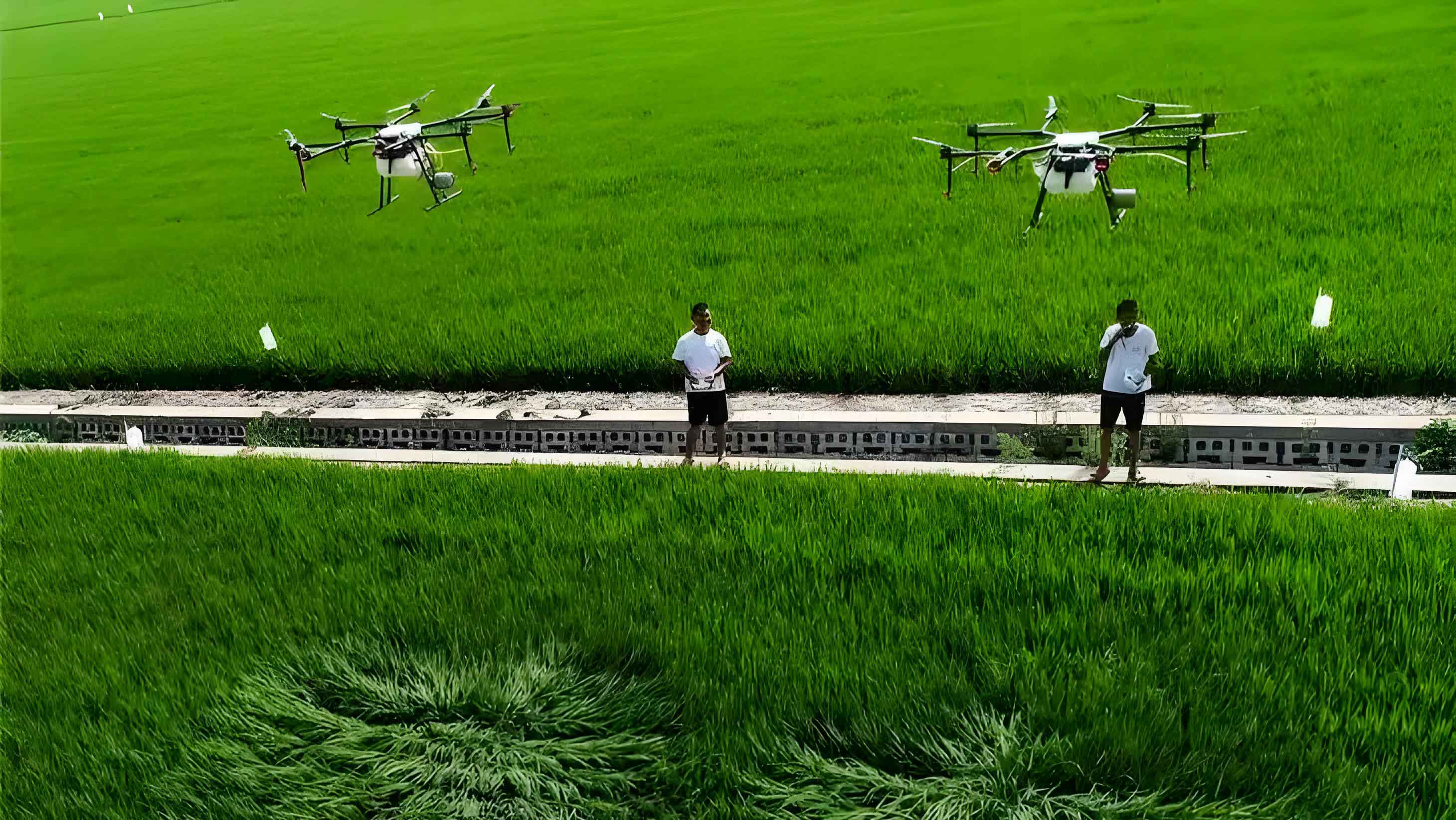
In my experimental design, I utilized a DJI MG-1P agricultural drone, a model selected for its advanced features such as high-precision radar, obstacle avoidance systems, and GPS positioning. The drone is equipped with four nozzle sprayers and has a theoretical payload capacity of 10 kg. For biocontrol agents, I employed two types: 2% matrine aqueous solution and a short-stable bacillus formulation, both chosen for their environmental safety and efficacy against lepidopteran pests. The methodology followed standardized grassland pest survey and control protocols, with pre- and post-treatment assessments conducted at intervals of 3, 5, and 7 days after spraying. Key metrics included larval density reduction, operational efficiency, and technical feasibility under field conditions.
To optimize the agricultural drone’s performance, I first conducted a series of parameter tests to determine ideal operating conditions. These tests measured factors such as flight height, speed, spray width, droplet density, payload capacity, and environmental constraints. The results are summarized in the table below, which highlights the agricultural drone’s capabilities in varying weather scenarios. Notably, the agricultural drone demonstrated stable operation at heights of 2–2.5 meters, with wind speeds below 4 levels (approximately 5.5–7.9 m/s), and on slopes up to 30 degrees. Payloads exceeding 7 kg were found to impair stability, thus defining a practical limit for efficient spraying.
| Weather Condition | Flight Height (m) | Flight Speed (m/s) | Spray Width (m) | Droplet Density (drops/cm²) | Payload (kg) | Daily Sorties | Daily Coverage (ha) |
|---|---|---|---|---|---|---|---|
| Calm (no wind) | 2.0–2.5 | 5 | 4.5–5.5 | 30–50 | 7 | 48–58 | 23.3–30.0 |
| Cloudy with breeze (3–4 level wind) | 2.0–2.5 | 5 | 4.5–5.5 | 25–45 | 7 | 62–72 | 20.0–26.7 |
| Windy (>4 level wind) | Not recommended | Not recommended | Not applicable | Not applicable | Not applicable | 0 | 0 |
The operational efficiency of the agricultural drone was quantified using performance equations. For instance, the area covered per sortie (A_s) can be expressed as: $$ A_s = v \times w \times t $$ where v is the flight speed (m/s), w is the effective spray width (m), and t is the sortie duration (s). Given typical values of v = 5 m/s, w = 5 m, and t = 480 s (8 minutes), the agricultural drone covers approximately 12,000 m² per sortie, or 1.2 hectares. However, factoring in turning times and battery changes, the practical coverage is about 0.47–0.6 ha per sortie, as observed in field tests. The daily operational area (A_d) is then: $$ A_d = N \times A_s $$ where N is the number of sorties per day. Under calm conditions, with N ranging from 48 to 58, A_d varies from 22.6 to 34.8 ha, aligning with empirical data.
For the control efficacy trials, I applied the biocontrol agents at different dosage rates using the agricultural drone. Post-treatment assessments revealed significant reductions in larval densities. The control efficacy (CE) was calculated using the formula: $$ CE = \left(1 – \frac{D_p}{D_0}\right) \times 100\% $$ where D_0 is the pre-treatment density and D_p is the post-treatment density. The results after 5 days are presented in the table below, demonstrating that both agents achieved efficacies above 90% at optimal dosages, with no adverse effects on pasture grasses observed during follow-up monitoring.
| Agent | Dosage (ml/ha) | Pre-treatment Density (ind./m²) | Post-treatment Density (ind./m²) | Control Efficacy (%) |
|---|---|---|---|---|
| Short-stable bacillus | 225 | 46 | 5.00 | 89.21 |
| Short-stable bacillus | 300 | 55 | 4.33 | 92.12 |
| Short-stable bacillus | 375 | 87 | 5.67 | 93.49 |
| 2% Matrine | 150 | 87 | 9.00 | 89.69 |
| 2% Matrine | 225 | 36 | 2.67 | 92.52 |
| 2% Matrine | 300 | 49 | 2.67 | 94.52 |
Building on these results, I established a demonstration zone spanning approximately 3,300 hectares, where the agricultural drone was deployed over 18 days using seven DJI MG-1P units. A total of 60 kg of short-stable bacillus and 705 kg of 2% matrine were applied, with real-time monitoring of flight trajectories, operational times, and coverage areas. This large-scale application confirmed the agricultural drone’s precision and scalability, as each unit consistently achieved daily coverages of 20–30 ha, depending on weather conditions. The integration of GPS data allowed for exact mapping of treated zones, minimizing overlaps and omissions—a key advantage over manual methods.
From this research, I derived several insights into the advantages and limitations of agricultural drone technology for grassland pest control. The agricultural drone offers notable benefits: it operates with high efficiency, covering large areas rapidly; its smart control systems enable precise spraying with minimal pesticide drift; and it enhances operator safety by reducing direct exposure to chemicals. Moreover, the agricultural drone’s ability to generate detailed logs of flight paths and treated areas supports accountable and data-driven management. However, challenges persist, such as limited battery life—each battery supports only 7–9 minutes of flight, with recharging times around 30 minutes, which can hinder continuous operations. The agricultural drone also performs best on gentle slopes (≤30 degrees) and in winds below level 4, restricting its use in steeper or windier terrains. Additionally, the high initial investment and need for skilled pilots may pose barriers to widespread adoption, suggesting that specialized organizations or enterprises are best suited to leverage this technology.
To further analyze the agricultural drone’s performance, I developed a cost-benefit model comparing it to traditional methods. Let C_d represent the daily operational cost of an agricultural drone, including depreciation, energy, and labor, while C_t represents the cost of manual spraying. The efficiency ratio (ER) can be expressed as: $$ ER = \frac{A_d / C_d}{A_t / C_t} $$ where A_d and A_t are the daily areas covered by the agricultural drone and manual methods, respectively. Based on field data, the agricultural drone covers 20–30 ha per day, whereas a manual team might cover 2–5 ha, yielding an ER greater than 5, indicating superior cost-effectiveness for large-scale operations. Furthermore, the pesticide utilization efficiency (PUE) of the agricultural drone can be modeled as: $$ PUE = \frac{M_e}{M_a} $$ where M_e is the effective pesticide mass deposited on target areas and M_a is the total mass applied. With optimized droplet sizes and flight patterns, the agricultural drone achieves a PUE of approximately 85–90%, compared to 50–70% for manual spraying, reducing environmental impact.
The prospects for agricultural drone adoption in grassland management are promising. This technology fills a gap between low-efficiency manual tools and high-cost aerial methods like helicopters, creating a versatile “high-medium-low” spatial framework for integrated pest management. In alpine regions, where terrain and climate pose unique challenges, the agricultural drone’s adaptability and precision make it a valuable tool for sustainable control. Future work should focus on standardizing operational protocols for such environments, including guidelines for flight parameters, pesticide selection, and safety measures. By refining these aspects, the agricultural drone can become a cornerstone of modern grassland conservation, supporting ecological balance and pastoral livelihoods.
In conclusion, my study demonstrates that agricultural drones are highly effective for controlling grassland caterpillars, with efficacies exceeding 90% under optimized technical conditions. The key parameters for the DJI MG-1P agricultural drone include an operating height of 2–2.5 meters, wind speeds below level 4, slopes up to 30 degrees, and a payload limit of 7 kg. While limitations exist in battery life and terrain adaptability, the agricultural drone’s advantages in efficiency, precision, and safety justify its integration into pest control programs. As grassland ecosystems face increasing pressures from pests and climate change, innovations like the agricultural drone offer a pathway to more resilient and productive management practices. I recommend further trials to expand the application of agricultural drones to other grassland pests and regions, coupled with policy support to facilitate their adoption across pastoral communities.