This paper systematically reviews the achievements in legal frameworks, technical countermeasures, and institutional innovation within the domain of drone regulation. It delves into prominent challenges such as emerging public safety risks, technological monitoring bottlenecks, and lagging regulatory systems. From four dimensions—improving legal systems, strengthening collaborative governance, enhancing technical support capabilities, and deepening public education and participation—it proposes actionable and forward-looking countermeasures that align with public safety needs. These efforts aim to fortify low-altitude security lines and balance the growth of the low-altitude economy with public safety assurance.
Keywords: drone regulation, public safety, collaborative governance, low-altitude security
1. Introduction
The rapid proliferation of unmanned aerial vehicles (UAVs) has brought unprecedented convenience to sectors such as logistics, agriculture, and entertainment. However, it has also introduced significant threats to public safety, national security, and social order. As first responders and enforcers of low-altitude security, public security agencies worldwide are grappling with the dual challenge of enabling legitimate drone use while curbing malicious or negligent operations. Our experience in a representative urban center highlights both the progress and persistent gaps in drone regulation. This paper draws on practical exploration to propose a comprehensive framework for strengthening drone regulation from a public security standpoint.
2. Practical Exploration in Drone Regulation
Our city has implemented a multi-pronged approach to drone regulation, focusing on legal rigidity, technological innovation, and collaborative mechanisms. The following table summarizes key initiatives and outcomes.
| Dimension | Initiative | Key Measures | Results |
|---|---|---|---|
| Legal Foundation | Local regulation drafting | Developed a municipal public safety management regulation; established cross-department joint meeting with 12 agencies; introduced a dual-track registration system (online APP + offline police station). | Registered over 2,600 drones; cleaned 520 invalid data entries; registration coverage and data accuracy improved continuously. Core area violations reduced significantly. |
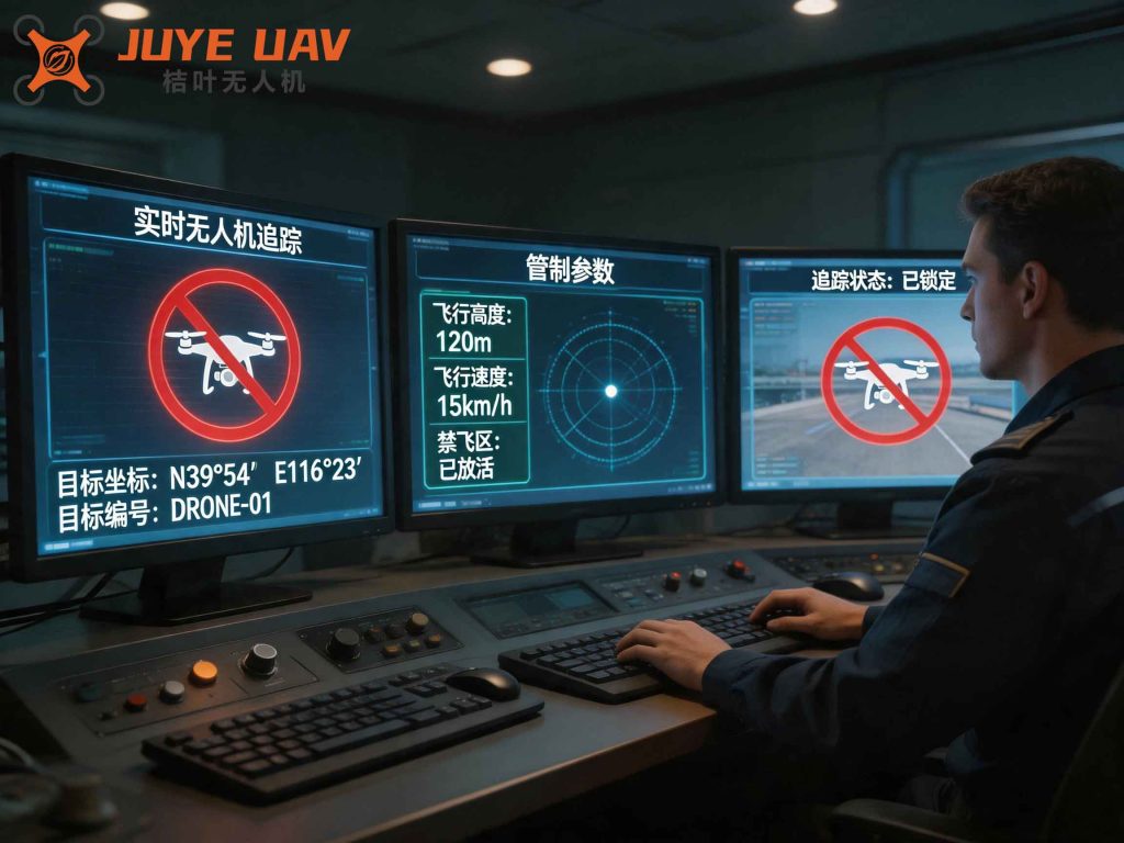
| Technical Countermeasures | AI and sensor network | Deployed 6 spectrum sensing base stations; built AI models for crowd detection, traffic congestion, abnormal trajectory; integrated 5G-A integrated sensing equipment at 5 core sites; established fixed-drone-hub + vehicle-mounted terminal combat mode. | 151 warning interventions against illegal flights; 85% warning accuracy; 60% improvement in enforcement response time; 300% faster response in major events; zero black-flight in key areas. |
| Institutional Innovation | Multi-stakeholder governance | Developed 32 specialized courses; trained 389 certified pilots and 91 police aviation specialists; equipped 680 police drones and 85 automated hangars across all police stations; formed “1 city command + 2 county rapid-response units + N mobile terminals” structure; mobilized 460 drone enthusiasts as “Safety Volunteers” for patrol and persuasion. | Completed 110+ major security tasks; intercepted 60+ black-flights in real time; average response time reduced to 8 minutes. |
3. Current Challenges and Issues in Drone Regulation
Despite progress, several persistent challenges undermine the effectiveness of drone regulation. These are categorized into three areas: emerging public safety risks, technical monitoring bottlenecks, and regulatory system lag.
| Challenge Domain | Specific Issues | Description |
|---|---|---|
| Public Safety Risks | Threats to national security | Drones used for espionage against government/military sites, attack on critical infrastructure (power plants, oil pipelines), interference with airport operations. |
| Social order disruption | Illegal filming, privacy invasion, cross-border smuggling, weaponized drones at mass gatherings. | |
| Development vs. security balance | Overly restrictive no-fly zones may stifle innovation; high cost of detection and countermeasure deployment strains local budgets. | |
| Technical Bottlenecks | Black-flight detection | Incomplete registration; users evade tracking; lack of aviation knowledge among consumer drone pilots; drone modification (camera, payload, jamming devices) increasingly easy. |
| Sensor limitations | Radar poor for low-altitude small drones; optical/IR affected by weather; false alarms; difficulty in identifying drone type and pilot location. Jammers, GPS spoofing, net capture all have constraints; legal authorization for countermeasures unclear. | |
| Escalating technical confrontation | Use of frequency hopping, encrypted communication, electronic fence bypass, stealth design, swarm AI; open-source flight controllers and DIY culture lower the barrier for malicious modifications. | |
| Regulatory Lag | Imperfect legal system | National regulations lack detailed implementation rules on airspace classification, privacy, liability; penalty clauses in Public Security Punishment Law too vague; no unified enforcement guidelines. |
| Regulatory blind spots | Micro-drones (<250g) and emerging technologies (hydrogen-powered, eVTOL) lack mature certification and supervision measures; cross-border flight rules absent. | |
| Fragmented responsibilities | Multiple agencies (industry, market supervision, public security, civil aviation, air traffic) have overlapping or unclear duties; industry associations not fully leveraged for training and self-discipline. |
4. Strategic Recommendations for Strengthening Drone Regulation
To address these challenges, we propose a four-pillar strategy: legal refinement, collaborative governance, technical empowerment, and public engagement. The following sections elaborate on each, incorporating quantitative models and performance indicators.
4.1 Legal Refinement: Building a Solid Enforcement Foundation
We advocate for amending the Public Security Punishment Law to introduce a specific offense of “Operating a Drone Endangering Public Safety,” with graduated penalties based on harm severity. For example, penalties can be scaled linearly with the number of flight hours illegally conducted or the distance from restricted zones:
$$ P = \alpha \cdot H + \beta \cdot D + \gamma \cdot C $$
where \( P \) is the penalty (in days of detention or monetary fine), \( H \) is the duration of illegal flight (hours), \( D \) is the proximity to a restricted zone (meters), \( C \) is a classification factor for the drone type (e.g., 1 for micro, 2 for light, 3 for medium), and \( \alpha, \beta, \gamma \) are coefficients determined by law. This formula ensures proportionality and consistency across jurisdictions.
We also recommend establishing a centralized drone countermeasure equipment management regulation, specifying that only authorized public security and civil aviation units may operate jammers or spoofers, with mandatory logging and post-action review. The compliance rate of countermeasure deployment should be monitored using:
$$ CR = \frac{N_{authorized}}{N_{total}} \times 100\% $$
where \( N_{authorized} \) is the number of deployments authorized by a court or senior command, and \( N_{total} \) is the total number of countermeasure activations. A target of 100% is sought to prevent misuse.
| Legal Measure | Implementation Detail | Expected Impact |
|---|---|---|
| Amend Public Security Punishment Law | Add specific offense; define tiers of penalties (fines, detention, criminal liability) based on threat formula. | Enhanced deterrence; reduced variance in sentencing across regions. |
| Develop Drone Enforcement Guidelines | Standardize evidence collection, penalty discretion, and procedural steps for black-flight incidents. | Improved enforcement consistency and credibility. |
| Regulate Countermeasure Devices | Define authorized users, operational protocols, liability exemptions; mandate usage logs. | Prevent collateral damage to civilian communications; legal clarity for operators. |
4.2 Collaborative Governance: Unifying Multi-Sector Efforts
A whole-of-society approach is essential. Public security agencies should lead a task force comprising civil aviation, industry regulators, market supervision, transportation, and emergency management. The following table outlines responsibilities and coordination mechanisms.
| Agency | Primary Responsibility | Coordination Requirement |
|---|---|---|
| Public Security | Enforcement, investigation, public order maintenance | Chair joint meetings; share real-time drone tracking data with civil aviation. |
| Civil Aviation | Airspace planning, flight plan approval, airport safety | Provide no-fly zone updates to public security; approve countermeasure use at airports. |
| Industry & IT | Manufacturing standards, electronic fence enforcement, anti-modification | Mandate unique serial numbers; implement “purchase registration” at point of sale. |
| Market Supervision | E-commerce platform oversight, counterfeit/illegal drone sales | Real-time data feed of sold drones to public security database. |
| Transportation | Railway, highway, port security coordination | Share infrastructure vulnerability maps; integrate drone detection into transport control centers. |
To ensure accountability, we propose incorporating drone regulation performance into the local government public safety assessment index:
$$ S = w_1 \cdot R_{reg} + w_2 \cdot T_{response} + w_3 \cdot C_{black} $$
where \( S \) is the composite score, \( R_{reg} \) is the drone registration rate (target >95%), \( T_{response} \) is the average response time to black-flight alerts (target <5 minutes), \( C_{black} \) is the number of black-flight incidents per month (target zero), and \( w_1, w_2, w_3 \) are weights set by the provincial government.
4.3 Technical Empowerment: Achieving Precision Control
A multi-layered sensing network is the backbone of modern drone regulation. We recommend deploying a fusion of radar, radio frequency spectrum analyzers, optical/IR cameras, and acoustic sensors in concentric zones around critical infrastructure. The detection probability for a drone at distance \( d \) can be modeled as:
$$ P_{detect}(d) = 1 – \prod_{i=1}^{N} \left(1 – p_i(d)\right) $$
where \( p_i(d) \) is the detection probability of the \( i \)-th sensor type at distance \( d \), and \( N \) is the number of complementary sensors. For typical urban environments, with radar ( \( p_1=0.7 \) at 1km), RF scanner ( \( p_2=0.85 \) ), and IR camera ( \( p_3=0.6 \) ), the combined detection probability at 1 km exceeds 0.98.
Furthermore, an AI-powered early warning system should classify threats into three levels (yellow, orange, red) using a risk score:
$$ Risk = k_1 \cdot Speed + k_2 \cdot Altitude + k_3 \cdot Proximity + k_4 \cdot SwarmSize + k_5 \cdot RegistrationFlag $$
where \( RegistrationFlag \) is 1 if unregistered, 0 otherwise; thresholds for yellow/orange/red are set at Risk>50, Risk>100, Risk>200 respectively. When a red alert is triggered, the system automatically activates countermeasures (e.g., jamming or spoofing) within 1 second, and simultaneously notifies the command center and nearby patrol units.
The following table summarizes technical deployments recommended for a typical metropolis:
| Sensor Type | Quantity (per 100 km²) | Coverage Radius | Primary Use |
|---|---|---|---|
| Radar (L-band) | 5 | 3 km | Long-range coarse detection |
| RF Spectrum Scanner | 10 | 1.5 km | Signal fingerprinting and pilot localization |
| Optical/IR Camera | 20 | 0.5 km | Visual verification and intent analysis |
| Acoustic Sensor | 15 | 0.8 km | Detection of silent/stealth drones |
| 5G-A Base Station | 8 | 0.5 km | High-precision tracking via integrated sensing |
4.4 Public Education and Participation: Fostering Shared Responsibility
Awareness and compliance among drone users are critical. We propose a stratified education program: for schoolchildren, integrate drone safety into STEM curricula; for community residents, disseminate “no-fly zone maps” and case studies via social media; for professional users, organize workshops on regulations and ethical operation. We recommend the creation of a public reporting platform with gamified incentives, such as points redeemable for drone accessories or priority service at charging stations. The effectiveness of public engagement can be measured by the ratio of citizen-reported violations to total detected incidents:
$$ E_{public} = \frac{V_{citizen}}{V_{total}} \times 100\% $$
Targeting a 30% contribution rate within two years. Additionally, industry associations should be empowered to issue “safety flight pledges,” and a blacklist system should ban repeat offenders from participating in commercial drone services.
5. Conclusion
Strengthening drone regulation is a dynamic, multi-faceted endeavor that requires continuous adaptation to technological evolution and societal needs. By integrating robust legal frameworks, collaborative governance, advanced technical systems, and engaged public participation, we can achieve a state where the low-altitude sky remains both open for innovation and secure from threats. The formulas and quantitative targets presented here provide a roadmap for public security agencies to benchmark their progress and fine-tune interventions. Only through such a holistic, data-driven approach can we truly balance the promise of the low-altitude economy with the imperative of public safety.