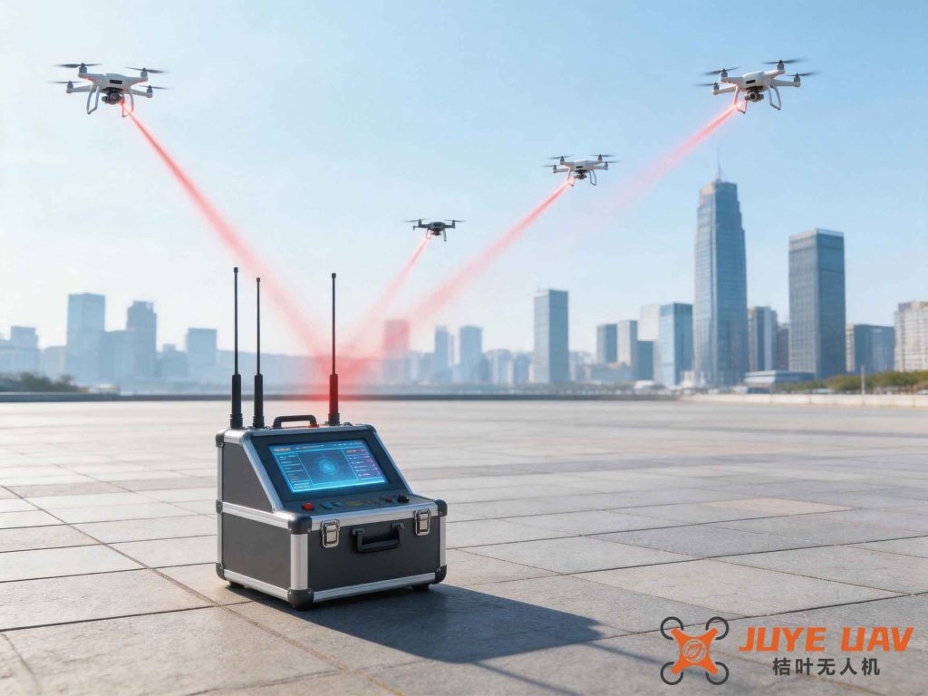
In recent years, the rapid advancement of unmanned aerial vehicle (UAV) platforms, remote sensing payloads, and ground data reception systems has enabled high-frequency, fast-response area networking for remote sensing applications. Our research focuses on the deployment of a bee colony formation of UAVs to form an ad-hoc measurement and control network that is decentralized, autonomous, and self-organizing. The core challenge lies in replacing traditional centralized flight mission pre-planning algorithms with real-time, intelligent resource allocation to meet the stringent requirements of bee colony remote sensing networks. This paper presents a prototype verification system that integrates intelligent perception of collaborative flight task distributions, dynamic multi-agent role division, multi-access protocols, and adaptive network resource scheduling. By leveraging these technologies, we achieve dynamic and intelligent control of measurement and control resources, thereby solving resource allocation problems in large-scale node networks. The framework also considers drone regulation compliance, ensuring that all operations adhere to evolving aviation safety and spectrum usage policies. The work lays a solid foundation for task-oriented intelligent management of bee colony measurement and control resources in future UAV area networking scenarios.
1. Introduction
The growing demand for rapid-response remote sensing in environmental monitoring, disaster management, and homeland security requires flexible and scalable UAV networks. Traditional single-UAV, single-sensor approaches fall short of providing multi-perspective, stereoscopic imaging and collaborative measurement capabilities. The bee colony UAV concept, inspired by swarm intelligence, offers a promising solution by deploying multiple heterogeneous platforms that can dynamically adapt to mission requirements. However, the effective operation of such swarms heavily depends on robust drone regulation frameworks that govern airspace access, data link frequencies, and safety protocols. Our work integrates these regulatory considerations into the design of intelligent control systems, ensuring that the network not only delivers high performance but also complies with national and international standards for unmanned aircraft operations.
The key technical pillars of our approach include mission planning for bee colony flights, real-time monitoring and control, task distribution protocols, and self-organizing network architectures. Each pillar leverages mathematical models and optimization algorithms to enhance efficiency, reliability, and adaptability under dynamic environmental conditions.
2. Mission Planning for Bee Colony UAVs
We address the complexity of flight mission planning for swarms by combining autonomous formation, formation maintenance, formation reconfiguration, and coverage assessment. The planning algorithm generates initial trajectories based on mission requirements, platform capabilities, and payload constraints. During flight, the system continuously re-plans to adapt to changes such as obstacles, weather, or failures. The formation control uses a leader-follower approach, where the leader executes the planned trajectory and the followers maintain relative positions through local sensing and communication.
The coverage assessment relies on an optimization model that maximizes the probability of target detection while minimizing redundant paths. For a region of interest \( \mathcal{R} \), we define the cumulative coverage \( C(t) \) as:
$$ C(t) = \int_{\mathcal{R}} p(\mathbf{x}, t) \, d\mathbf{x} $$
where \( p(\mathbf{x}, t) \) is the probability that point \( \mathbf{x} \) is covered by at least one sensor at time \( t \). The planner solves a mixed-integer programming problem to assign waypoints and sensor orientations, subject to constraints such as maximum flight distance, fuel consumption, and regulatory no-fly zones. The following table summarizes the key parameters used in our mission planning model:
| Parameter | Symbol | Description |
|---|---|---|
| Number of UAVs | \( N \) | Total vehicles in formation |
| Leader position | \( \mathbf{p}_L(t) \) | Reference trajectory for followers |
| Follower offset | \( \mathbf{d}_i \) | Desired relative position of follower \( i \) |
| Payload coverage radius | \( r_s \) | Effective sensing range of onboard sensor |
| Waypoint set | \( \mathcal{W} \) | Sequence of locations to visit |
| Max flight time | \( T_{\max} \) | Endurance limit |
| Minimum overlap ratio | \( \eta \) | Required overlap for stitching images |
To achieve formation reconfiguration, we use a virtual leader approach where each follower computes its desired state relative to a virtual point that moves along the leader’s path. The steering law for follower \( i \) is:
$$ \dot{\mathbf{p}}_i = \mathbf{K}_p (\mathbf{p}_L + \mathbf{d}_i – \mathbf{p}_i) + \mathbf{K}_v (\mathbf{v}_L – \mathbf{v}_i) $$
where \( \mathbf{K}_p \) and \( \mathbf{K}_v \) are gain matrices. This formulation ensures smooth transitions between formations while respecting drone regulation constraints on minimum separation distances and maximum approach speeds.
3. Real-Time Flight Monitoring and Control
Real-time monitoring is essential to ensure the safety and effectiveness of bee colony operations. Our system continuously compares telemetry data (position, attitude, velocity) with predictions from a six-degree-of-freedom (6-DOF) dynamic model driven by the latest uplink commands. When discrepancies exceed pre-defined thresholds, an expert system triggers alerts or automatic corrective actions. The prediction model is:
$$ \mathbf{x}(k+1) = \mathbf{f}(\mathbf{x}(k), \mathbf{u}(k), \mathbf{w}(k)) $$
where \( \mathbf{x} = [x,y,z,\phi,\theta,\psi]^T \) is the state vector, \( \mathbf{u} \) is the control input vector, and \( \mathbf{w} \) represents disturbances. The monitoring software displays real-time parameters as shown in the interface table below:
| Parameter | Units | Display Range |
|---|---|---|
| Latitude | deg | –90 to 90 |
| Longitude | deg | –180 to 180 |
| Altitude | m | 0 – 5000 |
| Roll / Pitch / Yaw | deg | –180 to 180 |
| Ground speed | m/s | 0 – 100 |
| Battery voltage | V | 10 – 50 |
| Sensor gimbal azimuth | deg | –180 to 180 |
| Sensor gimbal elevation | deg | –90 to 90 |
The monitoring system also supports three flight modes: autonomous (following pre-planned waypoints), commanded (directive-based like “go left”), and manual (joystick control). Switching between modes must ensure smooth transitions and compliance with drone regulation regarding operator override capabilities and fail-safe behaviors.
4. Task Distribution and Data Dissemination
For efficient utilization of swarm resources, we implement a multi-level task distribution architecture comprising a command center, regional centers, and field control stations. The system processes remote sensing request applications from users and then schedules tasks to appropriate UAVs. The distribution network uses a publish-subscribe middleware (like DDS) to decouple data producers and consumers. Each node maintains a local database of subscribed topics, and data is routed via a dynamic routing table that accounts for link quality and congestion.
The routing algorithm minimizes end-to-end delay while meeting bandwidth requirements. For a path \( P \) from source \( s \) to destination \( d \), the cumulative delay is:
$$ D(P) = \sum_{(i,j) \in P} \left( t_{prop}(i,j) + \frac{L}{R_{ij}} + t_{proc} \right) $$
where \( t_{prop} \) is propagation delay, \( L \) is packet size, \( R_{ij} \) is data rate, and \( t_{proc} \) is processing delay. The system dynamically adapts to network topology changes caused by UAV mobility or node failure.
To ensure that the dissemination of sensitive imagery complies with drone regulation on data privacy and security, all transmissions are encrypted and logged. The following table outlines the main components of the task distribution system:
| Component | Role | Examples |
|---|---|---|
| Command Center | Global mission planning and resource coordination | Flight plan generation, anomaly handling |
| Regional Center | Intermediate management of local swarm | Task assignment within region |
| Field Control Station | Direct interface with UAV operators | Manual override, live video display |
| Airborne Terminal | Data acquisition and relay | Camera, radar, communication module |
| User Terminal | Receive and visualize remote sensing products | Ground station with GIS |
5. Self-Organizing Network (Ad-Hoc Networking)
The bee colony UAVs must form a flexible, high-dynamic data link network that supports real-time command, control, and payload data transfer. Our network architecture operates at the physical, data link, and network layers. It employs a time-division multiple access (TDMA) scheme with dynamic slot allocation, synchronized by a leader node. The synchronization procedure uses time-stamped polling frames to minimize drift. The node joining process is as follows:
- A new node listens for a polling frame from the network time reference (leader).
- It sends a join request in a random contention slot.
- If a collision occurs, the node retries after a random backoff.
- The leader assigns a dedicated time slot and confirms with an acknowledgment.
The slot assignment problem is formulated as a binary integer linear programming (BILP) model. Let \( x_{n,t} \) be 1 if node \( n \) is assigned slot \( t \), and 0 otherwise. The objective is to minimize the maximum number of used slots while ensuring each node gets at least one slot per frame:
$$ \min \max_t \sum_n x_{n,t} $$
$$ \text{s.t.} \quad \sum_t x_{n,t} \ge 1, \quad \forall n $$
After assignment, each node transmits in its own slot without collisions, achieving deterministic delay. The network supports up to 12 UAVs per swarm, but the protocol scales to larger groups by increasing frame length.
To maintain operational safety under drone regulation, the network includes a dedicated control channel for emergency messaging. For instance, if any node detects loss of link with the leader, it broadcasts a distress signal and the remaining nodes autonomously elect a new leader. This self-healing behavior is modeled using a consensus algorithm where each node \( i \) maintains a reputation score \( r_i \). The election criterion is:
$$ i^* = \arg\max_i \left( r_i + \alpha \cdot \text{link\_quality}_i \right) $$
where \( \alpha \) is a weighting factor. The chosen leader synchronizes the network using the current global time, and the process completes within one frame period (typically 4 seconds maximum).
6. Prototype System for Intelligent Resource Scheduling
We developed a prototyping system consisting of three workstations: a mission planning station, a command and control station, and a 3D visualization simulation station. The system demonstrates the full lifecycle of a bee colony mission from scenario definition to safe return. The interfaces are shown conceptually; the actual software runs across three screens with synchronized data exchange via a local network.
The mission planning software (on the left screen) allows operators to define remote sensing areas, select detection mode, configure formation size, and automatically allocate tasks. The load balancing algorithm follows a cost function that minimizes total flight time while respecting sensor coverage constraints. The cost for a given assignment \( A \) is:
$$ \text{Cost}(A) = \sum_{i=1}^N w_1 \cdot t_i + w_2 \cdot d_i + w_3 \cdot \text{regulatory\_penalty}_i $$
where \( t_i \) is flight time, \( d_i \) is travel distance, and the penalty term accounts for violations of drone regulation such as prohibited airspace or altitude limits. The weights \( w_1, w_2, w_3 \) are tuned empirically.
The command and control screen displays the real-time status of all UAVs in the formation, including telemetry, video feeds, and health indicators. Operators can switch between individual and swarm views. The manual override function respects regulatory requirements: joystick inputs are filtered through a safety envelope that prevents excessive speed or altitude changes.
The 3D visualization screen presents a synthetic environment with terrain, airspace restrictions, and dynamic UAV positions. It supports switching between formations and shows coverage footprints. The simulation also evaluates the impact of drone regulation on mission effectiveness, for example by visualizing no-fly zones that the mission planner must avoid.
The prototype also integrates a formation control module that maintains several pre-defined shapes (e.g., line, V-formation, circle) and allows smooth transitions. The transition algorithm uses Bézier curves to generate smooth paths for each UAV, satisfying velocity and acceleration constraints. The control authority can be transferred between stations, ensuring collaborative operation.
7. Conclusion
This paper has presented a comprehensive framework for intelligent control of bee colony measurement and control resources in UAV area networking. The system addresses the key challenges of decentralized operation, real-time mission planning, dynamic task distribution, and self-organizing network protocols. By integrating mathematical optimization models, we ensure efficient coverage and collision avoidance. Furthermore, the explicit incorporation of drone regulation into planning and operation ensures compliance with airspace, spectrum, and safety standards.
The prototype system validates the proposed concepts and demonstrates the feasibility of autonomous swarm operations. Future work will focus on scaling the network to larger swarms (hundreds of UAVs), integrating multi-modal sensors (SAR, LiDAR), and incorporating machine learning for adaptive resource allocation. The continuous evolution of drone regulation will also drive the development of more flexible and resilient control architectures for heterogeneous unmanned systems.