With the rapid development of the low-altitude economy and drone technology, the proliferation of unmanned aerial vehicles (UAVs) brings both convenience and severe low-altitude security challenges. In response, we integrate multi-dimensional anti-UAV technical means to construct a three-tier collaborative defense architecture consisting of a warning zone, a defense zone, and a core zone. At the technical level, we systematically analyze the principles of reconnaissance and detection (including radar, optoelectronic, acoustic, and radio detection), communication suppression, navigation deception, physical destruction, and comprehensive countermeasures. In the architecture design, we define a hierarchical strategy: the warning zone primarily relies on multi-source reconnaissance and detection, the defense zone integrates soft/hard kill means, and the core zone deploys high-precision interception equipment. Cross-region system coordination is achieved through communication systems and command-and-control systems. This study provides comprehensive theoretical guidance and practical solutions for ensuring the security of key areas, contributing to enhanced defense capabilities against low-altitude, slow-speed, small-sized drones (LSS-UAVs), and effectively maintaining national security and social stability. Throughout this review, we emphasize the critical role of drone regulation as a foundational pillar for any effective anti-UAV strategy, and we argue that robust drone regulation must be integrated with technical countermeasures to achieve sustainable low-altitude security. We further discuss how evolving drone regulation frameworks shape the development of multi-layer defense systems and how technical innovations can, in turn, inform future drone regulation policies.
## 1. Introduction
In the era of rapid technological advancement, UAVs have become deeply integrated into both military and civilian domains. Militarily, drones perform reconnaissance, surveillance, and strike missions, providing critical support for combat operations. Civilians benefit from drones in aerial photography, logistics delivery, agricultural spraying, and numerous other applications, driving industry development and efficiency. However, the widespread adoption of UAVs has also introduced negative consequences. Uncontrolled “black flights” (unauthorized operations) are increasingly rampant, posing numerous safety hazards. While properly managed civilian drones can play a positive role, low-altitude, slow-speed, small-sized (LSS) UAVs present particularly difficult challenges due to their unique characteristics: low flight altitude, small radar cross-section (RCS), diverse signal schemes, rapid ascent, and high maneuverability. Traditional detection and interception methods often fail against such targets. In key military and high-value civilian areas—such as military bases, missile launch sites, airports, nuclear power plants, and government facilities—LSS-UAVs can conduct espionage, carry explosive devices for attacks, or disrupt operations, threatening lives, property, and social stability.
Previous studies have explored various aspects of the drone problem. Some analyzed drone applications in military and civilian fields but lacked deep investigation into anti-UAV techniques. Others reviewed 2024 drone hotspots without focusing on defense system architectures for key areas. Research on low-altitude economy market applications and urban airspace planning provided context but did not address threat mitigation. Some surveys systematically reviewed anti-UAV detection and identification technologies but often listed existing achievements superficially. While bio-inspired architectures were proposed for multi-target defense, they overlooked model assumptions and complex adversarial environments. Additionally, studies on UAV security threats, attacks, and traditional defenses rarely discussed coordinated swarm attacks or AI-driven new penetration methods, nor the risk diffusion when UAVs interact with IoT devices.
In contrast, our study integrates multi-dimensional technical means and proposes a three-tier collaborative architecture (“warning-defense-core”) with dynamic task allocation and intelligent decision-making. We aim to fill the theoretical gap in complex key-area defense system design. Furthermore, we highlight that drone regulation—encompassing laws, standards, registration, geofencing, and operational restrictions—is inseparable from technical countermeasures. Effective drone regulation establishes the legal and behavioral baseline that allows detection and interdiction systems to differentiate legitimate from malicious flights. Without proper drone regulation, even the best technology may be overwhelmed by non-compliant but non-hostile drones, causing false alarms and resource waste. Therefore, we weave drone regulation throughout this review as a core enabler of defense architecture validity.
## 2. Characteristics and Threat Analysis of LSS-UAVs
### 2.1 Unique Characteristics
LSS-UAVs exhibit distinctive features that complicate defense:
- Low altitude: Typically operate below 1000 m, prone to terrain and building obstructions, increasing detection difficulty.
- Small RCS: Common multi-rotor drones have RCS as small as a few square centimeters or less, making long-range radar detection challenging.
- Diverse signal schemes: Use Wi-Fi, Bluetooth, digital radio, and satellite navigation (GPS, BeiDou), some with encrypted signals, complicating identification and jamming.
- Rapid ascent: Can climb tens of meters in seconds, compressing reaction time for defense systems.
- High maneuverability: Capable of hovering, sharp turns, and dives, evading detection and interception in confined spaces.
- Low cost: Manufacturing, R&D, operation, maintenance, and training costs are low, leading to widespread availability and management difficulty.
### 2.2 Threats to Key Areas
In military defense, LSS-UAVs pose silent threats via covert reconnaissance near bases, command centers, or strategic assets. They can be modified to carry explosives or small missiles, exploiting low-altitude low-speed flight to bypass traditional air defense systems. In civilian high-value areas, unauthorized drone incursions have caused significant disruptions. For example, drones entering airport no-fly zones have led to numerous flight delays and cancellations; near nuclear facilities, they risk nuclear safety. Such incidents worldwide underscore the urgency of constructing effective anti-UAV defense systems.
Numerous incidents have been reported: illegal drone intrusions over the White House, Japanese Prime Minister’s residence, French presidential palace, South Korea’s Blue House, the Kremlin, and China’s South China Sea. The 2019 attack on Saudi Aramco facilities used 18 drones and 7 cruise missiles, causing global oil price spikes. In 2022, Tianjin Binhai International Airport suffered two consecutive drone interference events, affecting thousands of passengers. Even an assassination attempt using two explosive-carrying drones occurred at a political rally in Venezuela. These examples demonstrate that drone regulation must be strictly enforced and backed by technical systems. We believe that strict drone regulation—including mandatory registration, geofencing, remote identification, and no-fly zones—is the first line of defense, while technical countermeasures serve as the second line to enforce those regulations when compliance fails.
## 3. Multi-Dimensional Anti-UAV Technical Means Analysis
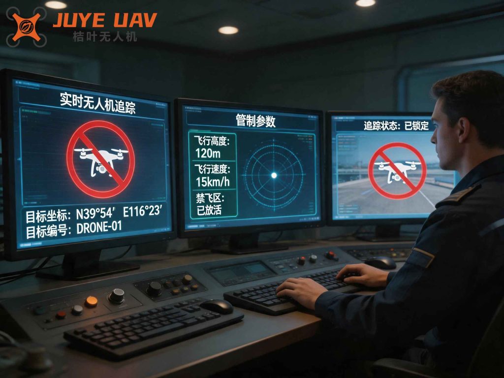
### 3.1 Reconnaissance and Detection Technologies
Reconnaissance and detection form the initial step in anti-UAV operations. Four primary modalities are used:
| Type | Principle | Advantages | Limitations | Example/Metrics |
|---|---|---|---|---|
| Radar | Transmits radio waves; measures reflected signal from UAV | Long range (5–20+ km); all-weather | Poor detection of small RCS; clutter issues | AN/TPQ-50 adapted for drones (10 km); Sokul-P (UHF/VHF) reduces false alarm by 40% |
| Optoelectronic | Visible/infrared cameras track thermal or visual signature | High angular resolution; classification capability | Limited range (2–5 km); weather dependent | Spoter dual-band IR: 5 km identification; DriverU302: 400 m detection in fog |
| Acoustic | Captures UAV motor/propeller noise via microphone arrays | Passive; immune to EM interference; low cost | Short range (<1 km); affected by ambient noise | MIT Lincoln Lab 64-channel array: detection at 1 km, false alarm <0.1/h |
| Radio | Detects communication/navigation signals (2.4/5.8 GHz) | Passive; can identify drone type via protocol | Cannot detect autonomous drones; encrypted signals | Blighter AUDS: scans 2.4/5.8 GHz; fingerprinting via deep CNN |
We propose a unified detection model where the overall probability of detection Pd given sensor fusion can be expressed as:
$$
P_d = 1 – \prod_{i=1}^{N} (1 – P_{d,i})
$$
where Pd,i is the detection probability of the i-th sensor. For radar, the signal-to-noise ratio (SNR) for a Swerling-1 target is:
$$
SNR = \frac{P_t G^2 \lambda^2 \sigma}{(4\pi)^3 R^4 k T_0 B F L}
$$
with Pt transmit power, G antenna gain, λ wavelength, σ RCS, R range, k Boltzmann constant, T0 noise temperature, B bandwidth, F noise figure, L losses. Effective drone regulation mandates that all consumer drones broadcast a remote ID signal, which can be exploited by radio detection to achieve near-certain detection at low cost.
### 3.2 Communication Suppression
Communication suppression blocks the link between the drone and its controller or satellite navigation. Two main approaches: radio frequency (RF) jamming and GPS jamming. RF jamming emits high-power noise on the drone’s communication bands (e.g., 2.4 GHz, 5.8 GHz). GPS jamming disrupts satellite signals, causing the drone to lose positioning. The jamming effectiveness can be modeled by the jamming-to-signal ratio (JSR):
$$
JSR = \frac{P_j G_j G_{rj} \lambda^2}{(4\pi R_j)^2} \cdot \frac{(4\pi R_s)^2}{P_s G_s G_{rs} \lambda^2} = \frac{P_j G_j G_{rj} R_s^2}{P_s G_s G_{rs} R_j^2}
$$
where subscripts j and s denote jammer and signal source, respectively. A JSR greater than the jammer-to-noise margin of the drone’s receiver (typically 10–20 dB) will suppress the link. However, modern drones with frequency hopping spread spectrum (FHSS) require sophisticated responsive jamming. The U.S. Raytheon “Tempest” DRFM technology enhances jamming effectiveness sixfold. China’s “Tianwang” series supports adaptive jammer. Drone regulation often requires drones to implement fail-safe behaviors (e.g., return-to-home or landing) upon loss of control link, which slightly reduces the effectiveness of pure jamming—but regulation can also mandate that such behaviors only trigger after a reasonable timeout, allowing jamming to force a predictable response.
### 3.3 Navigation Deception
Navigation deception involves sending forged GNSS signals to mislead the drone’s navigation system, causing deviation from its intended path. The attacker transmits counterfeit satellite signals with slightly higher power to override genuine signals. The probability of successful deception Pspoof depends on the power ratio and the drone’s authentication capability:
$$
P_{spoof} = \frac{1}{1 + e^{-k(\frac{P_f}{P_g} – \gamma)}}
$$
where Pf is forged signal power, Pg is genuine signal power, γ is a threshold (typically about 1–2 dB), and k is a steepness factor. With modern multi-constellation receivers (GPS + GLONASS + BeiDou + Galileo), spoofing must cover multiple bands simultaneously. Advanced systems like HENSOLDT NavGuard generate false GPS signals; Chinese BeiDou spoofing technology achieves >95% success rate using B1C/B2a dual-band cooperative deception. Drone regulation requiring authenticated navigation messages (e.g., Galileo’s OS-NMA or GPS authentication) could make spoofing significantly harder, but such features are not yet mandated for civil drones. We advocate integrating drone regulation that mandates low-cost authentication schemes for drones operating near sensitive areas.
### 3.4 Physical Destruction
Physical destruction directly incapacitates the drone through hard-kill means: laser weapons, high-power microwaves (HPM), and net guns. Lasers deliver high-energy beams that heat and melt structural components, while HPM damages electronics. The laser kill probability as a function of target range R and atmospheric transmission τ can be modeled:
$$
P_{kill}(R) = 1 – \exp\left(-\frac{\eta P_{laser} A_t}{\pi \theta^2 R^2 E_{threshold}} \tau(R) \cdot t_{dwell}\right)
$$
where η is beam quality, Plaser laser power, At target area, θ beam divergence, Ethreshold required energy density, tdwell dwell time. The U.S. ATHENA 30 kW fiber laser can shoot down a drone at 1.6 km within 5 s. HPM weapons (e.g., the U.S. CHAMP) radiate wide-area pulses to disable electronics. Drone regulation can mandate that drones have basic electromagnetic shielding, but such requirements remain rare due to cost and weight concerns. For key area defense, hard-kill is often the ultimate backup, but its use must comply with laws governing the use of force—which are themselves part of drone regulation.
### 3.5 Integrated Countermeasure
Comprehensive countermeasure systems combine multiple means into a layered defense network. The U.S. Joint Counter-UAS Office proposes a “Detect-Identify-Intercept” three-layer architecture. The 2022 Beijing Winter Olympics employed a “Low-Altitude Guardian” laser system integrated with a drone management platform, achieving full-time, comprehensive monitoring. A typical integrated system operates as follows:
| Layer | Function | Technologies |
|---|---|---|
| Detection & Identification | Confirm UAV presence, classify, track | Radar, EO/IR, acoustic, radio |
| Soft Kill | Disrupt control or navigation | RF jamming, GPS spoofing |
| Hard Kill | Destroy or capture | Laser, HPM, net gun, kinetic interceptor |
The decision logic can be formalized as a multi-objective optimization: given M threats and N effectors, assign effectors to maximize total threat mitigation while minimizing collateral damage and cost. We define a utility function:
$$
\max \sum_{i=1}^{M} \sum_{j=1}^{N} x_{ij} \cdot (w_1 \cdot P_{neutralize,ij} – w_2 \cdot C_{j} – w_3 \cdot D_{collateral,ij})
$$
subject to effctor capacity constraints, where xij ∈ {0,1} is assignment, Pneutralize is success probability, Cj cost, Dcollateral expected collateral damage weight, and w1,w2,w3 weighting factors. Drone regulation heavily influences Dcollateral and w3: in densely populated urban areas, collateral damage must be avoided at almost all costs, favoring soft-kill or directed-energy weapons with minimal secondary effects.
## 4. Defense System Architecture for Key Areas
### 4.1 Scientific Zoning of Defense Areas
Based on the security requirements of key areas and the threat level of drones, we divide the defense space into three zones: warning zone, defense zone, and core zone. This layered concept, while not entirely new, is refined with dynamic resource allocation using game theory and AHP-entropy weight methods.
- Warning Zone: Extends several to tens of kilometers from the key asset. For an airport, this is typically 5–30 km. The zone deploys a dense network of radar, EO/IR, acoustic, and radio sensors. Upon detection, target information is relayed to the command center. Low-threat drones are simply tracked; high-threat ones trigger alerting to the defense zone.
- Defense Zone: Ranges from hundreds of meters to a few kilometers outside the asset. This is the primary engagement area, equipped with jammers, spoofers, lasers, HPM, and net guns. The command center selects the appropriate countermeasure based on the drone type, threat level, and operational environment.
- Core Zone: The innermost perimeter (tens to hundreds of meters). High-precision sensors and advanced weapons (e.g., high-power lasers, smart interceptors) are deployed. Every drone that enters is engaged with maximum probability of immediate neutralization.
The figure illustrates an unmanned traffic management system, which is closely tied to drone regulation—such systems enforce no-fly zones, flight authorizations, and real-time compliance monitoring. In our defense architecture, the warning zone’s detection assets can be augmented by data from UTM providers, ensuring that cooperative drones are distinguished from non-cooperative ones, thus reducing false alarms.
### 4.2 Application of Countermeasures in Each Zone
- Warning Zone: Primarily passive and active sensing. Jamming and spoofing are generally avoided to prevent interference with surrounding communications and navigation. Only if a drone is confirmed hostile and poses an immediate threat (e.g., heading directly with high speed) might soft-kill be initiated at the outer range.
- Defense Zone: Sensors provide continuous tracking. For consumer drones, soft-kill (jamming/spoofing) is preferred to minimize liability and damage. For military drones, hard-kill is used. The decision is made by an AI-based system that updates in real-time using Bayesian inference:
$$
P(H_t | data) = \frac{P(data | H_t) P(H_t)}{P(data)}
$$
where Ht is the hypothesis “threat type = hostile,” updated via sensor data. Drone regulation can enforce that all drones entering the defense zone must carry a valid digital license and respond to remote identification requests; failure to do so raises the threat level, triggering automatic engagement protocols.
- Core Zone: High-precision tracking (e.g., monopulse radar, laser radar) guides laser or kinetic interceptor. The engagement time budget is extremely short (a few seconds). Pre-computed firing solutions using Kalman filters are essential:
$$
\mathbf{x}_{k|k-1} = \mathbf{F}_k \mathbf{x}_{k-1|k-1} + \mathbf{B}_k \mathbf{u}_k
$$
$$
\mathbf{P}_{k|k-1} = \mathbf{F}_k \mathbf{P}_{k-1|k-1} \mathbf{F}_k^T + \mathbf{Q}_k
$$
$$
\mathbf{K}_k = \mathbf{P}_{k|k-1} \mathbf{H}_k^T (\mathbf{H}_k \mathbf{P}_{k|k-1} \mathbf{H}_k^T + \mathbf{R}_k)^{-1}
$$
$$
\mathbf{x}_{k|k} = \mathbf{x}_{k|k-1} + \mathbf{K}_k (\mathbf{z}_k – \mathbf{H}_k \mathbf{x}_{k|k-1})
$$
where x is state vector (position, velocity), F transition matrix, P covariance, Q process noise, K Kalman gain, H measurement matrix, R measurement noise, z measurement. The core zone operations must comply with strict drone regulation rules of engagement to avoid accidental harm to manned aircraft or bystanders.
### 4.3 Collaborative Operation of the Defense System
The three zones are connected via a high-speed, secure communication network (e.g., 5G) and a unified command-and-control (C2) system. The C2 system maintains a common operational picture (COP) and optimizes resource allocation across zones. We model the resource allocation as a Markov decision process (MDP) where the state s includes the number and positions of detected drones, available effectors, and their status. The action a includes which effectors to deploy. The reward R(s,a) penalizes missed threats and excessive resource use. The optimal policy is found using value iteration:
$$
V^*(s) = \max_{a} \left[ R(s,a) + \gamma \sum_{s’} P(s’|s,a) V^*(s’) \right]
$$
Drone regulation influences the reward structure: unauthorized drones in restricted zones may carry a higher penalty (i.e., higher reward for interception), but also impose legal constraints on the use of certain weapons. Therefore, our MDP includes a constraint function g(s,a) ≤ 0 that encodes regulatory limits (e.g., no laser use above certain power in populated areas). Solving this constrained MDP yields policies that are both effective and compliant.
## 5. Challenges, Key Technologies, and Development Trends
### 5.1 Current Challenges
Despite progress, current defense systems face several challenges:
- Technical integration: Information fusion between sensors and effectors suffers from latency and inconsistency. Electromagnetic interference degrades radar performance; jamming fails against frequency-hopping or encrypted links.
- Architectural coupling: Zone handover is not seamless. A drone transiting rapidly from warning to defense zone may not be tracked continuously, leading to engagement delays.
- Swarm defense: Scalability to handle coordinated swarms is limited. Resource allocation algorithms cannot yet optimize for dozens or hundreds of simultaneous threats.
- Human factors: Operator shortage and skill gaps; inadequate training on advanced systems. Uniform emergency protocols are lacking.
Drone regulation itself can be a challenge: regulations vary by jurisdiction, making cross-border drone threats difficult to handle. Inconsistent enforcement and loopholes (e.g., drones bought as toys but used maliciously) undermine regulatory effectiveness. We need harmonized international drone regulation standards that include provisions for remote identification, geofencing, and no-fly zone compliance as mandatory features.
### 5.2 Key Technologies
- Artificial Intelligence (AI): Deep learning for target classification and intent prediction. Convolutional neural networks (CNNs) on radar range-Doppler maps or EO/IR images achieve >99% classification accuracy. Reinforcement learning for autonomous resource allocation and maneuver planning.
- 5G Communication: Ultra-reliable low-latency communication (URLLC) for real-time sensor data sharing (<1 ms end-to-end latency). Network slicing can prioritize defense commands over civilian traffic.
- Multi-Sensor Fusion: Bayesian inference and Dempster-Shafer theory to combine heterogeneous sensors. Sensor management optimization using mutual information criterion:
$$
\max_{sensor\_select} I(\mathbf{x}; \mathbf{z}_{select}) = H(\mathbf{x}) – H(\mathbf{x}|\mathbf{z}_{select})
$$
where I is mutual information, H entropy. This reduces uncertainty about the drone state.
- Quantum Technologies: Quantum radar (e.g., quantum illumination) can theoretically detect stealthy drones with high sensitivity. Quantum key distribution secures C2 links against eavesdropping. However, these are still at low TRL.
Integrating AI requires careful drone regulation to ensure that autonomous decision-making respects human oversight and accountability rules. We propose a “human-on-the-loop” paradigm where AI recommends actions but a human operator confirms lethal engagements, aligning with emerging drone regulation frameworks for autonomous weapons.
### 5.3 Development Trends
Future anti-UAV defense systems will trend toward:
- Intelligence: Full AI lifecycle from detection to engagement, self-optimizing via deep reinforcement learning in simulated environments.
- Integration: Seamless fusion with other security systems (ground surveillance, air traffic control) and cross-domain information sharing.
- Networking: Distributed, mesh-connected sensor and shooter nodes that can be dynamically redeployed. Edge computing reduces latency by processing data near the sensor.
- Miniaturization: Compact high-power lasers and HPM sources using new materials (e.g., diamond lasers) for deployment on vehicles or even man-portable units.
- International cooperation: Joint R&D, shared threat databases, and harmonized drone regulation standards to address global drone threats.
The evolution of drone regulation will likely move toward “performance-based” standards—requiring drones to have certain capabilities (e.g., automatic compliance with dynamic no-fly zones, cybersecurity measures) rather than prescribing specific technologies. Our defense system must be designed with open interfaces that can accept new regulatory requirements as they emerge.
## 6. Conclusion
As drone technology continues to innovate, the threat posed by LSS-UAVs to key areas becomes increasingly complex and severe. Through an in-depth study of multiple anti-UAV means and the construction of a three-tier defense architecture, this paper provides a comprehensive solution for addressing this challenge. In practice, the selection of anti-UAV means and defense tactics must be tailored to the security requirements of specific key areas and the characteristics of drone threats, with continuous optimization of the defense system. At the same time, sustained investment in anti-UAV R&D, encouragement of innovation, and cross-domain collaboration should be pursued to drive the development of smarter and more efficient countermeasures. In the future, the key-area anti-UAV defense system will continue to improve, building a solid security barrier for military strategic assets and high-value civilian infrastructure, thereby safeguarding national security and social stability.
Crucially, drone regulation must evolve in parallel with technical countermeasures. Regulation provides the legal framework that legitimizes detection and interdiction actions, sets the baseline for cooperative behavior, and shapes the design of defense technologies. Conversely, the capabilities of defense systems can inform regulators about what is technically feasible and what loopholes need closing. We strongly advocate for a symbiotic relationship between drone regulation and anti-UAV technology development. Future work should focus on developing regulatory-compliant autonomous engagement rules, creating digital twins of defense zones for testing regulations and algorithms, and establishing international agreements on mutual recognition of drone regulation and defense coordination. Only by integrating strong drone regulation with multi-layered technical defense can we truly secure our key areas against the rising drone threat.