As a radio frequency monitoring engineer with extensive experience in securing large-scale events, I have witnessed firsthand the critical role that electromagnetic spectrum management plays in ensuring the success and safety of modern spectacles, particularly drone light shows. These dazzling displays, where hundreds or even thousands of unmanned aerial vehicles (UAVs) perform synchronized maneuvers to create intricate aerial images, are entirely dependent on reliable radio communication links. Any interference can lead to catastrophic failures, including mid-air collisions or the complete dissolution of the intended formation. In this article, I will draw from my professional engagements to detail the comprehensive strategies, technical frameworks, and operational protocols essential for achieving the coveted “zero interference, zero error” objective in radio frequency (RF) security. The principles discussed are universally applicable, but the unique challenges posed by drone light shows will be a central focus throughout our exploration.
The foundational principle of any RF security operation is proactive electromagnetic environment monitoring. Before an event commences, a detailed baseline of the ambient RF noise and signal levels across relevant frequency bands must be established. This involves sophisticated equipment and systematic data collection. The signal-to-interference-plus-noise ratio (SINR) is a key metric we constantly monitor, as it directly predicts link quality. It is defined as:
$$ \text{SINR} = \frac{P_{\text{signal}}}{P_{\text{interference}} + P_{\text{noise}}} $$
where \(P_{\text{signal}}\) is the power of the desired signal, \(P_{\text{interference}}\) is the power of interfering signals, and \(P_{\text{noise}}\) is the background thermal noise power. For a drone light show control link, we typically require a minimum SINR threshold, \(\text{SINR}_{\text{min}}\), to guarantee a sufficiently low bit error rate (BER). The relationship between BER and SINR for a common modulation scheme like QPSK in an additive white Gaussian noise (AWGN) channel can be approximated as:
$$ \text{BER} \approx Q\left(\sqrt{2 \cdot \text{SINR}}\right) $$
where \(Q(x)\) is the Q-function. Our goal is to maintain operational conditions where BER remains below \(10^{-6}\). To manage the complex variables, we often utilize a layered monitoring approach, summarized in the following table for a standard pre-event survey:
| Monitoring Layer | Equipment Type | Key Measured Parameters | Typical Duration (Hours) |
|---|---|---|---|
| Fixed Station | High-gain directional antenna, spectrum analyzer | Occupied bandwidth, power spectral density, spurious emissions | 24-72 |
| Mobile Unit | Vehicle-mounted scanning receiver, GPS | Signal geolocation, spatial distribution of emitters | 8-12 |
| Portable | Handheld spectrum analyzer, omnidirectional antenna | On-the-spot signal strength, quick interference checks | As needed at key points |
One of my most memorable assignments involved providing RF security for a major international sporting event. While not a drone light show, the principles of rigorous, multi-point monitoring were identical. Our team deployed a combination of fixed, mobile, and portable equipment along the race route and at broadcast points. We operated on the principle of real-time spectrum surveillance, where any deviation from the baseline would trigger an immediate investigation. The success of such an event hinges on clear communication channels for organizers, security, and media. The probability of a disruptive interference event occurring, \(P_{d}\), can be modeled as a function of the number of active transmitters \(N\) and the effectiveness of our coordination \(C\) (a dimensionless parameter between 0 and 1):
$$ P_{d} = \alpha \cdot \frac{N \cdot (1 – C)}{B} $$
where \(\alpha\) is a scaling constant specific to the environment, and \(B\) is the total available bandwidth in MHz. By working closely with all stakeholders to coordinate frequency assignments—effectively maximizing \(C\)—we pushed \(P_{d}\) statistically close to zero.
However, the complexity increases exponentially when the event in question is a drone light show. Here, the primary RF links are for command and control (C2) and sometimes first-person-view (FPV) video. These typically operate in segments of the 2.4 GHz and 5.8 GHz ISM bands, which are also crowded with Wi-Fi, Bluetooth, and other consumer devices. The risk of co-channel or adjacent-channel interference is high. For a drone light show involving \(n\) drones, the total number of potential interfering interactions if frequency coordination fails is combinatorially large. We can consider a simplified model for the system’s robustness, \(R\):
$$ R = \sum_{i=1}^{k} \frac{S_{i} \cdot \log_{2}(1 + \text{SINR}_{i})}{L_{i}} $$
In this conceptual formula, \(k\) is the number of independent communication channels used, \(S_i\) is the spectral efficiency of the modulation on channel \(i\), and \(L_i\) represents the local interference load. The goal is to maximize \(R\) through careful planning.
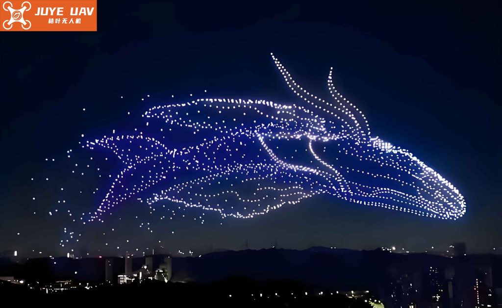
The image above captures the breathtaking beauty of a drone light show, a beauty made possible only by invisible layers of RF security. In one specific instance, our team was tasked with securing such a performance in a scenic urban park. The request highlighted the “multi-scenario overlay and high-frequency band application” nature of the modern drone light show. Our first action was to convene a specialized meeting and draft a detailed保障 plan. A critical step was establishing a Temporary Clear Zone (TCZ) or净空保护区 in collaboration with local authorities and the event organizer. This zone, typically a cylinder with a defined radius and altitude, restricts all non-essential transmissions. The effectiveness \(E\) of a TCZ in reducing interference power at the show’s center can be expressed as:
$$ E_{\text{TCZ}} = 10 \log_{10}\left( \frac{P_{\text{without}}}{P_{\text{with}}} \right) = 10 \log_{10}\left( \frac{\int_{0}^{R_{\text{max}}} D(r) \cdot r \, dr}{\int_{R_{\text{TCZ}}}^{R_{\text{max}}} D(r) \cdot r \, dr} \right) $$
where \(D(r)\) is the spatial density of potential interferers as a function of distance \(r\), \(R_{\text{TCZ}}\) is the TCZ radius, and \(R_{\text{max}}\) is the maximum interference range. By making \(R_{\text{TCZ}}\) sufficiently large and enforcing it through coordinated spectrum policing, we can achieve significant attenuation of external noise.
Our deployment for this drone light show was a textbook example of the “fixed + mobile + portable” trinity model. We positioned fixed sensors on rooftops for wide-area surveillance, a mobile monitoring van for perimeter sweeps, and technicians with portable gear at the launch and control site. The operational details are captured in the table below:
| Task Phase | Deployed Assets | Primary Frequency Bands Monitored | Key Performance Indicators (KPIs) |
|---|---|---|---|
| Pre-Show (72 hrs prior) | 2 Fixed Stations, 1 Mobile Unit | 2.400-2.4835 GHz, 5.725-5.850 GHz, local public safety bands | Baseline noise floor < -110 dBm, identification of all permanent emitters |
| Show Day (Setup & Rehearsal) | 1 Mobile Unit, 4 Portable Kits | Drone proprietary control bands, Wi-Fi channels | Control link SINR > 20 dB, zero unauthorized signals in TCZ |
| Live Performance | All assets active, real-time correlation center | All above, plus backup frequency bands | 100% packet success rate for C2, instantaneous interference detection < 2 sec |
| Post-Show | Mobile Unit for residual analysis | All bands | Confirmation of spectrum return to baseline |
Furthermore, we implemented a full-chain closed-loop management system: “Monitor-Locate-Resolve.” When our systems detect an anomaly—such as an unexpected signal in the drone light show’s dedicated band—the location is triangulated using time-difference-of-arrival (TDoA) or direction-finding techniques. The position \((x, y)\) of an interferer can be estimated from measurements at \(M\) sensors with known positions \((x_i, y_i)\). For TDoA with a reference sensor at index 1, we solve for \((x, y)\) in the set of hyperbolic equations:
$$ \sqrt{(x – x_i)^2 + (y – y_i)^2} – \sqrt{(x – x_1)^2 + (y – y_1)^2} = c \cdot \Delta t_{i1} \quad \text{for } i=2,\ldots,M $$
where \(c\) is the speed of light and \(\Delta t_{i1}\) is the measured time difference. Once located, a rapid response team is dispatched to negotiate with the source or, if malicious, to deploy countermeasures like targeted jamming of the interfering signal itself. For a drone light show, this process must be extraordinarily swift; we practice these drills relentlessly.
The importance of inter-agency collaboration cannot be overstated. For every drone light show, we establish real-time information-sharing protocols with aviation authorities, local law enforcement, emergency services, and the cultural or tourism departments. This ensures that the drone flight plan, including its dynamic geofence, is harmonized with all other airspace users and communication systems. We develop a joint probability matrix to assess risks:
| Potential Conflict Source | Probability of Occurrence (P) | Severity Impact (S) on Show | Mitigation Strategy | Residual Risk (P x S) |
|---|---|---|---|---|
| Consumer Drone Hobbyist | 0.05 | High (Collision risk) | TCZ enforcement, public announcements | 0.01 |
| Public Safety Radio Traffic | 0.10 | Medium (Possible C2 desense) | Frequency deconfliction, band filtering | 0.02 |
| Wi-Fi Hotspot Surge | 0.30 | Low (Increased noise floor) | Monitor and advise on channel selection | 0.03 |
| Intentional Jamming | 0.01 | Critical (Show failure) | Signal localization and legal intervention | 0.002 |
Another significant aspect of modern RF security extends beyond entertainment to include critical infrastructure and intellectual forums. I recall supporting a major national knowledge产权 week启动仪式, which required flawless wireless connectivity for live streaming, interactive displays, and media communications. While not involving a drone light show, the core challenge was similar: ensuring spectrum order amidst dense, high-demand usage. We coordinated with multiple telecommunication carriers to deploy temporary cells and Wi-Fi hotspots, implementing a dual-path fiber + 5G backup传输 scheme. The available capacity \(C_{\text{total}}\) for such an event can be estimated using a modified Shannon-Hartley theorem for a multi-operator environment:
$$ C_{\text{total}} = \sum_{j=1}^{O} B_j \cdot \log_2\left(1 + \frac{\sum_{u=1}^{U_j} P_{u,j}}{N_0 B_j + I_{\text{inter-operator}}}\right) $$
Here, \(O\) is the number of operators, \(B_j\) is the bandwidth allocated to operator \(j\), \(U_j\) is their number of users, \(P_{u,j}\) is the received power from user \(u\), \(N_0\) is noise density, and \(I_{\text{inter-operator}}\) is the managed interference between operators. By carefully assigning frequencies and physically positioning resources, we minimized \(I_{\text{inter-operator}}\) and maximized \(C_{\text{total}}\).
Returning to the paramount example of a drone light show, the post-event analysis is as crucial as the preparation. We collect gigabytes of spectral data for later examination. One analytical tool we use is the Ambiguity Function \(A(\tau, f_d)\) to characterize signal resilience, though it’s more common in radar. For communication signals in a drone light show, we analyze the cyclostationary properties to fingerprint authorized transmitters and distinguish them from interferers. The cyclic autocorrelation function \(R_x^\alpha(\tau)\) for a signal \(x(t)\) at cyclic frequency \(\alpha\) is:
$$ R_x^\alpha(\tau) = \lim_{T \to \infty} \frac{1}{T} \int_{-T/2}^{T/2} x\left(t + \frac{\tau}{2}\right) x^*\left(t – \frac{\tau}{2}\right) e^{-j2\pi \alpha t} dt $$
Authorized drone control signals often exhibit specific cyclic features due to their periodic framing, which our monitoring systems can recognize, allowing for极其 sensitive detection of anomalies.
The evolution of drone light show technology also demands evolving RF security tactics. Shows are growing in scale, with drone counts exceeding 5,000. This necessitates more sophisticated frequency hopping or spread spectrum techniques. The processing gain \(G_p\) of a direct-sequence spread spectrum system, for instance, provides a inherent interference margin:
$$ G_p = 10 \log_{10}\left( \frac{R_c}{R_b} \right) $$
where \(R_c\) is the chip rate and \(R_b\) is the data rate. A higher \(G_p\) makes the drone light show control link more robust against narrowband interference. Our monitoring equipment must be capable of analyzing these wideband, low-power signals. We are also exploring the use of AI-driven predictive interference modeling, where machine learning algorithms trained on historical spectrum data from previous drone light show events forecast potential conflict zones in time and frequency.
In conclusion, securing the radio frequency environment for any major event is a complex, multi-disciplinary engineering endeavor. The stakes are perhaps highest for a drone light show, where the spectacle’s very existence hangs on the integrity of unseen radio waves. Through meticulous pre-event planning, employing a layered monitoring strategy with fixed, mobile, and portable assets, establishing clear zones and inter-agency coordination, and preparing rapid response protocols, we can systematically de-risk the operation. The mathematical models and operational frameworks discussed—from SINR calculations and TCZ effectiveness to risk matrices and capacity estimations—form the backbone of a professional RF security posture. Every successful, interference-free drone light show is a testament to this behind-the-scenes science, ensuring that the public sees only the brilliant, synchronized dance of lights in the sky, never the intricate dance of data and vigilance that makes it possible. The pursuit of “zero interference, zero error” is a continuous journey, pushing the boundaries of spectrum management technology and collaboration, with the drone light show serving as one of its most demanding and rewarding proving grounds.
To further illustrate the resource commitment, here is a consolidated summary of assets deployed across three different event types I’ve been involved with, emphasizing the scale for a drone light show:
| Event Type | Typical Duration (Hours) | Monitoring Devices Deployed | Technical Personnel (Person-Shifts) | Primary Frequency Bands of Concern | Achieved KPI (Target) |
|---|---|---|---|---|---|
| Marathon/Sporting Event | 8-12 | 3-5 portable/mobile sets | 6-8 | VHF/UHF (Public Safety, Media) | 100% clear comms for organizers |
| Drone Light Show | 60-72 (total monitoring period) | 8-10 (incl. fixed stations) | 12-15 | 2.4 GHz, 5.8 GHz ISM, C2 proprietary bands | >99.999% C2 link reliability |
| Large Conference/Expo | 24-48 | 4-6 (focus on cellular/Wi-Fi boost) | 8-10 | 700 MHz, 1.8/2.1/2.6 GHz (Cellular), 2.4/5 GHz Wi-Fi | User data throughput > 5 Mbps avg. |
The formulas, tables, and strategies outlined here are part of a living document, constantly refined with each new drone light show and event we secure. The fundamental equation remains: Uncompromising RF vigilance plus seamless coordination equals spectacular, safe success.