
In the modern era, the proliferation of unmanned aerial vehicles (UAVs), commonly known as drones, has introduced significant challenges for security and privacy. As a researcher deeply involved in counter-UAV technology, I have dedicated efforts to developing an effective anti-UAV solution that operates passively, without emitting any signals. This article presents our anti-UAV passive detection and localization system, which leverages advanced radio frequency (RF) analysis to detect, identify, and locate drones and their operators. The core philosophy behind this anti-UAV system is to provide a robust, non-intrusive, and reliable method for mitigating drone threats in sensitive areas. By passively intercepting communication signals between drones and their remote controllers, our anti-UAV approach ensures minimal environmental impact and high stealth, making it ideal for critical infrastructure protection, public event security, and military applications. I will delve into the technical intricacies, performance metrics, and real-world applications of this anti-UAV system, supported by mathematical formulations and comprehensive tables to elucidate its capabilities.
The fundamental principle of our anti-UAV system is based on passive RF surveillance. Unlike active radar systems that emit electromagnetic waves, our system listens to the wireless communication links—specifically, the video transmission (telemetry) and control signals—exchanged between a drone and its operator (often referred to as the “pilot” or “flyer”). These signals are typically in the 2.4 GHz or 5.8 GHz bands, common for consumer drones. By employing sophisticated software-defined radio (SDR) platforms and signal processing algorithms, the system can detect, characterize, and geolocate these emissions. The passive nature of this anti-UAV technology means it does not interfere with other electronic devices and remains undetectable to the drone operator, enhancing its effectiveness in covert operations. Moreover, this anti-UAV method is impervious to weather conditions such as rain, snow, fog, or haze, enabling 24/7, all-weather operation—a critical advantage over optical or acoustic-based anti-UAV systems.
To understand the detection process, consider the signal model. Let $s(t)$ represent the transmitted signal from the drone or controller, which can be expressed as:
$$ s(t) = A(t) \cos(2\pi f_c t + \phi(t)) $$
where $A(t)$ is the time-varying amplitude, $f_c$ is the carrier frequency, and $\phi(t)$ is the phase modulation. Our anti-UAV system uses a broadband RF receiver to capture this signal, yielding a received signal $r(t)$:
$$ r(t) = h(t) * s(t) + n(t) $$
Here, $h(t)$ is the channel impulse response accounting for propagation effects, and $n(t)$ is additive white Gaussian noise. Through spectral analysis and feature extraction, we estimate parameters such as frequency, bandwidth, and modulation type, which are crucial for identifying the drone model. The detection range $R_{\text{max}}$ of our anti-UAV system can be derived from the Friis transmission equation:
$$ P_r = P_t G_t G_r \left( \frac{\lambda}{4\pi R} \right)^2 $$
where $P_r$ is the received power, $P_t$ is the transmitted power (e.g., 0.1 W for mini-drones), $G_t$ and $G_r$ are the antenna gains, $\lambda$ is the wavelength, and $R$ is the distance. Rearranging for maximum range:
$$ R_{\text{max}} = \frac{\lambda}{4\pi} \sqrt{\frac{P_t G_t G_r}{P_{\text{min}}}} $$
where $P_{\text{min}}$ is the minimum detectable power of our receiver. For a typical mini-drone with 0.1 W power and 40 cm wingspan, our anti-UAV system achieves $R_{\text{max}} > 10$ km, showcasing its long-range capability. This exceptional range is a key feature of our anti-UAV solution, allowing early warning and response.
| Parameter | Value | Description |
|---|---|---|
| Detection Range | > 10 km | For 0.1 W transmit power, 40 cm drone |
| Frequency Bands | 2.4 GHz, 5.8 GHz | Covers most consumer drone communications |
| Angle Accuracy | < 2° RMS | Direction-finding precision |
| Identification Rate | > 95% | For mainstream micro/mini drones |
| Power Consumption | < 50 W | Low power operation for portability |
| Weight | < 10 kg | Lightweight for easy deployment |
| Weather Resistance | Fully operational | Unaffected by rain, snow, fog, or haze |
Direction finding (DF) is a cornerstone of our anti-UAV system. We employ interferometric or Doppler-based techniques to estimate the angle of arrival (AoA) of signals. For a linear antenna array with $N$ elements, the phase difference $\Delta \phi$ between adjacent elements for a plane wave arriving at angle $\theta$ is:
$$ \Delta \phi = \frac{2\pi d \sin \theta}{\lambda} $$
where $d$ is the element spacing. By measuring phase differences across the array, we compute $\theta$ using algorithms like MUSIC or ESPRIT, achieving high accuracy for anti-UAV tracking. This enables single-station localization through triangulation over time, as the drone moves. Specifically, by combining multiple AoA measurements from a moving drone, we can estimate its position via kinematic modeling. Let $\theta_k$ be the AoA at time $t_k$, and assume a constant velocity model. The drone’s state vector $\mathbf{x}_k = [x_k, y_k, \dot{x}_k, \dot{y}_k]^T$ (position and velocity in 2D) is estimated using an extended Kalman filter (EKF) with measurement function:
$$ z_k = \arctan\left( \frac{y_k – y_s}{x_k – x_s} \right) + v_k $$
where $(x_s, y_s)$ is the sensor location, and $v_k$ is measurement noise. This single-station localization capability is a significant advancement in anti-UAV technology, reducing dependency on multiple sensors for rough positioning.
Target identification is another strength of our anti-UAV system. We have built a comprehensive database of RF fingerprints for over 95% of mainstream consumer drones, including models from DJI, Parrot, and Yuneec. Each drone type exhibits unique signal characteristics in terms of modulation schemes, pulse patterns, and protocol behaviors. Using machine learning classifiers, such as support vector machines (SVM) or convolutional neural networks (CNNs), we analyze features like cyclostationary properties or spectral correlation density. The identification process can be summarized as:
$$ \text{Drone Type} = \arg \max_{c_i} P(c_i | \mathbf{f}) $$
where $\mathbf{f}$ is the feature vector extracted from the signal, and $P(c_i | \mathbf{f})$ is the posterior probability for class $c_i$. This high identification rate enhances the anti-UAV system’s ability to tailor countermeasures, such as selective jamming, based on the drone model.
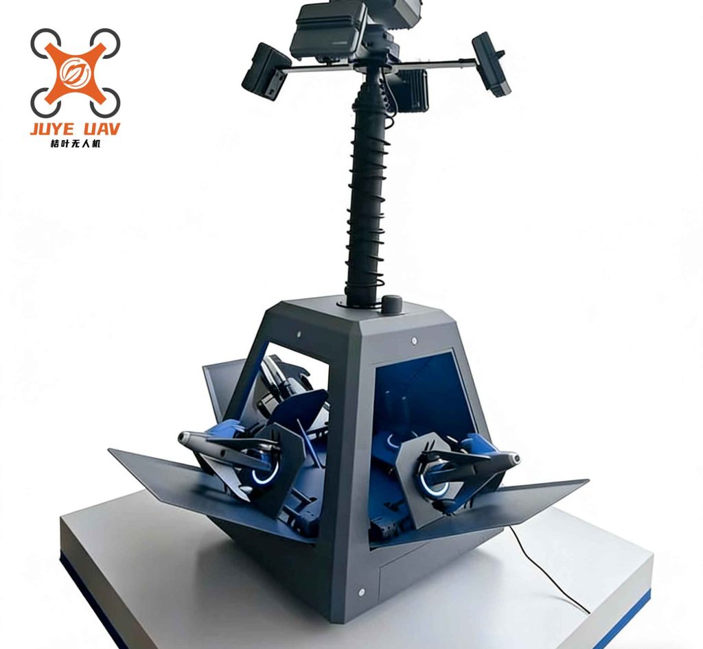
The system architecture of our anti-UAV solution comprises multiple sensor nodes, a management control center, and integration with countermeasure devices like RF jammers. Each sensor node performs signal detection, DF, and identification, relaying data to the central unit via secure links. The control center fuses information from multiple nodes to improve localization accuracy through triangulation, as illustrated in the diagram. For two sensor nodes at positions $\mathbf{p}_1$ and $\mathbf{p}_2$ measuring AoAs $\theta_1$ and $\theta_2$, the drone’s position $\mathbf{p}_u$ can be found by solving:
$$ \tan \theta_i = \frac{y_u – y_i}{x_u – x_i}, \quad i=1,2 $$
This multi-station cross-localization augments the single-station approach, providing precise coordinates for both the drone and the operator. The operator’s location is inferred by detecting the control signals, which are typically lower power but distinguishable through pattern analysis. Our anti-UAV system thus offers a dual-target capability: tracking the drone and potentially uncovering the “flyer,” which is crucial for law enforcement interventions.
Parameter measurement is vital for guiding precise electronic countermeasures. Our anti-UAV system extracts detailed signal parameters, including carrier frequency, bandwidth, pulse repetition interval (PRI), and modulation type. These parameters are fed into jamming systems to disrupt the drone’s communication links effectively. For example, if the system identifies a frequency-hopping spread spectrum (FHSS) signal, it can adaptively jam the hopping sequence. The jamming effectiveness $J$ can be modeled as:
$$ J = \frac{P_j G_j}{P_t G_t} \cdot \frac{B_j}{B_s} $$
where $P_j$ is the jamming power, $G_j$ is the jammer antenna gain, $B_j$ is the jamming bandwidth, and $B_s$ is the signal bandwidth. By optimizing these parameters based on our anti-UAV system’s measurements, we maximize disruption while minimizing collateral interference.
| Drone Manufacturer | Model | Typical Carrier Frequency | Modulation Type | Identification Confidence |
|---|---|---|---|---|
| DJI | Phantom 4 | 2.437 GHz | OFDM | 98% |
| Parrot | Bebop 2 | 5.725 GHz | QPSK | 96% |
| Yuneec | Typhoon H | 2.412 GHz | FHSS | 95% |
| Autel | X-Star Premium | 5.845 GHz | CCK | 94% |
| Holy Stone | HS700 | 2.4 GHz | DSSS | 92% |
Field applications of our anti-UAV system have demonstrated its efficacy. It has been deployed to secure major public events, where drone incursions pose safety risks. The system’s passive nature allows continuous monitoring without disturbing communications or broadcasting its presence. In one instance, the anti-UAV system detected a rogue drone at a distance of 8 km, identified it as a DJI Mavic, and provided azimuth data that enabled authorities to locate and apprehend the operator. Such successes underscore the practicality of this anti-UAV technology. Moreover, the system has garnered recognition in technical competitions, highlighting its innovation. These accolades reflect the advanced engineering behind our anti-UAV solution, which integrates hardware efficiency with intelligent software.
The design prioritizes portability and low power consumption, making the anti-UAV system suitable for rapid deployment in diverse environments. Each sensor node weighs less than 10 kg and consumes under 50 W, powered by batteries or solar panels. This lightweight attribute, combined with a compact form factor, allows setup in minutes—on rooftops, vehicles, or temporary mounts. The software interface provides real-time visualization on digital maps, displaying drone tracks, signal parameters, and alerts. Operators can interact with the system to initiate jamming or share data with other security assets. This user-centric design ensures that the anti-UAV system is accessible even to personnel with limited technical training, broadening its adoption.
Looking ahead, we are enhancing the anti-UAV system with artificial intelligence for predictive analytics. By learning from historical data, it can anticipate drone flight paths or identify anomalous behaviors, such as swarming attacks. Future versions may incorporate passive radar techniques using illuminators of opportunity (e.g., FM or TV broadcasts) to augment detection in RF-congested areas. The ultimate goal is to create a fully autonomous anti-UAV network that can detect, track, and neutralize threats with minimal human intervention. As drone technology evolves, so must anti-UAV defenses; our commitment is to stay at the forefront of this critical field.
In conclusion, the anti-UAV passive detection and localization system represents a paradigm shift in counter-drone technology. Its passive operation ensures environmental friendliness and stealth, while its advanced signal processing delivers long-range detection, accurate direction finding, and reliable identification. Through mathematical models and empirical data, we have shown how this anti-UAV system achieves superior performance in various scenarios. The integration of tables and formulas in this discussion underscores the technical rigor behind its development. As security challenges from drones intensify, such anti-UAV solutions will play an indispensable role in safeguarding airspace. I am confident that continued innovation will further solidify the effectiveness of passive anti-UAV systems in protecting our skies.