
As a researcher focused on modern law enforcement technologies, I find the integration of unmanned aerial vehicles (UAVs) into police and armed police forces to be a transformative advancement. These police UAVs provide a platform for ultra-low-altitude or close-range reconnaissance, surveillance, and engagement, making them indispensable tools in complex ground environments. To better accomplish missions and maintain national security, police forces are accelerating their informatization development, with UAVs playing an increasingly critical role. However, traditional police UAVs often follow pre-calculated, fixed trajectories based on ground task requirements. Real-time path planning is the technical foundation for autonomous operations such as UAV swarm coordination, tactical re-planning, and dynamic target reassignment. It is one of the most effective methods to enhance the survival probability of police UAVs. In this article, I will explore the framework, constraints, geometric modeling, and algorithms for police UAV path planning, emphasizing its significance in modern policing.
Path planning involves generating flight trajectories that satisfy specific constraints to achieve mission objectives. It is an integral part of autonomous systems, addressing the problem of moving from one location to another. For police UAVs, the goal is to compute optimal or shortest flight paths using pre-set digital maps and GPS/INS integrated navigation systems within an appropriate timeframe. Considering digital map errors and random environmental influences—such as obstacles or dynamic threats—police UAVs must possess the capability to dynamically correct trajectories during flight, avoiding areas threatened by criminals or hazards to safely complete predefined tasks. The path planning system for police UAVs encompasses environmental information (e.g., obstacles, criminal threat zones, terrain factors), UAV system constraints, path planners, and autopilots. Typically, the UAV system consists of two loops: an inner autopilot loop and an outer guidance loop. The guidance system provides lateral acceleration commands to ensure the police UAV tracks the path, while the autopilot controls the elevator, ailerons, and rudder to achieve the required lateral acceleration.
The objectives and methods of path planning vary based on the applications of police UAVs in law enforcement, including surveillance, search and tracking, rescue missions, and disaster monitoring. A simplified block diagram can represent the overall process, incorporating sensing, planning, and control modules. For instance, environmental data feeds into a path planner that considers constraints to generate feasible routes, which are then executed by the UAV’s control systems. This iterative process is crucial for adapting to real-time changes, especially in unpredictable police operations.
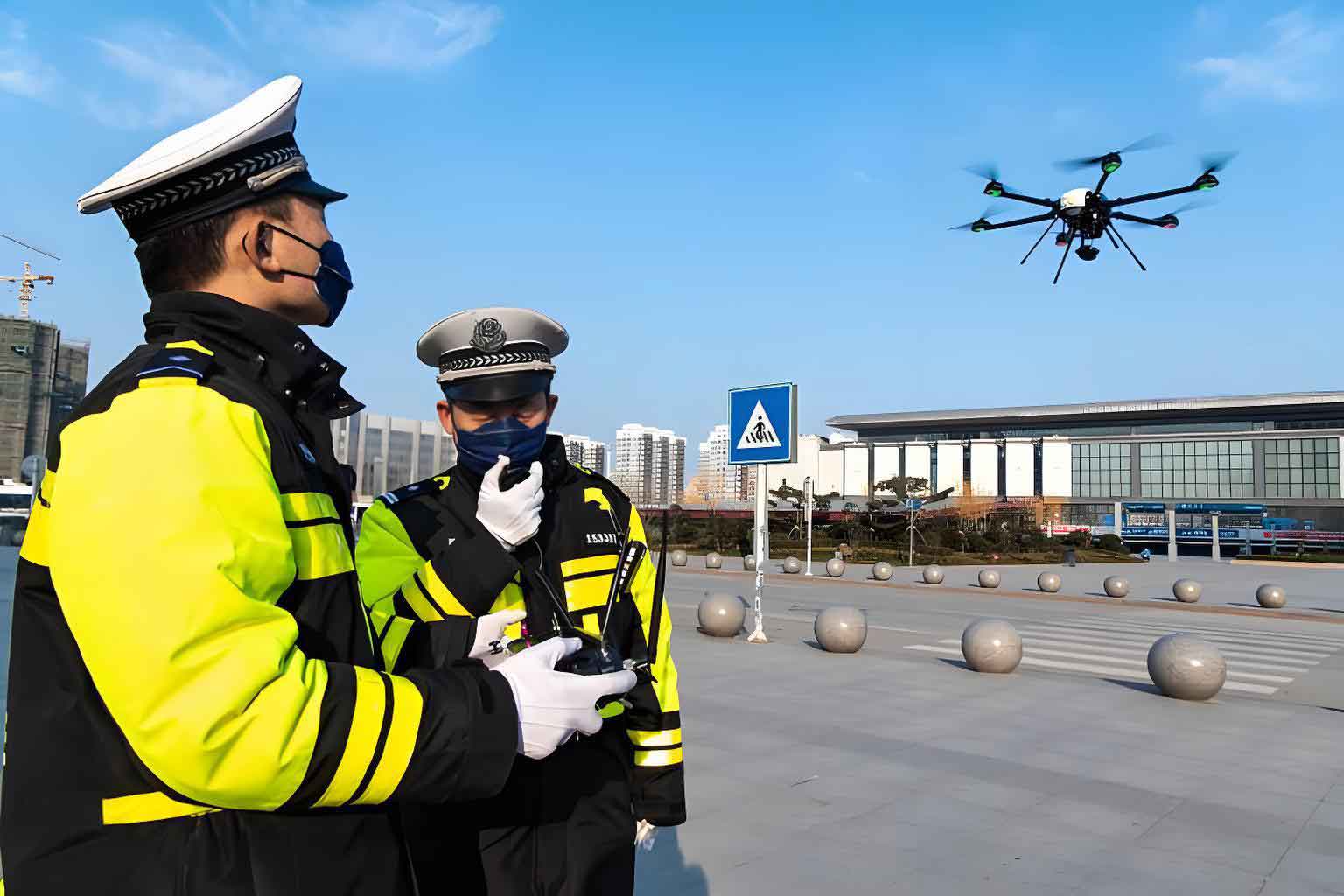
When designing path planning for police UAVs, it is essential to account for both system performance constraints and battlefield threat constraints. These factors ensure that generated paths are not only optimal but also feasible and safe in real-world scenarios.
Police UAVs have inherent机动性能 and physical limitations that impose several constraints during path planning. I will summarize these constraints using a table and mathematical formulations to clarify their impact.
| Constraint Type | Description | Mathematical Representation |
|---|---|---|
| Minimum Path Segment Length | The shortest straight-line distance a police UAV must fly before changing its flight attitude, determined by its机动性能. | Let \( L_{\min} \) be the minimum length. For a path segment between waypoints \( P_i \) and \( P_{i+1} \), the distance \( \| P_{i+1} – P_i \| \geq L_{\min} \). |
| Maximum Turning Angle | The maximum angle the police UAV can turn in the horizontal direction, ensuring smooth maneuvers. | Let \( \phi_{\max} \) be the maximum turning angle. For consecutive path vectors \( \vec{v}_i \) and \( \vec{v}_{i+1} \), the constraint is \( \cos^{-1}\left( \frac{\vec{v}_i \cdot \vec{v}_{i+1}}{\| \vec{v}_i \| \| \vec{v}_{i+1} \|} \right) \leq \phi_{\max} \). |
| Maximum Climb/Dive Angle | The maximum allowable angle for ascent or descent in the vertical direction, limited by the police UAV’s机动性能. | Let \( \theta_{\max} \) be the maximum angle. For vertical change \( \Delta z \) over horizontal distance \( d \), \( \left| \tan^{-1}\left( \frac{\Delta z}{d} \right) \right| \leq \theta_{\max} \). |
| Maximum Flight Range | The maximum length of the flight path due to fuel or energy limitations, ensuring the police UAV can return safely. | Let \( R_{\max} \) be the maximum range. The total path length \( \sum_{i=1}^{n-1} \| P_{i+1} – P_i \| \leq R_{\max} \). |
These constraints are critical for generating practical paths for police UAVs. For example, the maximum turning angle constraint can be expressed more formally: given a police UAV’s maximum turning angle \( \phi_{\max} \), and waypoints \( P_i \) or \( P_{i+1} \), each path segment vector \( \vec{v}_i = P_{i+1} – P_i \), the constraint is:
$$ \cos^{-1}\left( \frac{\vec{v}_i \cdot \vec{v}_{i+1}}{\| \vec{v}_i \| \| \vec{v}_{i+1} \|} \right) \leq \phi_{\max} $$
This ensures that the police UAV does not attempt sharp turns beyond its capabilities, which could lead to instability or mission failure.
In addition to performance constraints, police UAVs must navigate threat fields during operations. Threats may include natural geographical obstacles,恶劣复杂气候, or areas occupied by criminals. These are modeled as no-fly zones that the police UAV must avoid. Suppose a threat source has position coordinates \( (x_t, y_t) \) and a threat radius \( r_t \). Then, the region defined by \( \sqrt{(x – x_t)^2 + (y – y_t)^2} \leq r_t \) is prohibited. The path planning process must绕开 these areas, which involves threat field partitioning, feasible route identification, network establishment, and threat envelope recognition. For multiple threats, the combined no-fly zones form complex constraints. Mathematically, for \( n \) threats, the feasible region \( \mathcal{F} \) is:
$$ \mathcal{F} = \left\{ (x, y) \mid \sqrt{(x – x_{t,i})^2 + (y – y_{t,i})^2} > r_{t,i} \text{ for all } i = 1, 2, \dots, n \right\} $$
This formulation helps in constructing paths that minimize exposure to threats, a key consideration for police UAVs in high-risk environments.
To effectively plan paths for police UAVs, the environment must be represented geometrically. Common methods include grid-based and graph-based representations, each with its advantages. I will discuss these in detail, using formulas and tables to summarize their characteristics.
Grid-based geometric modeling involves decomposing the二维平面 into cells. Depending on cell uniformity, grids can be uniform or non-uniform. Uniform grids often use regular polygons like triangles, squares, or hexagons, while non-uniform grids may involve hierarchical decompositions. Square grids are widely used due to their simplicity, whereas hexagonal grids offer better geometric properties. For police UAV path planning, a grid cell can be marked as free or occupied based on obstacles or threats. The path is then found by traversing free cells. Let \( G \) be a grid with cell size \( \Delta \), and let \( c_{ij} \) represent the cell at row \( i \) and column \( j \). The state of \( c_{ij} \) is:
$$ s(c_{ij}) = \begin{cases}
0 & \text{if free} \\
1 & \text{if occupied}
\end{cases} $$
A path is a sequence of free cells connecting start and goal cells. This method is intuitive but can be computationally intensive for fine grids.
| Grid Type | Advantages | Disadvantages | Suitability for Police UAVs |
|---|---|---|---|
| Square Grid | Easy to implement; clear indexing. | May suffer from discretization errors; not optimal for diagonal movements. | Suitable for simple environments with regular obstacles. |
| Hexagonal Grid | Better adjacency representation; more natural for circular threats. | More complex to implement; less common in standard libraries. | Useful for detailed threat modeling in complex police operations. |
| Hierarchical Grid | Adaptive resolution; balances accuracy and efficiency. | Requires dynamic management; higher algorithmic complexity. | Effective for large-scale police UAV missions with varying terrain细节. |
Graph-based environment representation is another powerful approach for police UAV path planning. Based on graph来源, these methods can be categorized into visibility graphs, Voronoi diagrams, and probabilistic roadmaps (PRM). Each constructs a network of feasible paths for the police UAV.
Visibility graphs and tangent graphs are used for polygonal obstacles. In a visibility graph \( G = (V, E) \), vertices \( V \) represent obstacle vertices, and edges \( E \) are straight-line segments that do not intersect obstacles. For police UAVs, this method generates shortest paths but may expose the UAV to threats by skirting obstacle boundaries. Tangent graphs extend this to circular or扇形 threats by considering tangents to threat circles. Given threat circles with centers \( C_i \) and radii \( r_i \), tangent lines between circles or between start/goal points and circles form the graph edges. The path is found by searching this graph for the shortest route that avoids obstacle interiors. Mathematically, for two circles, the external tangents can be computed using geometric formulas, and these tangents represent safe passages for police UAVs.
Voronoi diagrams are particularly useful for maximizing distance from threats, which aligns with the safety goals of police UAV operations. A Voronoi diagram partitions the plane into regions based on proximity to threat points. Each edge of the diagram is equidistant from two threat points, making it a locally maximal安全 path. To generate a Voronoi diagram for police UAV path planning, threat points are identified from battlefield analysis. Let \( T = \{t_1, t_2, \dots, t_n\} \) be threat points. The Voronoi region for \( t_i \) is:
$$ V_i = \{ p \mid \| p – t_i \| \leq \| p – t_j \| \text{ for all } j \neq i \} $$
The edges of these regions form a graph where nodes are Voronoi vertices and edges are boundary segments. By assigning weights to edges (e.g., based on threat proximity or length), optimal paths for police UAVs can be found using graph search algorithms. This method prioritizes safety, making it ideal for police UAVs in hostile environments.
Probabilistic Roadmap (PRM) is a sampling-based method that randomly generates feasible points in the environment and connects them to form a graph. For police UAVs, this is effective in high-dimensional or dynamic spaces. The algorithm samples points \( p \) in the free space \( \mathcal{F} \), checks for collisions with threats or obstacles, and connects nearby points if the path between them is clear. The resulting graph \( G_{\text{PRM}} = (V_{\text{sample}}, E_{\text{connections}}) \) is then searched for a path. The probability of sampling ensures coverage of the space, and optimization criteria like shortest distance can be applied. Mathematically, for two sampled points \( p_i \) and \( p_j \), an edge is added if the line segment \( \overline{p_i p_j} \subset \mathcal{F} \). This approach is robust for complex police UAV scenarios but may not guarantee optimality without sufficient samples.
I will now compare these graph-based methods in a table to highlight their applicability to police UAV path planning.
| Graph Method | Key Principle | Advantages | Limitations | Use Case for Police UAVs |
|---|---|---|---|---|
| Visibility Graph | Connects visible obstacle vertices. | Guarantees shortest path; simple for polygonal obstacles. | Exposes UAV to threat boundaries; not suitable for circular threats without modification. | Rapid planning in urban environments with building obstacles. |
| Voronoi Diagram | Maximizes distance from threat points. | Enhances safety; good for threat avoidance. | May produce longer paths; computationally intensive for many threats. | Surveillance missions where staying away from criminal hideouts is critical. |
| Probabilistic Roadmap | Random sampling and connection of free points. | Handles complex, high-dimensional spaces; adaptable to动态变化. | No optimality guarantee; performance depends on sampling density. | Large-scale search and rescue operations with unpredictable obstacles. |
Path planning algorithms for police UAVs can be broadly classified into traditional classical algorithms and modern intelligent algorithms. I will discuss these in detail, incorporating formulas and comparative analysis to elucidate their roles in police UAV operations.
Traditional classical algorithms, such as dynamic programming, solve multi-step decision problems by breaking them into simpler subproblems. For police UAV path planning, dynamic programming can find globally optimal paths by considering all possible states and transitions. However, it suffers from the curse of dimensionality when applied to complex environments, limiting its use in real-time police UAV applications. Formally, let \( J(x) \) be the cost-to-go from state \( x \). The Bellman equation is:
$$ J(x) = \min_{u} \left[ g(x, u) + J(f(x, u)) \right] $$
where \( g(x, u) \) is the immediate cost, \( f(x, u) \) is the state transition function, and \( u \) is the control action. For a police UAV, states may include position and velocity, and actions correspond to steering commands. While dynamic programming provides exact solutions, its computational demand makes it less suitable for dynamic threat environments where police UAVs must react quickly.
Modern intelligent algorithms, such as A* and genetic algorithms, are more prevalent in police UAV path planning due to their efficiency and adaptability. A* algorithm is a heuristic search method that combines the cost to reach a node and a heuristic estimate to the goal. For a police UAV, the cost function \( f(n) = g(n) + h(n) \), where \( g(n) \) is the actual cost from the start to node \( n \), and \( h(n) \) is the heuristic estimate (e.g., Euclidean distance to the goal). A* guarantees optimality if \( h(n) \) is admissible (never overestimates). This algorithm is widely used for police UAVs because it reduces search space and speeds up planning. For example, in a grid-based representation, A* can efficiently find safe paths for police UAVs by evaluating threat proximity as part of the cost.
Genetic algorithms (GAs) simulate natural evolution to optimize complex problems. In police UAV path planning, a population of candidate paths is evolved through selection, crossover, and mutation to find an optimal solution. Each path is encoded as a chromosome, and fitness is evaluated based on criteria like length, threat exposure, and constraint satisfaction. The evolution process iteratively improves the population. Mathematically, for a path encoded as a sequence of waypoints \( \mathbf{P} = [P_1, P_2, \dots, P_m] \), the fitness function \( F(\mathbf{P}) \) might be:
$$ F(\mathbf{P}) = w_1 \cdot \text{Length}(\mathbf{P}) + w_2 \cdot \text{ThreatCost}(\mathbf{P}) + w_3 \cdot \text{ConstraintViolation}(\mathbf{P}) $$
where \( w_1, w_2, w_3 \) are weights. GAs are effective for multi-objective optimization in police UAV scenarios, such as balancing speed and safety. However, they may require significant computation time and do not guarantee global optimality.
To compare these algorithms, I present a table summarizing their features in the context of police UAV path planning.
| Algorithm Category | Example Algorithms | Strengths | Weaknesses | Applicability to Police UAVs |
|---|---|---|---|---|
| Traditional Classical | Dynamic Programming | Guarantees global optimality; systematic approach. | Curse of dimensionality; not suitable for real-time dynamic environments. | Offline planning for well-defined, static police UAV routes. |
| Modern Intelligent | A* Algorithm | Efficient with heuristics; guarantees optimality with admissible heuristics. | Heuristic design critical; may struggle in high-dimensional spaces. | Real-time path planning for police UAVs in已知威胁 environments. |
| Modern Intelligent | Genetic Algorithm | Handles complex, non-linear constraints; good for multi-objective optimization. | Computationally intensive; no optimality guarantee. | Mission planning for police UAVs with multiple competing objectives, like surveillance and rescue. |
| Modern Intelligent | Particle Swarm Optimization | Fast convergence; simple implementation. | May get stuck in local optima; parameter tuning required. | Dynamic re-planning for police UAVs in changing threat landscapes. |
| Modern Intelligent | Ant Colony Optimization | Inspiration from natural behavior; effective for combinatorial problems. | Slow for large problems; sensitive to parameter settings. | Network-based path planning for police UAVs in urban grids. |
As police UAVs undertake increasingly complex missions in uncertain environments, the demands on path planning continue to grow. Future directions and research priorities for police UAV path planning algorithms include several key areas. First, real-time path planning under uncertainty is crucial. Police UAVs must integrate multi-sensor information using uncertainty theories, such as Bayesian networks or fuzzy logic, to automatically modify paths based on real-time detections without human intervention. For example, probabilistic models can update threat assessments during flight, allowing police UAVs to adapt dynamically. Second, tactical-level,强实时的 path planning requires algorithms that balance computational speed with accuracy, enabling police UAVs to make rapid decisions in high-stakes scenarios like pursuits or hostage situations. Third, multi-task objective integration—such as low-altitude penetration, target search and rescue, and information reconnaissance—necessitates advanced optimization algorithms that can handle conflicting goals. Multi-objective evolutionary algorithms or Pareto-based methods could be explored for police UAVs. Fourth, multi-UAV协同规划 algorithms are essential for swarm operations, where multiple police UAVs must coordinate paths to avoid collisions and achieve collective objectives. Consensus algorithms or distributed optimization techniques may be employed. Fifth, research on algorithms for processing terrain and敌情 information is needed to improve environmental modeling for police UAVs. Machine learning approaches, like deep reinforcement learning, could enhance path planning by learning from past missions.
In conclusion, path planning for police UAVs is a multifaceted challenge that integrates constraints, geometric modeling, and algorithmic innovation. As a researcher, I believe that advancing these technologies will significantly enhance the effectiveness and safety of police UAVs in law enforcement. By leveraging modern algorithms and adaptive strategies, police forces can deploy UAVs more autonomously and efficiently in diverse scenarios, from urban surveillance to emergency response. The continuous evolution of path planning methods will ensure that police UAVs remain at the forefront of public safety technology, capable of navigating复杂 environments while minimizing risks. Through ongoing research and development, the potential of police UAVs to support critical missions will only expand, solidifying their role as indispensable assets in modern policing.