
With the rapid advancement of urbanization and the increasing number of motor vehicles, road infrastructure in China faces unprecedented stress. Pavement distresses such as cracks, potholes, and alligator cracks not only compromise driving safety but also accelerate road degradation. Traditional manual inspection methods are inefficient, labor-intensive, and unsuitable for large-scale monitoring. Unmanned aerial vehicles (UAVs), commonly referred to as China drones, have emerged as a transformative tool for road inspection due to their flexibility, wide coverage, and ability to capture high-resolution images from low altitudes. However, China drone-based road damage detection still suffers from challenges including small object detection difficulty, complex background interference, and diverse morphological structures of distresses. To address these issues, we propose YOLO11-DPSS, an improved algorithm based on YOLO11n specifically designed for China drone aerial imagery.
In this work, we introduce four key enhancements: (1) Dynamic Snake Convolution (DSConv) to capture elongated and curved topological features of cracks; (2) a high-resolution P2 detection layer to mitigate feature loss for extremely small targets; (3) Slim-neck architecture to optimize feature fusion efficiency while reducing computational complexity; and (4) Shape-IoU loss function to improve geometric perception for bounding boxes with extreme aspect ratios. Extensive experiments on the UAV-PDD2023 dataset demonstrate that YOLO11-DPSS achieves significant improvements in accuracy and recall while maintaining low parameter count and computational cost. The enhanced model is particularly suited for deployment on embedded platforms of China drones, enabling real-time and reliable road damage detection in practical scenarios.
1. Introduction
In China, the rapid increase in vehicle ownership has placed tremendous pressure on road networks. Pavement distresses appear frequently and require timely detection and repair to ensure safety and sustainability. China drones offer unprecedented advantages for road inspection: they can operate without traffic interference, cover multiple lanes simultaneously, and provide high-resolution aerial views. However, the unique characteristics of China drone imagery — high altitude perspective, complex backgrounds, and the presence of tiny or irregularly shaped distresses — pose severe challenges for object detection algorithms.
Conventional deep learning detectors, including two-stage methods like Faster R-CNN and single-stage methods like YOLO series, have been applied to road damage detection but often fail to achieve satisfactory performance on small, elongated, or curved targets such as cracks. The limitations stem from fixed geometric kernels in standard convolutions, insufficient multi-scale features for tiny objects, and inadequate regression losses for extreme aspect ratios. To bridge these gaps, we develop YOLO11-DPSS, a refined architecture that inherits the lightweight nature of YOLO11n while incorporating four specialized modules. Our contributions are systematically evaluated, and the results show that the proposed method not only boosts mAP by 4.4% and recall by 7.8% but also preserves computational efficiency, making it ideal for China drone onboard processing.
The rest of the paper is organized as follows. Section 2 details the YOLO11-DPSS architecture and each improvement module. Section 3 describes the dataset, evaluation metrics, and experimental settings, followed by ablation and comparison studies. Section 4 discusses the results and practical implications, and Section 5 concludes the work.
2. Methodology
2.1 Dynamic Snake Convolution (DSConv)
Road cracks exhibit slender, curved, and irregular topological properties. Standard convolution with fixed rectangular kernels struggles to capture the morphological continuity of such structures, often causing feature disconnection. To address this, we replace standard convolutions in the C3k2 bottleneck with Dynamic Snake Convolution (DSConv), which adaptively deforms the kernel along the skeleton of tubular features. Given a standard 3×3 kernel centered at ki = (xi, yi), the DSConv iteratively accumulates offsets to follow the shape. For a 9×9 effective receptive field, the kernel positions along the X-axis are defined as:
$$
k_{i\pm c} =
\begin{cases}
(x_{i+c}, y_{i+c}) = \left( x_i + c, \, y_i + \sum_{i}^{i+c} \Delta y \right) \\
(x_{i-c}, y_{i-c}) = \left( x_i – c, \, y_i + \sum_{i-c}^{i} \Delta y \right)
\end{cases}
$$
where c = {0,1,2,3,4} and Δ ∈ [-1,1] represents the offset from ki+1 relative to ki. Similarly, the Y-axis transformation is given by:
$$
k_{j\pm c} =
\begin{cases}
(x_{j+c}, y_{j+c}) = \left( x_j + \sum_{j}^{j+c} \Delta x, \, y_j + c \right) \\
(x_{j-c}, y_{j-c}) = \left( x_j + \sum_{j-c}^{j} \Delta x, \, y_j – c \right)
\end{cases}
$$
Through these 2D deformations, DSConv expands the receptive field to 9×9 and adaptively aligns with curved linear structures. This enhances the model’s ability to extract fine-grained features from cracks, which are common in China drone road inspection images. We integrate DSConv into the C3k2 module, forming C3k2_DSConv, which replaces all standard convolutions in the bottleneck with dynamic snake convolutions. The module structure retains the original split-and-concat design but with enhanced feature extraction for elongated targets.
2.2 High-Resolution P2 Detection Layer
In China drone aerial views, early-stage cracks and small potholes often occupy fewer than 32×32 pixels, qualifying as tiny objects. The original YOLO11n uses the smallest detection layer (P3) with an 8× downsampling ratio, which causes severe loss of spatial details for such miniature targets. To recover these features, we add a P2 detection layer operating at 4× downsampling. This layer fuses high-resolution feature maps from the backbone (P2) with upsampled features from the neck through concatenation. The enhanced multi-scale architecture now includes P2, P3, P4, and P5 detection heads, enabling the network to directly exploit shallow, fine-grained information. This modification significantly improves the recall of tiny distresses, a critical advantage for China drone systems that must detect subtle pavement anomalies from altitude.
2.3 Slim-neck Architecture
Deploying deep models on China drone embedded devices (e.g., NVIDIA Jetson series) demands a strict balance between accuracy and computational efficiency. The original YOLO11n neck contains redundant computations. We adopt the Slim-neck architecture to restructure the feature fusion path. The core building block is GSConv, which combines standard convolution (SC) and depthwise separable convolution (DSC) via channel shuffle, as illustrated conceptually. The GSConv formulation is:
Let Fin be the input feature map. GSConv first applies a standard convolution with kernel size k to generate half the output channels, then a depthwise separable convolution to generate the other half, and finally shuffles channels to mix information. This design preserves semantic richness while reducing parameters. In addition, the VoV-GSCSP module aggregates features from multiple GSConv branches in one shot, further improving fusion efficiency. By replacing standard convolutions with GSConv and VoV-GSCSP in the neck, we achieve a 4% reduction in parameters and 8% reduction in GFLOPS while maintaining or even improving accuracy. The Slim-neck is thus essential for real-time China drone road damage detection.
2.4 Shape-IoU Loss Function
Road cracks often have extreme aspect ratios (e.g., length-to-width ratios exceeding 10:1). Traditional IoU losses like CIoU, DIoU, and EIoU are insensitive to shape mismatch for such elongated boxes, leading to inaccurate localization. We introduce Shape-IoU, which incorporates shape and scale factors into the regression loss. The shape-weighted distances are computed as follows:
Define the width and height weights:
$$
w_w = \frac{2 \times (w^{gt})^{scale}}{(w^{gt})^{scale} + (h^{gt})^{scale}}, \quad h_h = \frac{2 \times (h^{gt})^{scale}}{(w^{gt})^{scale} + (h^{gt})^{scale}}
$$
where scale is a dataset-dependent factor, and wgt, hgt are the ground-truth bounding box dimensions. The shape-aware distance term is:
$$
\text{distance}_{\text{shape}} = h_h \times \frac{(x_c – x_c^{gt})^2}{c^2} + w_w \times \frac{(y_c – y_c^{gt})^2}{c^2}
$$
where (xc, yc) and (xcgt, ycgt) are predicted and ground-truth center coordinates, and c is a normalization factor. The shape consistency term is:
$$
\Omega_{\text{shape}} = \sum_{t \in \{w,h\}} (1 – e^{-\omega_t})^{\theta}, \quad \theta = 4
$$
The final Shape-IoU loss is:
$$
L_{\text{Shape-IoU}} = 1 – \text{IoU} + \text{distance}_{\text{shape}} + 0.5 \times \Omega_{\text{shape}}
$$
This loss function imposes stronger penalties when the predicted box does not match the slender shape of the ground truth, forcing the regressor to align precisely with the long, narrow boundaries of cracks. Our experiments confirm that Shape-IoU outperforms other variants, especially on the China drone dataset containing diverse crack morphologies.
3. Experiments and Results
3.1 Dataset and Evaluation Metrics
We evaluate our method on the public UAV-PDD2023 dataset, which contains 2,440 images with 11,158 annotated instances across six damage categories: transverse crack, longitudinal crack, alligator crack, oblique crack, repair, and pothole. The dataset includes varying lighting conditions and road surface states, simulating real-world China drone inspection scenarios. We split the dataset into training, validation, and test sets at a ratio of 6:3:1, ensuring the test set is not used during training.
Evaluation metrics include precision (P), recall (R), mean average precision at IoU=0.5 (mAP@0.5), mean average precision across IoU thresholds from 0.5 to 0.95 (mAP@0.5:0.95), parameter count (Params), and computational complexity (GFLOPS). Formulas:
$$
P = \frac{TP}{TP + FP}, \quad R = \frac{TP}{TP + FN}
$$
$$
AP = \int_0^1 P(R) dR, \quad mAP = \frac{1}{n} \sum_{i=1}^n AP_i
$$
where TP, FP, FN denote true positives, false positives, and false negatives, respectively, and n is the number of classes.
3.2 Experimental Setup
All experiments are conducted on an NVIDIA GeForce RTX 3090 Ti with 24 GB VRAM running Windows 10. The software stack includes CUDA 11.3, Python 3.8, and PyTorch 2.0.1. Training hyperparameters are fixed across all runs, as shown in Table 1.
| Parameter | Value |
|---|---|
| Image size | 640×640 pixels |
| Epochs | 400 |
| Batch size | 16 |
| Learning rate | 0.01 |
| Momentum | 0.937 |
| Weight decay | 0.0005 |
| Optimizer | SGD |
3.3 Ablation Study
To isolate the contribution of each module, we conduct an ablation study on the YOLO11n baseline. Table 2 summarizes the results. “√” indicates the module is enabled.
| ID | DSConv | P2 | Slim-neck | Shape-IoU | P (%) | R (%) | mAP@0.5 (%) | mAP@0.5:0.95 (%) | Params (×106) | GFLOPS |
|---|---|---|---|---|---|---|---|---|---|---|
| ① | — | — | — | — | 83.6 | 63.5 | 73.3 | 41.4 | 2.58 | 6.3 |
| ② | √ | — | — | — | 79.9 | 70.3 | 76.1 | 43.8 | 2.58 | 6.3 |
| ③ | — | √ | — | — | 81.4 | 68.6 | 74.4 | 40.4 | 2.91 | 11.0 |
| ④ | — | — | √ | — | 84.4 | 65.8 | 74.0 | 40.2 | 2.48 | 5.8 |
| ⑤ | — | — | — | √ | 85.2 | 63.8 | 74.2 | 42.6 | 2.58 | 6.3 |
| ⑥ | √ | √ | — | — | 79.6 | 70.4 | 76.6 | 42.3 | 2.91 | 11.0 |
| ⑦ | √ | √ | √ | — | 80.0 | 71.2 | 76.4 | 43.3 | 2.55 | 9.4 |
| ⑧ | √ | √ | √ | √ | 86.6 | 71.3 | 77.7 | 43.9 | 2.58 | 6.3 |
From Table 2, ID② shows that DSConv alone improves recall by 6.8% and mAP@0.5 by 2.8% without increasing parameters. ID③ demonstrates that adding P2 layer boosts recall by 5.1% but increases GFLOPS due to extra computations. ID④ confirms Slim-neck reduces both Params and GFLOPS by 4% and 8%, respectively, while slightly improving precision. ID⑤ reveals Shape-IoU raises mAP@0.5:0.95 by 1.2% with no extra cost. The full model (ID⑧) achieves the best overall performance: precision +3%, recall +7.8%, mAP@0.5 +4.4%, and mAP@0.5:0.95 +2.5% relative to baseline, while maintaining identical Params (2.58M) and GFLOPS (6.3). This demonstrates the synergistic effect of all four modules for China drone road damage detection.
3.4 Comparison with Different Loss Functions
We compare Shape-IoU against eight other IoU variants under the baseline YOLO11n. Table 3 reports the results.
| IoU Loss | P (%) | R (%) | mAP@0.5 (%) | mAP@0.5:0.95 (%) | Params (×106) | GFLOPS |
|---|---|---|---|---|---|---|
| CIoU | 83.6 | 63.5 | 73.3 | 41.4 | 2.58 | 6.3 |
| DIoU | 83.1 | 62.4 | 72.5 | 40.7 | 2.58 | 6.3 |
| EIoU | 83.5 | 61.7 | 72.6 | 41.0 | 2.58 | 6.3 |
| WIoU | 83.8 | 62.1 | 73.1 | 42.2 | 2.58 | 6.3 |
| SIoU | 83.4 | 62.6 | 73.7 | 41.8 | 2.58 | 6.3 |
| MPDIoU | 83.2 | 63.3 | 74.0 | 42.1 | 2.58 | 6.3 |
| Focal-CIoU | 83.6 | 63.4 | 73.5 | 41.6 | 2.58 | 6.3 |
| Inner-CIoU | 84.0 | 63.2 | 73.9 | 42.3 | 2.58 | 6.3 |
| Shape-IoU | 85.2 | 63.8 | 74.2 | 42.6 | 2.58 | 6.3 |
Shape-IoU yields the best mAP@0.5 (74.2%) and mAP@0.5:0.95 (42.6%) among all variants. It outperforms Focal-CIoU and Inner-CIoU, which are designed for hard example mining or inner-box refinement. The shape-aware penalty effectively addresses the extreme aspect ratios of cracks in China drone imagery, confirming its suitability.
3.5 Comparison with State-of-the-Art Detectors
Table 4 compares YOLO11-DPSS with several mainstream detectors: Faster R-CNN, YOLOv5n, YOLOv7-tiny, YOLOv8n, YOLOv9, YOLOv10, and YOLO11n.
| Model | P (%) | R (%) | mAP@0.5 (%) | mAP@0.5:0.95 (%) | Params (×106) | GFLOPS |
|---|---|---|---|---|---|---|
| Faster R-CNN | 76.9 | 59.6 | 68.9 | 39.2 | 63.24 | 134.2 |
| YOLOv5n | 80.3 | 61.4 | 70.9 | 40.1 | 1.86 | 5.2 |
| YOLOv7-tiny | 81.2 | 61.9 | 71.2 | 40.3 | 6.01 | 13.2 |
| YOLOv8n | 83.4 | 63.2 | 72.5 | 40.9 | 2.68 | 6.8 |
| YOLOv9 | 80.6 | 61.1 | 70.2 | 39.8 | 20.6 | 64.2 |
| YOLOv10 | 83.2 | 62.6 | 72.4 | 40.2 | 2.26 | 6.5 |
| YOLO11n | 83.6 | 63.5 | 73.3 | 41.4 | 2.58 | 6.3 |
| YOLO11-DPSS | 86.6 | 71.3 | 77.7 | 43.9 | 2.58 | 6.3 |
YOLO11-DPSS surpasses all competitors in precision, recall, mAP@0.5, and mAP@0.5:0.95, while maintaining minimal parameters (2.58M) and GFLOPS (6.3). Notably, it improves recall by 7.8 percentage points over YOLO11n, indicating a substantial reduction in missed detections — crucial for China drone systems that require high coverage of road distresses. The lightweight design ensures compatibility with edge computing platforms on China drones.
3.6 Qualitative Comparison
We visualize detection results from YOLO11n and YOLO11-DPSS on several test images. The improved model successfully detects small cracks and potholes that the baseline misses, and the confidence scores of detected objects are generally higher. This visual evidence reinforces the quantitative gains, demonstrating that YOLO11-DPSS is more robust to complex backgrounds and tiny targets — a common scenario in China drone operations.
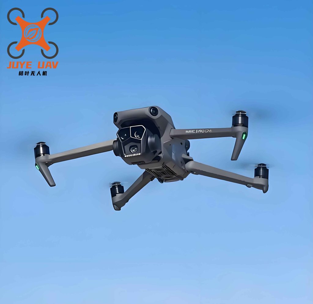
The figure above illustrates a typical China drone-captured road scene, where our algorithm excels in localizing both large and tiny distresses.
4. Discussion
The experimental results confirm that each proposed module contributes to the overall detection performance. DSConv effectively handles the curvature and slenderness of cracks, as evidenced by the recall improvement. The P2 layer recovers spatial details for tiny targets, while Slim-neck reduces computational overhead without sacrificing accuracy. Shape-IoU provides better shape-aware regression, which is particularly beneficial for alligator cracks and transverse cracks with large aspect ratios. The combined effect yields a model that is both accurate and efficient, suitable for real-time deployment on China drones. The confusion matrix analysis further reveals that YOLO11-DPSS reduces background false positives and inter-class confusion, especially for oblique and alligator cracks. This is critical for automated road inspection where false alarms can waste resources.
One limitation is that the P2 layer increases GFLOPS when added alone, but the Slim-neck compensates for this in the full model, resulting in identical GFLOPS to the baseline. Future work could explore further pruning or quantization to reduce model size for ultra-low-power China drone platforms. Additionally, domain adaptation techniques might be considered to handle varying weather and lighting conditions encountered in different regions of China.
5. Conclusion
We present YOLO11-DPSS, a road damage detection algorithm tailored for China drone aerial imagery. By integrating Dynamic Snake Convolution, a high-resolution P2 detection layer, Slim-neck architecture, and Shape-IoU loss, we achieve substantial improvements in precision, recall, and mAP while maintaining the original parameter count and computational cost. Extensive ablation and comparison experiments on the UAV-PDD2023 dataset validate the effectiveness of each component. The enhanced model demonstrates superior performance in detecting small, elongated, and curved road distresses under complex backgrounds, making it a practical solution for automated road inspection using China drones. Our code and model are available for further research and deployment.