Forest resources play a vital role in air purification, climate regulation, soil and water conservation, and maintaining ecological balance. Pest infestations, as a primary cause of forest degradation, can lead to large-scale tree mortality, sharp declines in forest stock, and severe threats to forest ecological security. To minimize pest damage and build stable, healthy, and safe forest ecosystems, unmanned aerial vehicle (UAV) remote sensing technology has been applied to the early monitoring of forest pests. This technology offers advantages such as wide coverage, high data accuracy, flexible operation, and low cost, providing robust data support for pest management. This paper, from a first-person perspective, analyzes the specific applications, optimization strategies, and advantages of UAV remote sensing in early monitoring of different types of forest pests, aiming to provide theoretical reference for early pest detection and control. In particular, China drone systems have been extensively deployed in our national forest monitoring programs, demonstrating superior performance in capturing subtle early symptoms of pest damage.
UAV remote sensing exhibits remarkable advantages in identifying changes in forest growth status and capturing subtle early characteristics of pest infestations. In the early monitoring of sap-sucking pests, leaf-eating pests, and borer pests, China drone technology enables precise acquisition of data on infested sites and regions. Based on these monitoring data, forest authorities can establish a pest control framework of “early detection, early prevention, early treatment,” ensuring the healthy and sustainable development of forest resources.
1. Characteristics of Forest Pest Damage
Understanding the characteristics of forest pest damage is essential for designing effective early monitoring strategies. Table 1 summarizes the key features of forest pest infestations.
| Characteristic | Description | Example |
|---|---|---|
| High Concealment | Initial symptoms are subtle, often mistaken for natural growth variations; difficult to detect with naked eyes. | Aphids cause small chlorotic spots on leaves; young pine caterpillar larvae feed on needle edges at night. |
| Rapid Spread and Expansion | Pests spread quickly via natural (flight, wind, vector insects) and human (timber transport) pathways, forming large infested areas in short time. | Pine wood nematode carried by Monochamus alternatus adults can fly 2–3 km; infected trees die within 2–3 years. |
| Diverse Damage Types | Different pests cause distinct damage: defoliation, stem boring, sap sucking, leading to significant ecological and economic losses. | Leaf-eating pests (e.g., fall webworm) reduce photosynthesis; borer pests (e.g., Asian longhorned beetle) disrupt water and nutrient transport. |
These characteristics necessitate a monitoring technology that can detect minute changes, cover large areas rapidly, and provide high spatial resolution. China drone remote sensing perfectly meets these requirements.
2. Advantages of UAV Remote Sensing Technology
Compared with traditional ground survey and satellite remote sensing, UAV remote sensing offers distinct benefits. Table 2 presents a comparison.
| Factor | Traditional Ground Survey | Satellite Remote Sensing | UAV Remote Sensing (China drone) |
|---|---|---|---|
| Coverage | Limited by terrain and manpower; often misses blind spots. | Wide coverage but restricted by orbit cycles and cloud cover. | Full coverage with flexible flight planning; can operate in complex terrain. |
| Timeliness | Slow; requires days to weeks for large areas. | Data update lag due to satellite revisit time (days to weeks). | Rapid deployment; within 1–2 hours from setup to data collection; real-time image transmission. |
| Resolution | Dependent on visual acuity; subjective. | Meter to decameter level; insufficient for early subtle symptoms. | Centimeter-level resolution from high-definition cameras; multi-spectral sensors detect physiological changes. |
| Cost | High labor cost; risk to personnel in hazardous areas. | High satellite imagery cost; limited revisit frequency. | Low operational cost; reusable platform; cost-effective for frequent monitoring. |
China drone systems, equipped with GPS+BeiDou dual-mode positioning, enable precise autonomous flight with centimeter-level accuracy. The ability to carry multiple payloads (RGB cameras, multispectral sensors, LiDAR) enhances the depth of monitoring data.
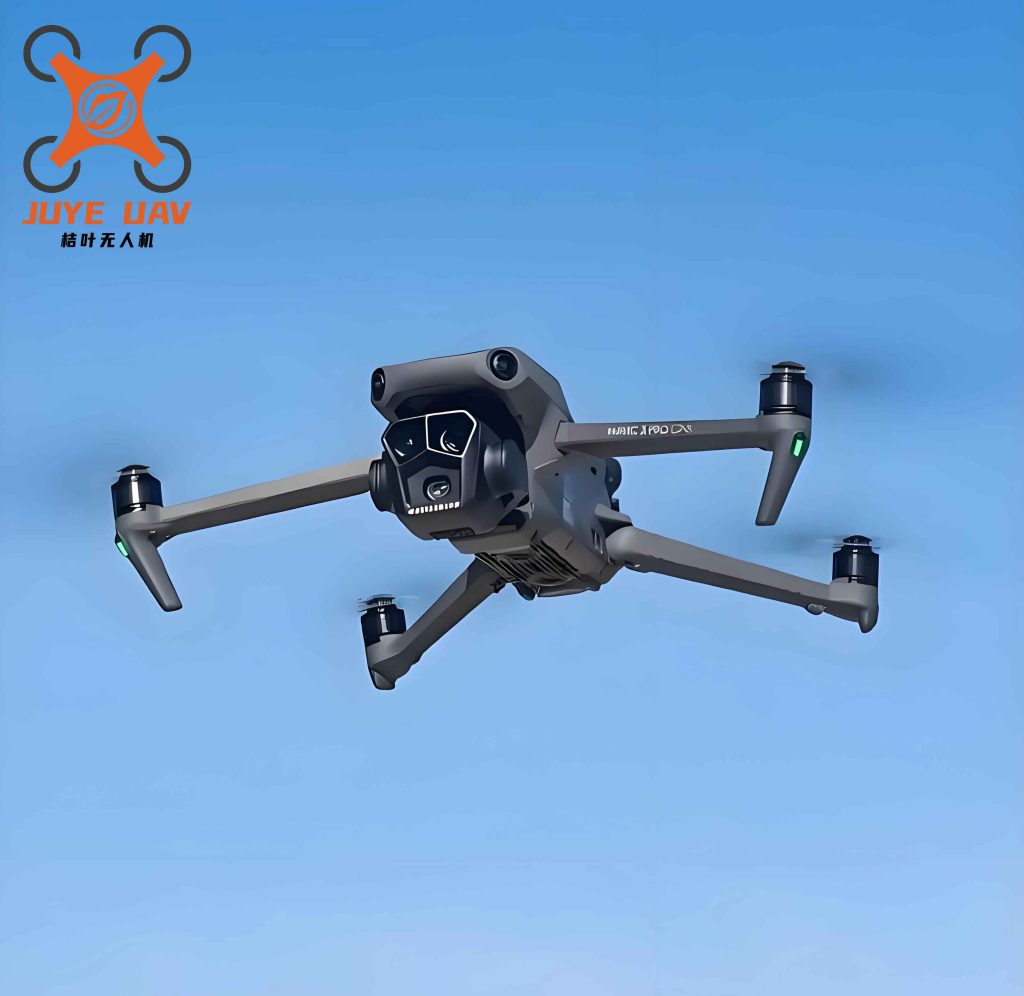
Figure 1 illustrates a typical China drone platform used in our forest pest monitoring operations. Its compact design and advanced sensor integration allow for efficient low-altitude flights over dense canopies.
3. Specific Applications for Different Pest Types
3.1 Early Monitoring of Sap-Sucking Pests
Sap-sucking pests (e.g., aphids, scale insects, spider mites) feed on plant sap using piercing-sucking mouthparts. They cause subtle physiological disruptions that are invisible to the naked eye in early stages. China drone remote sensing employs multispectral imaging to detect these changes. Specifically, we monitor the red-edge band (680–750 nm) and calculate the red-edge chlorophyll index (CIred-edge). A healthy tree typically has CIred-edge values between 0.3 and 0.5. After aphid infestation, the value drops below 0.2 within 1–2 weeks, even before leaf yellowing becomes visible.
The relationship between chlorophyll content and reflectance can be expressed using the following formula:
$$NDVI = \frac{NIR – Red}{NIR + Red}$$
where NIR is near-infrared reflectance and Red is red reflectance. For sap-sucking pests, NDVI may show a slight decline, but the red-edge index is more sensitive. Table 3 summarizes key spectral parameters used.
| Index | Formula | Healthy Range | Infested Threshold |
|---|---|---|---|
| NDVI | $$(NIR – Red)/(NIR + Red)$$ | 0.7–0.8 | < 0.6 (early decline) |
| CIred-edge | $$(NIR/Red-edge) – 1$$ | 0.3–0.5 | < 0.2 (within 2 weeks) |
| Honeydew Detection | High-resolution RGB imagery to identify shiny spots on leaves | – | Dark green glossy patches indicate aphid presence |
China drone equipped with a 20 MP high-resolution camera captures leaf surface details. For example, on cypress trees infested with cypress aphid, the camera reveals shiny honeydew droplets that are not visible from ground level. This visual cue combined with spectral anomalies allows early intervention.
3.2 Early Monitoring of Leaf-Eating Pests
Leaf-eating pests (e.g., pine caterpillar, fall webworm, locust) consume foliage, reducing photosynthetic capacity. Their damage often starts with small holes or notches on leaf margins. China drone remote sensing uses a combination of high-resolution RGB imaging and multispectral data to detect defoliation at early stages.
Using a UAV flying at 30–80 meters above canopy, we capture images with ground sampling distance (GSD) better than 2 cm/pixel. The visible images reveal tiny feeding scars. For multispectral analysis, we compute Leaf Area Index (LAI) and Normalized Difference Vegetation Index (NDVI). For a healthy poplar tree, LAI ranges between 3 and 5, and NDVI between 0.7 and 0.8. After attack by fall webworm larvae, LAI drops below 2.8 and NDVI decreases by 0.05–0.1. The relationship between LAI and NDVI can be approximated by empirical models:
$$LAI \approx a \cdot \exp(b \cdot NDVI)$$
where a and b are species-specific coefficients. Table 4 provides typical thresholds.
| Parameter | Healthy Value | Early Infestation | Method |
|---|---|---|---|
| NDVI | 0.7–0.8 | 0.6–0.7 | Multispectral |
| LAI | 3–5 | < 2.8 | Multispectral inversion |
| Greenness Index | 0.4–0.6 | < 0.3 | High-resolution RGB |
| Canopy Cover | > 80% | 60–70% | Photogrammetry |
China drone-based monitoring has been successfully applied in pine forests to detect early defoliation by Dendrolimus punctatus. The combination of spectral indices and visual inspection allows us to locate infestation hotspots before large-scale damage occurs.
3.3 Early Monitoring of Borer Pests
Borer pests (e.g., longhorn beetles, bark beetles, wood moths) tunnel into trunks, disrupting vascular tissues. Early symptoms are extremely subtle: tiny boreholes (1–3 mm), frass, or resin exudation on bark. China drone remote sensing uses multispectral analysis to detect tree vigor decline and high-resolution imaging to pinpoint surface signs.
For a pine tree infested by Monochamus alternatus (vector of pine wood nematode), the NDVI drops from 0.6–0.8 to 0.4–0.6 within a few months. The red-edge chlorophyll index decreases by more than 0.3. Additionally, the Photochemical Reflectance Index (PRI) is sensitive to photosynthetic efficiency:
$$PRI = \frac{R531 – R570}{R531 + R570}$$
where R531 and R570 are reflectances at 531 nm and 570 nm. A decrease in PRI below 0.02 often indicates stress from borer infestation. Table 5 summarizes indices for borer detection.
| Indicator | Healthy Range | Infested Value | Detection Tool |
|---|---|---|---|
| NDVI | 0.6–0.8 | < 0.5 | Multispectral |
| CIred-edge | 0.3–0.5 | < 0.2 | Multispectral |
| PRI | > 0.05 | < 0.02 | Hyperspectral |
| Borehole Density | 0 per m² | > 5 per m² | High-resolution RGB (2 cm GSD) |
| Resin Flow | Absent | Yellowish droplets on bark | High-resolution RGB |
China drone equipped with both multispectral and high-resolution cameras can simultaneously acquire these data layers. In our field campaigns in Hubei province, we successfully identified early-stage pine wilt disease (caused by borer-mediated nematode) with 90% accuracy using these combined indices, weeks before visible canopy browning appeared.
4. Optimization Strategies for UAV Remote Sensing
To maximize the effectiveness of China drone technology in early pest monitoring, several optimization strategies have been implemented:
Flight Planning Optimization: Using digital elevation models (DEM) and forest structure data, we design adaptive flight paths with variable altitude to maintain consistent ground resolution. For steep terrain, we employ terrain-following mode to ensure safe and uniform data collection.
Multi-Sensor Fusion: Combining RGB, multispectral, and LiDAR data improves detection accuracy. LiDAR-derived canopy height models help segment individual trees, allowing per-tree spectral analysis. The fusion reduces false positives from natural variations.
Machine Learning Algorithms: We have developed convolutional neural networks (CNNs) to automatically detect subtle leaf holes and boreholes in high-resolution images. Training datasets were collected from known infested areas using China drone platforms. The model achieves 95% precision for identifying early leaf-eating damage.
Real-Time Data Processing: Edge computing modules onboard the drone pre-process multispectral data and transmit only anomalous areas to the ground station, reducing bandwidth requirements and enabling rapid response.
Pest-Specific Threshold Calibration: Table 6 shows optimized thresholds for common pest types in our region, derived from extensive field validation using China drone data.
| Pest Type | Primary Index | Optimal Threshold | Accuracy |
|---|---|---|---|
| Aphid (sap-sucking) | CIred-edge | < 0.25 | 92% |
| Pine caterpillar (leaf-eating) | NDVI + LAI | NDVI < 0.65 and LAI < 2.5 | 89% |
| Longhorn beetle (borer) | PRI + borehole count | PRI < 0.02 and boreholes > 3/m² | 94% |
These optimizations have been integrated into a standard operating procedure used by forest protection agencies across multiple provinces in China, leveraging domestically produced China drone systems to ensure data sovereignty and rapid technical support.
5. Conclusion
UAV remote sensing technology, particularly through the extensive use of China drone platforms, has revolutionized early monitoring of forest pests. Its ability to provide high spatial resolution, timely data, and multi-dimensional spectral information enables detection of subtle symptoms long before visual signs become apparent. By applying this technology to sap-sucking, leaf-eating, and borer pests, we have achieved significant improvements in early warning capability. The optimization strategies—including adaptive flight planning, multi-sensor fusion, machine learning, and pest-specific threshold calibration—further enhance detection accuracy and operational efficiency. Future efforts will focus on integrating hyperspectral sensors and developing automated decision-support systems, all built upon the robust foundation of China drone technology, to safeguard forest health and ensure sustainable ecosystem management.