
From my perspective as a practitioner deeply involved in the integration of aerial technology into public safety operations, the evolution of the police drone is one of the most significant tactical advancements of the past decade. The dream of flight has always offered a transformative viewpoint, and today, that perspective is not from a hot balloon or a spacecraft, but from a compact, intelligent platform hovering silently over a city street or a remote mountain range. This is the reality of modern policing.
The concept of unmanned aerial vehicles (UAVs) is over a century old, rooted primarily in military applications. However, their migration into civil and public safety spheres has been rapid. For law enforcement, the adoption timeline is remarkably short, spanning roughly ten years globally. The driver for this adoption is a clear and pressing operational need. Police work is inherently characterized by danger, complexity, tedium, and high-stress scenarios—whether in criminal investigations, counter-terrorism, narcotics interdiction, or public order management. The police drone emerged as a direct response to these challenges, offering a force-multiplying effect that enhances officer safety and operational effectiveness.
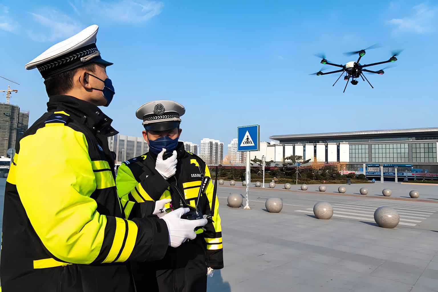
Early pioneering uses, such as during the security preparations for a major international sporting event in 2008, demonstrated potential. But the true proving grounds were high-stakes operations. In a notorious village known for entrenched narcotics production, traditional ground reconnaissance was nearly impossible due to vigilant counter-surveillance. The deployment of a police drone fleet provided critical overhead imagery, mapping dozens of suspected lab locations with precise GPS coordinates. This intelligence was pivotal for planning a massive, successful raid that dismantled a significant narcotics network. In another region, a hotbed for violent extremism, police drone units were deployed following a brutal terrorist attack. They performed wide-area searches over sparse, complex terrain, providing real-time situational awareness to ground commanders and capturing high-resolution evidence for post-event investigation and prosecution.
These examples underscore a fundamental shift. The police drone is not merely a flying camera; it is a mobile sensor platform that extends the eyes, ears, and even the communication reach of a command center. It mitigates extreme risk. Consider a prolonged hostage situation where an armed suspect barricades himself inside a building. Without aerial oversight, commanders are blind to interior layouts, suspect movements, and potential escape routes. A police drone, perhaps equipped with a thermal sensor, could provide continuous surveillance, informing tactical decisions and potentially resolving the crisis without direct, dangerous confrontation. The absence of such technology in past incidents starkly highlights its value.
The operational portfolio of the modern police drone is vast and growing. Its applications can be systematically categorized, as shown in the table below.
| Operational Domain | Primary Functions | Key Technologies Used |
|---|---|---|
| Major Event Security & Crowd Control | Aerial patrol, crowd monitoring, traffic flow analysis, “low-slow-small” (LSS) threat interdiction, temporary communications relay. | HD/4K gimbaled cameras, loudspeakers, strobe lights, mesh networking payloads. |
| Criminal Investigation & Surveillance | Crime scene documentation & 3D mapping, suspect tracking, covert surveillance over difficult terrain, search for evidence or missing persons. | Photogrammetry software, optical/thermal zoom cameras, automated mapping flight patterns. |
| Traffic Management & Accident Reconstruction | Highway traffic congestion monitoring, accident scene rapid mapping, overhead violation detection (e.g., illegal use of emergency lanes). | High-resolution still photography, video streaming, LiDAR for precise measurement. |
| Narcotics Enforcement & Illegal Cultivation Eradication | Large-area scanning of remote regions for illicit crop detection, monitoring of suspected production sites. | Multispectral sensors, near-infrared (NIR) cameras, precise GPS geotagging. |
| Search & Rescue (SAR) & Disaster Response | Searching vast wilderness areas, assessing flood/fire/earthquake damage, delivering emergency supplies (e.g., life vests, radios), providing post-disaster comms. | Thermal imaging cameras, spotlights, payload drop mechanisms, long-endurance airframes. |
| Critical Incident Response | Tactical overwatch for armed suspects, barricade situations, chemical/radiation sensing, pre-raid reconnaissance. | Thermal cameras, gas sensors, real-time encrypted video downlink. |
From a technical and operational standpoint, the effectiveness of a police drone mission hinges on several core parameters. We can express some fundamental relationships mathematically. For instance, the power required for a multi-rotor police drone to hover is a key factor in its endurance and design. A simplified version of this power equation is:
$$ P_{\text{hover}} \approx \frac{(mg)^{3/2}}{\sqrt{2 \rho A}} $$
where $P_{\text{hover}}$ is the hover power, $m$ is the mass of the police drone, $g$ is gravitational acceleration, $\rho$ is air density, and $A$ is the total disk area swept by the rotors. This shows that endurance (flight time, $t$) is directly linked to battery energy ($E$) and power draw:
$$ t = \frac{E}{P_{\text{total}}} $$
where $P_{\text{total}} = P_{\text{hover}} + P_{\text{avionics}} + P_{\text{payload}}$. Maximizing $t$ is a constant engineering challenge, especially when adding power-hungry payloads like thermal cameras or loudspeakers.
Another critical concept is sensor coverage. The area a police drone can effectively monitor from a given altitude depends on the sensor’s field of view (FOV). The ground sampling distance (GSD), or the distance between pixel centers on the ground, determines the level of detail. It can be approximated as:
$$ \text{GSD} = \frac{H \times p}{f} $$
where $H$ is flight altitude, $p$ is the pixel size on the sensor, and $f$ is the focal length of the lens. For a surveillance mission, a commander must balance a lower GSD (higher detail) with a higher altitude (wider coverage and safer stand-off distance).
The hardware spectrum for police drone units is broad, tailored to mission profiles. The following table contrasts typical platforms.
| Platform Type | Typical Size/Endurance | Primary Police Use Case | Advantages | Limitations |
|---|---|---|---|---|
| Small Multi-Rotor (e.g., Quadcopter) | ~0.5-2 kg, 20-40 min flight | Close-range inspection, indoor search, rapid deployment from patrol car. | Extreme maneuverability, VTOL, low cost, easy transport. | Short flight time, vulnerable to strong wind. |
| Large Multi-Rotor / Hexa/Octocopter | 5-15 kg, 30-60 min flight | Heavy payload missions: dual-sensor (EO/IR), loudspeaker, delivery, tactical operations. | High payload capacity, stability in mild wind, redundant motors. | Larger logistics footprint, higher cost, louder acoustic signature. |
| Fixed-Wing Hybrid VTOL | Wingspan 1-3m, 60-120 min flight | Large-area search (SAR, narcotics), long-duration perimeter patrol, linear infrastructure inspection (pipelines, railways). | Exceptional endurance and range, efficient forward flight. | Requires more space for launch/recovery (unless VTOL), less agile for hovering. |
Beyond the hardware, the true value is unlocked by software and data integration. Photogrammetry processing turns hundreds of overlapping images from a police drone into accurate 2D orthomosaics and 3D models of crime or accident scenes. These models allow for virtual walkthroughs and precise measurements long after the scene is cleared. Real-time video streaming, encrypted for operational security, feeds directly into mobile command vehicles or headquarters. Furthermore, the concept of the police drone as an “aerial cell tower” is revolutionary. In a disaster or a crowded event where ground networks are overloaded or destroyed, a police drone carrying a mesh network or micro-cell payload can hover as a temporary communications relay, restoring critical voice and data links for first responders.
The operational doctrine for police drone units emphasizes three pillars: Safety, Speed, and Efficacy. Safety is paramount—not just for the aircraft, but for the public and officers. Robust risk assessments for flights over crowds, fail-safe procedures, and stringent maintenance are non-negotiable. Speed refers to rapid deployment and operational tempo. The police drone must be airborne within minutes of arrival at a scene to capture fleeting evidence or provide immediate situational awareness. Efficacy means the system must reliably accomplish the mission objective, which is directly tied to pilot skill, appropriate platform selection, and mission planning.
This leads to the human element: the pilots and operators. A police drone is only as good as its crew. Effective use requires a blend of technical piloting proficiency and tactical police experience. Many agencies are establishing dedicated Unmanned Aerial Systems (UAS) units, staffed by sworn officers who undergo extensive flight training. They must understand airspace regulations, weather limitations, data privacy laws, and tactical employment. The training equation is intensive:
$$ \text{Operator Readiness} = f(\text{Flight Hours}, \text{Scenario Training}, \text{Legal Knowledge}, \text{Tactical Experience}) $$
Crew resource management (CRM) for multi-person police drone teams—involving a pilot, a payload operator, and a mission coordinator—is also critical for complex operations.
Deploying a police drone is not without challenges. Airspace integration in dense urban environments, public concerns over privacy, and the threat of counter-UAV technologies are ongoing issues. Adversaries may use radio frequency jammers to disrupt control links. To counter this, sophisticated police drone systems employ frequency hopping, encrypted GPS, and autonomous return-to-home functions. The risk matrix for a police drone operation must account for these factors.
| Risk Category | Potential Issue | Mitigation Strategy |
|---|---|---|
| Technical | Battery failure, signal loss, mechanical fault, cyber-attack. | Pre-flight checklists, redundant systems (dual GNSS, redundant IMU), secure encrypted links, regular maintenance. |
| Operational | Mid-air collision, loss of visual line-of-sight (VLOS), flight over uninvolved persons, mission creep. | Airspace deconfliction procedures, trained visual observers, rigorous operational approvals, clear mission parameters. |
| Legal/Privacy | Unauthorized surveillance, data storage and retention issues, evidentiary chain of custody. | Strict policies compliant with local laws, data encryption, audit trails, transparent public guidelines on use. |
| Environmental | High winds, precipitation, extreme temperatures. | Weather minimums, platform rated for appropriate conditions, mission postponement when necessary. |
The future trajectory for the police drone is toward greater autonomy, integration, and specialization. We are moving beyond remotely piloted vehicles towards intelligent partners. Concepts like drone swarms, where multiple networked police drone units coordinate to search a forest or secure a large perimeter, are under active research. Enhanced artificial intelligence (AI) will enable real-time video analytics onboard the police drone—automatically detecting unusual heat signatures in a search grid, counting crowds, or recognizing specific vehicle types. Integration with other police systems is key; the live feed from a police drone will be a standard layer in computer-aided dispatch (CAD) and geographic information system (GIS) maps, accessible to authorized personnel on their mobile data terminals.
In conclusion, the journey of the police drone from a novel gadget to a core piece of public safety infrastructure has been swift and impactful. It has proven its worth in the most demanding scenarios, from dismantling criminal empires to saving lives in disasters. The fundamental equation it solves is simple yet profound: it dramatically increases situational awareness and operational capability while proportionally decreasing risk to human life. As the technology continues to mature, regulations evolve, and training programs standardize, the police drone will become as ubiquitous and essential as the patrol car or the radio. It represents not just a new tool, but a new dimension in policing—a persistent, intelligent, and flexible presence in the sky, serving as a guardian for those who serve on the ground.