
Standing at the edge of a vast, green field, the familiar scent of soil and growing plants fills the air. Yet, in my hands, I hold not a traditional tool, but a sophisticated remote controller. Before me, resting on its landing pad, is the true instrument of modern farming: the multirotor agricultural drone. The integration of this technology represents a paradigm shift, a fusion of the ancient art of cultivation with the cutting-edge precision of the digital age. My experience has taught me that the agricultural drone is far more than a simple flying sprayer; it is a data-gathering platform, an efficiency multiplier, and a cornerstone of sustainable practice. This article will delve deep into the operational essence, the quantitative benefits, and the transformative potential of these remarkable machines from my firsthand perspective.
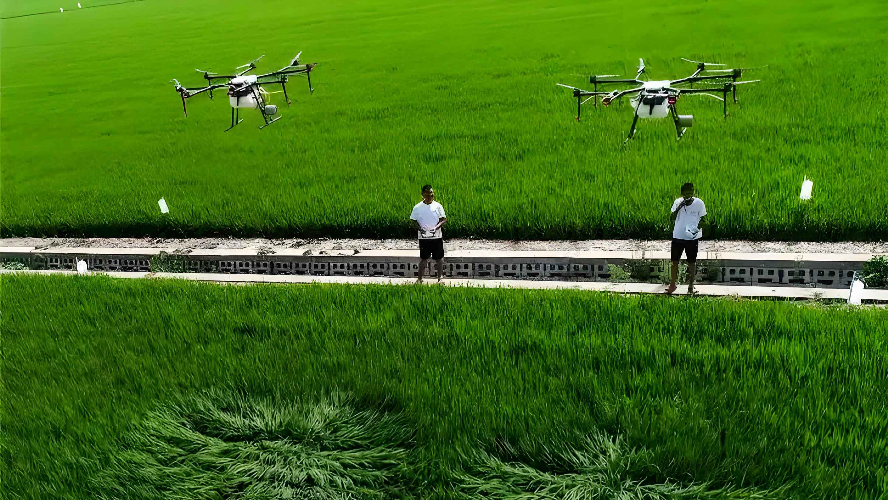
The core appeal of the multirotor agricultural drone lies in its elegant simplicity and operational superiority. From a technical standpoint, its configuration is a masterpiece of functional design. The standard setup involves four, six, or eight brushless electric motors paired with efficient propellers, providing vertical take-off and landing (VTOL) capability and stable hovering. This negates the need for runways and allows operation in fragmented fields. The heart of the system is the flight controller, an onboard computer running complex algorithms for stability and navigation. Coupled with a high-precision Global Navigation Satellite System (GNSS) receiver, often with Real-Time Kinematic (RTK) correction, it achieves centimeter-level positioning accuracy. The payload typically consists of a lightweight liquid tank, a diaphragm pump for generating pressure, and a series of nozzles mounted on a spray boom. The entire operation is managed via a radio link from a ground control station (GCS), which can be a dedicated remote control or a tablet running specialized application software.
| Parameter | Common Range / Specification | Impact on Operation |
|---|---|---|
| Frame Type | X8, Hexacopter, Quadcopter | Defines payload capacity and redundancy. |
| Max Takeoff Weight | 25 kg – 50 kg | Determines combined weight of drone, battery, and payload. |
| Payload Capacity (Liquid) | 10 L – 30 L | Directly affects sortie duration and refill frequency. |
| Endurance per Battery | 10 – 25 minutes | Dictates operational planning and battery logistics. |
| Spraying Width (Swath) | 3 m – 8 m | Influences flight path planning and overlap requirements. |
| Operating Speed | 3 m/s – 8 m/s | Balances coverage rate and application quality. |
| Positioning System | GNSS (GPS/GLONASS/BEIDOU) + RTK | Ensures precise, repeatable flight paths and avoids overlaps/misses. |
The operational workflow for a successful agricultural drone mission is a structured sequence that prioritizes safety and precision. My standard pre-flight checklist is exhaustive. First, personnel readiness: the pilot must be certified, physically fit, and equipped with appropriate Personal Protective Equipment (PPE) including masks, goggles, and chemical-resistant clothing. The preparation of the chemical solution is a critical step, requiring precise mixing and filtration to prevent nozzle clogging. The agricultural drone itself undergoes a thorough inspection—checking the structural integrity of the frame, the tightness of propellers, the cleanliness of filters, and the calibration of sensors like the flow meter and compass. A critical phase is mission planning on the GCS software. I digitally map the field boundary, and the software automatically generates an optimal flight path, calculating waypoints, turnarounds, and accounting for necessary overlaps (typically 10-20%). Parameters such as flight altitude, speed, and spray rate are set based on the crop, canopy density, and target pest.
The moment of launch is always a mix of focus and anticipation. I ensure the takeoff zone is clear and all personnel are at a safe distance, always standing upwind. During autonomous flight, the agricultural drone follows its pre-programmed route with remarkable accuracy. My role shifts from active piloting to vigilant monitoring. I watch the telemetry data for battery voltage, satellite count, and pump status, while visually confirming the spray swath and droplet deposition. The downwash generated by the rotors is a key advantage, forcefully pushing droplets into the lower canopy, leading to superior coverage compared to traditional ground sprayers. A mission ends with a controlled landing, followed by a strict decontamination protocol: flushing the tank and lines with clean water multiple times, cleaning the airframe, and safely storing or charging batteries.
| Category | Checklist Item | Rationale & Consequence of Neglect |
|---|---|---|
| Personnel & Environment | Pilot certification and physical fitness verified. | Ensures legal and competent operation, prevents accidents due to error or incapacity. |
| Full PPE (Mask, Goggles, Gloves, Suit) worn by all crew. | Prevents acute or chronic chemical exposure and poisoning. | |
| Field scouted for obstacles (wires, trees, poles). | Prevents catastrophic mid-air collisions leading to “crash” or loss of the asset. | |
| Weather conditions checked (Wind < 4 m/s, no rain). | High wind causes spray drift and flight instability; rain dilutes application. | |
| Aircraft & Payload | Frame and propeller integrity inspection. | A cracked arm or propeller can lead to immediate structural failure in flight. |
| Battery charge level and health confirmed. | Prevents loss of power mid-flight, causing an uncontrolled descent. | |
| Spray system tested with water; nozzles clean. | Ensures even application; clogged nozzles create untreated strips, reducing efficacy. | |
| Mission & Legal | Flight path planned and verified on map, isolation zones set. | Avoids spray drift onto sensitive areas (water bodies, houses, organic farms). |
| Necessary local aviation/agricultural permits secured. | Prevents legal penalties and ensures compliance with national airspace regulations. |
The quantitative advantages of using an agricultural drone are profound and can be expressed through efficiency metrics and mathematical models. The most immediate benefit is the dramatic increase in work rate or area covered per unit time. Let’s define a simple efficiency metric, $E_{cover}$, the coverage efficiency in hectares per hour (ha/hr):
$$E_{cover} = \frac{W_{eff} \times V_{ground} \times 3600}{10,000}$$
Where $W_{eff}$ is the effective spraying width in meters (considering overlap), and $V_{ground}$ is the ground speed in meters per second. For a agricultural drone with a $W_{eff}$ of 5 meters flying at $V_{ground}$ = 6 m/s:
$$E_{cover} = \frac{5 \times 6 \times 3600}{10,000} = 10.8 \, \text{ha/hr}$$
This does not account for turn-around time and battery swap/refill time, but even with a 30% operational duty cycle, the rate far exceeds manual backpack spraying. Another critical formula relates to the application rate, ensuring the correct volume of chemical is deposited per unit area. The required flow rate $Q$ (in liters per minute) from the pump is calculated as:
$$Q = \frac{R \times W_{eff} \times V_{ground} \times 60}{1000}$$
Here, $R$ is the desired application rate in liters per hectare (L/ha). If $R=30$ L/ha, with our previous parameters:
$$Q = \frac{30 \times 5 \times 6 \times 60}{1000} = 54 \, \text{L/min}$$
The flight controller and flow sensor work in a closed loop to maintain this $Q$ by adjusting pump speed as $V_{ground}$ changes, ensuring consistent application. Furthermore, the reduction in chemical and water usage is staggering. Studies and my own logs show that precision application via agricultural drone can reduce pesticide volume by 20-30% compared to conventional broadcast spraying, while using up to 90% less water due to ultra-low volume (ULV) techniques. This leads to direct cost savings and monumental environmental benefits by minimizing chemical runoff and soil/water pollution.
| Performance Metric | Multirotor Agricultural Drone | Manual Backpack Sprayer | Tractor-Mounted Boom Sprayer |
|---|---|---|---|
| Typical Work Rate (ha/day) | 40 – 80 | 2 – 4 | 20 – 40 |
| Water Usage (L/ha) | 10 – 30 | 300 – 600 | 100 – 300 |
| Operator Safety | High (Remote Operation) | Very Low (Direct Exposure) | Low (Proximity to Tractor & Chemical) |
| Soil Compaction | None | Negligible | Significant |
| Ability to operate in wet/muddy conditions | Excellent | Poor | Very Poor |
| Crop damage from machinery traffic | None | Low | Moderate to High |
| Initial Capital Investment | Moderate | Very Low | High |
| Precision & Uniformity of Application | Very High | Low (Operator-dependent) | Moderate (Terrain-dependent) |
Beyond mere spraying, the true future of the agricultural drone lies in its role as a node in a larger “Internet + Agriculture” ecosystem, a concept highlighted in the provided materials. The drone is a perfect platform for multi-spectral and RGB sensors. By collecting data on crop health (via NDVI – Normalized Difference Vegetation Index), moisture stress, or pest hotspots, the agricultural drone transitions from a treatment tool to a diagnostic one. This data can be processed using cloud-based algorithms to generate prescription maps. These maps can then be fed back into the same agricultural drone for variable-rate application (VRA), applying fertilizer or pesticide only where needed, in the exact quantity required. This creates a virtuous cycle of scouting and targeted treatment, embodying the “research, technology, promotion” model. The economic model for this shifts from a simple service fee per acre to a value-added data analytics and precision execution package.
$$NDVI = \frac{(NIR – Red)}{(NIR + Red)}$$
A low NDVI value might indicate poor plant health, triggering a targeted investigation or treatment in that specific zone, rather than a blanket application across the entire field. This is the essence of “foolproof farming” or precision agriculture, where the farmer manages the field via smartphone dashboards informed by data collected by the agricultural drone. Furthermore, this technology is fundamental for promoting green agriculture. By enabling precise micro-dosing of inputs and using biodegradable agents effectively, it drastically cuts the environmental footprint of farming, protecting pollinators and water sources. In disaster monitoring, fleets of agricultural drones can rapidly survey areas for frost damage, flooding, or disease outbreaks, enabling swift mitigation responses.
However, the path is not without challenges. Regulatory frameworks for beyond-visual-line-of-sight (BVLOS) flights are still evolving. Public perception regarding safety and privacy needs management. The initial skill barrier for pilots, while lowering, requires structured training programs. Battery technology, though improving, still limits continuous flight time, making efficient field logistics and battery-swap systems critical. Looking ahead, I envision advancements in swarm technology, where multiple agricultural drones operate in a coordinated fleet managed by a single operator, dramatically scaling up operations. Integration with autonomous ground vehicles for refilling could create a fully autonomous farm input application system. Advancements in artificial intelligence will enable real-time, onboard image processing for instant weed identification and spot-spraying.
In conclusion, from my hands-on experience, the multirotor agricultural drone is far more than a technological novelty; it is an indispensable tool reshaping the agricultural landscape. Its value proposition is clear and quantifiable: unprecedented efficiency, pinpoint accuracy, enhanced operator safety, significant resource savings, and a drastically reduced environmental impact. By serving as both a precise actuator and a rich data source, it is the key enabler for sustainable, intelligent, and profitable farming. As the technology matures and integrates deeper into the digital farm management stack, the sight of these silent, diligent agricultural drones working over fields will become as fundamental to agriculture as the tractor once was, heralding a new era of abundance and stewardship for our planet.