In recent years, I have observed the rapid evolution of unmanned aerial vehicles (UAVs), or drones, across various sectors, with agriculture standing out as a field ripe for transformation. The integration of advanced communication technologies, particularly 5G, into drone image transmission systems promises to revolutionize how we monitor and manage crops. This article delves into the technical aspects of 5G-based UAV image transmission, its advantages over existing methods, and its profound implications for agricultural drones, especially in precision spraying applications. As a researcher immersed in this domain, I aim to provide a comprehensive overview, leveraging tables and formulas to elucidate key concepts, while emphasizing the role of agricultural drones in shaping the future of smart farming.
The foundation of effective drone operations lies in robust image transmission systems, which serve as the “eyes” of these aerial platforms. Traditionally, several technologies have been employed for UAV image transmission, including 4G cellular networks, Orthogonal Frequency Division Multiplexing (OFDM), Coded OFDM (COFDM), WiFi, and proprietary systems like Lightbridge. Each method has its strengths and limitations, which I will analyze in detail. However, the emergence of 5G technology heralds a new era, offering unprecedented speeds and low latency that can address many existing bottlenecks. In agriculture, this is particularly significant for agricultural drones, where real-time, high-definition imagery is crucial for tasks such as crop health monitoring and targeted spraying. My exploration begins with a comparative assessment of these transmission technologies, highlighting why 5G stands out as a game-changer for agricultural drone applications.
| Technology | Typical Transmission Rate | Latency | Range | Key Advantages | Key Disadvantages | Suitability for Agricultural Drones |
|---|---|---|---|---|---|---|
| 4G Networks | Up to 100 Mbps (theoretical) | 30-50 ms | Several kilometers (network-dependent) | Wide coverage, established infrastructure | Limited bandwidth for HD video, higher latency | Moderate; useful for basic monitoring but insufficient for real-time precision tasks |
| 5G Networks | 1-20 Gbps (peak) | 1-10 ms | Enhanced with dense network deployment | Ultra-high speed, ultra-low latency, high connection density | Requires extensive infrastructure, signal variability at high altitudes | High; ideal for real-time HD video and precise control in agricultural drone operations |
| OFDM | Varies (e.g., 10-100 Mbps) | Moderate (e.g., 20-100 ms) | Medium to long range (line-of-sight) | Efficient spectrum utilization, resistant to multipath fading | Sensitive to carrier frequency offset, high peak-to-average power ratio (PAPR) | Moderate; used in some drone systems but may lack reliability for agricultural drone applications in complex environments |
| COFDM | Varies (similar to OFDM) | Moderate (e.g., 20-150 ms) | Long range (non-line-of-sight possible) | Enhanced error correction, robust in noisy environments | Increased complexity, higher cost | Moderate to high; suitable for agricultural drones in rugged terrains but may have latency issues |
| WiFi | Up to 1 Gbps (e.g., 802.11ac) | 10-50 ms | Short range (typically under 100 meters) | Easy deployment, low cost | Limited range, susceptible to interference | Low; impractical for large-scale agricultural drone fields due to range constraints |
| Lightbridge | High (e.g., up to 40 Mbps for video) | 100-200 ms | Long range (several kilometers) | Optimized for video streaming, low latency relative to distance | Proprietary, limited flexibility for integration | Moderate; used in some commercial agricultural drones but may not support advanced real-time processing |
To quantify the performance of these systems, we can use fundamental communication formulas. For instance, the channel capacity according to Shannon’s theorem is given by: $$ C = B \log_2\left(1 + \frac{S}{N}\right) $$ where \( C \) is the maximum achievable data rate in bits per second, \( B \) is the bandwidth in Hertz, and \( \frac{S}{N} \) is the signal-to-noise ratio (SNR). For 5G networks, the bandwidth \( B \) is significantly larger (e.g., up to 400 MHz in millimeter-wave bands), leading to higher capacities suitable for agricultural drones transmitting high-resolution imagery. In contrast, 4G networks typically operate with narrower bandwidths, limiting \( C \). The latency \( L \) in transmission can be modeled as: $$ L = T_{\text{processing}} + T_{\text{transmission}} + T_{\text{propagation}} $$ where \( T_{\text{transmission}} = \frac{D}{R} \), with \( D \) being data size and \( R \) the transmission rate. For agricultural drones, low \( L \) is critical for real-time responses; 5G reduces \( T_{\text{transmission}} \) due to higher \( R \) and minimizes \( T_{\text{processing}} \) through edge computing integration.
The architecture of a 5G-enabled UAV image transmission system involves several components: the drone equipped with a 5G module, a cloud-based relay server, and a ground control station. In my experience, deploying such a system requires careful integration. The drone captures video via onboard cameras, encodes it using protocols like H.264 or H.265, and transmits it via the 5G network to a server. The ground station then retrieves the stream for real-time display and analysis. This setup leverages 5G’s key performance indicators (KPIs), which I summarize in the following table, underscoring its superiority for agricultural drone applications.
| Performance Indicator | 4G Networks | 5G Networks | Improvement Factor | Impact on Agricultural Drones |
|---|---|---|---|---|
| User Experienced Data Rate | 0.01 Gbps | 1 Gbps | 100x | Enables transmission of 4K/8K video from agricultural drones for detailed crop analysis |
| Connection Density | 100,000 devices/km² | 1,000,000 devices/km² | 10x | Supports fleets of agricultural drones operating simultaneously in dense farming areas |
| Air Interface Latency | 10 ms | 1 ms | 10x reduction | Facilitates real-time control and immediate response in precision spraying by agricultural drones |
| Mobility Support | 350 km/h | 500 km/h | ~1.4x | Ensures stable connectivity for fast-moving agricultural drones during large-scale operations |
| Traffic Density | 0.1 Tbps/km² | 10 Tbps/km² | 100x | Handles massive data flows from multiple sensors on agricultural drones for comprehensive field mapping |
| Peak Data Rate | 1 Gbps | 20 Gbps | 20x | Allows rapid upload of high-resolution multispectral imagery from agricultural drones to cloud servers |
These advancements are not merely theoretical; they translate into tangible benefits for agricultural drones. For example, in precision agriculture, the ability to stream high-definition video in real-time enables on-the-fly decision-making. Consider a scenario where an agricultural drone is tasked with target spraying—a method that applies pesticides or fertilizers only where needed, based on crop health data. Traditional approaches involve two separate flights: one for aerial imaging to generate a prescription map, and another for spraying based on that map. With 5G image transmission, this process can be streamlined into a single flight, as I will elaborate later. The mathematical formulation for spray quantification in such systems often involves vegetation indices derived from imagery. For instance, the Normalized Difference Vegetation Index (NDVI) is calculated as: $$ \text{NDVI} = \frac{NIR – Red}{NIR + Red} $$ where \( NIR \) is near-infrared reflectance and \( Red \) is red reflectance. This index correlates with plant health, and agricultural drones can use it to modulate spray output \( Q \) via a function such as: $$ Q = k \cdot \text{NDVI} + b $$ where \( k \) and \( b \) are calibration constants based on crop type and pest severity. With 5G’s low latency, NDVI values can be computed in near real-time at the ground station and transmitted back to the agricultural drone for instantaneous adjustment of spraying mechanisms.
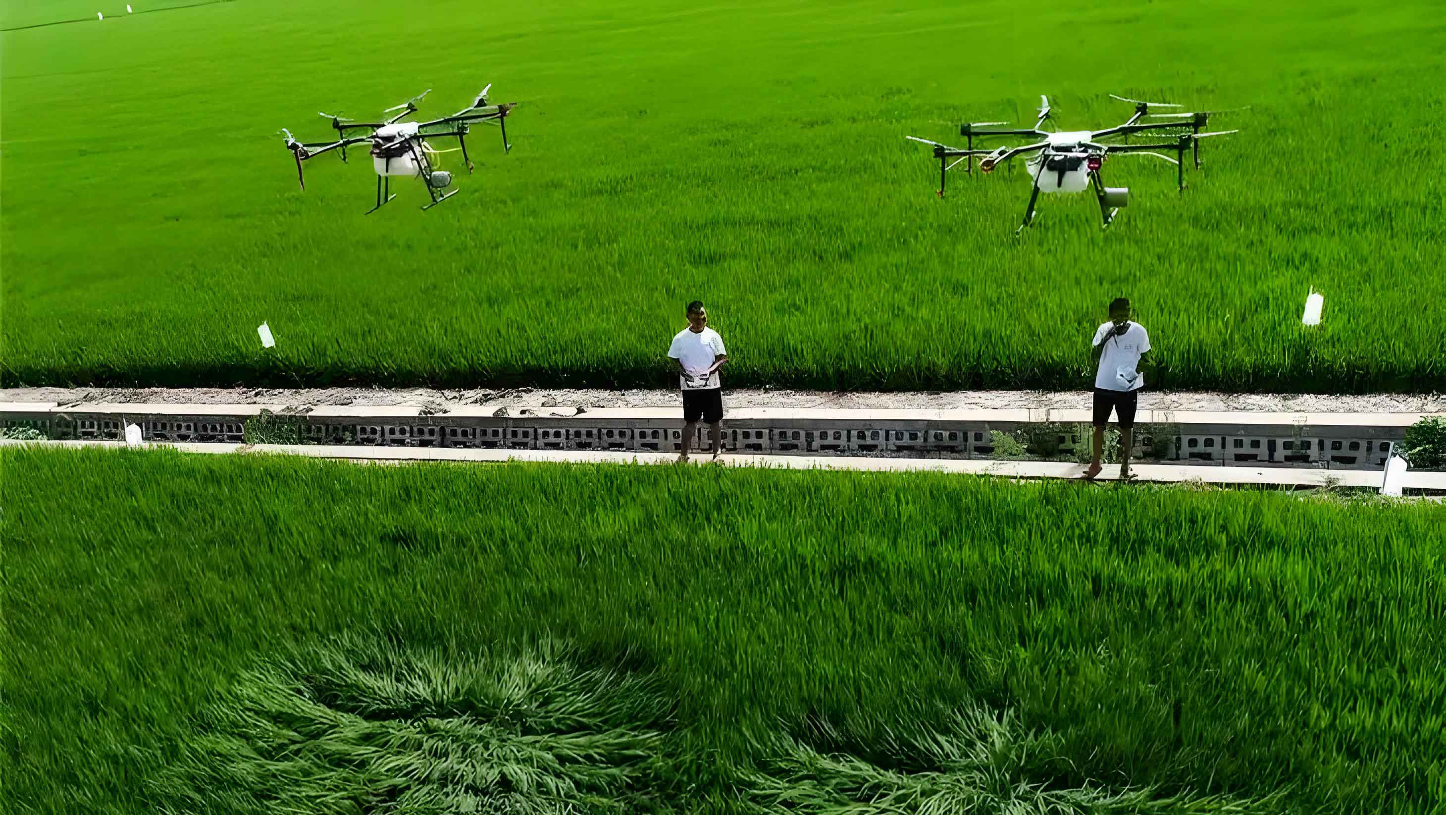
The research landscape for 5G UAV image transmission and its application in agricultural drones is burgeoning globally. Studies have demonstrated the feasibility of using 5G for drone control and high-definition video streaming in sectors like live broadcasting and infrastructure inspection. In agriculture, however, the focus is shifting towards integrating these capabilities for precision tasks. For instance, experiments have shown that 5G can support the transmission of multispectral imagery from agricultural drones, enabling real-time generation of prescription maps for target spraying. This eliminates the delay associated with offline processing, making agricultural drones more efficient and responsive. A critical aspect is the design of the transmission framework, which I have implemented in prototypes. The drone end typically employs embedded platforms like Raspberry Pi or Jetson TX2, coupled with 5G modules to access the network. Video streams are encoded using codecs like H.264 and transmitted via User Datagram Protocol (UDP) for efficiency, while control commands use Transmission Control Protocol (TCP) for reliability. On the ground, software developed with tools like Qt Creator handles decoding, display, and analysis. This setup underscores the potential of 5G to transform agricultural drones into intelligent, connected systems.
To illustrate the workflow for target spraying using 5G-enabled agricultural drones, I propose the following sequence, which integrates image transmission and real-time processing:
- Image Acquisition: The agricultural drone captures real-time video or still images of the crop field using onboard RGB or multispectral cameras.
- 5G Transmission: The imagery is encoded and transmitted via the 5G network to a cloud server or directly to a ground station with high-speed connectivity.
- Real-Time Analysis: At the ground station, algorithms—such as convolutional neural networks (CNNs) for weed detection or NDVI calculators—process the imagery to identify areas requiring treatment. The processing time \( T_{\text{analysis}} \) is minimized due to 5G’s low latency, often satisfying: $$ T_{\text{analysis}} \leq \frac{d}{v} $$ where \( d \) is the distance the agricultural drone travels during processing, and \( v \) is its velocity, ensuring timely decision-making.
- Prescription Map Generation: A dynamic prescription map is created, specifying spray quantities for different zones. This map can be represented as a matrix \( M \) where each element \( m_{ij} \) corresponds to the spray dose for a grid cell \( (i,j) \).
- Command Transmission: The prescription map or control commands are sent back to the agricultural drone via the 5G network, leveraging its uplink capabilities.
- Target Spraying: The agricultural drone adjusts its sprayers in real-time based on the received commands, applying pesticides or fertilizers precisely. The spray volume \( V \) for a given area can be modeled as: $$ V = \sum_{i,j} m_{ij} \cdot A_{ij} $$ where \( A_{ij} \) is the area of cell \( (i,j) \).
This integrated approach highlights how 5G image transmission can enhance the efficiency of agricultural drones, reducing chemical usage and environmental impact. However, several challenges persist in deploying such systems at scale, as I have encountered in my research.
| Challenge | Description | Impact on Agricultural Drones | Proposed Solution |
|---|---|---|---|
| 5G Signal Instability | Signal attenuation at high altitudes (e.g., above 50 meters) and in rural areas with sparse infrastructure; non-standalone (NSA) deployments may fall back to 4G, increasing latency. | Intermittent video streams or control delays can disrupt precision spraying operations by agricultural drones, leading to over- or under-application of inputs. | Deploy more 5G base stations in agricultural regions; use standalone (SA) network architectures; optimize antenna designs on agricultural drones for better signal reception. |
| Limited Functionality of Image Transmission Systems | Many current systems focus on unidirectional video streaming, lacking bidirectional data flow and integration with external devices for advanced processing. | Agricultural drones may not leverage real-time analytics or collaborative decision-making, limiting their intelligence and autonomy. | Develop ground stations with enhanced capabilities, such as connecting to image processing servers or AI models; implement protocols for two-way communication between agricultural drones and ground systems. |
| Insufficient Research on 5G Integration for Target Spraying | Most studies on 5G drones emphasize surveillance or entertainment, with few exploring agricultural applications like real-time prescription mapping for spraying. | The full potential of agricultural drones for precision agriculture remains untapped, delaying adoption and innovation in farming practices. | Foster interdisciplinary research combining 5G technology, computer vision, and agronomy; conduct field trials with agricultural drones to validate performance in varied conditions. |
| High Cost and Complexity | 5G modules and compatible hardware add expense to agricultural drones; system integration requires technical expertise, posing barriers for farmers. | Small-scale farmers may be unable to afford or manage advanced agricultural drones, exacerbating digital divides in agriculture. | Promote subsidies or shared economy models for agricultural drone services; simplify user interfaces and provide training to lower adoption barriers. |
| Data Security and Privacy Concerns | Transmitting sensitive farm data over 5G networks raises issues of cybersecurity and ownership, especially when using cloud servers. | Farmers may hesitate to deploy agricultural drones due to fears of data breaches or misuse of proprietary information. | Implement end-to-end encryption for data transmission; use private 5G networks or edge computing to keep data on-premises; establish clear data governance policies. |
Addressing these challenges requires concerted efforts from technology developers, network operators, and agricultural stakeholders. Based on my experience, I offer the following recommendations to accelerate the adoption of 5G image transmission in agricultural drones. First, enhancing 5G infrastructure in rural areas is paramount. This involves not only expanding coverage but also ensuring signal reliability at operational altitudes for agricultural drones. Techniques like beamforming and massive MIMO (Multiple-Input Multiple-Output) can be employed to improve link quality, mathematically expressed as: $$ \text{SNR}_{\text{improved}} = \frac{|h^H w|^2 P}{\sigma^2} $$ where \( h \) is the channel vector, \( w \) is the beamforming weight vector, \( P \) is transmit power, and \( \sigma^2 \) is noise variance. Second, ground stations should be equipped with multifunctional capabilities, such as real-time image processing servers that run deep learning models for crop disease detection. These servers can analyze streams from agricultural drones and send back actionable insights, leveraging 5G’s high throughput. The processing throughput \( \Theta \) can be modeled as: $$ \Theta = \frac{N_{\text{frames}} \cdot R_{\text{resolution}}}{T_{\text{process}}} $$ where \( N_{\text{frames}} \) is the number of video frames per second, \( R_{\text{resolution}} \) is the resolution per frame, and \( T_{\text{process}} \) is the processing time per frame—5G enables high \( N_{\text{frames}} \) and \( R_{\text{resolution}} \) without bottlenecks.
Third, research must prioritize the integration of 5G image transmission with target spraying algorithms for agricultural drones. This includes developing adaptive control systems that adjust spray parameters based on real-time data. For example, the spray rate \( S_r \) can be dynamically tuned using a PID controller influenced by vegetation indices: $$ S_r(t) = K_p e(t) + K_i \int_0^t e(\tau) d\tau + K_d \frac{de(t)}{dt} $$ where \( e(t) = \text{NDVI}_{\text{target}} – \text{NDVI}_{\text{measured}}(t) \), and \( K_p, K_i, K_d \) are tuning constants. Such systems require low-latency transmission to function effectively, which 5G provides. Additionally, standardization of communication protocols for agricultural drones will facilitate interoperability and scalability. I envision a future where fleets of agricultural drones collaborate via 5G networks, sharing data and coordinating tasks like swarm-based spraying, optimized through algorithms that minimize resource use while maximizing coverage.
The economic and environmental implications of deploying 5G-enabled agricultural drones are significant. By enabling precise application of inputs, these drones can reduce pesticide and fertilizer usage by up to 30-50%, as suggested by pilot studies. This not only lowers costs for farmers but also mitigates runoff and soil contamination. The efficiency gain \( E \) can be quantified as: $$ E = \frac{A_{\text{treated accurately}}}{A_{\text{total}}} \times 100\% $$ where \( A_{\text{treated accurately}} \) is the area where sprays are applied only to target zones (e.g., weeds or nutrient-deficient crops), and \( A_{\text{total}} \) is the total field area. With 5G’s real-time capabilities, \( E \) approaches 100% for well-calibrated systems. Moreover, the data collected by agricultural drones can contribute to long-term farm management, supporting practices like variable rate irrigation and yield prediction. As 5G networks evolve towards 6G, with even higher frequencies and integrated sensing, agricultural drones will become even more autonomous and intelligent, potentially operating continuously as part of the Internet of Things (IoT) ecosystem in smart farms.
In conclusion, the fusion of 5G technology with UAV image transmission holds immense promise for transforming agricultural drones into precision tools for modern farming. From my perspective, the key lies in overcoming technical hurdles through innovation and collaboration. By enhancing network infrastructure, enriching ground system functionalities, and deepening research into agricultural applications, we can unlock the full potential of agricultural drones. The journey towards sustainable and efficient agriculture is paved with data-driven insights, and 5G-enabled agricultural drones are poised to lead the way. As we advance, continuous evaluation and adaptation will be essential, ensuring that these technologies serve the needs of farmers globally while safeguarding our environmental resources.
To further illustrate the technical nuances, consider the following formula for overall system latency in a 5G-enabled agricultural drone scenario: $$ L_{\text{total}} = L_{\text{acquisition}} + L_{\text{encoding}} + L_{\text{transmission}} + L_{\text{processing}} + L_{\text{feedback}} $$ where each component can be optimized. For instance, \( L_{\text{transmission}} = \frac{D_{\text{image}}}{R_{\text{5G}}} \), with \( R_{\text{5G}} \) being the 5G data rate, which is substantially higher than in 4G, thus reducing latency. Similarly, edge computing can minimize \( L_{\text{processing}} \) by analyzing data closer to the source. These improvements collectively enable agricultural drones to perform complex tasks like target spraying with unprecedented accuracy and speed. As I reflect on the future, I am optimistic that with ongoing advancements, 5G will become the backbone of agricultural drone operations, driving a new era of precision agriculture that is both productive and sustainable.