
The landscape of fire and rescue is undergoing a profound transformation. As urban density increases and architectural complexities grow, traditional firefighting methods are often challenged by the volatile and confined nature of modern fire scenes. In this evolving environment, the fire UAV (Unmanned Aerial Vehicle) has emerged not just as a tool, but as a pivotal force multiplier in my daily operations. From my vantage point on the ground, coordinating with these aerial assets, I have witnessed firsthand how they redefine safety, efficiency, and strategic depth in fire suppression and rescue. This technology is more than an accessory; it is becoming the cornerstone of next-generation fireground intelligence and intervention. The purpose of this discourse is to delve into the operational principles, multifaceted applications, and the ongoing challenges of integrating fire UAV systems, articulating their role through the lens of field experience and technical necessity.
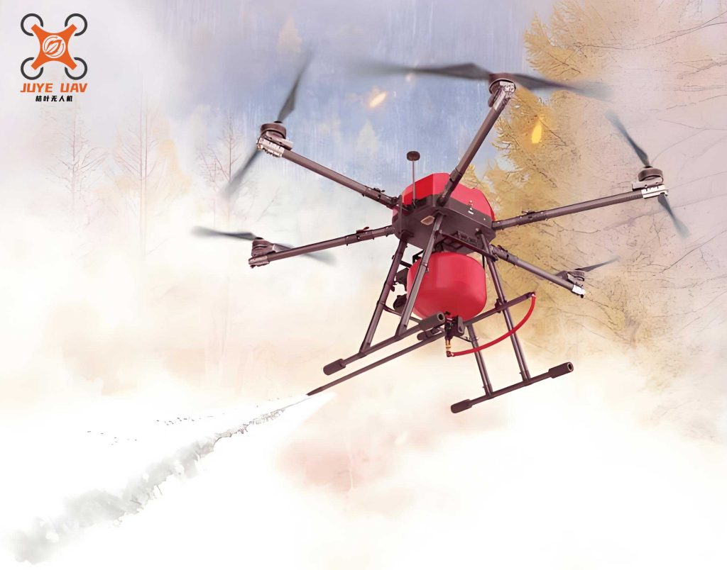
The fundamental principle of a fire UAV operation rests on its triad of capabilities: remote sensing, data telemetry, and agile mobility. Unlike manned aircraft, a fire UAV can be deployed within minutes, achieving a stable observation platform directly over a hazardous zone without risking a pilot. Its core function is to serve as a mobile sensor node. Equipped with electro-optical (EO) and thermal imaging cameras, the fire UAV captures real-time visual and infrared data. This data is processed and transmitted via secure datalinks, often integrated with satellite communication systems for robustness, to a command vehicle or central dispatch. The operational paradigm can be summarized by a core information flow equation:
$$ \text{Fireground Decision Quality} \propto \frac{\text{Spatial Resolution} \times \text{Temporal Frequency} \times \text{Spectral Data}}{\text{Response Latency}} $$
Here, the fire UAV excels by providing high-resolution imagery from unique vantage points (Spatial Resolution), continuous or frequent updates (Temporal Frequency), and multi-spectral data like visual and thermal (Spectral Data), all while minimizing the delay between acquisition and command reception (Response Latency). Its programmability allows for automated flight paths, such as perimeter scans or structure inspections, ensuring systematic coverage. The data fusion from a fire UAV creates a Common Operational Picture (COP), a synchronized digital model of the incident that is indispensable for coordinated action.
System Characteristics and Advantages
The adoption of fire UAV technology is driven by a set of inherent advantages that directly address the limitations of ground-based reconnaissance.
| Characteristic | Technical Manifestation | Operational Impact |
|---|---|---|
| Enhanced Safety | Remote operation from a safe distance; ability to penetrate toxic, hot, or structurally unstable environments. | Eliminates or reduces the need for initial and ongoing interior reconnaissance by personnel, directly lowering responder risk. |
| Rapid Deployment & Agility | Small take-off/landing footprint; high maneuverability in 3D space. | Provides situational awareness within the first critical minutes; can navigate complex urban canyons and building interiors. |
| Multi-Sensor Payload Integration | Modular bays for EO/IR cameras, gas sensors, loudspeakers, LiDAR, and payload drop mechanisms. | Enables a single fire UAV platform to perform reconnaissance, victim location, atmospheric monitoring, and light logistical support. |
| Cost-Effectiveness | Lower acquisition and maintenance costs compared to manned aviation; minimal crew requirements. | Makes aerial intelligence accessible to a wider range of fire departments, enabling more frequent training and deployment. |
Furthermore, the operational persistence of a fire UAV, while a challenge, is continually improving. The endurance for a typical multi-rotor fire UAV can be modeled as a function of its battery capacity, weight, and power draw:
$$ T = \frac{C \cdot V \cdot \eta}{P} $$
Where \( T \) is flight time (minutes), \( C \) is battery capacity (Amp-hours), \( V \) is voltage, \( \eta \) is power system efficiency, and \( P \) is average power consumption (Watts). Advances in battery energy density directly extend \( T \), increasing the time a fire UAV can remain on station, which is critical for prolonged incidents like wildland fires or large-scale industrial blazes.
Tactical Applications in Fire and Rescue Operations
The utility of a fire UAV permeates every phase of an incident response, from size-up to overhaul. Its applications can be categorized into four primary domains.
1. Situational Awareness and Fire Dynamics Mapping
This is the most immediate and critical application. Upon arrival, a fire UAV is launched to perform a 360-degree size-up. The thermal camera is particularly valuable, as it can see through smoke to identify the seat of the fire, track fire spread within voids or attics, and detect hotspots long before they are visible. For structural fires, a fire UAV can map thermal gradients on a facade, helping to predict potential flashover conditions or structural failure. The data supports calculations of fire growth rate. A simplified model for radiative heat flux from the fire UAV’s perspective can inform exposure protection:
$$ \dot{q}” = \epsilon \sigma (T_f^4 – T_s^4) $$
Here, \( \dot{q}” \) is the incident radiant heat flux (kW/m²), \( \epsilon \) is the emissivity, \( \sigma \) is the Stefan-Boltzmann constant, and \( T_f \) and \( T_s \) are the absolute temperatures of the fire and exposed surface (e.g., an adjacent building), respectively. By estimating \( T_f \) from thermal imagery, commanders can assess the threat to exposures with greater accuracy.
2. Command, Control, and Communications (C3) Enhancement
The fire UAV acts as an airborne command post. Live video feeds are streamed to Incident Command (IC) and sector officers, providing a shared, top-down view of the entire operation. This is invaluable for managing resources in complex incidents. For example, during a warehouse fire, the fire UAV can monitor the effectiveness of master stream appliances, track the collapse zone, and observe the rear of the structure simultaneously, information that is nearly impossible to gather reliably from the ground. Furthermore, some fire UAV systems can act as temporary communication relays, extending radio coverage in areas with poor signal, such as underground facilities or remote wildlands.
3. Search and Rescue (SAR) Optimization
In both structural collapses and wide-area disasters, locating victims quickly is paramount. A fire UAV equipped with thermal imaging can scan large areas systematically and far faster than ground teams. In rubble, the thermal signature of a trapped person can be detected. In wildland-urban interface fires, a fire UAV can identify stranded residents in driveways or yards obscured by smoke. The efficiency of a search pattern using a fire UAV can be expressed in terms of area coverage rate:
$$ A_{rate} = v \cdot s \cdot \eta_{search} $$
Where \( A_{rate} \) is the area covered per unit time (m²/min), \( v \) is the flight speed (m/min), \( s \) is the sensor swath width (m), and \( \eta_{search} \) is the search pattern efficiency factor (typically 0.6-0.8 for systematic sweeps). This rate is often an order of magnitude higher than that of ground search teams.
4. Direct and Indirect Fire Attack Support
While most fire UAVs are for reconnaissance, specialized platforms are emerging for direct suppression. These fire UAVs can carry extinguishing agents like dry chemical, compressed aerosol fire suppression grenades, or even water. They are deployed for targeted, high-risk initial attacks—such as on an electrical transformer fire or a blaze on an exterior high-rise balcony—where deploying a crew is dangerous or slow. More commonly, a standard fire UAV provides indirect attack support by guiding ground crews. It can identify the optimal point of entry, locate specific fire compartments, and after the attack, perform post-knockdown thermal scans to identify remaining hotspots, ensuring complete extinguishment.
| Incident Type | Primary Fire UAV Role | Key Data Provided |
|---|---|---|
| High-Rise Fire | External Reconnaissance & Exposure Monitoring | Flame migration up facade, window failure, HVAC system involvement, thermal mapping of floors. |
| Wildland/WUI Fire | Perimeter Mapping & Spread Prediction | Fire front location, rate of spread, spot fires, identification of control lines and resources. |
| Hazardous Materials (HazMat) | Remote Sampling & Reconnaissance | Visual plume tracking, thermal images of leaking vessels, gas concentration readings (with specialized sensor). |
| Technical Rescue (Collapse, Flood) | Overhead Assessment & Victim Location | Structural stability assessment, victim identification via thermal imaging, safe route planning for crews. |
Current Challenges and Technical Limitations
Despite its transformative potential, the integration of the fire UAV into standard fireground operations faces significant hurdles that must be acknowledged and addressed.
1. Payload, Endurance, and Environmental Limitations: The physical constraints are paramount. The flight time of a multi-rotor fire UAV, the most common type for tactical work, is typically limited to 25-40 minutes under ideal conditions. High winds, precipitation, and extreme temperatures drastically reduce this. The power required for lift (\( P_{lift} \)) is a cube of the thrust required, which increases with payload and wind resistance:
$$ P_{lift} \propto T^{3/2} $$
Where \( T \) is the thrust needed. Adding a heavy thermal camera or communication relay reduces endurance. Furthermore, operating a fire UAV in dense smoke or intense heat poses risks to its electronics and airframe, limiting how close it can get to the core of a severe fire.
2. Data Overload and Integration: A single fire UAV can generate terabytes of video and sensor data during a prolonged incident. The challenge lies in processing, analyzing, and distributing this data in a meaningful, real-time way to decision-makers. Without intelligent software to highlight anomalies (e.g., automatic hotspot detection, person-in-smoke alerts), the video feed risks becoming just another screen to monitor, potentially adding to cognitive load rather than reducing it.
3. Regulatory and Airspace Integration: Operating a fire UAV in controlled airspace, especially near airports or in crowded urban environments, requires coordination with Air Traffic Control (ATC). During large-scale disasters where multiple agencies deploy fire UAVs, the risk of mid-air collisions or frequency interference is real. Robust protocols for multi-agency UAS traffic management (UTM) are still under development.
4. Training and Cost of Ownership: Effective use of a fire UAV requires specialized pilots and data interpreters. This represents a significant training investment for departments. Beyond the initial purchase, costs include maintenance, software subscriptions, battery replacement, and regular pilot recertification, which can be a barrier for smaller departments.
Future Trajectories and Concluding Synthesis
The future of the fire UAV is oriented towards greater autonomy, resilience, and integration. We are moving towards swarms of heterogeneous fire UAVs: smaller scouts entering ultra-hazardous zones, relay nodes maintaining communications, and larger suppression platforms working in concert. Advances in artificial intelligence will enable a fire UAV to autonomously track fire spread, follow specific assets like hose lines, or conduct pre-programmed building inspections. Materials science will yield more heat-resistant and waterproof designs, expanding the operational envelope. The ultimate goal is a fully networked fireground where data from fire UAVs, ground sensors, wearable tech on firefighters, and building information models (BIM) fuse into a single, immersive, and predictive tactical interface.
In conclusion, the fire UAV is not merely an aerial camera; it is a sophisticated data acquisition and delivery system that fundamentally enhances firefighter safety and operational effectiveness. It provides the “eyes above” that turn chaos into a comprehensible battlefield. From rapid size-up and victim location to guiding complex attacks and monitoring for flare-ups, the applications are profound and growing. While challenges in endurance, data management, and integration persist, the trajectory of innovation is clear. The fire UAV has irrevocably changed the art and science of firefighting, pushing it into an era of data-driven precision and heightened safety. Its continued evolution promises to further empower responders, save more lives, and protect communities with unprecedented efficiency.