
The rapid proliferation of unmanned aerial vehicles (UAVs) represents a paradigm shift in modern policing. From their origins in military applications, these systems have become accessible, sophisticated tools with profound implications for public safety. I have witnessed this transformation firsthand within the law enforcement community. The appeal of the police drone is undeniable: it offers cost-effective aerial surveillance, enhanced situational awareness, and operational capabilities that were once the exclusive domain of manned aviation units. Statistics indicate explosive growth; from a handful of units a decade ago, hundreds of police drone systems are now deployed across numerous provincial and municipal agencies in China, participating in everything from traffic management and crowd control to anti-drug operations and disaster response. However, this rapid adoption has outpaced the development of robust regulatory frameworks and standardized operational doctrines. The core challenge we face is no longer acquiring the technology, but integrating it safely, effectively, and ethically into the fabric of policing. This analysis, from my perspective as a practitioner engaged with this technology, explores the operational landscape, identifies critical gaps in governance, and proposes a structured pathway for the mature deployment of police drone fleets.
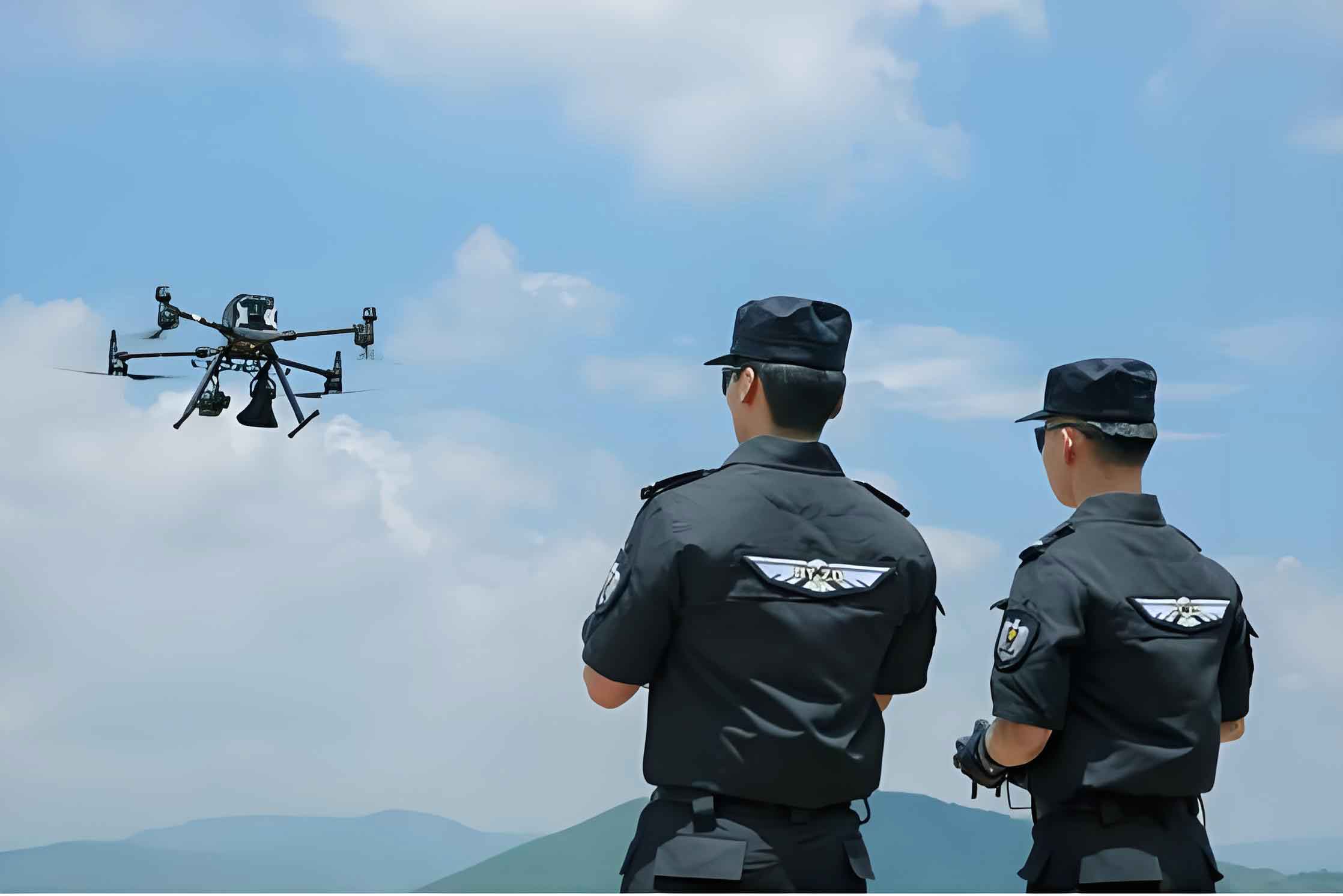
The term “police drone” refers to a professional or industrial-grade unmanned aircraft system (UAS) deployed for law enforcement purposes. It is a system comprising the aerial vehicle itself, a ground control station (GCS), data communication links, and often specialized mission payloads. The historical application of drones in Chinese policing is often traced to security operations for major international events, which served as proving grounds. A modern police drone is expected to be more than a simple flying camera; it is a multi-role platform. Key technical requirements distinguish it from consumer models:
- Enhanced Robustness: Superior wind resistance, longer flight endurance, and operation in diverse weather conditions.
- Secure Communications: Encrypted data links using dedicated, protected frequencies to prevent interception or jamming.
- Payload Flexibility: The ability to integrate modular payloads such as high-zoom electro-optical/infrared (EO/IR) cameras, loudspeakers, thermal imagers, or even specialized non-lethal payloads.
- Operational Range: Capability for both visual line-of-sight (VLOS) and, crucially, beyond visual line-of-sight (BVLOS) operations for large-area missions.
The classification of drones relevant to policing can be summarized in the following table, highlighting the necessity for professional-grade systems:
| Drone Category | Typical Characteristics | Suitability for Police Work |
|---|---|---|
| Consumer/Recreational | Short flight time, limited payload, unencrypted video, minimal weather resistance. | Low. Useful only for basic, non-critical visual reconnaissance in ideal conditions. |
| Professional/Industrial | Extended endurance, heavier payload capacity, more stable platforms, often modular. | High. The minimum standard for a dedicated police drone. Can be equipped with tactical payloads. |
| Military-Grade | Maximum endurance, resilience, advanced stealth and sensor capabilities, weaponized variants. | Specialized. Certain high-end surveillance or endurance models may be adapted for critical counter-terrorism or maritime patrol roles. |
The utility of the police drone in real-world operations is vast and continually expanding. Its primary value lies in providing a rapid, mobile, and elevated sensor platform. We can formalize the advantage of an aerial perspective for area coverage. The ground area \(A\) covered from a given altitude \(h\) with a sensor with a field-of-view angle \(\theta\) is approximately:
$$ A \approx \pi (h \cdot \tan(\frac{\theta}{2}))^2 $$
This quadratic relationship shows that even modest increases in altitude or sensor capability exponentially increase the monitored area compared to a ground-level officer. The following table delineates key operational applications:
| Operational Domain | Specific Applications | Value Proposition of Police Drone |
|---|---|---|
| Emergency Response & Public Order | Monitoring large-scale protests, riots, industrial accidents, chemical spills, natural disasters. | Real-time, overarching situational awareness for command decision-making; assessment of crowd dynamics and size; identification of hot spots without exposing personnel. |
| Major Event Security | Surveillance of perimeters, monitoring crowd flow at festivals, sports events, political summits. | Persistent, flexible aerial patrol; ability to track suspicious movement across a wide area; live feed to central command. |
| Tactical Operations & Pursuit | Tracking fleeing suspects, scouting buildings prior to raids, monitoring hostage situations. | Covert overwatch; ability to peer into upper floors or courtyards; thermal imaging to locate suspects in darkness or foliage. |
| Routine Patrol & Crime Prevention | Aerial patrol of neighborhoods, monitoring of high-crime areas, inspection of critical infrastructure. | Force multiplier; visible deterrent; ability to cover “blind spots” not covered by fixed CCTV. |
| Traffic Management | Accident scene documentation, monitoring traffic congestion, detecting violations (e.g., illegal lane changes). | Rapid scene mapping for faster clearance; aerial perspective on congestion causes; evidence gathering for violations. |
| Narcotics Eradication | Aerial scanning of remote farmland, forests, or rural properties for illegal crop cultivation. | Efficient scanning of large, inaccessible terrain; use of multispectral cameras to identify specific plant signatures. |
| Search & Rescue (SAR) | Locating lost hikers, missing persons; assessing flood/fire zones; delivering emergency supplies. | Rapid coverage of vast search areas; thermal imaging to detect body heat; ability to reach hazardous areas. |
| Investigation & Forensics | Crime scene and traffic accident photogrammetry; 3D mapping of complex scenes; aerial imagery for court exhibits. | Creation of accurate, scalable 3D models and orthomosaic maps; documentation from unreachable angles. |
Despite this impressive range of applications, the integration of the police drone into mainstream law enforcement is hampered by significant systemic and operational challenges. These issues, observed across many jurisdictions, threaten to limit effectiveness and create new risks.
1. The Absence of Unified Technical Standards. There is no nationally mandated technical standard defining what constitutes a police drone. This leads to procurement based on price or vendor claims rather than proven performance metrics like mean time between failures (MTBF), encryption levels, or interoperability. The reliability \(R_{sys}\) of a drone system with \(n\) critical components, each with reliability \(R_i\), can be modeled as:
$$ R_{sys} = \prod_{i=1}^{n} R_i $$
Without standard-enforced minimum \(R_i\) for components, overall system reliability is unpredictable. Many agencies acquire lightly modified commercial drones that lack secure data links, operating on public frequencies vulnerable to interference, leaving sensitive operations exposed.
2. Non-Standardized Operations and Training Deficits. Operational protocols are often ad-hoc. There is a tendency towards “demonstration mode” – using the police drone for simple, line-of-sight videography rather than leveraging advanced functions like automated BVLOS waypoint missions or real-time data analytics. Training is frequently outsourced to manufacturers, resulting in narrow, device-specific competency rather than broad, doctrine-based operational mastery. A severe shortage of certified pilots, maintenance technicians, and mission commanders (Payload Operators) exists.
3. Ambiguity in Licensing and Certification. While regulations stipulate the need for a police drone pilot license, the ecosystem for standardized, accredited, and legally recognized training and testing for law enforcement personnel is underdeveloped. Relying on generic civilian certifications (like AOPA) may not address tactical law enforcement scenarios, rules of engagement, or legal considerations specific to police aviation.
4. Cumbersome Regulatory and Airspace Coordination. Current regulations often require time-consuming, multi-layered approval processes for flights, especially for BVLOS missions or those using drones over a certain weight. The very nature of emergency policing is spontaneity. A police drone needed for a barricaded suspect or a fleeing vehicle cannot be grounded by bureaucratic delay. Furthermore, the proliferation of civilian drones creates “counter-UAV” challenges; police must now also manage and mitigate unauthorized drones in protected airspace, a task requiring its own specialized technology and protocols.
5. Siloed Existence Within Police ICT Architecture. Most police drone systems operate as stand-alone tools. The valuable data they collect—live video, geotagged imagery, thermal data—is rarely integrated seamlessly into broader police information and command systems (e.g., Computer-Aided Dispatch (CAD), Geographic Information Systems (GIS), real-time crime centers). This creates a data bottleneck. The intelligence gathered by the police drone cannot instantly query databases or alert nearby patrol units, diminishing its potential for proactive policing. The data flow remains manual and slow.
Addressing these challenges requires a concerted, top-down strategic approach focused on institutionalization, standardization, and integration. The future of the police drone program depends on moving from ad-hoc project status to a core operational capability.
1. Establish Comprehensive Technical and Operational Standards. A national standards body, led by apex public security agencies in collaboration with industry and academia, must define mandatory Technical Standards for police drone procurement. These should specify minimum thresholds for:
– **Security:** Encryption standards (e.g., AES-256) for command and video links.
– **Reliability:** Documented MTBF for critical components.
– **Interoperability:** Standardized data output formats (e.g., for video streaming) and physical interfaces for payloads.
– **Performance:** Minimum benchmarks for endurance, wind resistance, and operational ceiling.
Concurrently, Standard Operating Procedures (SOPs) must be developed for all major use cases, from evidence collection to tactical deployments, ensuring consistency and legal defensibility across all units.
2. Develop a Professionalized Organizational and Management Structure. A dedicated, vertical management structure within the public security apparatus is essential. This would involve:
– A central command at the ministry level responsible for policy, standard-setting, and high-level coordination with national aviation authorities.
– Provincial or regional branches managing licensing, training accreditation, and major incident support.
– Local “Drone Units” embedded within tactical or operational support divisions at the municipal level. These units should be staffed not just by pilots, but by full crews: a Remote Pilot in Command (RPIC), a Visual Observer (VO), a Mission Commander/Payload Operator, and a dedicated Data/Intelligence Analyst.
3. Invest in Holistic Human Capital Development. Building professional capacity is paramount. This involves:
– **Creating a Certified Career Track:** Establish a formal qualification path for police drone operators and technicians, with ranks and special pay incentives to attract and retain talent.
– **Founding Accredited Training Academies:** Develop national or regional training centers that offer curricula covering aviation law, meteorology, flight planning, tactical employment, data ethics, maintenance, and counter-drone tactics. Training must be scenario-based and include regular proficiency checks.
– **Building Counter-UAV Capacity:** Every major police drone unit should also possess a counter-UAV capability. This includes training in detecting, identifying, and mitigating rogue drones using a graduated toolkit—from radio frequency jammers and GNSS spoofers to net-capture drones and kinetic interdiction systems for extreme threats.
4. Systematize Fleet Management, Logistics, and Data Foundations.
– **Stratified Fleet Composition:** Agencies should maintain a mixed fleet. A simple formula for initial fleet sizing for a municipal force could consider core responsibilities:
$$ N_{total} = N_{tactical} + N_{patrol} + N_{special} $$
Where \(N_{tactical}\) are long-endurance drones for major incidents, \(N_{patrol}\) are multi-rotor drones for daily response, and \(N_{special}\) are for specific tasks like mapping or heavy payloads.
– **Dedicated Funding Streams:** Procurement and lifecycle costs (training, maintenance, software updates) must be part of core budgeting, not discretionary grants.
– **Invest in Foundational Data:** The full potential of a police drone is unlocked with high-resolution 3D basemaps and digital elevation models. Agencies should partner with geospatial firms to create accurate 3D models of their jurisdictions, enabling precise flight planning, augmented reality overlays during operations, and advanced analytics.
5. Drive Technological Innovation and Deep Systems Integration. Police agencies must actively guide R&D by expressing operational requirements to manufacturers. Key innovation areas include:
– **Swarm Technology:** Coordinated fleets of police drone units for searching large areas.
– **AI-Powered Analytics:** Onboard or real-time edge processing for automatic detection of anomalies (e.g., unattended bags, unusual crowd patterns, specific vehicle types).
– **Advanced Datalinks:** Secure, resilient mesh networks for police drone operations in communication-degraded environments.
– **Seamless System Integration:** This is the most critical technical evolution. The police drone must become a node in the Internet of Police Things (IoPT). This requires middleware that can:
1. Ingest live drone video and metadata.
2. Parse it using AI (e.g., license plate recognition, object detection).
3. Cross-reference results in real-time with police databases (wanted persons, stolen vehicles).
4. Instantly alert relevant human operators or dispatch systems.
The integration pathway can be visualized as a data value chain:
$$ \text{Drone Sensor} \rightarrow \text{Secure Link} \rightarrow \text{AI Analytics Engine} \rightarrow \text{Police Database Query} \rightarrow \text{Command Center Alert/Decision Support} $$
The journey of the police drone from a novel gadget to a foundational pillar of 21st-century policing is underway. The technology itself will continue to advance, becoming more autonomous, resilient, and intelligent. However, the true measure of success will not be the sophistication of the hardware, but the maturity of the governance ecosystem surrounding it. By implementing rigorous standards, building professional institutions, fostering deep technical integration, and maintaining a clear ethical and legal framework, we can ensure that the police drone fulfills its promise as a powerful tool for enhancing public safety, operational efficiency, and officer security, while steadfastly protecting the rights and privacy of the communities we serve.