
In modern hydraulic engineering, the demand for high-precision and timely topographic data has become increasingly critical for effective river management, flood control design, and water resource allocation. Traditional river surveying methods, such as total station measurements and GPS point surveys, often suffer from inefficiencies, inadequate measurement density, and challenges in adapting to complex terrains. These limitations hinder the ability to capture dynamic changes in river morphology, which is essential for scientific hydrological analysis and informed decision-making. In response, I propose a robust river surveying technology system based on unmanned aerial vehicle (UAV) drones, leveraging their high-resolution, rapid deployment, and three-dimensional modeling capabilities. This study develops a complete workflow encompassing platform configuration, route planning, control point layout, data processing, and cross-sectional analysis, validated through a case study on a mid-stream river section. By comparing with real-time kinematic (RTK) measurement technology, I demonstrate the high efficiency and extensive coverage advantages of UAV drones under controllable accuracy. Difference analysis further reveals migration and erosion-deposition characteristics of the main channel, highlighting the strong monitoring capacity of this technology for hydro-geomorphological evolution. This research aims to provide a technical foundation for smart water management systems, supporting dynamic monitoring, emergency response, and decision-making in urban water resource platforms.
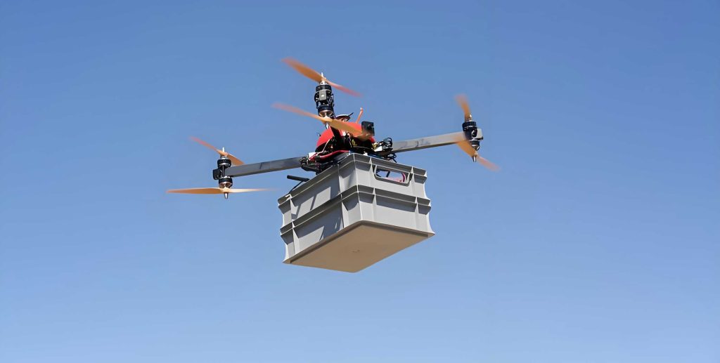
The adoption of UAV drones in river surveying represents a paradigm shift from labor-intensive, point-based methods to automated, area-based data acquisition. UAV drones equipped with advanced sensors can efficiently capture high-density spatial information over large areas, even in inaccessible or hazardous environments. This technology not only enhances measurement accuracy but also facilitates repeated surveys for temporal analysis, crucial for understanding river dynamics. In this article, I detail the implementation and validation of a UAV drone-based approach, emphasizing its integration into modern geospatial workflows. The methodology is designed to meet the stringent technical requirements of river engineering, such as high elevation precision and dense spatial sampling, while optimizing operational efficiency. Through empirical analysis, I show how UAV drones can transform river monitoring into a digital, intelligent, and dynamic process, contributing to the development of smart cities and resilient water infrastructure.
Study Area and Geographical Overview
The study focuses on a mid-stream river section located in a transitional zone between hilly terrain and alluvial plains. This river segment, approximately 5.2 kilometers in length, is part of a larger river system and exhibits typical valley morphology characterized by higher banks and a lower central channel. The river width varies between 20 and 70 meters, with a bed composition primarily of sand, gravel, and silty clay. Local features include sandbar accumulations and exposed bedrock, indicating complex hydrodynamic conditions. Over recent years, human activities and upstream developments have led to significant morphological changes, such as cross-sectional siltation, irregular widening, bank erosion, and collapse. Existing management efforts, often limited to sectional repairs and bank reinforcement, lack high-frequency monitoring, making it difficult to track evolutionary processes. Therefore, there is an urgent need for a high-precision surveying system that enables digital, three-dimensional, and time-series monitoring of river channels. UAV drones offer a promising solution due to their adaptability to diverse terrains and ability to provide comprehensive spatial data.
Technical Requirements and Adaptability of UAV Drones
River surveying demands specific technical indicators to ensure accurate representation of channel morphology. For cross-sectional and longitudinal profile measurements, elevation accuracy at the 0.1-meter level and horizontal resolution within 0.5 meters are required to capture bed structures and bank contours effectively. The error in elevation measurements can be estimated using an error propagation formula that accounts for various sources of uncertainty. This formula is expressed as:
$$ \sigma_h = \sqrt{\sigma_p^2 + \sigma_g^2 + \sigma_m^2} $$
where \(\sigma_h\) is the total elevation error, \(\sigma_p\) is the image measurement error influenced by resolution and attitude accuracy, \(\sigma_g\) is the ground control point error, and \(\sigma_m\) is the aerial triangulation model fitting error that varies with terrain complexity. In terms of measurement density, traditional methods typically deploy 3-5 cross-sections per kilometer, with increased density at critical bends or flood retention areas. To capture micro-topographic details, this study enhances the density to 7-10 cross-sections per kilometer, ensuring elevation sampling points at intervals no greater than 1 meter within each section.
The adaptability of UAV drones is analyzed by comparing them with conventional techniques. RTK measurements offer high precision (\(\pm 2-3\) cm) but are limited to discrete point data, with daily efficiency around 2 kilometers. Total stations provide similar accuracy but lower efficiency and terrain dependency. Underwater sonar can yield continuous subaqueous profiles but requires boat platforms and has operational constraints. In contrast, UAV drones achieve elevation accuracy of \(\pm 5-10\) cm, spatial resolution of 0.05-0.20 meters, daily coverage of 5-8 kilometers, broad environmental adaptability, and lower overall costs. This makes UAV drones highly suitable for large-scale, frequent surveying needs. The following table summarizes the comparison between traditional methods and UAV drone-based aerial surveying:
| Parameter | RTK Measurement | UAV Drone Aerial Survey |
|---|---|---|
| Elevation Accuracy (cm) | ±2.5 | ±4.8 (RMSE) |
| Spatial Resolution | Discrete points (5-10 m spacing) | Continuous surface (GSD 2.5 cm) |
| Operational Efficiency [km²/(day·2 personnel)] | 2 | 6-8 |
| Coverage Capability | Limited to accessible points | Extensive area coverage |
| Cost-Effectiveness | Higher per unit area | Lower per unit area |
This comparison underscores the advantages of UAV drones in terms of efficiency, data completeness, and suitability for dynamic monitoring scenarios. The integration of UAV drones into river surveying workflows can significantly enhance data acquisition processes, enabling more detailed and frequent assessments of channel conditions.
Implementation Plan for UAV Aerial Survey
The implementation of UAV drone-based river surveying involves a systematic approach from platform setup to data processing. I designed a comprehensive plan to ensure high-quality data collection and accurate terrain modeling.
Platform Configuration and Flight Parameters
For this study, a multi-rotor UAV drone platform equipped with a high-resolution optical camera and an integrated RTK/INS navigation system was utilized. The system incorporated ground-based intelligent control for autonomous mission planning, path optimization, and real-time data management. An improved A* algorithm was applied for intelligent route planning, considering river boundaries, obstacle distribution, and overlap requirements to generate optimal flight paths. The number of flight lines, \(N\), is determined by:
$$ N = \left\lceil \frac{W + 2M}{w \cdot (1 – OL_s)} \right\rceil $$
where \(W\) is the river width, \(M\) is the boundary redundancy (set to 20 meters), \(w\) is the single image coverage width, and \(OL_s\) is the side overlap ratio (set to 65%). Forward overlap control depends on the photo interval \(t\) and flight speed \(v\), calculated as:
$$ d = v \cdot t $$
$$ OL_f = 1 – \frac{d}{L} $$
where \(d\) is the baseline length, \(OL_f\) is the forward overlap ratio, and \(L\) is the camera field of view length. With \(v = 4.5\) m/s and \(t = 2.5\) s, \(d \approx 11.25\) meters, meeting the 80% forward overlap requirement. Flight parameters were set at an altitude of 120 meters, speed of 4.5 m/s, resulting in a ground sampling distance (GSD) of 2.5 cm. Each mission covered approximately 0.4 km² (2.0 km × 0.2 km), demonstrating the extensive coverage capability of UAV drones.
Control Point Layout and Data Collection
Accurate georeferencing is crucial for UAV drone surveys. An intelligent control point (GCP) layout assistance system was employed, using digital elevation models (DEM) and automated terrain analysis algorithms to optimize GCP placement. The system recommended positions based on elevation gradient, visibility index, and boundary redundancy, adopting a “global uniformity + local high-relief terrain densification” strategy. GCP density was maintained at 8-10 points per km², covering edges, central areas, and high-slope zones. The number of control points \(N_c\) was estimated using the empirical formula:
$$ N_c \geq 4 + \frac{A}{0.25} $$
where \(A\) is the survey area in square kilometers. GCP coordinates were obtained via dual-frequency RTK-GNSS measurements, with precision requirements: planar error ≤ ±1 cm and elevation error ≤ ±2 cm. Points were marked with smart recognition patterns combining standard red-white targets and high-contrast QR codes (diameter ≥ 40 cm), enabling automated identification during processing. Data collection followed a standardized logging protocol, recording flight time, sortie numbers, GCP identifiers, and environmental parameters. An intelligent track monitoring and breakpoint management module ensured continuity by triggering hover-return-resume actions in case of signal loss or low battery, with automatic补拍 path planning based on operation logs.
Data Processing and Terrain Modeling
Post-flight data processing involved several steps to generate high-fidelity terrain models. First, an intelligent quality assessment module screened images based on criteria such as edge gradient entropy (\(H_g < 5\) for blur detection), histogram analysis for exposure anomalies, and attitude deviations. Poor-quality images were automatically filtered out to enhance modeling accuracy. Next, structure from motion (SfM) techniques were applied to reconstruct geometric relationships from overlapping images. Scale-invariant feature transform (SIFT) and speeded-up robust features (SURF) algorithms facilitated precise image matching, followed by adaptive weighted bundle adjustment (ABA) integrating GCP data to optimize accuracy and robustness. This produced sparse point clouds and exterior orientation parameters for each image. Coordinate transformation from WGS84 to the national standard CGCS2000 (with Gauss-Krüger projection) was performed using:
$$ (X, Y)_{\text{CGCS2000}} = T(\text{Lat}, \text{Lon})_{\text{WGS84}} $$
where \(T\) represents the coordinate transformation algorithm module.
Dense point cloud reconstruction utilized multi-view stereo matching algorithms, achieving densities over 500 points per square meter. Noise filtering and classification, including cloth simulation filter (CSF) and random sample consensus (RANSAC) model fitting, isolated ground points and removed outliers. Digital surface models (DSM) and digital elevation models (DEM) were generated through triangulated irregular network (TIN) interpolation and high-resolution raster resampling, with DEM resolution set at 0.1 meters. For river channel analysis, cross-sections and longitudinal profiles were extracted automatically using GIS tools. Elevation values \(z\) along sections were computed as:
$$ z = \text{DEM}(x_i, y_i), \quad i = 1, 2, \dots, N $$
where \((x_i, y_i)\) are sampling point coordinates and \(N\) is the number of points. Sections were spaced every 50 meters, enabling detailed morphological analysis of width, bank height, and slope.
Analysis of UAV Aerial Survey Results
The effectiveness of UAV drone-based surveying was evaluated through comparative analysis with traditional methods and assessment of river channel changes.
Comparison with Traditional Measurement Methods
To validate the UAV drone approach, five typical cross-sections in the study area were surveyed simultaneously using UAV drones and RTK-GPS methods. Key metrics including elevation accuracy, spatial resolution, and operational efficiency were compared. The results, summarized in the table below, confirm that UAV drones offer superior coverage and efficiency while maintaining acceptable accuracy levels. The root mean square error (RMSE) for UAV-derived elevations was ±4.8 cm, slightly higher than RTK’s ±2.5 cm, but the continuous surface data from UAV drones provide a more comprehensive representation of river morphology. Moreover, the daily coverage of UAV drones reached 6-8 km² per two-person team, significantly outperforming RTK’s 2 km². This demonstrates that UAV drones are particularly advantageous for large-scale, repetitive monitoring tasks where high spatial density is essential.
| Section ID | RTK Elevation (m) | UAV Drone Elevation (m) | Difference (m) | Remarks |
|---|---|---|---|---|
| S1 | 45.23 | 45.28 | +0.05 | Within tolerance |
| S2 | 44.67 | 44.72 | +0.05 | Within tolerance |
| S3 | 43.89 | 43.95 | +0.06 | Within tolerance |
| S4 | 45.01 | 45.08 | +0.07 | Within tolerance |
| S5 | 44.12 | 44.18 | +0.06 | Within tolerance |
The consistency between methods underscores the reliability of UAV drones for engineering applications. The ability of UAV drones to capture dense point clouds allows for detailed topographic analysis, which is often unattainable with point-based RTK surveys. This makes UAV drones invaluable for projects requiring high-resolution digital twins of river environments.
River Channel Deformation and Siltation Analysis
Using UAV drone-acquired DEM data from two time periods (August 2024, T1, and May 2025, T2), elevation changes were computed to assess channel deformation. The difference \(\Delta z\) at each point \((x, y)\) was calculated as:
$$ \Delta z(x, y) = \text{DEM}_{T2}(x, y) – \text{DEM}_{T1}(x, y) $$
Results were rasterized to produce elevation change maps, highlighting areas of accumulation and erosion. Cross-sectional analysis revealed distinct morphological trends. For instance, the left bank of the main channel showed positive differences (up to +0.41 m), indicating deposition zones, while the right bank or shoal areas exhibited negative differences (up to -0.31 m), suggesting scour and undercutting. These patterns reflect mainstream migration and asymmetric sediment transport, likely influenced by seasonal flow variations and local geomorphic controls. The table below presents elevation change statistics for five representative cross-sections, demonstrating the dynamic nature of the river channel.
| Section ID | Location (Chainage) | Mean \(\Delta z\) (m) | Max Deposition (m) | Max Erosion (m) | Primary Change Feature |
|---|---|---|---|---|---|
| D1 | K1+000 | +0.18 | +0.35 | -0.22 | Left bank deposition, right bank erosion |
| D2 | K2+050 | -0.07 | +0.12 | -0.31 | Overall channel scour |
| D3 | K3+100 | +0.22 | +0.41 | -0.15 | Significant shoal accumulation |
| D4 | K4+150 | -0.04 | +0.08 | -0.19 | Localized slight erosion |
| D5 | K5+200 | +0.11 | +0.25 | -0.10 | Minor central channel deposition |
These findings illustrate the capability of UAV drones to detect subtle geomorphic changes, providing insights into river behavior that are critical for management interventions. For example, identified deposition zones may require dredging to maintain flow capacity, while erosion areas might need bank stabilization measures. The temporal analysis enabled by repeated UAV drone surveys supports proactive decision-making in river conservation and flood risk reduction.
Conclusion
This study establishes a comprehensive framework for river surveying using UAV drones, detailing every step from mission planning to data analysis. The proposed methodology addresses the limitations of traditional techniques by offering high efficiency, extensive coverage, and controllable accuracy. Empirical validation through comparison with RTK measurements confirms that UAV drones can achieve elevation precision within ±5 cm while covering large areas rapidly. The difference analysis of multi-temporal DEM data further demonstrates the utility of UAV drones in monitoring hydro-geomorphological evolution, revealing patterns of channel migration and sediment dynamics. UAV drones thus serve as a powerful tool for digital river management, enabling the creation of detailed 3D models that support hydraulic simulations, flood forecasting, and infrastructure planning. Future work could integrate UAV drone data with other sensing technologies, such as LiDAR or multispectral imagery, to enhance classification and monitoring capabilities. Additionally, automating data processing pipelines using machine learning algorithms could further reduce turnaround times. In summary, the adoption of UAV drones in river surveying paves the way for smarter water resource management, contributing to the resilience and sustainability of urban and rural water systems. By leveraging the flexibility and precision of UAV drones, stakeholders can make informed decisions based on up-to-date, high-resolution topographic information, ultimately advancing the goals of smart cities and integrated water governance.
The continuous evolution of UAV drone technology promises even greater advancements in aerial surveying. Innovations in sensor miniaturization, battery life, and autonomous navigation will expand the applicability of UAV drones to more challenging environments, such as steep gorges or turbid waterways. Moreover, the integration of real-time data transmission and cloud-based processing platforms can enable near-instantaneous analysis, supporting emergency response during flood events. As regulatory frameworks adapt to accommodate widespread UAV drone usage, their role in environmental monitoring and infrastructure management will undoubtedly grow. This study underscores the transformative potential of UAV drones in geospatial sciences, highlighting their capacity to bridge the gap between field data collection and digital modeling. By embracing UAV drone-based approaches, the water sector can achieve a new level of operational efficiency and analytical depth, fostering a more proactive and data-driven approach to river stewardship. Ultimately, the insights gained from UAV drone surveys will inform sustainable development practices, ensuring that river systems continue to provide ecological, economic, and social benefits for future generations.