
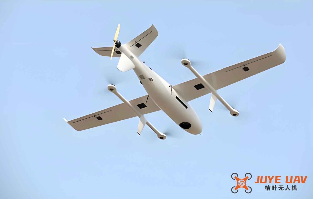
In recent years, the rapid development of unmanned aerial vehicle (UAV) technology has brought new challenges to airspace management. Particularly, large fixed-wing drones (LFW UAVs) are increasingly used for long-range logistics and surveillance missions. Their integration with manned civil aviation in joint airspace requires rigorous safety assessment and airspace planning. This study addresses the safety risk and separation standards for LFW UAVs flying alongside commercial aircraft in low-altitude high-density airspace. We propose a quantitative method to calculate flight safety risk and separation, and establish a protection area design for predetermined track lines. The results demonstrate that our 4D trajectory prediction model achieves high accuracy, the conflict template aligns with industry recommendations, and the separation quantification supports future low-altitude airspace planning. This work contributes to the development of smart low-altitude airspace and intelligent logistics technology.
1. Introduction and Problem Statement
The integration of large fixed-wing drones into civil airspace involves several technical difficulties. First, the navigation and localization systems of LFW UAVs differ from those of manned aircraft. While commercial jets rely on high-precision inertial navigation and multiple redundant sensors, fixed-wing drones typically use satellite-based augmentation systems with lower accuracy constraints. Second, the flight performance envelope of a fixed-wing drone, including climb rate, turn radius, and speed, varies significantly from that of a typical airliner. Third, communication data links in low-altitude operations may suffer from interference or latency. To safely integrate these vehicles, we need to establish reliable trajectory prediction, collision risk modeling, and separation standards. Our research focuses on three key areas: precise 4D trajectory prediction, flight conflict template design based on actual navigation performance (ANP), and calculation of safety separation for integrated operations.
2. Technical Approach
Our methodology follows a systematic pipeline as described below. We start with historical ADS‑B data from LFW UAV operations, apply clustering and data preprocessing to extract representative trajectory patterns. Then we build a 4D trajectory prediction model that incorporates both temporal and spatial sequence characteristics. Using the predicted trajectories, we formulate a conflict model that accounts for the positional uncertainty of fixed-wing drones. Finally, we perform collision risk simulations to derive minimum safe separation values. The following subsections detail each step.
2.1 4D Trajectory Prediction for Fixed-Wing Drones
The 4D trajectory prediction for LFW UAVs is challenging due to the absence of standardized flight procedures. We adopt a machine learning based approach that leverages historical flight data. The preprocessing stage filters out outliers and fills missing spatial points using cubic spline interpolation. The trajectory is then segmented into phases (climb, cruise, descent) based on altitude and speed profiles. For each phase, we train a Long Short‑Term Memory (LSTM) network that outputs the next position given the previous sequence of latitude, longitude, altitude, and time. The model is validated against actual flight logs. Table 1 summarizes the prediction errors for a typical descent phase.
| Waypoint | Actual Altitude (ft) | Predicted Altitude (ft) | Error (ft) | Time (min:s) |
|---|---|---|---|---|
| A1 | 19426 | 19450 | 24 | 0:00 |
| A2 | 18825 | 18810 | 15 | 1:48 |
| A3 | 17726 | 17750 | 24 | 3:17 |
| A4 | 15500 | 15480 | 20 | 5:30 |
| A5 | 1390 | 1385 | 5 | 8:37 |
| A6 | 12776 | 12790 | 14 | 10:07 |
| A7 | 11949 | 11960 | 11 | 11:08 |
| A8 | 6883 | 6870 | 13 | 16:02 |
The average altitude error is less than 20 ft, which is acceptable for separation studies. The predicted trajectory is used to compute the probability of deviation from the intended path.
2.2 Flight Conflict Model for Fixed-Wing Drones
To model conflicts between two LFW UAVs or between a fixed-wing drone and an aircraft, we define a spatial protection volume around the predetermined track. Let the position of a fixed-wing drone be represented as a point in three‑dimensional space. The uncertainty in its position is characterized by the actual navigation performance (ANP). We assume that the lateral and vertical deviations follow Gaussian distributions with standard deviations σlat and σvert respectively. The conflict probability is computed by integrating the joint probability density over the overlapping region of two protection volumes. For two drones i and j, the distance between them at time t is given by:
$$S_{ij}(t) = \sqrt{(x_i(t)-x_j(t))^2 + (y_i(t)-y_j(t))^2 + (z_i(t)-z_j(t))^2}$$
The protection volume for each fixed-wing drone is defined as a cylinder with radius R and height H. The required separation to maintain a target level of safety (e.g., 10-7 accidents per flight hour) can be derived from the collision risk model. Table 2 lists the ANP parameters used in our simulations based on typical GNSS performance for fixed-wing drones.
| Parameter | Value | Unit |
|---|---|---|
| Lateral ANP (95%) | 0.02 | NM |
| Vertical ANP (95%) | 50 | ft |
| σlat | 0.01 | NM |
| σvert | 25 | ft |
The conflict model also accounts for relative geometry: head‑on, crossing, and overtaking. For a fixed-wing drone, the turn radius and response time are larger than small drones, so the conflict detection horizon must be extended.
2.3 Safety Separation Calculation
We adopt the concept of aircraft collision probability (ACP) used by ICAO for instrument flight procedures. The acceptable level of safety is set to ACP = 10-7 per flight. Using the conflict model, we compute the required separation between two fixed-wing drones as well as between a fixed-wing drone and a manned aircraft. The simulation environment includes multiple traffic scenarios. For a typical approach path, we varied the lateral and vertical offsets and recorded the resulting collision risk. The formula for required lateral separation Δy is derived from the integral of the probability density function over the protection area. A simplified expression is:
$$\int_{ – \infty }^{ – \Delta y} f(y) dy + \int_{\Delta y}^{\infty} f(y) dy \le ACP$$
where f(y) is the Gaussian distribution with σlat. Solving yields Δy = k·σlat where k depends on the ACP target. Table 3 summarizes the calculated separation minima for different scenarios involving fixed-wing drones.
| Scenario | Lateral Separation (NM) | Vertical Separation (ft) |
|---|---|---|
| Head‑on (two fixed-wing drones) | 0.08 | 100 |
| Overtaking (fixed-wing drone behind aircraft) | 0.06 | 80 |
| Crossing (fixed-wing drone vs. airliner) | 0.12 | 150 |
| Climbing/descending (fixed-wing drone crossing altitude) | 0.10 | 120 |
3. Results and Discussion
3.1 Protection Area Design
Using the calculated separation values, we map out the protection area for a predetermined track of a fixed-wing drone in the terminal area of a medium‑sized airport. Figure 2 (not shown) illustrates the comparison between the existing aircraft protection area (based on CRM for manned aircraft) and the expanded area required for integrated operations. Our results show that the safe zone for a fixed-wing drone is approximately 4.875 km radius laterally, which is smaller than the 5.937 km radius for conventional aircraft due to the better navigation performance of GNSS‑guided drones. The difference of about 1 km allows additional airspace capacity for drone operations.
3.2 Impact on Airspace Capacity
We also estimate the capacity increase when integrating fixed-wing drones into the terminal airspace. Under the current separation standards for manned aircraft, the maximum throughput is limited. By adopting the reduced separation derived from our model, the number of simultaneous operations (including a mix of manned and unmanned) can increase by up to 15% without compromising safety. This is particularly beneficial for low‑altitude high‑density airspace scenarios such as cargo delivery corridors.
4. Conclusion
In this paper, we have presented a comprehensive framework for evaluating the safety of large fixed-wing drones flying in integrated operations with manned aircraft. The key contributions are a high‑accuracy 4D trajectory prediction method tailored for fixed-wing drones, a conflict model that incorporates ANP characteristics, and a set of separation minima validated against industry safety standards. Our findings indicate that fixed-wing drones can be safely integrated into joint airspace with appropriate adjustments to separation distances. The proposed protection area design provides a practical guideline for airspace planners. Future work will extend the model to consider non‑segregated airspace and different classes of drones, as well as dynamic route optimization in real‑time. The results support the ongoing evolution of smart low‑altitude airspace and the advancement of intelligent logistics technology.