In recent years, the rapid advancement and industrial proliferation of civilian drones technology have led to their widespread application across numerous sectors, including agriculture, forestry, meteorology, natural resource exploration, surveying and mapping, urban planning, and disaster relief. However, the lack of necessary regulatory measures has resulted in the disordered development and use of civilian drones, posing potential threats to aviation safety and public security. This article provides a comprehensive overview of the current status of civilian drones operation, the associated safety hazards, and related control methods. It further explores, from the perspective of flight control technology, the role that radio regulatory bodies can and should play in the oversight of civilian drones.
Introduction to Civilian Drones
Types and Characteristics of Civilian Drones
The rapid popularization of civilian drones has been driven by advancements in sensor, processor, and servo technologies, particularly the miniaturization and cost reduction of components. Based on platform configuration, common civilian drones are primarily categorized into three types, as summarized in the table below.
| Platform Type | Key Characteristics | Typical Use Cases |
|---|---|---|
| Fixed-Wing | Long endurance, high speed, requires runway/launcher for takeoff and landing, cannot hover. | Large-area mapping, long-distance inspection, surveying. |
| Helicopter (Single Rotor) | Vertical Take-Off and Landing (VTOL), can hover, agile, complex mechanics. | Precision payload delivery (e.g., LiDAR), heavy-lift operations. |
| Multi-Rotor (e.g., Quadcopter) | VTOL, excellent hovering stability, simple mechanical design, limited flight time. | Aerial photography, surveillance, close-range inspection, agriculture. |
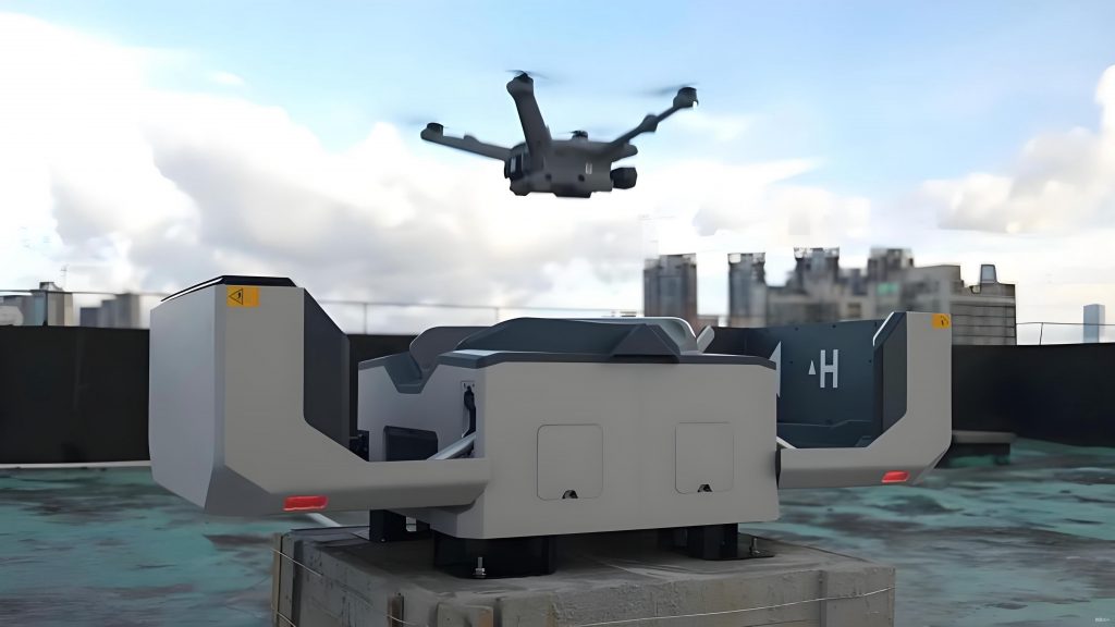
The current consumer-grade civilian drones market is dominated by multi-rotor platforms. Mainstream brands include DJI, Autel, Skydio, and Parrot. While basic toy-grade models may have control ranges under 100 meters, advanced consumer and prosumer models from companies like DJI can operate at distances of 1-2 kilometers or more, transmitting high-definition video back to the pilot. With aftermarket modifications to the remote control and video transmission systems, some civilian drones can achieve operational ranges exceeding 5 kilometers.
Applications of Civilian Drones
The application spectrum of civilian drones is vast and continuously expanding. The primary application areas are outlined below.
| Application Sector | Specific Uses |
|---|---|
| Aerial Photography & Videography | Personal recreational use, filmmaking, real estate, event coverage. |
| Precision Agriculture | Crop monitoring, multispectral analysis, spraying pesticides and fertilizers (Agricultural Drones). |
| Public Safety & Infrastructure | Police surveillance, traffic monitoring, search and rescue, firefighting support. |
| Industrial Inspection | Power line and pipeline inspection, wind turbine inspection, construction site monitoring. |
| Logistics & Delivery | Package delivery, medical supply transport (under trial and regulatory development). |
| Environmental & Scientific | Weather monitoring, geological survey, wildlife tracking, topographic mapping. |
Development Trends and Safety Hazards
The global market for civilian drones has experienced exponential growth, transitioning from niche professional applications to mass-market consumer products. Industry analysts project shipments to reach millions of units annually. This proliferation, while driving innovation, has introduced significant safety and security challenges due to unregulated or negligent operation, often termed “rogue flights.”
The potential hazards posed by civilian drones are multifaceted:
- Aviation Safety: Near-misses with manned aircraft pose a catastrophic risk of collision, potentially leading to loss of life. Incidents of drones disrupting airport operations, causing flight delays, diversions, and cancellations, have been recorded globally.
- Public Security & Privacy: Drones can be used for unauthorized surveillance, smuggling contraband into secure facilities (e.g., prisons), or causing disruption over crowded public spaces and government installations.
- Malicious Use: The potential for civilian drones to be weaponized or used as platforms for cyber-attacks, electronic warfare (e.g., signal jamming), or as radio relays for illicit activities like examination cheating represents a serious threat.
The risk equation can be conceptualized as a function of probability and impact:
$$ R_{hazard} = P_{incident} \times I_{severity} $$
where $P_{incident}$ increases with the number of drones and lack of operator awareness, and $I_{severity}$ is critically high in contexts like aviation or critical infrastructure.
Current Regulatory Framework for Civilian Drones
Aviation Authority Regulations
Aviation authorities worldwide have established frameworks to manage civilian drones. Key regulatory pillars typically include:
| Regulatory Aspect | Typical Requirements | Governing Body Example |
|---|---|---|
| Operator Certification | Mandatory pilot licenses or certificates for drones above a certain weight or operating in controlled airspace. | FAA (USA), EASA (EU), CAAC (China) |
| Vehicle Registration | Drones must be registered with a unique identifier, linking them to an owner. | FAA, Transport Canada |
| Operational Limitations | Rules on maximum altitude, distance from operator (Visual Line of Sight – VLOS), no-fly zones (e.g., near airports), and daylight-only operation. | Most National Aviation Authorities |
| Remote ID | Requirement for drones to broadcast identification and location information, enabling in-flight identification. | FAA (phasing in), EASA |
For instance, a common classification defines “micro” drones (e.g., <250g) as subject to minimal regulation for VLOS flight, while larger civilian drones require formal registration and pilot certification.
Radio Spectrum Regulations
The role of radio spectrum management is foundational. Civilian drones rely entirely on radio links for command & control (C2), payload data (e.g., video), and often for navigation (GPS/GNSS). Uncoordinated use of spectrum can lead to harmful interference, causing loss of control. National radio regulatory bodies (e.g., FCC in USA, Ofcom in UK) are responsible for allocating specific frequency bands for civilian drones operations.
A typical regulatory notice for Unmanned Aircraft System (UAS) frequencies might designate:
- C2 Uplink: 840.5 – 845 MHz (primary).
- Telemetry & Data Downlink: 1430 – 1444 MHz.
- Secondary/Backup Band: 2400 – 2483.5 MHz (ISM band), under the condition of “no protection from interference” and “no causing interference.”
The Equivalent Isotropically Radiated Power (EIRP) is a key regulated parameter to limit range and interference potential:
$$ EIRP = P_{tx} + G_{tx} – L_{cable} $$
where $P_{tx}$ is transmitter power (dBm), $G_{tx}$ is antenna gain (dBi), and $L_{cable}$ is cable loss (dB). Regulations set a maximum EIRP, e.g., 20 dBm (100 mW) in certain ISM sub-bands.
A significant challenge is the widespread use of unlicensed ISM bands (2.4 GHz, 5.8 GHz) by consumer civilian drones for both C2 and video. While legal under ISM rules, this creates a congested, unpredictable radio environment where drones must coexist with Wi-Fi, Bluetooth, and other devices, relying on techniques like frequency hopping for robustness rather than protected spectrum access.
Technical Control Principles of Civilian Drones
Radio Channel Architecture
Understanding the radio links is essential for both operation and control. A civilian drone system typically utilizes three main wireless channels:
- Global Navigation Satellite System (GNSS) Receiver: A passive receiver for GPS, GLONASS, Galileo, or BeiDou signals, providing positioning data.
- Command & Control (C2) Link: An uplink from the remote controller to the drone. This is critical for flight stability and safety. Advanced systems use robust modulation like Frequency-Hopping Spread Spectrum (FHSS) in the 2.4 GHz or 900 MHz bands.
- Payload or Telemetry Downlink: A downlink from the drone to the ground, transmitting video, sensor data, and status telemetry. This often uses Wi-Fi protocols (2.4/5.8 GHz) or proprietary digital video transmission systems.
Some systems, like DJI’s Lightbridge or OcuSync, combine C2 and video into a single, bi-directional data link using advanced spectrum technologies. The signal-to-noise ratio (SNR) for these links is crucial for reliable operation:
$$ SNR = \frac{P_{rx}}{N} = \frac{P_{tx} + G_{tx} + G_{rx} – L_{path}}{N} $$
where $L_{path}$ is the path loss and $N$ is the noise power. Jamming aims to drastically reduce this SNR.
Flight Modes and Safety Protocols
Modern civilian drones incorporate intelligent flight modes and automated safety protocols. These protocols, while designed for safety, define the “logic” that counter-drone systems can exploit.
| Flight Mode | Description | Control Autonomy |
|---|---|---|
| GPS-Assisted (P-Mode) | Uses GNSS and vision systems for stable hovering and position hold. Default and safest mode. | High (Automatic Stabilization) |
| Attitude (A-Mode) | Maintains altitude only; drone drifts with wind. Used when GNSS is unreliable. | Medium |
| Sport (S-Mode) | High-speed, responsive handling for agile flight. | Low (Direct Pilot Response) |
| Autonomous (Waypoint) | Follows a pre-programmed flight path without real-time pilot input. | Full (Pre-programmed) |
Critical Safety Protocols include:
- Loss of C2 Link (Fail-safe RTH): Upon losing the C2 signal for a set duration (e.g., 3 seconds), the drone automatically executes a Return-to-Home (RTH) sequence, ascending to a pre-set RTH altitude and flying directly to the recorded home point.
- Low Battery RTH: Triggers an automated return when battery levels reach a calculated threshold needed for a safe return.
- GNSS Signal Loss: The drone may automatically switch from GPS-Assisted mode to Attitude mode to prevent erratic behavior from faulty positioning data.
- Critical Battery Forced Landing: Initiates an immediate, controlled vertical descent if the battery is too low for RTH.
The RTH function relies on knowing the home point $(X_h, Y_h, Z_h)$, typically recorded at takeoff via GNSS. The drone’s navigation system calculates the vector to home. If GNSS is jammed, this calculation fails.
Principles and Methods for Counter-Drone (C-UAS) Control
Counter-Unmanned Aircraft Systems (C-UAS) measures aim to detect, identify, track, and mitigate rogue civilian drones. Mitigation, from a radio frequency (RF) perspective, primarily involves two outcomes: Diversion/Repulsion (forcing a safe return) and Neutralization/Forced Landing.
RF-Based Mitigation Principles
RF mitigation exploits the drone’s dependence on wireless links and its programmed safety protocols.
- Diversion via C2 Link Jamming: A directional high-power RF signal is aimed at the drone to jam its specific C2 frequency. This simulates a “loss of signal” condition.
$$ Jamming Success Condition: \quad JSR = \frac{P_j / L_{j-path}}{P_{sig} / L_{sig-path}} > JSR_{min} $$
where $JSR$ is the Jamming-to-Signal Ratio, $P_j$ is jamming power, $P_{sig}$ is the legitimate signal power, and $L_{path}$ are respective path losses. If $JSR$ is sufficiently high for >3 seconds, the drone triggers its fail-safe RTH. - Neutralization via GNSS Jamming: Jamming the GNSS receiver (e.g., GPS L1 band at 1575.42 MHz) prevents the drone from knowing its location. If triggered during an RTH (initiated by C2 jamming), the drone cannot navigate home. It typically then executes a secondary fail-safe: either hovering, landing in place, or descending vertically.
- Spoofing: A more advanced technique involves transmitting forged but stronger GNSS signals to trick the drone into believing it is elsewhere, allowing it to be “guided” to a safe landing zone. The spoofed position $(X_s, Y_s, Z_s)$ replaces the true position in the drone’s navigation filter.
Categories of C-UAS Equipment
RF mitigation systems vary in form factor and deployment strategy.
| System Type | Deployment | Typical Range | Use Case |
|---|---|---|---|
| Handheld/Jammer Gun | Man-portable, operator aims at visual target. | 500m – 2km | Short-term, mobile response for specific threats. |
| Portable/Deployable System | Tripod or vehicle-mounted, rapid setup. | 1km – 3km | Temporary protection for events, VIP visits. |
| Fixed/Installed System | Permanently installed on buildings or perimeters. | 3km – 5km+ | Continuous protection for critical infrastructure (airports, power plants). |
The effective mitigation range $R_{eff}$ depends on the jamming Effective Radiated Power (ERP), drone receiver sensitivity, and environmental factors, often modeled with a modified log-distance path loss model:
$$ P_{rx}(d) = P_{tx} + ERP – (10n \log_{10}(d) + X_\sigma) $$
where $n$ is the path loss exponent and $X_\sigma$ is a shadowing factor. Mitigation requires $P_{rx}(R_{eff})$ at the drone to exceed its jamming threshold.
The Evolving Role of Radio Management Authorities
As the primary stewards of the radio spectrum, national radio management authorities are uniquely positioned to address the challenges posed by civilian drones. Their role extends beyond simple frequency allocation to active enforcement and ecosystem management.
Strategic and Administrative Measures
- Enhanced Regulations & Standards: Updating regulations to mandate Remote ID not just as an aviation rule but as a spectrum compliance requirement, ensuring all drones broadcast a standard digital license plate on a specified frequency. Enforcing strict technical standards for drone RF emissions to prevent out-of-band interference.
- Supply Chain Oversight: Collaborating with market surveillance bodies to ensure all civilian drones sold comply with national RF emission standards and are pre-configured to respect geofenced no-fly zones (NFZs) at the firmware level.
- Operator Database Management: Integrating drone and operator registration databases with spectrum management systems to enable rapid identification of a drone’s owner from its RF emissions or Remote ID broadcast.
Advanced Technical Monitoring and Enforcement
Radio management authorities must evolve their monitoring infrastructure and capabilities.
- Deploying Dedicated Drone Monitoring Networks (DMN): Installing a dense network of low-cost, specialized RF sensors around critical sites (airports, government districts, stadiums). These sensors would continuously scan the designated drone frequency bands (e.g., 840 MHz, 2.4 GHz, 5.8 GHz) for signatures unique to civilian drones. A detection can be localized using Time Difference of Arrival (TDOA) or Direction Finding (DF) techniques. The location of a drone emitting a signal can be estimated by solving for $(x, y, z)$ in a set of equations from multiple sensors i:
$$ \sqrt{(x – x_i)^2 + (y – y_i)^2 + (z – z_i)^2} = c \cdot \Delta t_i + d_0 $$
where $c$ is the speed of light, $\Delta t_i$ is the measured TDOA, and $d_0$ is a reference distance. - Signature Analysis & AI-Powered Identification: Moving beyond simple power measurement. Using Software-Defined Radios (SDRs) and machine learning to analyze signal modulation, hopping patterns, and protocol-specific features to fingerprint different drone models and even distinguish them from common Wi-Fi traffic in the ISM bands.
- Active Coordination with C-UAS Operations: Acting as the spectrum authority during C-UAS engagements. This includes granting temporary, localized authorization for jamming or spoofing signals within strict parameters to prevent collateral interference to legitimate services (e.g., hospital communications, airport radars). The authority can manage a “Dynamic Spectrum Access” zone for C-UAS.
- Forensic Signal Analysis for Prosecution: Capturing and analyzing RF signals from a rogue drone incident to provide legally admissible evidence. This can link a specific, captured drone to its controller’s unique RF fingerprint, aiding law enforcement in prosecution.
In conclusion, the management and control of civilian drones present a complex, multi-domain challenge lying at the intersection of aviation law, public security, and radio spectrum engineering. Effective governance requires a layered approach combining robust regulations, pilot education, and advanced technology. Radio management authorities must transition from passive spectrum allocators to active spectrum enforcers and intelligence providers in this new ecosystem. By deploying specialized monitoring networks, mandating and monitoring standardized Remote ID, and providing the technical oversight for safe C-UAS operations, they can become the central pillar in enabling the safe and secure integration of civilian drones into the national airspace, ensuring this transformative technology delivers its benefits while minimizing its risks.