The outbreak of a major infectious disease represents one of the most severe tests for public safety and urban governance systems. The characteristics of such events—sudden onset, rapid spread, high uncertainty, and significant derivative risks—demand a response that is swift, precise, and highly coordinated. From the standpoint of public security organs, maintaining social order while supporting large-scale public health interventions creates a complex operational landscape. In this context, information becomes the most critical strategic asset. The entire process of epidemic prevention and control can be conceptualized as a continuous cycle of information acquisition, processing, dissemination, and decision-making execution. The quality, speed, and completeness of information flow directly determine the effectiveness of the response.
This article, from a first-person analytical perspective, argues that police UAVs (Unmanned Aerial Vehicles) have emerged as transformative tools in this informatic landscape. By providing an aerial platform for data collection and communication, they effectively bridge critical gaps in traditional ground-based response frameworks. They enhance situational awareness, expand operational reach, and facilitate a more integrated, intelligence-led approach to managing major public health crises. The core value proposition of the police UAV lies in its ability to serve as a mobile, versatile node in the broader information network, thereby strengthening the entire emergency management ecosystem.
The fundamental challenge in any crisis is the “fog of war”—the lack of clear, timely, and actionable information. Decision-making under such conditions is inherently suboptimal. We can model the value of information (V) in emergency response as a function of its accuracy (A), timeliness (T), relevance (R), and completeness (C):
$$ V = f(A, T, R, C) = \alpha \cdot A + \beta \cdot \log(T^{-1}) + \gamma \cdot R + \delta \cdot C $$
where \(\alpha, \beta, \gamma, \delta\) are weighting coefficients specific to the crisis context. The police UAV directly optimizes this function by improving T (through rapid deployment), C (via wide-area sensing), and A (through technological payloads).
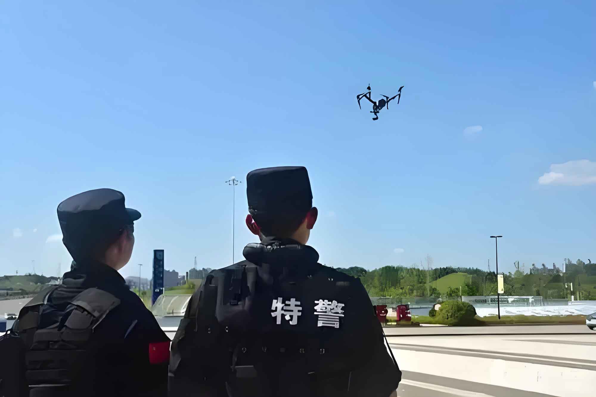
I. Acquiring the Information Source: The UAV as an Aerial Sensor Platform
The first step in crafting an effective response is establishing a comprehensive and accurate information picture. Traditional methods of patrol, surveillance, and data collection are often hampered by physical barriers, resource constraints, and risk to personnel. The police UAV transcends these limitations, acting as a force multiplier for information gathering.
1.1 Wide-Area Surveillance and Patrol
Monitoring key areas such as transportation hubs, public squares, residential compounds, and industrial zones is paramount for enforcing movement restrictions and identifying potential gatherings. UAVs enable persistent, large-area observation that is difficult to achieve with ground teams alone. The operational advantage can be summarized by comparing patrol methodologies:
| Patrol Method | Coverage Area | Deployment Speed | Personnel Risk | Real-time Data Feed |
|---|---|---|---|---|
| Foot Patrol | Low | Slow | High | Delayed/Verbal |
| Vehicle Patrol | Medium | Medium | Medium | Limited |
| Police UAV Patrol | High | Very Fast | None (Remote) | Continuous Video/Telemetry |
By following pre-programmed routes or being manually piloted, a police UAV can systematically scan an area. The live video feed is transmitted back to a command center, creating a common operational picture. This capability is crucial for dynamic assessment of crowd density, traffic flow, and compliance with lockdown measures. The information yield \(I_{patrol}\) from a UAV patrol over time \(t\) and area \(S\) can be conceptualized as:
$$ I_{patrol} = \int_{0}^{t} \int_{S} \rho(x,y,\tau) \cdot \eta_{sensor} \, dA \, d\tau $$
where \(\rho(x,y,\tau)\) represents the density of relevant events or observations at location (x,y) and time \(\tau\), and \(\eta_{sensor}\) is the efficiency coefficient of the UAV’s sensor payload (e.g., camera resolution, stability).
1.2 Non-Contact Temperature Screening
Fever is a primary symptom screened for in many infectious disease outbreaks. While point-of-entry screening with handheld thermometers is common, it creates bottlenecks and exposes frontline workers. UAVs equipped with high-precision radiometric thermal imaging cameras offer a scalable alternative for mass screening. The process involves:
- Deploying the police UAV over a screening point (e.g., highway checkpoint, neighborhood entrance).
- Using its visual camera and AI-powered face detection algorithms to identify individuals within the frame.
- Mapping the facial region to the thermal image to measure skin temperature at the canthus (inner corner of the eye), a reliable proxy for core body temperature.
- Flagging individuals whose temperature exceeds a defined threshold for secondary, ground-based verification.
The system’s accuracy is enhanced by using a calibrated reference blackbody source. The measured temperature \(T_{measured}\) is a function of the actual skin temperature \(T_{skin}\), environmental factors, and sensor calibration:
$$ T_{measured} = \epsilon \cdot T_{skin} + (1-\epsilon)T_{ambient} + \Delta_{calibration} $$
where \(\epsilon\) is the emissivity of human skin (~0.98). With proper calibration (\(\Delta_{calibration} \approx 0\)), modern systems can achieve an accuracy of ±0.5°C at distances of 3-5 meters. This allows one police UAV to screen hundreds of people per hour from a safe distance, dramatically increasing throughput and safety.
| Screening Parameter | Handheld Thermometer | Fixed Thermal Camera | Police UAV with Thermal Payload |
|---|---|---|---|
| Throughput (persons/hour) | 50-100 | 200-300 (static queue) | 300-500 (dynamic/mobile) |
| Operator Safety | Low (close contact) | High | Very High (remote) |
| Deployment Flexibility | High | None (fixed location) | Very High |
| Coverage Area | Single point | Fixed field of view | Large, adjustable area |
1.3 Covert Reconnaissance for Hidden Threats
During lockdowns, while street crime may decrease, clandestine activities such as illegal gatherings, gambling dens, or covert operations can flourish in secluded locations. Investigating these poses significant challenges due to difficult terrain and suspect counter-surveillance. A police UAV serves as an ideal tool for covert reconnaissance. It can quietly observe a target location from a high vantage point, providing critical intelligence on:
- Layout and topography of the area.
- Entry and exit points.
- Number and identity of individuals present.
- Security patterns (lookouts, patrols).
This aerial intelligence directly informs tactical planning for raids or interventions, increasing the probability of successful, safe outcomes. The information gain for a reconnaissance mission \(G_{recon}\) can be modeled as the reduction in operational uncertainty \(U\):
$$ G_{recon} = U_{before} – U_{after} = H(Target) – H(Target | UAV\_Data) $$
where \(H\) represents the information entropy (uncertainty) about the target before and after the police UAV mission.
II. Facilitating Information Flow: The UAV as an Aerial Communication Node
Possessing information is only half the battle; effectively disseminating it to shape public behavior and ensuring its flow between agencies is equally vital. The police UAV also excels in this domain.
2.1 Public Awareness and Dissemination
Clear communication of health guidelines, restrictions, and warnings is essential for public compliance. UAVs equipped with loudspeakers become mobile aerial broadcast units. They can fly over neighborhoods, parks, or lines of people, delivering pre-recorded or live audio messages. This method is particularly effective for:
- Dispersing unauthorized gatherings with targeted instructions.
- Reminding citizens in specific locales to wear masks or maintain social distance.
- Broadcasting urgent announcements when traditional media or digital channels are insufficient.
The effective communication range \(R_{comm}\) of a police UAV loudspeaker depends on speaker power \(P\), atmospheric attenuation \(\alpha_{atm}\), and ambient noise level \(N\):
$$ R_{comm} \propto \sqrt{ \frac{P}{N \cdot e^{\alpha_{atm} \cdot r}} } $$
With powerful speakers (≥100 dB), messages can be clearly heard over a kilometer away, effectively “casting a net” of auditory information over a wide area.
2.2 Traffic Management and Emergency Response Support
Epidemic responses often involve sudden road closures, checkpoint setups, and changes in traffic patterns, leading to congestion. A police UAV provides a rapid aerial overview of traffic conditions. It can:
- Identify congestion sources and accident sites in real-time.
- Monitor queue lengths at checkpoints for dynamic resource allocation.
- Guide ground units to incident locations via live feed.
- Use its loudspeaker to issue direct instructions to drivers (e.g., “Clear the left lane,” “Move forward”).
This real-time traffic intelligence \(I_{traffic}(t)\) allows for optimized traffic flow. The benefit can be quantified as the reduction in total system delay \(D_{total}\):
$$ \Delta D_{total} = \int (D_{baseline}(t) – D_{UAV\_assisted}(t)) \, dt $$
where a positive \(\Delta D_{total}\) indicates time saved across the transportation network due to interventions informed by the police UAV.
2.3 Enabling Multi-Agency Information Integration and Sharing
Perhaps the most significant informatic contribution of police UAVs is their role in fostering interoperability. In a complex crisis, data silos between public security, health, transportation, and civil affairs departments can be catastrophic. UAV-derived data, when integrated into a common operational platform, becomes a shared “source of truth.”
Geotagged data from UAVs—whether thermal alerts, crowd density maps, or traffic footage—can be fused with data from other sources (e.g., hospital admissions, mobile phone signals) to create layered, dynamic situation maps. This facilitates coordinated decision-making. For instance, heatmaps of population density derived from police UAV patrols can inform health authorities about areas requiring more intensive testing resources.
The process of multi-source information fusion for situational awareness \(SA\) can be represented as:
$$ SA(t) = F \left( \bigcup_{i=1}^{n} D_{UAV_i}(t), \bigcup_{j=1}^{m} D_{Agency_j}(t), M \right) $$
where \(F\) is the fusion function, \(D_{UAV_i}\) is data stream from the i-th police UAV, \(D_{Agency_j}\) is data from the j-th cooperating agency, and \(M\) represents the base map or geographic information system.
| Data Type from Police UAV | Potential Integration with Agency | Shared Operational Outcome |
|---|---|---|
| Thermal screening anomaly locations | Health Department | Targeted testing and contact tracing |
| Crowd density heatmaps | City Management / Civil Affairs | Dynamic allocation of crowd control & public service resources |
| Traffic flow & checkpoint video | Transportation Department | Optimized traffic management and logistics for supply chains |
| Reconnaissance of large facilities | Emergency Management / Fire Department | Improved contingency planning for quarantine sites or field hospitals |
III. Synthesis, Challenges, and Future Trajectory
The integration of police UAVs into the framework of major epidemic response represents a paradigm shift towards data-driven, agile public safety operations. From an informatic perspective, they act as both powerful sensors and unique communication relays, effectively shortening the “OODA Loop” (Observe, Orient, Decide, Act) for command centers. They enhance the completeness and timeliness of the observation phase and can directly influence the act phase through aerial communication.
The overall effectiveness \(E\) of a police UAV fleet in epidemic response can be considered a multi-dimensional metric:
$$ E = \sum_{k} w_k \cdot \frac{I_k}{C_k} $$
where for each mission type \(k\) (patrol, screening, etc.), \(I_k\) is the information utility provided, \(C_k\) is the cost (operational, financial), and \(w_k\) is a priority weight.
However, the widespread deployment of police UAVs is not without challenges that must be addressed to fully realize their potential:
| Challenge Category | Specific Issues | Potential Mitigation Strategies |
|---|---|---|
| Technical & Operational | Limited flight time (endurance), weather dependency, spectrum congestion for data links, payload integration complexity. | Development of hybrid power systems, stricter pilot/operator certification, adoption of AI for automated flight and data analysis, use of 5G/secure mesh networks. |
| Regulatory & Legal | Airspace restrictions, privacy regulations concerning aerial surveillance, lack of standardized protocols for data sharing between agencies. | Developing clear “blue sky” corridors for emergency UAV operations, establishing strict data governance frameworks (purpose limitation, anonymization), creating inter-agency data-sharing agreements. |
| Ethical & Social | Public perception of surveillance, risk of mission creep, balancing public safety with individual liberties. | Transparent public communication about UAV mission purposes, sunset clauses for special surveillance powers granted during emergencies, robust oversight mechanisms. |
Looking forward, the role of the police UAV will evolve. We can anticipate trends such as:
- Swarm Intelligence: Coordinated fleets of police UAVs covering vast areas autonomously, with distributed sensing and communication tasks.
- Advanced Sensor Fusion: Integration of hyperspectral imaging, gas sensors, or advanced biometrics for more comprehensive environmental and health monitoring.
- AI-Powered Analytics: Real-time, on-board video analytics for automatic detection of specific behaviors (e.g., fighting, falling) or compliance violations (e.g., mask detection).
- Seamless C4ISR Integration: Deeper embedding of police UAV data streams into Command, Control, Communications, Computers, Intelligence, Surveillance, and Reconnaissance systems for holistic crisis management.
In conclusion, from an informatic standpoint, the police UAV is far more than just a flying camera; it is a pivotal node in the modern public safety information network. By dramatically enhancing our ability to see, understand, and communicate across the complex terrain of a major epidemic, it empowers a more proactive, precise, and unified response. The continued development, ethical deployment, and intelligent integration of police UAV technology will be a cornerstone of building more resilient cities and societies capable of withstanding the public health challenges of the future.