
As a researcher in the field of unmanned aerial vehicle technology, I have extensively studied the application of police UAVs in highway rescue systems. The increasing demand for efficient traffic management and emergency response on expressways has driven the exploration of advanced technological solutions. Based on current trends, I will delve into the system design of police UAVs for highway rescue, emphasizing their feasibility, design requirements, and operational workflows. This discussion is grounded in the broader context of UAV development from military to civilian use, highlighting how police UAVs can address critical challenges in highway safety.
The evolution of unmanned aerial vehicles has followed a trajectory from military to civilian applications, leveraging their unique advantages such as flexibility, cost-effectiveness, and minimal human risk. In recent years, police UAVs have gained prominence in areas like urban management, environmental monitoring, and disaster relief. For highway rescue, their potential is immense, given the rising incidence of traffic accidents characterized by severe vehicle damage, high casualty rates, and secondary collisions. Statistical data indicates that expressway accidents often lead to congestion and compounded emergencies, necessitating proactive measures. Integrating police UAVs into rescue systems can enhance response times, improve situational awareness, and alleviate the burden on highway patrol officers. This article, from my perspective, aims to outline a comprehensive framework for deploying police UAVs in highway rescue, incorporating technical insights, design specifications, and process flows to foster a safer traffic environment.
To understand the foundation of police UAVs, it is essential to review the core technologies enabling their operation. Modern UAVs rely on three key technological pillars: wireless remote sensing, perception and avoidance, and aerial photography. These technologies have matured through advancements in miniaturization, collision resistance, and signal transmission, making police UAVs viable for diverse scenarios. Below, I summarize these technologies using a table and mathematical formulations to clarify their principles.
| Technology | Description | Key Components |
|---|---|---|
| Wireless Remote Sensing | Involves controlling UAVs and data acquisition via onboard computer programs or radio遥控 devices. | Radio transmitters, receivers, GPS modules |
| Perception and Avoidance | UAVs use sensors to detect飞行 conflicts and avoid obstacles, ensuring safety. | LiDAR, cameras, ultrasonic sensors |
| Aerial Photography | UAVs capture images using遥感 equipment, processed for analysis and mapping. | High-resolution cameras, image processors |
In mathematical terms, the perception and avoidance technology can be modeled using sensor fusion algorithms. For instance, the probability of detecting an obstacle within a given range can be expressed as:
$$ P_d = 1 – e^{-\lambda \cdot A \cdot t} $$
where \( P_d \) is the detection probability, \( \lambda \) is the sensor sensitivity coefficient, \( A \) is the area covered, and \( t \) is the time interval. This formula underscores how police UAVs can dynamically assess their environment to prevent collisions. Additionally, the image transmission efficiency for aerial photography relies on data rate equations, such as:
$$ R = B \cdot \log_2 \left(1 + \frac{S}{N}\right) $$
where \( R \) is the data rate, \( B \) is the bandwidth, \( S \) is the signal power, and \( N \) is the noise power. These technical foundations enable police UAVs to perform reliably in highway settings, where real-time data and precise maneuvering are crucial.
The feasibility of deploying police UAVs in highway rescue stems from their ability to address specific emergency scenarios. Based on analysis, highway emergencies can be categorized into three primary factors: vehicle-related, human-related, and traffic-related. Each category presents distinct challenges that police UAVs can mitigate through tailored interventions. I have compiled a table to summarize these factors and corresponding UAV applications.
| Emergency Factor | Common Incidents | Police UAV Intervention |
|---|---|---|
| Vehicle-Related | Tire bursts, brake failures, lighting malfunctions | UAVs provide surveillance and isolation of affected vehicles, preventing accidents. |
| Human-Related | Speeding, fatigue driving, improper distancing, pedestrian intrusions | UAVs monitor and warn drivers via audio alerts, enhancing prevention. |
| Traffic-Related | Congestion, secondary accidents due to poor visibility | UAVs疏导 traffic and broadcast real-time road conditions to incoming vehicles. |
From my observation, vehicle-related issues often arise from mechanical failures that are preventable through regular maintenance. However, when such failures occur on highways, police UAVs can be dispatched promptly to track the vehicle and warn other drivers, reducing collision risks. For human-related factors, which involve driver behavior, police UAVs offer a监督 mechanism; for example, they can calculate speeding using velocity formulas like \( v = \frac{d}{t} \), where \( v \) is velocity, \( d \) is distance, and \( t \) is time, and then issue penalties. Traffic-related emergencies, such as congestion, benefit from police UAVs’ aerial perspective to transmit live footage and optimize flow. The versatility of police UAVs in these scenarios underscores their feasibility, as evidenced by pilot programs in regions like Chongqing and Jiangxi, where UAVs have been used for traffic疏导 and violation monitoring. Thus, integrating police UAVs into highway rescue systems is not only practical but also increasingly necessary for modern traffic management.
Highway patrol officers, the primary users of police UAVs, operate under demanding conditions, including 24/7 shifts and regular patrols. Their duties encompass accident investigation, electronic data collection, and vehicle inspections. Introducing police UAVs can significantly enhance their efficiency by automating surveillance and initial response tasks. For instance, police UAVs can cover vast highway stretches quickly, providing real-time updates to officers stationed at control centers. This synergy between human personnel and police UAVs creates a more resilient rescue framework. In my assessment, the workload reduction for officers can be quantified using efficiency metrics, such as:
$$ \eta = \frac{T_{\text{manual}} – T_{\text{UAV}}}{T_{\text{manual}}} \times 100\% $$
where \( \eta \) represents the efficiency improvement, \( T_{\text{manual}} \) is the time required for manual operations, and \( T_{\text{UAV}} \) is the time with police UAV assistance. This formula highlights how police UAVs can streamline processes, allowing officers to focus on critical decision-making. Moreover, the continuous operation capability of police UAVs aligns with the non-stop nature of highway policing, ensuring constant vigilance against emergencies.
Designing an effective police UAV platform for highway rescue requires careful consideration of both造型 and functional aspects. From my perspective, the造型 must balance aerodynamic efficiency with professional aesthetics to convey authority and integrate into the traffic system. Functionally, the police UAV should extend beyond basic technologies to include modules tailored for highway-specific tasks. Below, I outline the design requirements in a table format to clarify these elements.
| Design Aspect | Requirements | Rationale |
|---|---|---|
| 造型 Design | Streamlined shape for low wind resistance, durable materials, authoritative appearance (e.g., reflective markings) | Enhances flight stability and续航, while ensuring recognizability and威慑. |
| Functional Design | Wireless remote sensing, perception and avoidance, high-resolution cameras,扩音 speakers, warning signal lights, GPS定位 | Enables comprehensive救援 tasks, such as audio warnings and traffic alerts. |
The aerodynamic performance of a police UAV can be modeled using drag force equations, such as \( F_d = \frac{1}{2} C_d \rho A v^2 \), where \( F_d \) is drag force, \( C_d \) is the drag coefficient, \( \rho \) is air density, \( A \) is cross-sectional area, and \( v \) is velocity. Minimizing \( F_d \) through sleek造型 improves续航, which is critical for prolonged patrols. Functionally, the police UAV must incorporate advanced sensors for obstacle detection, with algorithms for real-time data processing. For example, the warning signal module can use light intensity formulas like \( I = \frac{P}{4\pi r^2} \), where \( I \) is intensity, \( P \) is power, and \( r \) is distance, to ensure visibility. Additionally, the integration of扩音 systems allows officers to broadcast instructions directly from the police UAV, enhancing communication during emergencies. These design considerations ensure that the police UAV is not only technologically robust but also user-friendly for highway personnel.
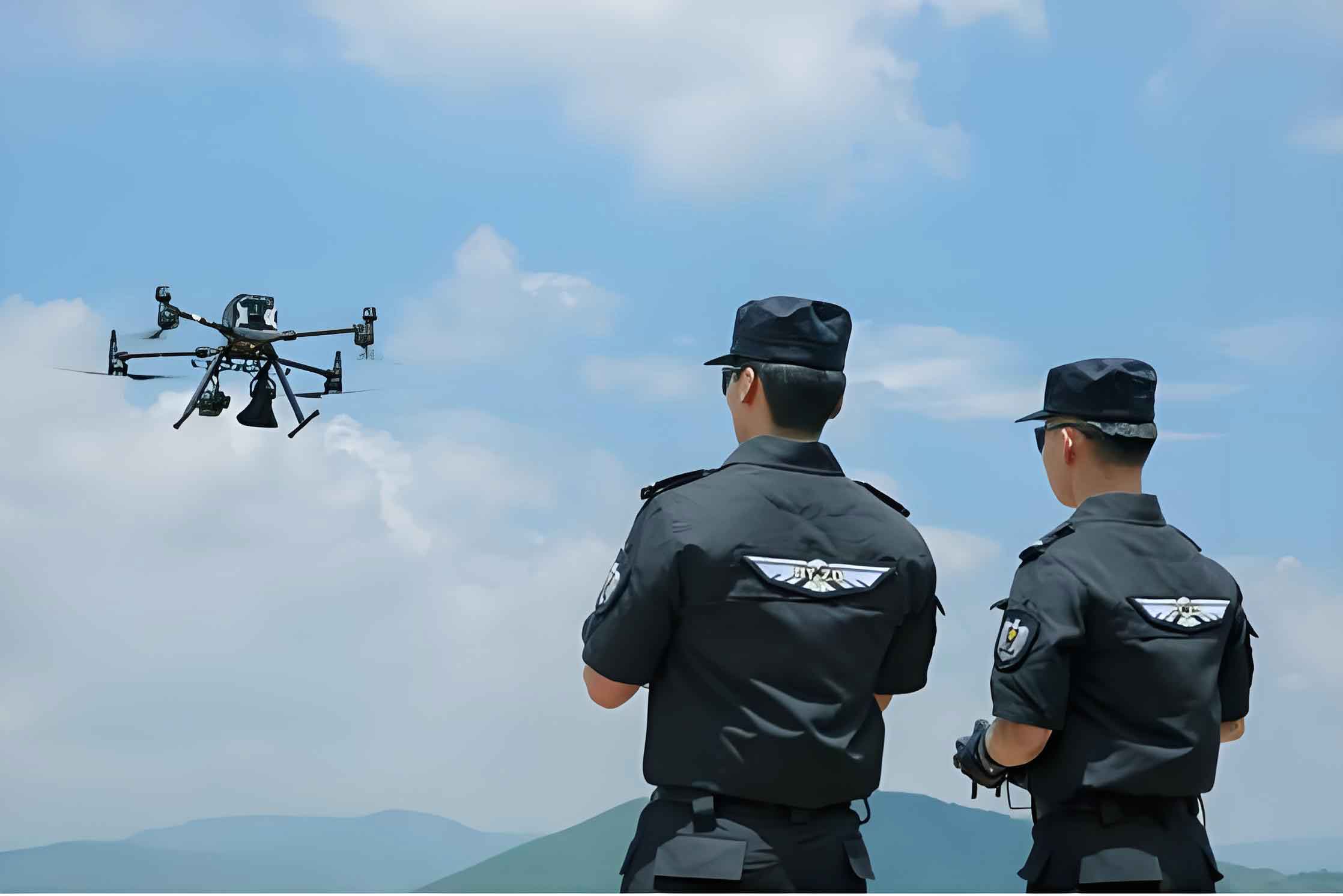
The operational workflow for police UAVs in highway rescue involves a systematic process from alert reception to现场 response. Based on my analysis, I propose three distinct rescue modes tailored to the emergency categories discussed earlier. Each mode leverages the capabilities of police UAVs to provide timely assistance before human responders arrive. The overall system relies on a centralized control platform where officers coordinate UAV dispatches based on GPS data and real-time feeds. To illustrate, I describe these modes in detail, emphasizing how police UAVs execute specific tasks.
In Mode 1, designed for vehicle-related failures like tire bursts or brake issues, the police UAV is dispatched upon receiving a distress call via a mobile app linked to the rescue platform. Using GPS定位, the police UAV navigates to the vehicle, isolates it from traffic by警示 surrounding drivers, and tracks it until officers arrive. This prevents secondary accidents and stabilizes the situation. The response time can be optimized using path planning algorithms, such as minimizing the distance function \( D = \sqrt{(x_2 – x_1)^2 + (y_2 – y_1)^2} \) for coordinates, ensuring swift deployment of the police UAV.
Mode 2 addresses human-related incidents, such as collisions or追尾 accidents. Here, the police UAV is sent to the site to capture live footage and assess damage. It simultaneously疏导 traffic by broadcasting warnings via its扩音 system and signal lights. The police UAV transmits data back to the control center, enabling officers to dispatch medical and救援 teams accurately. The efficiency of this mode hinges on the police UAV’s ability to process visual data, which can be quantified using image resolution metrics like pixels per meter.
Mode 3 focuses on traffic-related congestion, often during peak hours or post-accident scenarios. The police UAV flies over congested areas, providing real-time video feeds to officers who then guide drivers through audio commands. This mode leverages the police UAV’s mobility to cover large areas quickly, reducing gridlock and preventing further incidents. The traffic flow improvement can be modeled using queue theory formulas, such as \( L = \lambda W \), where \( L \) is the average number of vehicles, \( \lambda \) is arrival rate, and \( W \) is waiting time, demonstrating how police UAVs can lower \( W \) through timely interventions.
To summarize these modes, I present a comparative table highlighting key actions and outcomes involving police UAVs.
| Rescue Mode | Trigger Emergency | Police UAV Actions | Expected Outcome |
|---|---|---|---|
| Mode 1 | Vehicle failures (e.g., tire bursts) | GPS navigation, vehicle isolation, tracking | Prevents collisions, stabilizes until救援 arrives |
| Mode 2 | Accidents (e.g., collisions) | Aerial surveillance, traffic疏导, data transmission | Speeds up救援 dispatch, reduces secondary risks |
| Mode 3 | Traffic congestion | Real-time broadcasting, flow management | Alleviates congestion, enhances driver awareness |
Implementing these modes requires robust communication networks and integration with existing highway infrastructure. From my viewpoint, the police UAV system should be designed with scalability in mind, allowing for future upgrades like autonomous decision-making based on machine learning algorithms. For instance, the police UAV could use predictive models to estimate accident probabilities using historical data, further optimizing resource allocation. The continuous evolution of police UAV technology will undoubtedly refine these processes, making highway rescue more proactive and efficient.
In conclusion, the application of police UAVs in highway rescue represents a promising frontier in traffic safety and emergency management. From my research, I have outlined how police UAVs can address diverse emergencies through tailored designs and workflows. The feasibility is supported by technological advancements and real-world pilot programs, while the design requirements emphasize both aesthetic and functional rigor to ensure effectiveness. The rescue modes I proposed leverage the unique strengths of police UAVs, such as rapid deployment and real-time data acquisition, to create a responsive system that complements human efforts. However, the long-term success of police UAVs depends not only on technical enhancements but also on regulatory frameworks and public acceptance. As we move forward, further exploration into areas like battery续航, sensor accuracy, and interoperability with other smart traffic systems will be crucial. Ultimately, police UAVs have the potential to transform highway rescue by providing timely interventions, reducing casualties, and fostering a safer driving environment. This discussion, grounded in current capabilities, aims to inspire continued innovation and adoption of police UAVs in global highway networks.