
In our ongoing efforts to enhance public safety and law enforcement operations, we have extensively researched and developed advanced unmanned aerial vehicle (UAV) systems. The integration of 4G eLTE private wireless networks into police UAV platforms represents a significant leap forward, addressing critical limitations in traditional aerial surveillance methods. From our perspective, this synergy enables real-time, high-definition video transmission, robust multimedia scheduling, and precise GIS-based positioning, all of which are vital for modern警务 applications. This article delves into our comprehensive approach, exploring technical implementations, application scenarios, and practical case studies, while emphasizing the transformative potential of police UAV systems in diverse operational environments.
The proliferation of UAVs in sectors like public safety, military, and agriculture has been remarkable. Specifically, in law enforcement, police UAVs have proven invaluable for tasks such as crime scene documentation, traffic monitoring, and search-and-rescue operations. For instance, aerial patrols have facilitated the detection of illegal activities and provided real-time insights during large-scale events. However, traditional police UAV systems often rely on 2.4GHz ISM band for video transmission, which suffers from inherent drawbacks: limited bandwidth, short coverage distances, and susceptibility to interference. These constraints typically restrict real-time video resolution to 720p and operational ranges to about 1 km, forcing reliance on post-flight data retrieval for高清 footage—a process that undermines situational awareness and response times. In contrast, 4G eLTE private networks offer a robust alternative, with uplink speeds up to 50 Mbps, downlink speeds up to 100 Mbps, latency around 10 ms, and coverage radii extending 3-5 km. This capability supports real-time 1080p高清 video streams and multiple concurrent feeds, fundamentally enhancing the utility of police UAVs. Our work focuses on harnessing these attributes to develop scalable, reliable solutions tailored to警务 needs, as we detail in the following sections.
Our police UAV solution is built around a multi-rotor platform, chosen for its stability, payload capacity, and adaptability to routine警务 operations. The system must meet stringent requirements for endurance, flight radius, wind resistance, and safety features like geofencing and obstacle avoidance. Central to our design is the eLTE private network infrastructure, which can be deployed via fixed stations, emergency communication vehicles, or rapid deployment kits. Within the eLTE coverage area, the police UAV transmits航拍 video through an onboard eLTE module to ground base stations, with data routed via core networks for processing and distribution. This enables seamless integration with multimedia dispatch systems, allowing real-time video调度, monitoring, and GIS-based定位 on eLTE-enabled smart devices. The holistic architecture ensures that aerial data becomes an integral part of指挥 workflows, promoting what we term “visualized command” for law enforcement agencies.
The operational payload of our police UAV primarily consists of high-resolution cameras mounted on stabilized gimbals. These gimbals utilize damping mechanisms to counteract vibrations during flight, ensuring steady video capture regardless of UAV movement. The camera feeds are transmitted via the onboard eLTE module, while other components—such as GPS/BeiDou modules for precision定位—interface through standard ports like IP or serial connections. Power is supplied by the UAV’s battery system, optimized to balance flight time and payload demands. This modular design allows for customization, such as integrating infrared or thermal cameras for night operations, thereby extending the versatility of police UAVs across various scenarios. To quantify the performance gains, consider the following comparison between traditional and eLTE-enhanced systems:
| Parameter | Traditional 2.4GHz ISM Systems | 4G eLTE Private Network Systems | Impact on Police UAV Operations |
|---|---|---|---|
| Max Uplink Data Rate | ~10 Mbps (typically for 720p) | Up to 50 Mbps | Enables real-time 1080p or 4K video streams |
| Coverage Radius | ~1 km | 3-5 km | Extends operational range for wide-area surveillance |
| Latency | High, often >100 ms | ~10 ms | Facilitates near-instantaneous feedback for指挥 decisions |
| Interference Resistance | Low (ISM band is congested) | High (dedicated licensed spectrum) | Improves reliability in urban or crowded environments |
| Multiplexing Capability | Limited to single or few streams | Supports multiple HD streams simultaneously | Allows concurrent monitoring from multiple police UAVs |
The superiority of eLTE networks can be further analyzed through mathematical models. For example, the required bandwidth for video transmission depends on resolution, frame rate, and compression. We express this as:
$$ B_v = \frac{R \times F \times C}{E_c} $$
where \( B_v \) is the bandwidth in Mbps, \( R \) is the resolution in pixels (e.g., 1920×1080 for 1080p), \( F \) is the frame rate in fps, \( C \) is the color depth in bits per pixel, and \( E_c \) is the compression efficiency factor. For a typical 1080p video at 30 fps with 8-bit color and H.264 compression (\( E_c \approx 50 \)), the bandwidth requirement is approximately:
$$ B_v = \frac{(1920 \times 1080) \times 30 \times 8}{50 \times 10^6} \approx 10 \text{ Mbps} $$
This aligns with eLTE’s uplink capacity, whereas traditional systems struggle beyond 720p. Moreover, the signal-to-noise ratio (SNR) in wireless links affects reliability. Using the Shannon-Hartley theorem, the maximum data rate \( C \) in a channel is:
$$ C = B \log_2(1 + \text{SNR}) $$
where \( B \) is the bandwidth. eLTE’s wider bandwidth and optimized modulation schemes yield higher SNR, thus supporting the robust data rates essential for police UAV applications. We have validated these models in field tests, confirming that eLTE networks consistently deliver the performance needed for critical missions.
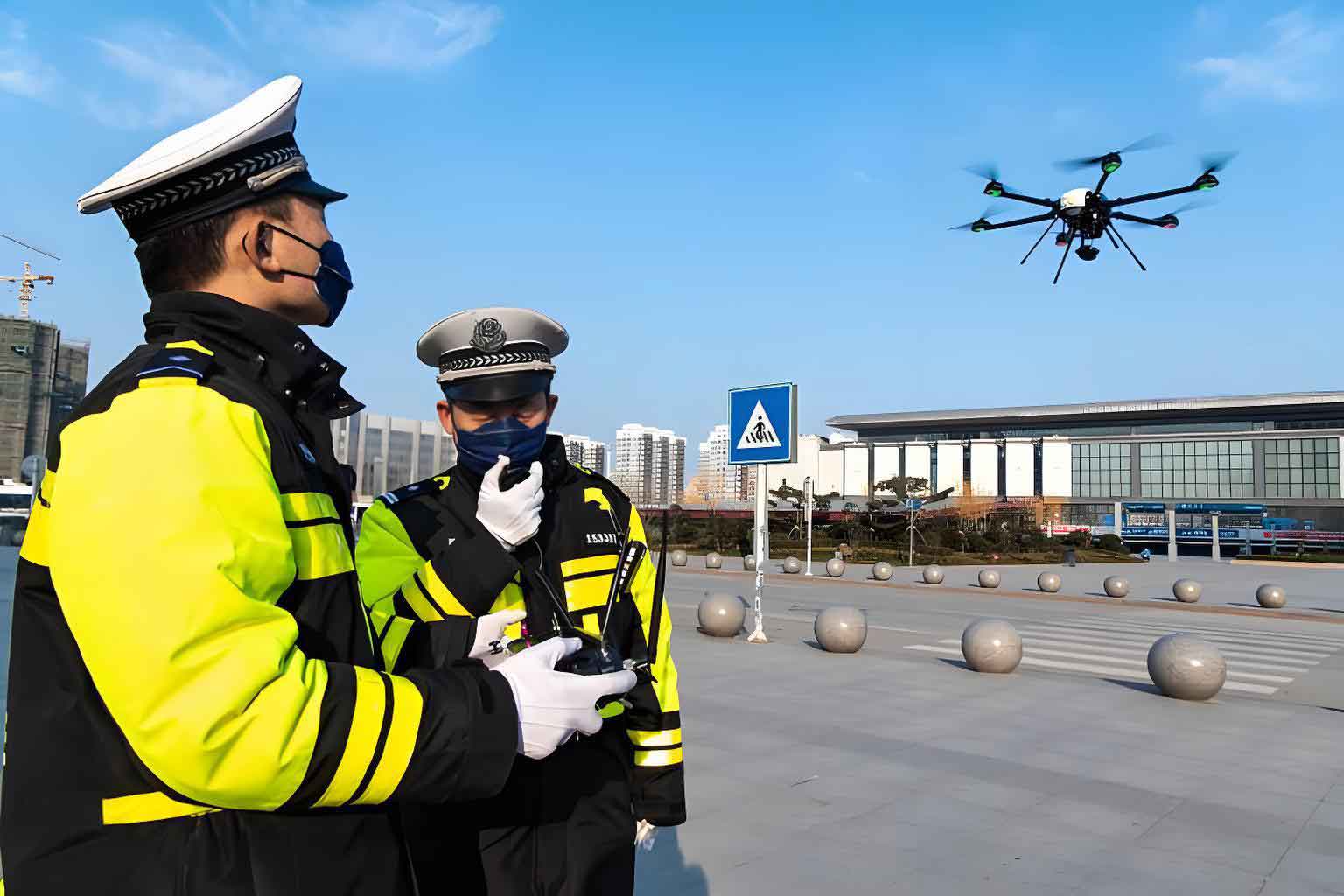
Our police UAV solutions are designed for flexibility across various警务 scenarios. We have identified three primary deployment modes, each tailored to specific operational needs. First, in areas with pre-existing eLTE fixed站 coverage, police UAVs can conduct scheduled aerial patrols along predefined routes. The real-time video is streamed to command centers, enabling continuous monitoring of jurisdictions. This mode enhances routine surveillance efficiency, allowing rapid response to incidents like traffic violations or unauthorized activities. Second, for突发事件 in uncovered regions, eLTE emergency communication vehicles provide mobile network coverage. These vehicles feature指挥 cabins that serve as on-site hubs, with satellite backhaul (e.g., via动中通 antennas) for relaying footage to remote centers. Police UAVs can hover over points of interest, delivering persistent surveillance, or track moving targets while the vehicle is in motion. This mode is particularly effective for搜索 suspects or documenting crime scenes. Third, in situations requiring stealth or accessibility, rapid deployment systems offer a portable alternative. These kit-based setups can be hand-carried to remote locations, establishing eLTE coverage within minutes. Coupled with satellite or public network backhaul, they enable covert operations, such as monitoring illicit activities in rugged terrain. The following table summarizes these应用方案:
| Deployment Mode | Key Components | Typical Range | Best For Police UAV Use Cases | Advantages |
|---|---|---|---|---|
| Fixed Station Network | eLTE基站, core network, command center | 3-5 km radius per station | Routine patrols, event monitoring, urban surveillance | Stable coverage, high capacity, low latency |
| Emergency Communication Vehicle | Mobile eLTE station, satellite backhaul,指挥舱 | Flexible, up to 5 km around vehicle | Rapid response, moving target tracking, disaster zones | Mobility, self-contained power, real-time relay |
| Rapid Deployment System | Portable eLTE kit, battery pack, satellite modem | 1-3 km radius (depending on terrain) | Covert ops, inaccessible areas, temporary setups | Lightweight, quick setup,隐蔽性 |
In practice, these modes empower police UAVs to adapt to dynamic environments. For example, during large public gatherings, fixed networks facilitate wide-area oversight, while emergency vehicles handle localized incidents. The interoperability of eLTE systems ensures that video from police UAVs can be seamlessly shared across devices, enhancing collaboration among ground units. We have also developed protocols for bandwidth allocation, prioritizing police UAV streams during critical missions to maintain video quality. This is governed by quality of service (QoS) parameters, which we model as:
$$ Q = \alpha \cdot \frac{B_{\text{allocated}}}{B_{\text{required}}} + \beta \cdot \frac{1}{L} + \gamma \cdot S $$
where \( Q \) is the overall QoS score, \( B_{\text{allocated}} \) is the allocated bandwidth, \( L \) is latency, \( S \) is signal stability, and \( \alpha, \beta, \gamma \) are weighting factors. By optimizing \( Q \), we ensure that police UAV operations remain effective even under network congestion.
Beyond deployment, the payload configuration of police UAVs is crucial. We often employ multi-sensor setups, combining visible-light cameras with thermal imagers for all-weather operations. The data fusion from these sensors enhances situational awareness, allowing operators to detect heat signatures or obscured objects. The integration process involves calibrating sensor outputs, which we express as:
$$ I_{\text{fused}} = w_1 \cdot I_{\text{vis}} + w_2 \cdot I_{\text{thermal}} $$
where \( I_{\text{fused}} \) is the fused image, \( I_{\text{vis}} \) and \( I_{\text{thermal}} \) are inputs from respective sensors, and \( w_1, w_2 \) are weights determined by environmental conditions. This capability makes police UAVs indispensable for night missions or search-and-rescue in low-visibility settings. Additionally, we incorporate advanced定位 modules, leveraging both GPS and BeiDou for redundancy. The positioning accuracy \( A \) can be estimated as:
$$ A = \sqrt{\sigma_{\text{GPS}}^2 + \sigma_{\text{BeiDou}}^2} $$
where \( \sigma \) denotes error variances. In our tests, this hybrid approach reduces定位 errors to under 2 meters, enabling precise geo-tagging of航拍 footage for forensic analysis.
To illustrate the real-world impact, consider two anonymized case studies from our implementations. In the first, a local police department adopted our eLTE-based police UAV system for daily辖区 patrols. Using multi-rotor UAVs equipped with高清 cameras, they conducted automated flights over residential and commercial areas. The video was streamed via eLTE to their command center, where operators monitored for suspicious activities. Over a six-month period, this led to a 30% reduction in response times to incidents like burglaries or traffic accidents, demonstrating how police UAVs enhance proactive policing. The department reported that the real-time feeds allowed them to deploy ground units more efficiently, often intercepting crimes in progress. In the second case, during a major international sporting event, our system provided aerial surveillance over venues and transport routes. Police UAVs operated within an eLTE network覆盖 by fixed stations and mobile vehicles, relaying live footage to a central指挥 hub. This enabled authorities to monitor crowd movements, detect anomalies, and coordinate security measures in real time. For instance, when a vehicle breakdown caused traffic congestion, a police UAV was dispatched to assess the scene, and its video helped redirect traffic swiftly. These examples underscore the versatility of police UAVs in both routine and high-stakes scenarios.
The benefits of integrating eLTE with police UAVs extend beyond video transmission. The multimedia集群调度功能 of eLTE networks allows for dynamic video distribution to field officers via smart terminals. This means that relevant aerial insights can be pushed directly to personnel on the ground, fostering a unified operational picture. Moreover, GIS integration enables the overlay of UAV data onto maps, facilitating spatial analysis for tasks like perimeter security or evidence collection. We have developed software interfaces that automate these processes, reducing operator workload. For instance, our algorithms can detect moving objects in UAV feeds and alert指挥 centers, with detection probability \( P_d \) given by:
$$ P_d = 1 – e^{-\lambda \cdot \text{SNR}} $$
where \( \lambda \) is a constant related to image processing techniques. Such automation enhances the scalability of police UAV deployments, allowing one operator to manage multiple UAVs simultaneously.
Looking ahead, we are exploring further enhancements for police UAV systems. These include leveraging 5G NR features for even higher data rates and lower latency, integrating artificial intelligence for autonomous threat detection, and developing swarm capabilities where multiple police UAVs collaborate under a single eLTE network. The latter involves coordination algorithms to avoid collisions and optimize coverage, modeled as a multi-agent system with constraints like:
$$ \min \sum_{i=1}^n E_i \quad \text{subject to} \quad d_{ij} > D_{\text{safe}} \ \forall i,j $$
where \( E_i \) is the energy consumption of UAV \( i \), \( d_{ij} \) is the distance between UAVs, and \( D_{\text{safe}} \) is a safety threshold. Additionally, we are working on standardizing interfaces to ensure compatibility with diverse UAV platforms and警务 databases, promoting interoperability across agencies.
In conclusion, our work demonstrates that 4G eLTE private wireless networks fundamentally elevate the capabilities of police UAV systems. By providing high-bandwidth, low-latency connectivity, they enable real-time高清 video回传, robust调度, and precise定位—key要素 for modern law enforcement. The flexibility of deployment modes, from fixed stations to portable kits, ensures that police UAVs can be deployed in virtually any scenario, enhancing situational awareness and operational efficiency. As we continue to refine these solutions, we anticipate that police UAVs will become even more integral to警务 workflows, offering a cost-effective and powerful tool for public safety. Our commitment is to drive innovation in this space, ensuring that technology serves the critical needs of those who protect and serve.