
In my extensive fieldwork and research on modern policing strategies in challenging terrains, I have observed a paradigm shift driven by technological integration. Among these innovations, the police drone stands out as a transformative tool. This is particularly evident in the context of maintaining public order and safety during annual Cordyceps sinensis harvesting seasons in high-altitude regions. The unique geographical and logistical constraints of these areas render traditional ground-based policing methods insufficient. This article details, from my first-hand analytical perspective, how the deployment of police drone units fundamentally enhances operational capabilities, offering a comprehensive solution to age-old challenges.
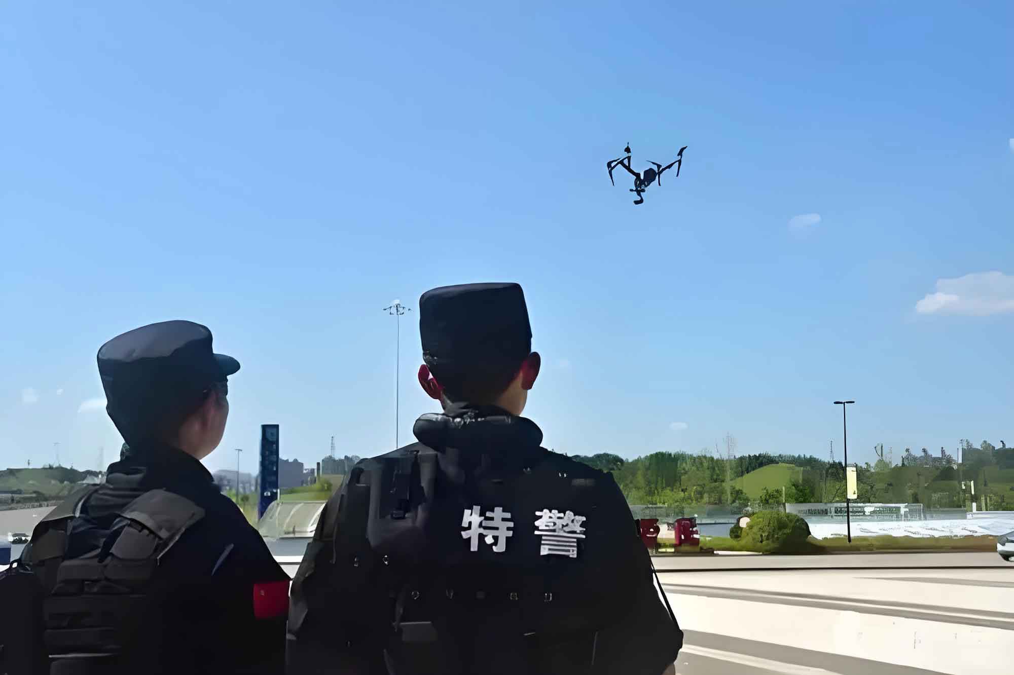
The core challenge stems from the operational environment. Harvesting zones are typically located in remote alpine meadows, rugged valleys, and mountainous terrains, often at elevations exceeding 4,500 meters. Access routes are primitive tracks, vulnerable to seasonal landslides and flash floods, making rapid response by vehicle or foot patrols nearly impossible. Concurrently, these periods witness a massive, temporary influx of a diverse population of harvesters, creating a dense, mobile community with inherent risks of territorial disputes, theft, illegal harvesting, and environmental damage. Traditional policing, constrained by limited personnel, difficult communications, and vast, inaccessible areas, struggles with effective surveillance, timely intervention, and evidence collection.
Challenges of Traditional Policing in High-Altitude Harvesting Zones
To systematically understand the limitations, we can categorize the primary constraints. The efficacy of a traditional patrol (P_trad) in such an environment can be modeled as a function negatively impacted by several key factors:
$$ P_{\text{trad}} = \frac{R_{\text{personnel}}}{A_{\text{zone}} \cdot T_{\text{access}} \cdot C_{\text{comm}}} $$
Where:
- $R_{\text{personnel}}$ represents the available personnel resources (a limited constant).
- $A_{\text{zone}}$ is the vast area to be covered (a large value).
- $T_{\text{access}}$ is the time multiplier due to difficult terrain and access (a value >1, significantly increasing with distance and obstacle density).
- $C_{\text{comm}}$ represents communication reliability (a value ≤1, often much less than 1 in valleys and remote areas).
As the denominator increases, the effective patrol coverage $P_{\text{trad}}$ diminishes rapidly towards zero.
| Challenge Category | Specific Issues | Impact on Policing Efficacy |
|---|---|---|
| Geographical & Environmental | High altitude (>4500m), rugged mountains, lack of roads, frequent landslides/mudflows, extreme weather (snow, hail, lightning). | Severely impedes physical movement of personnel and vehicles, increases response time from hours to potentially days, creates safety hazards for officers. |
| Demographic & Logistical | Large, transient population; complex mix of local and non-local harvesters; makeshift tent settlements; high density of people in remote spots. | Difficulties in population management, identity verification, and behavior monitoring. Increased potential for disputes, theft, and public order incidents. |
| Resource Limitations | Low police-to-population ratio over vast areas; finite number of patrol units; physical fatigue of officers at high altitude. | Inability to conduct comprehensive patrols, leading to large blind spots. Delayed response to incidents. Increased workload and stress on existing force. |
| Operational & Technical | Poor or non-existent communication signals in valleys and behind ridges; difficulty in real-time coordination and reporting. | Breaks the command-and-control link, leaving field officers isolated and preventing headquarters from obtaining situational awareness. |
The table above summarizes the multifaceted barriers. In my analysis, the critical path to overcoming these lies not in merely adding more personnel—a logistically and economically burdensome solution—but in augmenting the capabilities of existing forces through aerial intelligence, surveillance, and reconnaissance (ISR) platforms. This is where the police drone enters the equation as a force multiplier.
Technical Superiority of the Modern Police Drone
The operational advantage of a police drone stems from its specific performance parameters and payload flexibility. We can model the area coverage advantage of a police drone ($A_{\text{drone}}$) over a ground unit ($A_{\text{ground}}$) in a given time ($t$) as:
$$ \frac{A_{\text{drone}}(t)}{A_{\text{ground}}(t)} = \frac{v_d \cdot h_d \cdot \text{FOV}_d}{v_g \cdot h_g \cdot \text{FOV}_g} $$
Where $v$ is velocity, $h$ is effective observation height (which expands the visible horizon), and $\text{FOV}$ is the sensor field-of-view. For a police drone flying at 100m altitude with a high-resolution gimbal camera, this ratio is typically orders of magnitude greater than 1.
The selection of the police drone platform is mission-specific. Multi-rotor drones (quadcopters, hexacopters) offer vertical take-off and landing (VTOL), precise hovering, and exceptional low-speed maneuverability, ideal for focused inspection, standoff observation, and operations in confined areas like valleys. Fixed-wing drones, on the other hand, excel in endurance and speed, covering vast linear distances (like perimeter lines or mountain ridges) efficiently. The key is the modular payload, which transforms the police drone from a simple flying camera into a multi-role asset:
- High-Resolution EO/Zoom Cameras: For detailed daytime imagery and identification from a safe standoff distance.
- Thermal Imaging Cameras: Critical for night operations, searching for missing persons, or detecting hidden individuals and heat signatures through light foliage or in low-visibility conditions. The ability to detect human presence based on thermal radiation is a game-changer for 24/7 monitoring.
- LRAD (Long Range Acoustic Device) or Loudspeaker: Allows for direct audio communication, issuing warnings, or broadcasting instructions over a wide area without physical deployment of officers.
- Emergency Payload Drop Mechanisms: Can deliver small medical kits, communication devices, or other critical supplies to stranded or injured individuals in inaccessible locations.
The operational cost model also favors the police drone. The cost per flight hour ($C_{\text{flight}}$) for a drone is significantly lower than mobilizing a vehicle patrol unit ($C_{\text{vehicle}}$), especially when factoring in fuel, maintenance, and the manpower required for the latter.
$$ \text{Cost-Benefit Ratio} = \frac{\text{Area Covered per Unit Time}}{\text{Operational Cost per Unit Time}} \quad \text{is generally:} \quad \frac{A_{\text{drone}}/t}{C_{\text{flight}}} > \frac{A_{\text{vehicle}}/t}{C_{\text{vehicle}}} $$
Application of Police Drones in Cordyceps Harvest Security: A Detailed Analysis
In the specific scenario of high-altitude harvest security, the police drone applications are multifaceted and impactful. I have conceptualized and observed their deployment in the following key roles:
1. Persistent Wide-Area Surveillance and Aerial Patrol
This is the most fundamental application. A single police drone operator can program a flight path that systematically covers dozens of square kilometers of harvesting valleys and slopes in a single mission, a task that would require multiple ground teams several days to complete. The drone’s bird’s-eye view eliminates terrain blind spots—no ridge or remote canyon is beyond its reach. The real-time video feed provides commanders with an unprecedented “God’s-eye view” of the entire operational area, showing population density, movement patterns, and potential flashpoints.
For instance, the detection of unauthorized gatherings or movements towards restricted or ecologically sensitive zones can be identified early. Using the police drone’s loudspeaker, a direct audio warning can be issued immediately to disperse the gathering or halt the activity, often resolving situations before they escalate, without a single officer having to undertake a arduous climb. This proactive deterrence is a cornerstone of modern, intelligence-led policing facilitated by the police drone.
2. Tactical Response and Crime Scene Investigation (CSI)
When an incident is reported—be it a theft from a tent, an assault, or a boundary dispute—the police drone becomes the first responder. It can be airborne in minutes and fly directly to the GPS coordinates at speeds of 50-80 km/h, bypassing all ground obstacles. Upon arrival, it can hover at a safe altitude, providing a stable live feed of the situation to the command center. This allows for immediate threat assessment: Are weapons visible? How many individuals are involved? What are the escape routes? This information is critical for formulating a safe and effective ground response strategy.
For CSI, the police drone is invaluable. It can perform comprehensive aerial photography of a crime scene, creating a high-resolution orthomosaic map. Using photogrammetry software, a detailed 3D model of the scene can be reconstructed. This process can be formalized:
- Grid or circular autonomous flight path over the scene at multiple altitudes.
- Capture of hundreds of overlapping high-resolution images ($I_n$).
- Processing through Structure from Motion (SfM) algorithms to generate a point cloud ($P_{cloud}$) and subsequently a 3D mesh model ($M_{3D}$).
$$ M_{3D} = \text{SfM}(I_1, I_2, …, I_n) $$
This digital model preserves the scene perfectly, allows for virtual walkthroughs, precise measurement of distances and object sizes, and provides uncontestable visual evidence for court proceedings. It is far superior to traditional sketches and ground-level photographs, especially on uneven terrain.
3. Search and Rescue (SAR) and Emergency Support
Harvesters can get lost, suffer from altitude sickness, or be injured in falls. Searching for a missing person in vast, trackless mountains is like finding a needle in a haystack. A police drone equipped with a thermal camera can scan large areas methodically. The thermal signature of a human body, even if unconscious and hidden among rocks, stands out clearly against the cooler background, especially at dawn or dusk. The search efficiency can be modeled by comparing the sweep width of a ground searcher ($W_g$) versus a thermal-equipped police drone ($W_d$), where $W_d$ is vastly greater due to altitude and sensor sensitivity.
$$ \text{Search Coverage Rate} = v \cdot W $$
Thus, $\text{Rate}_{\text{drone}} = v_d \cdot W_d \gg \text{Rate}_{\text{ground}} = v_g \cdot W_g$.
Once located, the drone can mark the precise GPS location, visually assess the individual’s condition, and, if equipped, drop a first-aid kit, warm clothing, or a two-way radio until a ground rescue team can arrive, significantly improving survival chances.
4. Environmental Monitoring and Enforcement
Over-harvesting and destructive digging practices can cause severe ecological damage, leading to soil erosion and degradation of the fragile alpine grassland. A police drone can monitor for illegal harvesting in conservation zones or assess the scale of environmental impact across different areas. High-resolution time-series imagery can be used to quantify the area of disturbed land, providing data for ecological impact assessments and guiding more sustainable management policies.
| Application Scenario | Police Drone Role | Key Payload Used | Measurable Benefit |
|---|---|---|---|
| Preventive Patrol & Situation Awareness | Persistent ISR, Pattern-of-Life Analysis | HD Zoom Camera, Thermal Camera | Reduction in blind spots >90%; Early warning capability for conflicts. |
| Incident Response | First Responder, Tactical Overwatch | Live Video Downlink, Loudspeaker | Response time reduced from hours to minutes; Safer ground team deployment. |
| Evidence Collection | Aerial CSI, 3D Scene Reconstruction | High-Res Photo/Video, Photogrammetry Software | Comprehensive, court-admissible evidence; Preservation of fragile scene details. |
| Search and Rescue | Rapid Area Search, Victim Location | Thermal Imaging Camera, Payload Dropper | Exponential increase in search area coverage per hour; Direct aid delivery. |
| Communication Relay | Aerial Communication Node | Radio Repeater Payload | Restores UHF/VHF comms in dead zones, enabling coordinated operations. |
Integrated Model: The “Air-Ground Integration” Policing Paradigm
The ultimate effectiveness is not achieved by the police drone operating in isolation, but as the aerial component of an integrated “Air-Ground Integration” (AGI) system. In this model, the police drone acts as the command center’s extended eyes, ears, and voice, while ground units act as the intervention force. The synergy can be expressed as a system where overall effectiveness ($E_{\text{total}}$) is greater than the sum of its parts.
$$ E_{\text{total}} = \alpha \cdot E_{\text{drone}} + \beta \cdot E_{\text{ground}} + \gamma \cdot (E_{\text{drone}} \cdot E_{\text{ground}}) $$
Here, $E_{\text{drone}}$ and $E_{\text{ground}}$ represent the effectiveness metrics of the drone and ground units independently. The cross-term $(E_{\text{drone}} \cdot E_{\text{ground}})$ represents the synergistic effect, with $\gamma$ as its coefficient. The police drone enhances ground unit effectiveness by providing navigation, overwatch, and intelligence ($\beta$ increases). The ground unit gives purpose and actionable resolution to the drone’s reconnaissance ($\alpha$ is realized). The workflow is cyclic:
- Drone-led Reconnaissance: The police drone conducts routine or targeted surveillance, identifying anomalies (e.g., a fight, illegal activity).
- Real-Time Data Fusion & Decision: Live feed is analyzed at the command center. A decision is made to intervene.
- Drone-Guided Deployment: The police drone remains on station, providing live tracking of subjects and the safest approach route to the nearest ground team. It can use its speaker to issue initial commands.
- Ground Action with Aerial Cover: The ground team moves in, with the police drone providing overwatch, warning of unseen threats, and recording the entire interaction for transparency and evidence.
- Post-Incident Documentation: The police drone documents the final scene and any suspect flight paths.
This integrated model, centered on the police drone, maximizes resource efficiency, officer safety, and operational success.
Conclusion
The integration of police drone technology into the public security framework for managing large-scale seasonal activities in difficult environments is not merely an upgrade; it is a necessity. From my perspective, the evidence is clear: the police drone overcomes the intrinsic limitations of terrain, distance, and limited manpower that have plagued traditional methods. It provides a persistent, flexible, and powerful platform for surveillance, deterrence, communication, response, and investigation. The mathematical models for coverage, cost-benefit, and search efficiency consistently demonstrate its superiority as a force multiplier. By enabling the Air-Ground Integration paradigm, the police drone transforms public safety operations from reactive and grueling to proactive, intelligent, and efficient. As this technology continues to evolve with greater autonomy, longer endurance, and more advanced sensors, its role as an indispensable partner in safeguarding order in the world’s most challenging landscapes will only become more profoundly cemented. The future of high-altitude and remote-area policing is, unequivocally, in the air.