The emergence of large-scale public health crises, such as the COVID-19 pandemic, has acted as a profound stress test for public security infrastructure worldwide. In this context, the integration of advanced technology into policing and public safety operations has transitioned from a progressive ideal to an operational imperative. Among the most transformative tools adopted during this period was the police drone. From a first-person perspective of analyzing this technological integration, I observed that police drone units were rapidly mobilized to create a “non-contact” operational layer, fundamentally altering traditional approaches to public order maintenance, community service, and emergency logistics. This analysis delves into the conceptual framework, practical applications, technological underpinnings, and systemic challenges of employing police drone systems during a pandemic, arguing for their essential role in building resilient, technology-augmented public safety ecosystems.
Conceptual Foundation and Typology of Police Drones
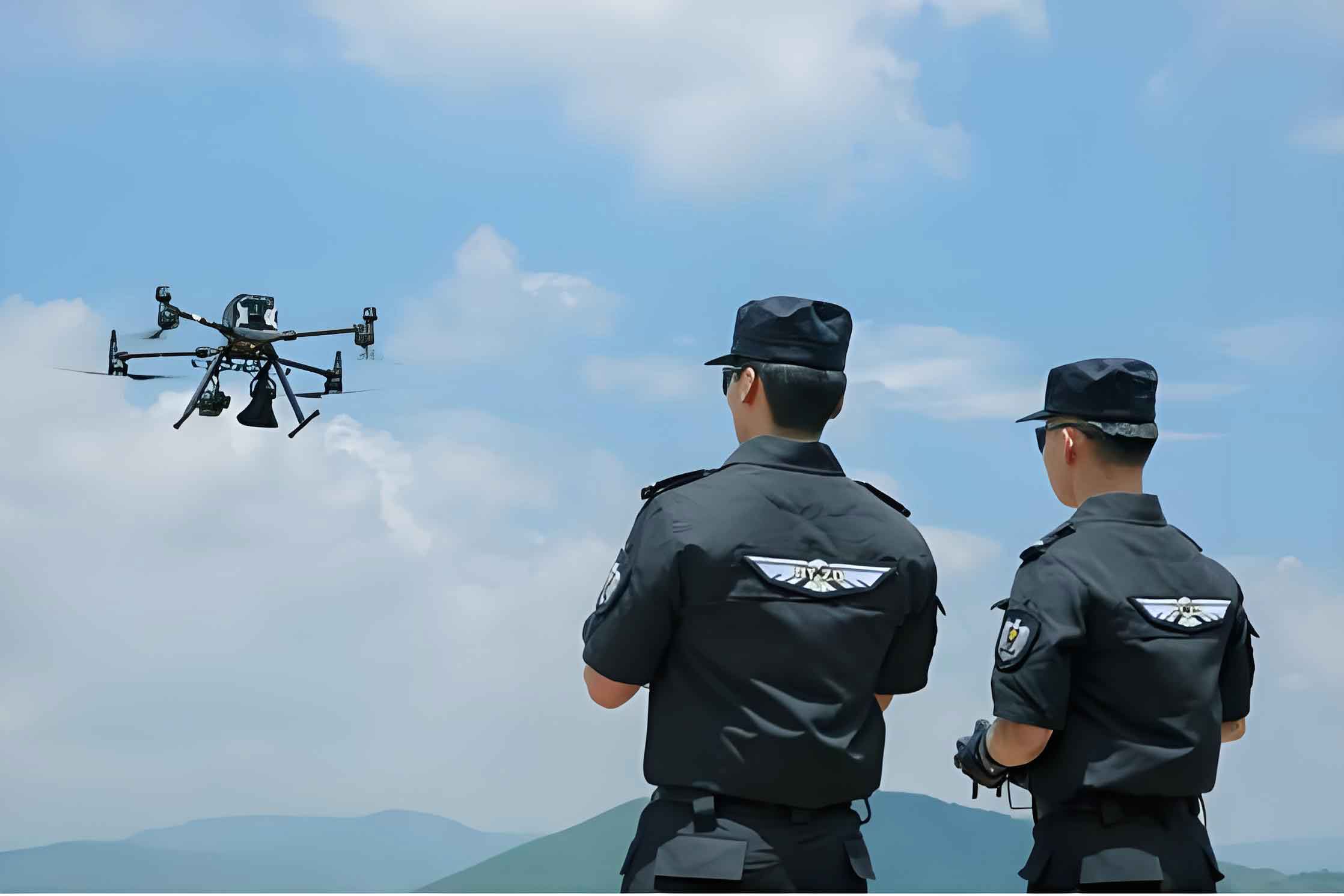
At its core, a police drone, or Unmanned Aerial Vehicle (UAV) for police service, is an aircraft system operated without a human pilot onboard, specifically designed and deployed by law enforcement agencies. Its system architecture extends beyond the flying platform to encompass the ground control station (GCS), data communication links, and mission-specific payloads. This holistic system view is crucial for understanding its capabilities. For pandemic operations, the choice of platform is primarily dictated by mission profile—hovering capability, endurance, speed, and payload capacity. The two most relevant categories are multi-rotor and fixed-wing police drone systems.
The operational parameters of these platforms can be summarized and compared to highlight their complementary roles. A multi-rotor police drone excels in vertical take-off and landing (VTOL), stable hovering, and ease of deployment in congested areas, making it ideal for precise, localized tasks. In contrast, a fixed-wing police drone offers superior range, endurance, and speed for large-area monitoring but requires runway or launcher for operation.
| Parameter | Multi-rotor Police Drone | Fixed-wing Police Drone |
|---|---|---|
| Primary Advantage | VTOL, Precision Hovering | Long Range & Endurance |
| Typical Max Endurance | 30 mins – 1.5 hours | 2 – 10+ hours |
| Typical Cruise Speed | 0 – 60 km/h | 60 – 120+ km/h |
| Optimal Mission Profile | Urban patrol, point inspection, close-range delivery | Border/coastal patrol, large-area mapping, linear infrastructure inspection |
| Payload Flexibility | High (easy to swap modules) | Moderate (often integrated) |
The effective payload coefficient, a key metric for utility, is defined as the ratio of useful load capacity to the drone’s own weight. For a police drone, this determines how much mission equipment (cameras, speakers, medical kits) it can carry. We can express the available payload for a mission as:
$$ P_{available} = M_{takeoff} \times \eta – M_{empty} $$
where \( P_{available} \) is the available payload weight, \( M_{takeoff} \) is the maximum takeoff mass, \( \eta \) is the effective payload coefficient (typically ≥0.2 for multi-rotor, ≥0.3 for police helicopters, and can exceed 1.0 for specialized agricultural drones), and \( M_{empty} \) is the empty weight of the aircraft. During the pandemic, maximizing \( P_{available} \) for disinfectant or supply transport was a constant engineering challenge.
Operational Application Matrix in Pandemic Scenarios
The deployment of police drone systems during the pandemic created a new dimension of “airborne policing,” or more broadly, aerial public safety service. Their unique advantages—minimized infection risk, rapid deployment, aerial perspective, and persistent presence—were leveraged across a spectrum of missions that blurred the lines between traditional law enforcement and civil emergency response.
| Application Scenario | Primary Police Drone Type | Key Payload | Operational Value Proposition |
|---|---|---|---|
| Aerial Sentry & Patrol | Multi-rotor, Fixed-wing | High-resolution Zoom Camera, Thermal Imager | Force multiplier; wide-area situational awareness; traffic flow monitoring at checkpoints; identification of unauthorized gatherings. |
| Public Address & Dissuasion | Multi-rotor | Loudspeaker / Siren Module | Non-contact crowd management; efficient dissemination of public health directives; remote guidance and warning. |
| Covert Surveillance & Search | Multi-rotor (low-noise) | Silenced Rotors, Low-light Camera | Detection of illicit gatherings (e.g., gambling); search for missing persons or non-compliant individuals in complex terrain. |
| Logistics & Delivery | Heavy-lift Multi-rotor | Cargo Release Mechanism, Insulated Box | “Contactless” transport of critical medical samples, vaccines, PPE, and supplies to quarantined zones or isolated hospitals. |
| Aerial Disinfection | Agricultural-grade Multi-rotor | Liquid Spraying System, Tank | Rapid, large-scale decontamination of public spaces, markets, transportation hubs. Efficiency is a function of coverage rate: \( A_{cov} = v \times w \times t \), where \( v \) is speed, \( w \) is spray swath width, and \( t \) is flight time. |
| Mass Temperature Screening | Multi-rotor with Gimbal | Radiometric Thermal Camera, “Black Body” Reference | Population-scale fever screening. Accuracy is enhanced by using a black body for calibration, reducing error to ±0.5°C. The system triggers alerts when \( T_{measured} \geq T_{threshold} \). |
The efficiency gain from using a police drone for aerial announcement, for instance, was quantified anecdotally as equivalent to 20 ground-based patrol cars, a testament to its coverage and mobility. The core equation for such efficiency in area coverage tasks is:
$$ E_{drone} = \frac{A_{covered}}{t_{mission} \times N_{personnel}} $$
where \( E_{drone} \) represents the efficiency metric (area per unit time per personnel), \( A_{covered} \) is the geographic area effectively monitored or addressed, \( t_{mission} \) is the mission duration, and \( N_{personnel} \) is the number of ground officers required to achieve a similar effect. For a police drone operated by a pilot and an observer, \( N_{personnel} \) is effectively 2, but \( A_{covered} \) can be orders of magnitude larger than a foot patrol, leading to a high \( E_{drone} \).
Technological Enablers and System Integration
The effective application of a police drone is not merely about the aircraft; it is about the integrated system. Key technological pillars enabled these pandemic missions:
1. Payload Modularity: The ability to quickly swap between a loudspeaker, a thermal sensor, a delivery hook, or a spray tank made the police drone a versatile platform. This modularity is governed by interface standards and power budget constraints on the drone.
2. Real-time Data Link and C2: Secure, low-latency communication between the police drone and the Ground Control Station (GCS) is the lifeline. During the pandemic, feeds were often integrated into command centers, creating a common operational picture. The required data rate \( R \) for video transmission can be estimated as:
$$ R = \frac{W \times H \times D \times F}{C} $$
where \( W \) and \( H \) are frame dimensions, \( D \) is color depth, \( F \) is frame rate, and \( C \) is the compression ratio. High-definition thermal video streams demanded robust links, pushing adoption towards 4G/LTE and 5G networks for beyond-visual-line-of-sight (BVLOS) operations.
3. AI-powered Analytics: Automated person detection, crowd counting, and anomaly detection algorithms processed the video streams from the police drone, alerting operators to potential gatherings or non-compliance, thus reducing operator workload.
4. Swarm Coordination (Emerging): For covering vast areas like cities or simultaneously monitoring multiple points of interest, the concept of coordinated police drone swarms is pivotal. The total area coverage \( A_{total} \) for \( n \) drones can be modeled, ignoring overlap for simplicity, as:
$$ A_{total}(n) = \sum_{i=1}^{n} A_{covered_i} = n \times \pi r_i^2 $$
where \( r_i \) is the effective sensor radius of the i-th police drone. Swarm control algorithms manage deconfliction and collaborative tasking.
Critical Challenges and Strategic Solutions
Despite their utility, the rapid deployment of police drone assets during the crisis exposed several systemic challenges.
1. Human Capital Deficit: There was a severe shortage of certified pilots, mission planners, and data analysts specialized in public safety UAV operations. The solution lies in institutionalizing police drone training within law enforcement academies, creating dedicated career tracks, and establishing partnerships with aviation authorities for standardized certification (like AOPA/ASFC).
2. Regulatory and Airspace Integration: Flying in urban areas, especially near hospitals or over crowds, is heavily regulated. BVLOS flights for delivery or large-scale patrol require approved corridors and risk assessments. The strategic path involves closer collaboration with civil aviation authorities to develop dynamic geofencing and UTM (Unmanned Traffic Management) systems tailored for emergency police drone operations.
3. Technical Limitations:
- Endurance-Payload Trade-off: Expressed by the fundamental equation: \( t_{endurance} = \frac{E_{battery}}{P_{total}} \), where \( P_{total} = P_{lift} + P_{avionics} + P_{payload} \). Heavier payloads (like disinfectant) drastically reduce \( t_{endurance} \). Advancements in battery energy density and hybrid propulsion are critical.
- Sensor Accuracy: While thermal screening was useful, ambient conditions affected accuracy. Multi-sensor fusion (thermal + visible-light analytics) and proper calibration protocols are necessary for reliable data.
- Communication Vulnerability: Public networks can be congested or insecure. Dedicated, encrypted LTE/5G networks or mesh networking between police drone units are essential for mission assurance.
4. Operational Protocol Gaps: Ad-hoc use led to inconsistencies. A standardized tactical workflow for police drone deployment in emergencies is required. This workflow can be conceptualized as a decision loop:
1. Alert & Triage: Incident reported and assessed for police drone suitability.
2. Mission Configuration: Select police drone platform, payload, and flight crew based on risk: \( Risk_{mission} = f(Hazard_{env}, Criticality_{task}, Vulnerability_{drone}) \).
3. Deployment & Execution: Launch, execute mission (patrol, deliver, broadcast).
4. Real-time Analysis: Live feed analysis at GCS for decision support.
5. Action & Resolution: Ground team dispatch based on drone intelligence, or direct action via drone (e.g., warning).
6. Post-mission Analysis: Data archiving, debrief, and process improvement.
5. Public Perception and Privacy: The use of police drone for surveillance raised privacy concerns. Transparent policies on data collection, retention, and usage, coupled with public awareness campaigns highlighting the humanitarian service role (delivery, disinfection), are vital for maintaining community trust.
Future Trajectory and Recommendations
The pandemic has irrevocably demonstrated that the police drone is more than a surveillance tool; it is a versatile platform for public service and force protection. To institutionalize this capability, the following strategic recommendations are proposed:
1. Develop Integrated “Air-Mobile” Units: Law enforcement agencies should establish permanent units combining police drone operators, data analysts, and tactical ground personnel. These units would train regularly for diverse scenarios, from search-and-rescue to crisis response.
2. Foster Inter-agency Interoperability: The police drone command and video feed should be interoperable with public health command centers, fire departments, and emergency medical services. This creates a unified “epidemic response grid.”
3. Invest in Next-Generation Platforms: Research and procurement should focus on:
– Hybrid police drone models for longer endurance.
– Standardized, secure payload interfaces.
– AI-at-the-edge for real-time onboard processing to reduce bandwidth needs.
– “Drone-in-a-box” solutions for automatic deployment from strategic locations.
4. Formalize Doctrine and Training: Write and publish standard operating procedures (SOPs) for police drone use in civil emergencies. Incorporate police drone tactics into regular law enforcement training curricula.
5. Pursue Public-Private Partnerships: Collaborate with technology companies, telecom providers, and drone manufacturers to co-develop solutions, share airspace management tools, and accelerate innovation tailored to public safety needs.
Conclusion
The deployment of police drone systems during the global pandemic was a pivotal moment in the evolution of modern policing. It showcased a rapid adaptation where technology was leveraged not primarily for enforcement, but for population protection, logistical support, and situational awareness in an unprecedented bio-threat environment. The police drone emerged as a critical node in a networked response, reducing risks to first responders while enhancing operational efficiency and reach. The challenges encountered—from manpower shortages to technical limits—are not indictments of the concept but roadmaps for its maturation. Moving forward, the lessons learned must catalyze the systematic integration of unmanned systems into the core infrastructure of public safety. By doing so, law enforcement agencies can build a more agile, resilient, and capable force, ready to leverage the vertical dimension for the complex challenges of the 21st century, whether they be pandemics, natural disasters, or other large-scale civic emergencies. The future of effective policing lies not just on the streets, but increasingly in the strategic use of the airspace above them, guided by the versatile eye of the police drone.