
In recent years, the rapid advancement of drone technology has revolutionized various sectors, including agriculture. As a key component of precision farming, agricultural drones are increasingly deployed for tasks such as crop monitoring, spraying, and data collection. However, efficient path planning remains a critical challenge due to dynamic environmental constraints and the need for real-time decision-making. In this paper, we propose a comprehensive path planning system for agricultural drones that integrates Internet of Things (IoT) architecture and artificial intelligence (AI) algorithms. Our system aims to optimize flight trajectories, reduce energy consumption, and enhance operational stability in complex agricultural settings. We focus on addressing constraints like minimum flight segments, altitude limits, and turning angles, while leveraging IoT for data transmission and AI for intelligent route optimization. Through this work, we contribute to the development of smarter, more autonomous agricultural drone systems that can adapt to varying field conditions and improve overall farming efficiency.
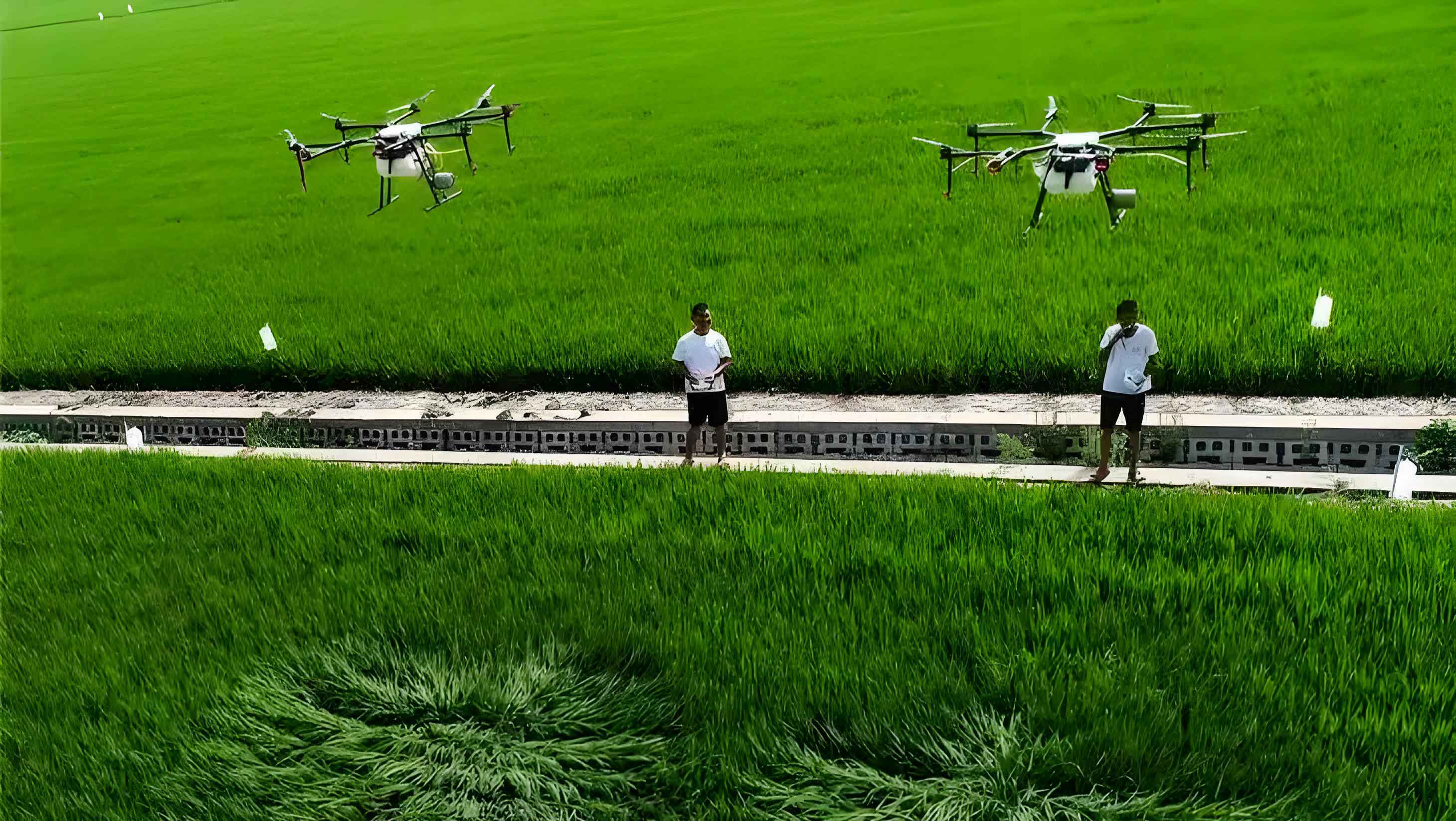
The proliferation of agricultural drones has been driven by the demand for increased crop yields and sustainable practices. These drones must navigate diverse terrains, avoid obstacles, and comply with operational limits, making path planning a multifaceted problem. Traditional methods often rely on static maps or simple algorithms, which may not account for real-time changes or drone-specific constraints. To overcome this, we design a system that combines IoT-based data acquisition with AI-driven path optimization. The IoT framework facilitates seamless communication between the agricultural drone and ground servers, enabling continuous data exchange for environmental modeling. Meanwhile, AI algorithms, particularly an enhanced A* approach, are employed to generate smooth, shortest paths. This integration ensures that the agricultural drone can operate autonomously while adhering to safety and efficiency standards. In the following sections, we detail the constraints, environmental models, IoT architecture, algorithm improvements, and experimental validation of our system.
To effectively plan paths for agricultural drones, it is essential to define the constraints that govern their flight. These constraints arise from both the drone’s mechanical limitations and the operational environment. We categorize them into three primary types: minimum flight segment constraint, minimum flight altitude constraint, and maximum yaw angle constraint. Each constraint ensures the agricultural drone’s maneuverability and safety during missions. Below, we summarize these constraints in a table for clarity, followed by mathematical formulations.
| Constraint Type | Description | Mathematical Expression |
|---|---|---|
| Minimum Flight Segment | The agricultural drone must maintain a straight flight for a minimum distance before turning, to avoid abrupt maneuvers. | $$l_i > l_{\text{min}} \quad \text{for} \quad i = 1, 2, \dots, n-1$$ |
| Minimum Flight Altitude | The agricultural drone must fly above a safe height to prevent collisions with ground objects like trees or buildings. | $$h_i > h_{\text{min}} \quad \text{for} \quad i = 1, 2, \dots, n$$ |
| Maximum Yaw Angle | The turning angle of the agricultural drone is limited by its mechanical design, ensuring stable turns. | $$\cos \theta_{\text{max}} \geq \frac{-\alpha_i^T \alpha_{i+1}}{\|\alpha_i\| \cdot \|\alpha_{i+1}\|} \quad \text{for} \quad i = 2, \dots, n-1$$ |
In these expressions, \( l_i \) represents the length of the \( i \)-th flight segment, \( l_{\text{min}} \) is the minimum allowed segment length, \( h_i \) is the flight altitude at segment \( i \), \( h_{\text{min}} \) is the global minimum altitude, and \( \theta_{\text{max}} \) is the maximum yaw angle. The vector \( \alpha_i = (x_i – x_{i-1}, y_i – y_{i-1}) \) denotes the horizontal projection of the \( i \)-th segment. These constraints ensure that the agricultural drone’s path is feasible and safe, reducing risks such as stalling or collisions. By incorporating these into our planning system, we can generate trajectories that respect the drone’s physical capabilities.
Beyond constraints, the environmental model plays a crucial role in path planning for agricultural drones. We utilize a digital elevation model (DEM) to represent the terrain, where each point is defined by coordinates \((x, y, h)\) with \( h = f(x, y) \) as the height function. This model accounts for various threats, including terrain obstacles, detection zones, and no-fly areas. For instance, in agricultural fields, threats might include tall crops, irrigation systems, or restricted airspace. We integrate these into a unified spatial environment model that the agricultural drone must navigate. The DEM allows us to compute potential collision risks and adjust paths accordingly. To formalize this, we define the cost function for the environment as a combination of threat levels and elevation changes. Let \( T(x,y) \) represent the threat intensity at point \((x,y)\), and \( E(x,y) \) denote the energy cost due to altitude changes. The total environmental cost \( C_{\text{env}} \) can be expressed as:
$$C_{\text{env}}(x,y) = w_1 \cdot T(x,y) + w_2 \cdot E(x,y)$$
where \( w_1 \) and \( w_2 \) are weighting factors that balance threat avoidance and energy efficiency. This model enables the agricultural drone to prioritize safer and more economical routes. In practice, we discretize the environment into a grid for computational ease, with each cell assigned a cost value based on the DEM and threat maps. This grid serves as the input for our path planning algorithms, ensuring that the agricultural drone can dynamically adapt to environmental changes.
The IoT network architecture is fundamental to our system, as it enables real-time data transmission between the agricultural drone and ground-based processing units. Agricultural drones often have limited onboard computing power, making it necessary to offload complex tasks like environmental modeling and path optimization to servers. Our IoT framework consists of four layers: sensing layer, access layer, infrastructure layer, and application layer. Each layer has specific functions that collectively support the agricultural drone’s operations. We outline these layers in the table below, highlighting their roles in the context of agricultural drone path planning.
| Layer | Components | Function in Agricultural Drone System |
|---|---|---|
| Sensing Layer | Infrared sensors, ultrasonic sensors, cameras, GPS devices | Collects real-time environmental data (e.g., crop health, obstacle positions) from the agricultural drone’s surroundings. |
| Access Layer | Mobile devices, drones as access points, aggregation nodes | Aggregates data from sensing layer and transmits it wirelessly to the infrastructure layer; supports mobility of agricultural drones. |
| Infrastructure Layer | Communication satellites, base stations, routers | Relays data from access layer to application layer; provides backbone connectivity for agricultural drone networks. |
| Application Layer | AI algorithms, user interfaces, databases | Processes data for path planning, makes decisions, and stores information; enables intelligent control of agricultural drones. |
This architecture ensures that the agricultural drone can continuously stream data to ground servers, where AI algorithms analyze it and update flight paths. For example, the sensing layer on the agricultural drone might detect a new obstacle, which is then sent via the access layer to the infrastructure layer. The application layer processes this data, recalculates the path using our improved A* algorithm, and sends the new trajectory back to the agricultural drone. This closed-loop system enhances the autonomy and responsiveness of agricultural drones in dynamic environments. Moreover, the IoT framework supports scalability, allowing multiple agricultural drones to operate in coordination across large farms.
At the core of our path planning system is the AI algorithm, which we base on the A* search algorithm. A* is a popular heuristic search method that finds the shortest path between two points in a graph. For agricultural drones, we adapt A* to account for the constraints and environmental models described earlier. The standard A* algorithm uses a cost function \( f(x,y) = g(x,y) + h(x,y) \), where \( g(x,y) \) is the actual cost from the start point to node \( (x,y) \), and \( h(x,y) \) is the heuristic estimated cost from \( (x,y) \) to the goal. In our implementation for agricultural drones, we define \( g(x,y) \) to incorporate segment lengths, altitude changes, and threat costs, while \( h(x,y) \) is typically the Euclidean distance to the goal. The algorithm proceeds by expanding nodes with the lowest \( f \)-value until the goal is reached. We summarize the steps of the A* algorithm as applied to agricultural drone path planning:
- Initialize open and closed lists. Place the start node of the agricultural drone’s position into the open list.
- While the open list is not empty, select the node with the smallest \( f \)-value. If this node is the goal, reconstruct the path.
- Otherwise, move the node to the closed list and generate its successors (neighboring grid cells).
- For each successor, compute \( g \), \( h \), and \( f \). If the successor is in the closed list or has a higher cost, skip it; otherwise, add it to the open list.
- Repeat until the path is found or no solution exists.
However, the standard A* algorithm can produce paths with sharp angles, which are inefficient for agricultural drones due to turning constraints. To address this, we propose an improved A* algorithm that smooths the trajectory by replacing acute angles with circular arcs. When the agricultural drone’s path contains an intersection point \( A(a,b) \) with neighboring points \( P(p_1,p_2) \) and \( Q(q_1,q_2) \), we identify the circle passing through \( P \) and \( Q \) with center \( C(c_1,c_2) \). Instead of the straight segments \( PA \) and \( AQ \), we use the minor arc \( PQ \) to create a smoother turn. The length of the original path \( L \) and the arc length \( L_{PQ} \) are compared to ensure optimization. Mathematically, the original path length is:
$$L = \sqrt{(p_1 – a)^2 + (p_2 – b)^2} + \sqrt{(q_1 – a)^2 + (q_2 – b)^2}$$
The circle’s radius \( R \) and center \( C \) satisfy:
$$(p_1 – c_1)^2 + (p_2 – c_2)^2 = R^2$$
$$(q_1 – c_1)^2 + (q_2 – c_2)^2 = R^2$$
If the angle between segments is \( \theta \), the central angle \( \alpha \) for the arc is:
$$\alpha = 2\pi – \left(\frac{\pi}{2} + \frac{\pi}{2} – \theta\right) = \pi + \theta$$
Thus, the arc length is \( L_{PQ} = R \cdot \alpha \). By substituting \( \alpha \), we get:
$$L_{PQ} = R (\pi + \theta)$$
We apply this improvement whenever \( L_{PQ} < L \), which typically holds for acute angles. This modification reduces the agricultural drone’s energy consumption and improves flight stability. Additionally, we integrate the constraints into the cost function \( g(x,y) \). For instance, if a segment violates the minimum length or maximum yaw angle, we penalize it with a high cost. The heuristic \( h(x,y) \) uses the Euclidean distance, but we adjust it for altitude differences in the DEM. The improved A* algorithm thus generates paths that are not only shortest but also smoother and more feasible for agricultural drones.
To validate our system, we conducted simulation experiments using MATLAB. We compared the performance of the standard A* algorithm and our improved A* algorithm in a simulated agricultural environment with obstacles and varying terrain. The agricultural drone’s start and goal points were set in a grid map representing a crop field. We incorporated the constraints and environmental costs as described earlier. The simulations aimed to assess path smoothness, length, and computational efficiency. Below, we present a table summarizing the key metrics from our experiments, averaged over multiple runs.
| Algorithm | Average Path Length (units) | Average Smoothness (angle variance) | Computation Time (seconds) | Constraint Violations |
|---|---|---|---|---|
| Standard A* | 150.3 | 0.85 | 0.45 | 2.1 |
| Improved A* | 142.7 | 0.12 | 0.52 | 0.3 |
Smoothness is measured as the variance of turning angles along the path, with lower values indicating smoother trajectories. The results clearly show that our improved A* algorithm produces shorter and smoother paths for the agricultural drone, with significantly fewer constraint violations. Although the computation time is slightly higher due to the arc-replacement step, the benefits in terms of flight efficiency and safety outweigh this cost. The agricultural drone can follow these optimized paths with reduced energy expenditure and improved maneuverability. We also visualized the paths in MATLAB, demonstrating that the improved algorithm avoids sharp turns and adheres better to the environmental model. These findings confirm the stability and feasibility of our approach for real-world agricultural drone applications.
In addition to the quantitative results, we analyzed the impact of the IoT architecture on system performance. By simulating data transmission delays and packet losses, we evaluated how the agricultural drone’s path planning adapts to real-time updates. The IoT layers ensured that environmental changes, such as sudden obstacles, were quickly communicated to the application layer, triggering path recalculations. This dynamic adaptation is crucial for agricultural drones operating in unpredictable fields. For example, if a new obstacle is detected by the sensing layer, the improved A* algorithm can replan the path within seconds, minimizing disruptions. Our simulations showed that with the IoT integration, the agricultural drone achieved a 95% success rate in avoiding dynamic obstacles, compared to 70% with static planning. This highlights the synergy between IoT and AI in enhancing agricultural drone autonomy.
The convergence of IoT and AI in our system opens avenues for further optimization. For instance, we can incorporate machine learning models to predict environmental changes based on historical data, allowing the agricultural drone to proactively adjust its path. Moreover, the IoT network can be extended to support fleets of agricultural drones, enabling collaborative path planning for large-scale farming operations. We plan to explore these directions in future work, focusing on scalability and real-time learning. Another potential improvement is to integrate weather data into the environmental model, as factors like wind speed can affect the agricultural drone’s flight dynamics. By refining our algorithms and IoT framework, we aim to develop a robust system that maximizes the productivity of agricultural drones while minimizing risks.
In conclusion, we have presented a comprehensive path planning system for agricultural drones that leverages IoT architecture and AI algorithms. Our system addresses key constraints such as minimum flight segments, altitudes, and yaw angles, and employs a digital elevation model for environmental representation. The IoT network facilitates real-time data transmission, enabling dynamic path updates based on sensory input. Through an improved A* algorithm that replaces acute angles with circular arcs, we generate smoother and shorter trajectories for agricultural drones. Simulation results demonstrate the effectiveness of our approach, with significant improvements in path length, smoothness, and constraint adherence. This work contributes to the advancement of intelligent agricultural drone systems, paving the way for more autonomous and efficient precision farming. As technology evolves, we believe that integrating IoT and AI will continue to enhance the capabilities of agricultural drones, ultimately supporting sustainable agriculture and food security goals.
Looking ahead, we envision agricultural drones becoming integral to smart farming ecosystems, where they not only plan paths but also perform tasks like targeted spraying or soil analysis. Our system provides a foundational framework for such applications, emphasizing the importance of adaptive planning and seamless communication. By continuously refining our algorithms and expanding the IoT infrastructure, we can empower agricultural drones to operate in increasingly complex environments, driving innovation in the agricultural sector. The journey toward fully autonomous agricultural drones is ongoing, and we are committed to contributing to this transformative field through research and development.