In recent years, the management of urban lighting facilities has faced significant challenges due to the limitations of traditional inspection methods, which rely heavily on manual patrols and system monitoring. These approaches are not only labor-intensive and costly but also prone to human error and safety risks, especially in high-traffic areas. As a solution, we have developed an intelligent inspection system leveraging unmanned aerial vehicles (UAVs), specifically designed for urban lighting applications. Our research focuses on integrating advanced technologies such as deep learning and visual recognition to enable efficient and accurate detection of lighting faults, including extinguished lamps, structural issues, and overheating components. This system utilizes lighting UAVs and lighting drones to autonomously patrol urban areas, capturing high-resolution images and thermal data for real-time analysis. By employing a customized YOLOv5 model and adaptive algorithms, our approach achieves high precision in identifying defects, complementing traditional methods and paving the way for smarter, more sustainable city management. In this paper, we present the design, implementation, and experimental results of our lighting UAV-based system, highlighting its potential to revolutionize urban lighting maintenance through digital and intelligent solutions.
Introduction to Urban Lighting Challenges and UAV Solutions
Urban lighting plays a critical role in ensuring public safety, energy efficiency, and aesthetic appeal in cities. However, conventional inspection techniques, which involve manual checks by personnel, often lead to inefficiencies, such as missed faults and prolonged response times. For instance, inspectors must stop vehicles to photograph issues, causing traffic disruptions and safety hazards. Moreover, the subjective nature of human observation results in variable detection rates. To address these shortcomings, we have turned to lighting UAVs and lighting drones, which offer a bird’s-eye view, comprehensive coverage, and the ability to operate in diverse environments. These lighting drones are equipped with high-definition cameras and infrared thermal imagers, allowing for detailed inspections without direct human intervention. Our system builds upon existing applications of UAVs in fields like power and water conservancy, adapting them specifically for urban lighting through machine learning and edge computing. The core innovation lies in combining deep learning-based illumination measurement and visual recognition for infrastructure monitoring, enabling proactive maintenance and reducing operational costs. By automating the inspection process, our lighting UAV system not only enhances accuracy but also supports the broader goals of smart city development, including sustainability and improved quality of life.
Related Technologies and Foundations
The foundation of our intelligent inspection system relies on several key technologies, including the selection of appropriate lighting UAVs, integration of multi-source devices, and implementation of advanced algorithms. In this section, we detail the technical aspects that underpin our approach, emphasizing the role of lighting drones in urban environments.
Inspection Work Mode and UAV Platform Selection
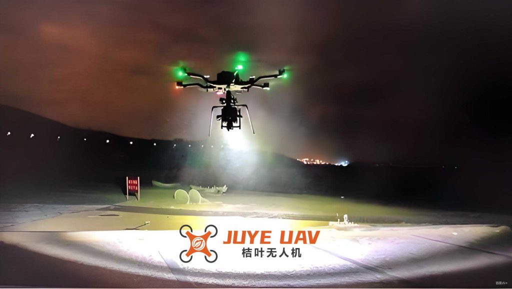
Our system employs an unmanned inspection mode, where lighting UAVs operate autonomously along predefined routes. To ensure continuous operation, we establish networks of drone landing pads equipped with charging stations, addressing limitations in battery life and range. For precise navigation, we utilize Real-Time Kinematic (RTK) high-precision positioning technology, which relies on base stations and mobile receivers to achieve centimeter-level accuracy. This is crucial for urban areas where obstacles like buildings can interfere with signals. The lighting drones are selected based on stability, controllability, endurance, and payload capacity. For example, we use quadcopter-style lighting UAVs with advanced flight control systems and inertial measurement units (IMUs) to maintain stability under varying wind conditions. The endurance is enhanced through high-capacity batteries, allowing flights of up to 30 minutes, while the payload supports devices such as HD cameras and thermal sensors. Key specifications for our lighting drone platform are summarized in Table 1.
| Parameter | Value | Description |
|---|---|---|
| Stability | Wind resistance up to 12 m/s | Achieved through IMU and flight control systems |
| Controllability | Autonomous flight with real-time telemetry | Includes obstacle avoidance and route planning |
| Endurance | 30 minutes per charge | Using lithium-polymer batteries |
| Payload Capacity | 1.5 kg | Supports cameras and thermal imagers |
| Positioning Accuracy | < 10 cm with RTK | Ensures precise location data for inspections |
Multi-Source Device Integration
To achieve comprehensive inspections, our lighting drones are integrated with multiple sensors. The HD camera captures visual data at resolutions up to 4K, enabling detailed analysis of lamp conditions, such as whether they are lit or damaged. The infrared thermal imager detects temperature variations, identifying potential faults like overheating in electrical components. This multi-source approach allows for simultaneous collection of visual and thermal data, which is processed in real-time or post-flight. For instance, the thermal imager can pinpoint hotspots in transformers or wiring, while the camera assesses physical integrity. The data fusion from these devices enhances the reliability of fault detection, making the lighting UAV system a versatile tool for urban lighting management.
Key Algorithms and Deep Learning Techniques
At the heart of our system are deep learning and visual recognition algorithms. We employ a YOLOv5-based convolutional neural network (CNN) for object detection, which is optimized for speed and accuracy. The algorithm processes images from lighting drones to identify faults such as extinguished lamps or structural defects. Key techniques include Mosaic data augmentation, adaptive anchor box computation, and feature fusion networks. For example, Mosaic augmentation combines multiple images into one, increasing dataset diversity and improving model robustness. The adaptive anchor mechanism adjusts bounding boxes based on the dataset characteristics, which is particularly useful for low-contrast nighttime images captured by lighting UAVs. The mathematical formulation for anchor box calculation is derived from the aspect ratio and area, as shown in Equation 1:
$$ w = \text{ratio} \times h, \quad s = \text{ratio} \times h^2 $$
where \( w \) is the width, \( h \) is the height, \( s \) is the area, and \( \text{ratio} \) is the aspect ratio. This equation ensures that anchor boxes are tailored to the specific dimensions of lighting components, enhancing detection precision. Additionally, we use the Complete Intersection over Union Loss (CIOU_Loss) as the loss function and Distance Intersection over Union Non-Maximum Suppression (DIOU_nms) for post-processing, which refine the bounding box predictions and reduce false positives.
System Design and Implementation
Our intelligent inspection system is designed as a seamless workflow involving data acquisition, processing, and response. The overall process is divided into two main stages: the inspection phase and the data processing phase. In the inspection phase, lighting UAVs follow pre-programmed routes, capturing video footage of urban lighting facilities. Upon returning to base, the data is uploaded to servers for analysis. In the processing phase, the video is fed into a trained YOLOv5 model for fault detection, and any identified issues are automatically reported to a maintenance platform for dispatch. This closed-loop system ensures timely repairs and efficient resource allocation.
Overall Workflow
The workflow begins with route planning for the lighting drones, considering factors like urban layout and lighting density. During flight, the lighting UAVs capture continuous video streams, which are stored locally and transmitted to cloud servers. The data is then processed using our deep learning model, which outputs detection results such as the location and type of faults. If an anomaly is detected—for example, a malfunctioning lamp—the system generates a work order and assigns it to maintenance teams. This automated process reduces human intervention and accelerates response times, making the lighting drone system highly efficient for large-scale urban areas.
Network Model Architecture
The neural network model for our system is based on YOLOv5, which consists of four main components: input, backbone, neck, and head. The input module uses Mosaic data augmentation and adaptive anchor computation to preprocess images, improving the model’s ability to handle varied lighting conditions. The backbone employs a Focus structure and CSP (Cross Stage Partial) networks to reduce information loss during downsampling and enhance feature extraction. The neck module combines FPN (Feature Pyramid Network) and PAN (Path Aggregation Network) for multi-scale feature fusion, which is crucial for detecting objects of different sizes, such as lamp posts and fixtures. Finally, the head module uses CIOU_Loss and DIOU_nms for output refinement. The network’s architecture can be represented mathematically through convolution operations and loss functions. For instance, the Focus operation slices an input image into patches, increasing channel depth while preserving spatial information. Given an input image of size \( 640 \times 640 \times 3 \), the Focus operation outputs a feature map of size \( 320 \times 320 \times 12 \), followed by convolution to \( 320 \times 320 \times 32 \). This process minimizes downsampling artifacts and is expressed as:
$$ \text{Focus}(I) = \text{Concat}(I[::2, ::2], I[1::2, ::2], I[::2, 1::2], I[1::2, 1::2]) $$
where \( I \) is the input image, and the slicing operation extracts pixels at intervals. The CSP structure splits the feature map into two paths, processing one through residual blocks and concatenating with the other to improve gradient flow. This design enhances learning efficiency and detection accuracy for lighting UAV applications.
Dataset and Experimental Analysis
To validate our system, we conducted experiments using a dataset collected from various urban roads via lighting drones. The dataset includes video footage of different lighting scenarios, such as elevated highways and flat streets, captured at night to simulate real-world conditions. We processed the videos into image frames and annotated them with labels for normal and faulty lamps. The dataset was split into 70% for training and 30% for testing, ensuring robust model evaluation.
Dataset Composition and Preprocessing
Our dataset comprises over 10,000 images from multiple routes, each video recorded at 30 frames per second for approximately 10 minutes. The images cover diverse environments, including areas with obstructions like trees and signs, which challenge detection algorithms. We applied data augmentation techniques, such as random scaling and cropping, to increase variability. The annotations include bounding boxes for lamp heads, with classes for “normal” and “faulty” based on illumination status. This dataset is essential for training the YOLOv5 model to recognize subtle features in lighting UAV imagery.
Prediction Process and Model Training
We trained the YOLOv5 model using the dataset, with modifications to the anchor boxes to suit the characteristics of lighting components. The initial anchor sizes were adjusted from the default 16×16 to 64×64, with aspect ratios of 1:3, 1:1, and 2:1, as defined by the parameter ratios = [0.33, 1, 2]. This adaptation improved the model’s performance on low-contrast targets, such as unlit lamps at night. During training, we used a batch size of 16 and trained for 100 epochs, monitoring metrics like confidence loss and intersection over union (IoU). The IoU threshold for positive detections was set to 0.62, while backgrounds were defined as IoU < 0.3. The training process involved optimizing the model parameters through backpropagation, with the loss function combining classification and localization errors. The overall loss \( L \) is given by:
$$ L = \lambda_{\text{coord}} \sum_{i=1}^{S^2} \sum_{j=1}^{B} \mathbb{1}_{ij}^{\text{obj}} \left[ (x_i – \hat{x}_i)^2 + (y_i – \hat{y}_i)^2 + (w_i – \hat{w}_i)^2 + (h_i – \hat{h}_i)^2 \right] + \lambda_{\text{obj}} \sum_{i=1}^{S^2} \sum_{j=1}^{B} \mathbb{1}_{ij}^{\text{obj}} \left( C_i – \hat{C}_i \right)^2 + \lambda_{\text{noobj}} \sum_{i=1}^{S^2} \sum_{j=1}^{B} \mathbb{1}_{ij}^{\text{noobj}} \left( C_i – \hat{C}_i \right)^2 + \sum_{i=1}^{S^2} \mathbb{1}_{i}^{\text{obj}} \sum_{c \in \text{classes}} \left( p_i(c) – \hat{p}_i(c) \right)^2 $$
where \( S^2 \) is the grid size, \( B \) is the number of anchors, \( \mathbb{1}_{ij}^{\text{obj}} \) is an indicator function for object presence, \( x, y, w, h \) are bounding box coordinates, \( C \) is the confidence score, and \( p(c) \) is the class probability. The weights \( \lambda_{\text{coord}}, \lambda_{\text{obj}}, \lambda_{\text{noobj}} \) balance the loss components.
Results and Performance Analysis
We evaluated the model on test datasets from different road types, comparing the baseline YOLOv5 with our modified version. The results, summarized in Table 2, show that our adaptive anchor approach significantly improves detection rates, especially in complex environments like flat streets. For instance, on a flat road segment, the fault detection accuracy increased from 92.6% to 93.8%, demonstrating the effectiveness of our customization for lighting UAV applications. The confusion matrix and confidence curves indicate high precision and recall, with overall accuracy exceeding 96% for fault detection and 99% for normal lamps. Sample detection outputs are visualized, highlighting the system’s ability to identify extinguished lamps and other anomalies in real-time.
| Algorithm | Elevated Road 1 (%) | Elevated Road 2 (%) | Flat Road 1 (%) | Flat Road 2 (%) |
|---|---|---|---|---|
| Default Anchor | 97.5 | 96.4 | 92.6 | 93.9 |
| Custom Anchor (Ours) | 97.4 | 96.6 | 93.8 | 95.2 |
The performance metrics confirm that our lighting drone system achieves robust fault identification, with minimal false positives. The use of lighting UAVs enables comprehensive coverage, and the deep learning model adapts to varying conditions, ensuring reliability across urban landscapes. Further analysis of the loss curves shows rapid convergence during training, indicating stable learning dynamics. The system’s efficiency is enhanced by edge computing, which allows for on-device processing in future iterations, reducing latency for real-time applications.
Conclusion and Future Prospects
In conclusion, our intelligent inspection system utilizing lighting UAVs and lighting drones represents a significant advancement in urban lighting management. By integrating deep learning, visual recognition, and autonomous drone technology, we have developed a solution that addresses the inefficiencies of traditional methods. The system achieves high accuracy in detecting faults such as extinguished lamps, structural issues, and thermal anomalies, facilitating prompt maintenance and reducing operational costs. The customized YOLOv5 model, with adaptive anchors and data augmentation, proves effective in handling the challenges of urban environments, as evidenced by our experimental results. Looking ahead, the continuous evolution of UAV technology and AI algorithms will further enhance the capabilities of lighting drone systems. We envision expansions into predictive maintenance, energy optimization, and integration with smart city platforms, contributing to safer, more sustainable urban living. The adoption of lighting UAVs not only improves inspection quality but also supports broader goals of digital transformation, making our system a valuable tool for cities worldwide.