The pre-dawn mist still clings to the rugged peaks of Changting County when the first forestry drone silently ascends from its automated nest in Cewu Town. Below, forests that once demanded grueling, days-long patrols by foot or motorcycle are now mapped in near real-time on a central command screen. This is the new frontier of wilderness management, where forestry drones are not just tools, but intelligent partners safeguarding vast, often inaccessible, ecosystems.
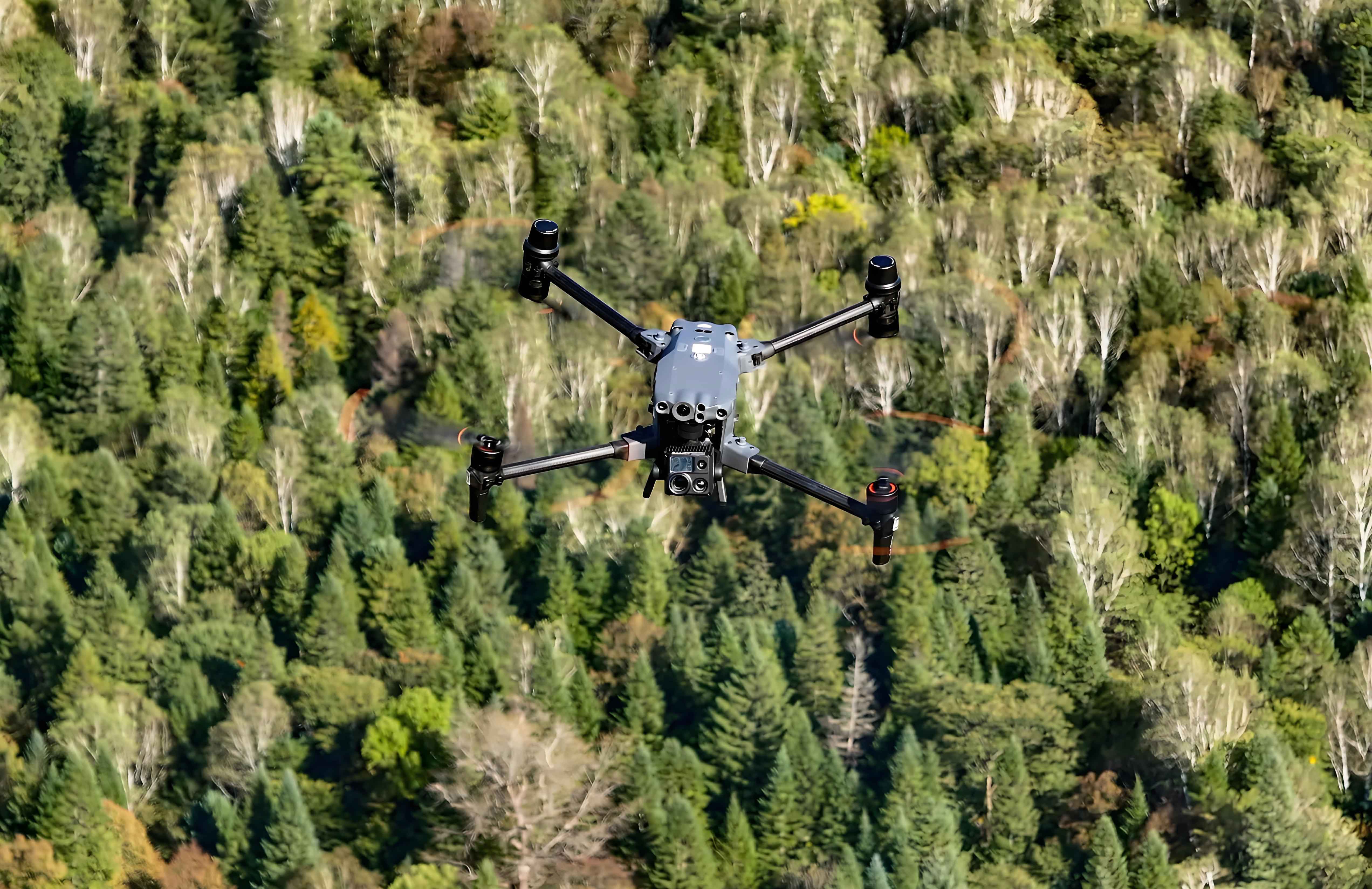
At the county’s Intelligent Forestry Center, operators like Hu Xiaohua begin their day not with boots and backpacks, but with sophisticated control interfaces. With a few commands, forestry drones embark on pre-programmed routes, their high-resolution and infrared cameras scanning thousands of hectares. Strategically positioned across five key townships – Datong, Cewu, Hetian, Zhuotian, and Sidu – these aerial sentinels ensure near-total coverage of critical forest zones. “Select the area on the map,” Hu explains, gesturing to the live feed, “and the system handles the rest. The drone departs, patrols autonomously, and brings the forest to us.”
This transformation stems from Changting County’s strategic embrace of the “forestry drone + ecosystem management” model. Facing the immense challenges of monitoring remote, mountainous terrain for illegal logging, wildfires, and disease outbreaks like pine wilt, traditional methods proved inefficient and perilous. The solution emerged as an integrated Forestry Drone Intelligent Management Platform, harnessing AI, big data analytics, and automated response systems.
The power lies not just in flight, but in intelligent perception. Equipped with advanced sensors, these forestry drones capture vast streams of visual and thermal data. Onboard AI algorithms process this information in near real-time, instantly flagging anomalies: the tell-tale heat signature of an unauthorized fire, the fresh scar of illegal timber cutting, or the distinctive discoloration of diseased trees. Crucially, the platform doesn’t just detect; it initiates action. Identified incidents are autonomously categorized, geotagged, and routed directly to the nearest forestry station for immediate dispatch of ground teams. This creates a seamless, closed-loop system: “Automatic Detection → Intelligent Dispatch → Rapid Ground Response → Automated Verification and Closure.”
The impact on efficiency and effectiveness is staggering. For veteran rangers like Fan Binkun, Chief of the Cewu Township Forestry Station, the change is profound. “Before forestry drones, we battled blind spots constantly,” he reflects. “Remote valleys, dense thickets – they were beyond practical reach. Now, alerts come directly from the sky. We know exactly where to go and what we’re facing. It’s transformative.” The data underscores his experience. Since deployment, Changting’s fleet of five forestry drones has executed over 6,056 patrol missions, covering an astonishing 56,235 kilometers. They’ve captured nearly 450,000 high-definition images and transmitted over 5,800 video streams. Critically, in the past year alone, the AI platform detected 1,612 actionable incidents – every single one was resolved, achieving a 100% closure rate.
The benefits cascade far beyond mere incident response. The relentless, high-altitude perspective of forestry drones provides an unprecedented historical record. Every flight’s data is meticulously stored, enabling precise temporal comparisons for ecological monitoring, change detection, and strategic planning. Rangers can now track forest health trends, assess reforestation progress, and verify land-use patterns with scientific rigor, providing invaluable data for policymakers and conservation scientists. Furthermore, the shift from labor-intensive ground patrols to aerial surveillance yields substantial cost and environmental savings. The county estimates a reduction of over 6,000 manual patrols annually, slashing operational costs by more than 900,000 RMB and cutting carbon emissions by approximately 14.3 tons – a significant green dividend from green technology.
Perhaps most significantly, forestry drones enhance ranger safety. Sidu Township, encompassing some of Changting’s most treacherous and remote forested mountains, epitomized the dangers of traditional patrols. Steep slopes, unstable terrain, and sheer isolation posed constant risks. “With the forestry drone covering vast distances quickly and safely, our patrol time is shorter, our coverage is wider, and our exposure to hazards is drastically reduced,” states Lai Wengen, a ranger in Sidu. The drone becomes a scout, eliminating the need for rangers to blindly enter potentially dangerous situations before assessing them from above.
The role of forestry drones in Changting is rapidly evolving beyond surveillance. They are becoming versatile aerial workhorses. In the dense woodlands near Tongren Village, Sidu Township, Liao Lianke, General Manager of Xinwang Forestry Service, demonstrates a powerful new application. A forestry drone, equipped with a secure tether, effortlessly lifts a heavy section of beetle-infested pine wood – a task that previously required multiple workers risking injury on steep slopes. The drone smoothly navigates the complex topography, transporting the hazardous material directly to a processing site. “Machinery often can’t reach these areas,” Liao explains. “The forestry drone solves that. It’s changing how we operate.” Similarly, forestry drones are now routinely employed for precision seeding in reforestation projects, transporting saplings and organic fertilizers to inaccessible slopes, and targeted aerial spraying of bio-pesticides to combat insect outbreaks, minimizing chemical drift and maximizing efficiency.
The Changting model demonstrates a fundamental shift. Forestry drones, integrated into a smart, AI-driven management ecosystem, are no longer experimental gadgets but core infrastructure for modern forestry. They provide persistent, intelligent oversight, transforming how we protect, manage, and restore vital forest ecosystems. They augment human capability, enhance safety, deliver unparalleled data, and unlock new operational possibilities. As the sun sets over the revitalized hills of Changting, the soft hum of returning forestry drones signals more than the end of a patrol; it heralds a smarter, safer, and more sustainable future for wilderness stewardship, where technology truly gives conservation wings. The sky is no longer the limit; it’s the vantage point.