
The establishment of a three-dimensional patrol and prevention system has long been a goal for public security organs worldwide. Beyond traditional two-dimensional methods like human patrols, physical barriers, and technical defenses, the advent of aerial policing has genuinely realized three-dimensional立体防控. While police helicopters have served in macro-level public security for decades, the police drone, as a component of the police aviation system, is garnering increasing attention for its micro-level capabilities. Its integration into daily patrol operations represents a significant shift towards intelligent and spatially layered policing, creating an integrated air-ground网格化巡逻防控体系.
1. Conceptual Foundation and Current Landscape of Police Drones
A police drone, also termed an Unmanned Aerial Vehicle (UAV) or Uncrewed Aircraft System (UAS) in a policing context, is defined as an aircraft with no pilot on board, operated by law enforcement agencies specifically for executing police duties. This definition hinges on three core elements: the user is the police force, the purpose is legitimate law enforcement activity, and the key characteristic is the absence of an onboard human pilot. The operational scope of a modern police drone system extends far beyond the aircraft itself, encompassing a suite of integrated components as illustrated below:
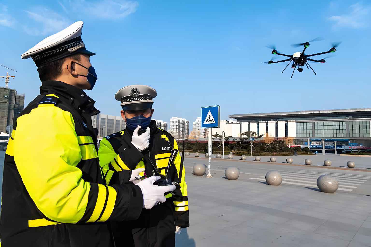
The proliferation of police drone applications marks a pivotal trend in modern policing. Following regulatory clarifications that formally brought police drones under aviation management, their adoption has accelerated. Training centers and specialized academic programs have emerged to cultivate expertise. From provincial-level UAV corps to municipal police aviation squadrons, the institutional framework is expanding, supported by tactical training and exercises conducted in collaboration with industry leaders. The practical applications for this technology are vast and growing, as summarized in the following table comparing core functional domains:
| Operational Domain | Primary Applications of Police Drone |
|---|---|
| Criminal Investigation | Thermal imaging reconnaissance, precision location tracking, search operations, aerial crime scene photography and mapping. |
| Public Order & Patrol | Real-time visualization of emergencies,定点巡航 (fixed-point cruising), aerial loudspeaker announcements, large-event crowd monitoring. |
| Traffic Management | Real-time traffic flow monitoring and预警 (early warning), violation detection (e.g., illegal parking, wrong-way driving), accident scene assessment and diagramming. |
| Emergency Response & Rescue | Infrared search in disasters, delivery of emergency supplies, initial assessment of fires or hazardous material incidents, lifeline deployment to inaccessible victims. |
| Narcotics Enforcement | Low-altitude surveillance for illicit crop cultivation, aerial monitoring of suspicious locations, public awareness campaigns. |
2. Strategic Analysis of Police Drone Deployment in Patrol
Effectively integrating police drones into patrol frameworks requires a clear understanding of their inherent strengths, weaknesses, and the external landscape. A structured SWOT (Strengths, Weaknesses, Opportunities, Threats) analysis provides this strategic insight.
| Category | Analysis |
|---|---|
| Strengths (Internal) |
|
| Weaknesses (Internal) |
|
| Opportunities (External) |
|
| Threats (External) |
|
This analysis dictates a focused development path: acquiring longer-endurance, quieter police drones; leveraging patrol vehicles as mobile control nodes; building a tactically savvy pilot corps; fostering industry partnerships for advanced training; and relentlessly exploring new functional integrations for the police drone platform.
3. Constructing the “Police Drone +” Patrol and Prevention Model
The “Police Drone +” model is a systematic, integrated framework where the police drone acts as a central enabling technology for立体化巡逻防控. It functions as the aerial dimension (“空防”) complementing ground personnel (“人防”), physical barriers (“物防”), and technical sensors (“技防”). Architecturally, it centers on a Police Tactical Unit (PTU) patrol vehicle, upgraded to serve as a mobile command and control hub for one or more police drones, all networked to the central 110 command center.
3.1 Core Architectural Components
The model’s efficacy relies on three tightly integrated components:
1. The Police Drone Mobile Command & Control System: This is the cognitive core. It is a consolidated platform handling image processing, wireless transmission, remote control, and mission planning. Crucially, it interfaces with essential police databases (e.g., Geographic Information Systems (GIS), wanted persons databases). Its functions can be modeled as a control loop. Let the system state be represented by a vector \( S(t) \), encompassing drone position, sensor status, and data flow. The command input \( C(t) \) from the operator or automated protocol drives the system. The output \( O(t) \) is the actionable intelligence (video feed, target coordinates) delivered to the patrol team and command center. The system aims to optimize a performance function \( P(S, C, O) \), which could represent metrics like area coverage per unit time or target identification speed.
$$ P(S, C, O) = \alpha \cdot \text{Coverage}(S,C) + \beta \cdot \text{Info\_Quality}(O) – \gamma \cdot \text{Resource\_Cost}(C) $$
where \( \alpha, \beta, \gamma \) are weighting coefficients for coverage, information quality, and operational cost, respectively.
2. The Certified Police Drone Pilot (“飞手”): The human element remains irreplaceable. The pilot, holding a specialized police UAV license, is responsible for safe flight, mission execution, sensor operation, and initial data analysis. Their skill directly impacts the performance function \( P \).
3. The Ground-Based Mobile Control Vehicle (Enhanced PTU): This is the physical and logistical hub. The vehicle interior is reconfigured into distinct zones:
| Vehicle Zone | Function & Equipment |
|---|---|
| Central Control Area | Large displays for real-time drone feeds, situation map, communication console for command decisions. |
| Pilot Operation Area | Ergonomic workstation with flight controllers, C2 system terminals, and communication headsets. |
| Logistics & Storage Area | Secure storage for multiple police drones, batteries, spare parts, and alternative payloads (e.g., loudspeaker, delivery mechanism). |
| Vehicle Exterior / Roof | Dedicated take-off/landing pad, 5G/4G communication relay antenna to extend control link range. |
3.2 Operational Protocols and Management
A robust operational framework is essential for safe, legal, and effective use.
Authorization Protocol: Strict pre-flight procedures are mandated. Every police drone must be registered with a unique ID. Flight authorization depends on parameters: for micro-drones (≤ 7 kg) operating within visual line-of-sight (VLOS) for standard patrols, unit commander approval suffices. For beyond visual line-of-sight (BVLOS) or complex airspace, coordination with civil aviation authorities is required. The pilot must always carry relevant certificates.
Patrol Execution Cycle: A standard mission follows a defined cycle, which can be seen as an optimization sequence to maximize operational readiness and data yield.
- Pre-flight (Check & Plan): A thorough checklist is followed: hardware inspection, system power-up, control link verification, payload check, and airspace/weather briefing. Mission parameters (waypoints, altitude, primary objectives) are programmed. Let \( R \) represent the drone’s readiness score, a function of \( n \) checked items \( x_i \) (e.g., battery level, GPS lock): \( R_{pre} = \sum_{i=1}^{n} w_i \cdot x_i \), where \( w_i \) is the weight/importance of item \( i \). A mission proceeds only if \( R_{pre} > R_{threshold} \).
- In-flight (Execute & Monitor): The police drone executes its planned route or responds to dynamic commands. The pilot monitors telemetry (altitude \( h \), speed \( v \), battery voltage \( V \)) and sensor output. A simple kinematic model for a patrol segment between two points \( A \) and \( B \) separated by distance \( d \) would estimate flight time \( t_{AB} = \frac{d}{v} \), which is constantly balanced against remaining battery life.
- Post-flight (Return & Maintain): The police drone returns to the vehicle, guided by precision landing. Data is downloaded, archived, and analyzed. The system undergoes maintenance (battery charging/cycling, cleaning, inspection) to restore \( R \) to its maximum value for the next mission: \( R_{post} \rightarrow R_{max} \).
Management & Training Ecosystem: Centralized aviation management offices oversee policy, procurement, and standards. Training adopts a “train-the-trainer” and competition-driven model, blending academy instruction, vendor technical training, and tactical exercises to produce pilots capable of translating flight skill into policing outcomes.
3.3 Dual-Function Operational Paradigm
The “Police Drone +” model delivers value through two complementary operational paradigms:
1. Routine Fixed-Point Cruise & Area Monitoring: This is the proactive, persistent surveillance mode. Police drones are deployed from fixed kiosks or patrol vehicles on pre-programmed routes covering关键区域 (key areas). Operating in automated orbit or waypoint patterns, they provide a constant aerial sentinel. The effectiveness of such a grid can be conceptualized. If \( N \) police drones are deployed, each with a sensor footprint area \( A_{sensor} \) and an average flight time \( T \), the total daily coverage area \( A_{total} \) is not simply \( N \times A_{sensor} \), but must account for overlap \( O \) and repositioning time \( t_{reposition} \):
$$ A_{total} \approx \sum_{i=1}^{N} \left( \frac{T_i}{t_{orbit_i} + t_{reposition_i}} \cdot (A_{sensor_i} – O_i) \right) $$
This function guides the optimization of patrol routes and drone numbers for maximal, overlapping coverage of high-priority zones.
2. Dynamic Tactical Response (“Wartime” Operations): This is the reactive, incident-driven mode. When a call is received or a suspicious event is observed, the police drone becomes a rapid response tool. Its advantages are quantified in terms of response time and pursuit kinematics. For a suspect fleeing at speed \( v_s \), a ground unit moving at \( v_g \) with a delay \( t_{d,ground} \) due to traffic has a closing time that can be long. A police drone launched from a nearby PTU vehicle, with ascent time \( t_{ascend} \) and cruise speed \( v_d \) (where \( v_d >> v_s \) and often \( v_d > v_g \)), can achieve visual contact much faster. The time \( t_{intercept} \) for the drone to reach the suspect located at initial distance \( d_0 \) is governed by:
$$ d_0 + v_s \cdot t_{intercept} = \frac{1}{2} a_{ascend} \cdot t_{ascend}^2 + v_d \cdot (t_{intercept} – t_{ascend}) $$
(assuming constant acceleration during ascent \( a_{ascend} \)). Solving for \( t_{intercept} \) demonstrates the significant time advantage of the aerial asset, enabling quicker tracking, containment, and intelligence-led ground interdiction.
| Operational Paradigm | Primary Function | Key Performance Metric |
|---|---|---|
| Routine Fixed-Point Cruise | Deterrence, Persistent Surveillance, Anomaly Detection | Area Coverage Rate (\( A_{total} / \text{time} \)), Pre-emption Rate of Incidents |
| Dynamic Tactical Response | Incident Response, Suspect Pursuit/Tracking, Scene Management | Response Time (\( t_{intercept} \)), Tracking Success Rate, Officer Safety Enhancement |
The integration of these paradigms—persistent automated awareness paired with agile tactical response—defines the powerful synergy of the “Police Drone +” model. It transforms the police drone from a simple flying camera into a intelligent node in a responsive grid, enabling forward warning, forward command, and forward intervention. The future of this model lies in further technological integration: advanced AI for automated threat detection, silent propulsion, sophisticated payloads (e.g., non-lethal deterrents), and seamless fusion with augmented reality systems for ground officers. The police drone has firmly established itself as indispensable tactical equipment, and its deep integration into air-ground joint patrol mechanisms is an inexorable trend in the evolution of 21st-century policing.