
In recent years, the integration of drone technology into aerial photogrammetry has transformed geospatial education, particularly in vocational colleges and universities offering surveying and geographic information programs. As an educator in this field, I have witnessed firsthand the challenges of outdoor drone training, which requires specific take-off sites, clear airspace, and poses significant safety risks such as crashes and injuries. These hurdles often hinder effective teaching and practical training. To address these issues, drone aerial photogrammetry simulation systems have emerged as a powerful tool, enabling immersive, safe, and efficient learning experiences. This article explores the application of such simulation systems in education, emphasizing their role in enhancing drone training through theoretical, virtual, and practical integration.
The core of a drone aerial photogrammetry simulation system lies in its ability to replicate real-world flight and data acquisition processes indoors. It typically consists of a detailed terrain sandbox, a high-precision rail system, control mechanisms for camera movement, and specialized software for orbit and exposure management. These components work together to simulate drone flight paths, allowing students to engage in comprehensive drone training without the dangers associated with outdoor operations. Below is a table summarizing the key components and their functions:
| Component | Specifications | Primary Function |
|---|---|---|
| Terrain Sandbox | Dimensions: 7m x 5m; Features: residential areas, schools, roads, rivers, hills, parks | Provides a realistic scale model for data capture and 3D modeling, supporting various surveying exercises. |
| Rail System | I-shaped tracks with parallel rails and a movable crossbeam; controlled by stepper motors | Mimics drone flight by moving the camera along predefined paths, ensuring precise positioning. |
| Control System | PC-based with microcontrollers, motor drivers, and synchronization modules | Orchestrates camera movement and exposure timing, simulating GPS-like coordinates for each shot. |
| Software Suite | Includes orbit design, exposure control, image processing, and 3D modeling tools | Enables flight planning, data processing, and product generation like digital orthophotos and DEMs. |
The simulation system operates by having the camera mounted on the rail move at controlled speeds, with exposures triggered at intervals to achieve specific overlap ratios. For instance, the forward overlap (along-track) and side overlap (across-track) are critical parameters in photogrammetry. These can be calculated using formulas such as:
$$ \text{Forward Overlap} = \left(1 – \frac{D_a}{C_a}\right) \times 100\% $$
$$ \text{Side Overlap} = \left(1 – \frac{D_s}{C_s}\right) \times 100\% $$
Where \( D_a \) and \( D_s \) are distances between exposures along and across the track, respectively, and \( C_a \) and \( C_s \) are the image coverage dimensions. In typical drone training scenarios, a forward overlap of 70% and side overlap of 35% are maintained, similar to real drone missions. The system’s camera, with a CCD size of 35.8 mm × 23.9 mm and a height of 3 m above the sandbox, allows students to experiment with these parameters, reinforcing core concepts in drone training.
The advantages of using a drone aerial photogrammetry simulation system are manifold, particularly in educational settings. First and foremost, it eliminates safety concerns associated with outdoor drone training, preventing accidents and ensuring a risk-free environment. Secondly, it breaks spatial constraints, enabling year-round instruction regardless of weather conditions. This aligns with modern educational trends that leverage information technology, such as virtual reality and artificial intelligence, to upgrade traditional curricula. Moreover, the system fosters a “theory-virtual-practice” integrated approach, where students can transition seamlessly from learning concepts to simulating flights and handling real data. This holistic method enhances engagement and retention in drone training programs. The table below highlights these advantages:
| Advantage | Description | Impact on Drone Training |
|---|---|---|
| Safety Assurance | No risk of drone crashes or injuries during indoor operations. | Allows frequent, hands-on practice without safety protocols, boosting confidence in drone training. |
| Spatial Flexibility | Indoor use negates need for open fields or clear airspace. | Enables consistent training sessions, improving skill development in drone training modules. |
| Technology Integration | Combines hardware and software for immersive learning. | Prepares students for industry-standard tools, enhancing employability after drone training. |
| Curriculum Alignment | Supports “theory-virtual-practice” pedagogy. | Facilitates deeper understanding of photogrammetry principles through iterative drone training. |
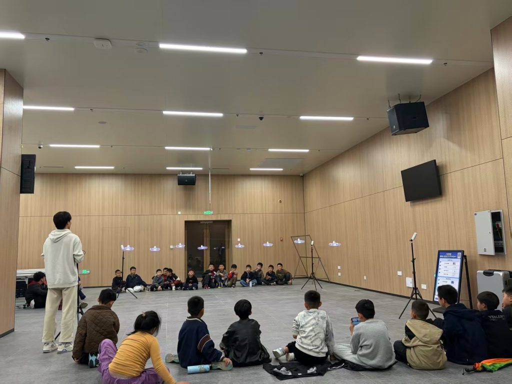
In practical applications, drone aerial photogrammetry simulation systems serve multiple roles across education and industry. For curriculum delivery, they meet the demands of courses focused on drone operations, data acquisition, and processing. Students can design flight plans, capture images, and generate 4D products (like digital surface models and orthophotos), all within a controlled setting. This hands-on experience is crucial for mastering drone training competencies. Additionally, the system promotes teacher development by encouraging innovative instructional designs and collaborations with enterprises. For example, schools can partner with surveying companies to create production-like projects, giving students real-world exposure. Such partnerships often involve developing training modules that simulate tasks like control point surveying or 3D modeling, further enriching the drone training ecosystem.
Another significant application is in supporting rural revitalization efforts. Through simulated drone training, students can analyze village landscapes and cultural heritage sites, aiding in tourism planning and conservation. This not only applies technical skills but also fosters social responsibility. The system also acts as a foundation for establishing specialized training centers, where extended programs—including second classroom activities—complement formal education. These centers can offer certifications, such as AOPA licenses, by combining indoor theory sessions with outdoor flight practice. The latter involves using training drones to bridge simulation and reality, a step essential for comprehensive drone training. To quantify the benefits, consider the efficiency gains: a simulation system can reduce training time by up to 30% compared to traditional methods, as shown in the formula for training effectiveness:
$$ E_t = \frac{T_s}{T_o} \times S_a $$
Where \( E_t \) is training effectiveness, \( T_s \) is time spent in simulation, \( T_o \) is time required outdoors, and \( S_a \) is safety adjustment factor (typically >1 due to reduced risks). This underscores the value of integrated drone training approaches.
Furthermore, simulation systems enhance social service capabilities by facilitating workshops and public training sessions. For instance, institutions can host short courses on drone piloting for professionals, covering topics from regulations to data processing. The table below outlines a typical drone training curriculum split between indoor and outdoor components:
| Training Phase | Content | Tools Used | Outcome |
|---|---|---|---|
| Indoor Theory | Aviation laws, meteorology, aerodynamics, flight principles | Simulation software, lectures | Foundational knowledge for drone training and certification exams. |
| Indoor Simulation | Flight path design, camera control, overlap calculations | Rail system, control software | Proficiency in virtual drone operations, a key part of drone training. |
| Outdoor Practice | Actual drone handling, data collection in fields | Training drones (e.g., DJI models) | Real-world skills, completing the drone training cycle. |
From a pedagogical perspective, the integration of simulation systems encourages active learning. Students can experiment with different parameters, such as flight altitude or camera angles, and observe outcomes instantly. For example, altering the height \( H \) in the photogrammetric scale formula:
$$ \frac{1}{m} = \frac{f}{H} $$
Where \( f \) is focal length and \( m \) is scale denominator, allows them to see how resolution changes. This iterative process solidifies concepts taught in drone training courses. Moreover, the system’s ability to generate datasets for software like Pix4D or Agisoft Metashape enables students to practice post-processing—a critical skill in modern drone training programs. By working on projects from start to finish, learners develop problem-solving abilities and readiness for industry challenges.
In conclusion, drone aerial photogrammetry simulation systems are transformative tools for education, addressing safety, spatial, and pedagogical limitations. They provide a robust platform for drone training, blending theory, simulation, and practice to produce skilled professionals. As technology advances, these systems will likely incorporate more AI-driven features, such as automated flight planning or real-time data analytics, further enriching the learning experience. For educators and institutions, investing in such simulations is not just about keeping pace with trends but about fostering a safer, more effective environment where students can thrive in the evolving field of geospatial sciences. Through continued innovation, drone training will remain at the forefront of vocational education, empowering the next generation of surveyors and remote sensing experts.