
In recent years, the rapid proliferation of unmanned aerial vehicles (UAVs) has brought unprecedented challenges to the security of critical infrastructure. The petrochemical industry, characterized by its inherent risks of flammability, explosion, high temperature, high pressure, and toxic hazards, has become a prime target for malicious UAV intrusions. Large oil and gas stations, refineries, and natural gas purification plants are particularly vulnerable. From my experience in engineering management, I have observed that many facilities still rely on manual patrols and ground-based security measures, leaving the airspace above these installations completely unprotected. This article presents a comprehensive design approach for an anti-UAV defense system based on satellite navigation spoofing technology, tailored specifically for large oil and gas stations. The discussion emphasizes drone regulation compliance, technical comparisons, and practical implementation details.
1. The Need for Airspace Protection
Traditional security systems in oil and gas stations focus on perimeter intrusion detection, video surveillance, and access control. However, these measures are ineffective against airborne threats. Unmanned aerial vehicles can fly over fences, bypass ground sensors, and potentially deliver explosives or conduct surveillance. Recent incidents worldwide have demonstrated that even small consumer drones can cause catastrophic damage when flown into sensitive areas. Therefore, a robust anti-UAV system is essential. Drone regulation frameworks globally are still evolving, but operators of critical infrastructure must proactively adopt countermeasures to mitigate risks. The following table summarizes the common types of anti-UAV equipment and their applicability.
| Category | Technology | Description | Suitability for Oil/Gas Stations |
|---|---|---|---|
| Detection | Radar | Detects drones using radio waves; effective at long range but may have blind spots. | High cost; interference from metal structures |
| Optical/Infrared | Camera-based detection; requires good visibility and lighting. | Limited in fog/dust; needs manual monitoring | |
| Radio Frequency (RF) Spectrum | Passively listens to drone communication signals. | Cannot detect autonomous drones; requires database | |
| Identification | Database Matching | Compares detected signals with known drone fingerprints. | Heavy reliance on updated libraries; not feasible for enterprises |
| Machine Learning | AI-based identification of drone signatures. | Requires significant computing and data resources | |
| Countermeasure | Radio Jamming | Overwhelms drone control frequencies; indiscriminate. | Illegal for civilian use; high power; risk of disrupting other communications |
| Net Capture | Physical capture using nets launched from another drone or launcher. | Low range; requires line-of-sight; projectile adds risk in explosive environments | |
| Laser | High-energy laser to destroy or disable drones. | High cost; falling debris hazard; legal concerns | |
| Navigation Spoofing | Transmits fake GPS/GNSS signals to deceive drone’s navigation system. | Low power, no debris, fully automatic, compliant with drone regulation requirements; ideal for hazardous areas |
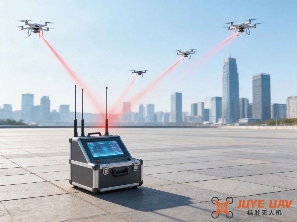
From the above comparison, it is clear that navigation spoofing (also known as satellite navigation deception) offers the best balance of safety, legality, and effectiveness for oil and gas stations. The technology creates a virtual “no-fly zone” by emitting low-power counterfeit satellite signals that cause drones to either be repelled or forced to land. This approach aligns with current drone regulation guidelines that prohibit destructive countermeasures in civilian environments.
2. Technical Analysis of Counter-UAV Technologies
I have evaluated the four main countermeasure technologies in depth. The following table highlights their operational characteristics.
| Aspect | Radio Jamming | Net Capture | Laser | Navigation Spoofing |
|---|---|---|---|---|
| Unattended Operation | No | No | No | Yes |
| 24/7 Monitoring | No | No | No | Yes |
| 360° Coverage | Yes | No | No | Yes |
| Electromagnetic Radiation | High (>10 GW) | None | High | Low (<10 mW) |
| Impact on Surroundings | Large (blocks all RF) | Minimal | Large (thermal damage) | Minimal (only affects GNSS receivers) |
| Secondary Hazards | Possible (explosion if drone crashes) | None (if captured safely) | High (falling debris) | None (drones are guided away) |
| Cost | High | Moderate | Very high | Low |
| Swarm Defense | No | No | No | Yes |
The navigation spoofing system operates continuously without human intervention, emits power comparable to a mobile phone’s signal (less than 0.4 W/m² at the receiver), and is approved for use in explosive atmospheres with proper certifications. This makes it the only viable option for large oil and gas stations where safety and drone regulation compliance are paramount.
3. System Design Overview
Based on the specific requirements of a natural gas purification plant I worked with, I designed a complete anti-UAV defense system with three main components: front-end spoofing devices, signal transmission network, and a central management platform. The system creates a spherical protective zone with a radius of at least 500 meters around each device. The principle is based on the formula for the effective range of the spoofing signal:
$$ R_{\text{effective}} \ge 500\,\text{m} \quad \text{(configurable up to 1 km)} $$
Within this zone, any UAV relying on satellite navigation (GPS, GLONASS, BeiDou, Galileo) will be deceived. The spoofing device transmits carefully crafted signals that mimic authentic satellite constellations but with manipulated ephemeris data. The drone’s flight controller interprets these signals and either alters its course to fly away from the protected area or enters a fail-safe mode like landing. The mathematical model for the spoofing signal power is given by:
$$ P_{\text{spoof}} = P_{\text{true}} – \text{LinkMargin} + \text{ProcessingGain} $$
where \(P_{\text{true}}\) is the actual satellite signal power at the drone’s antenna (typically around -130 dBm), LinkMargin accounts for atmospheric losses (~2 dB), and ProcessingGain from the drone’s receiver (~40 dB) ensures the spoofed signal dominates after correlation. Because the spoofing transmitter is much closer than satellites, the required output power is extremely low, typically less than 10 mW. This is a critical advantage for drone regulation as it avoids interference with other radio services.
3.1 Equipment Placement
In the purification plant, four spoofing units were strategically located on existing lamp posts or monitoring poles to cover the main process areas, tank farms, and loading zones. Each unit has an explosion-proof enclosure rated Ex d IIC T6 Gb, suitable for Zone 1 hazardous areas. The coverage is omnidirectional (360°), but the system can be configured for directional operation if needed. The placement ensures compliance with the mandatory requirement in GA 1551.1-2019: “Oil storage depots shall be equipped with anti-UAV active defense systems approved by national regulations, and the signal range shall cover the tank area.”
3.2 Signal Transmission
The front-end devices communicate with the central management platform via a 4G/5G cellular network. Each device contains a SIM card for data uplink. The network provides the following functions:
- Account management: Administrators can create sub-accounts with different permission levels.
- Operation monitoring: Real-time view of SIM card status, data usage, online history, and IP addresses.
- Fault diagnosis: Quick identification of connectivity or hardware issues.
- Alarm management: Customizable rules to send email/SMS alerts when abnormal events occur (e.g., device offline, intrusion detected).
- Traffic reminders: Threshold-based notifications for data consumption.
However, based on operational experience, I recommend using wired transmission (e.g., fiber optic or Ethernet) rather than cellular. This reduces recurring costs and improves reliability, especially in remote areas with poor network coverage. Additionally, wired connections avoid potential latency issues that could affect real-time responses to drone regulation events.
3.3 Management Platform
The central server is located in the plant’s control center. It performs the following tasks:
- Collects and analyzes data from both detection and spoofing devices.
- Identifies UAV threats by extracting signal characteristics (e.g., frequency hopping patterns, protocol signatures).
- Estimates the direction and altitude of incoming drones.
- Displays real-time situation on a large monitor with GIS mapping.
- Automatically triggers spoofing when a confirmed threat is detected.
- Logs all events permanently for post-incident analysis and compliance audits.
The platform includes strict password authentication and role-based access control. For example, a security guard may only view live status, while an engineer can modify configuration parameters. This ensures that drone regulation requirements for data security and audit trails are satisfied.
4. Technical Specifications of Equipment
I have compiled the critical technical parameters for the two main device types used in this system.
4.1 UAV Detection Unit
| Parameter | Specification |
|---|---|
| Frequency Range | All common ISM bands (2.4 GHz, 5.8 GHz) and GNSS L bands |
| Detection Range | 3–5 km (line-of-sight) |
| Interface | Ethernet (RJ45), TCP/IP |
| Multi-Target Capability | Simultaneous tracking of >20 drones |
| Coverage | 360° omnidirectional |
| Power Supply | AC 220 V, 50/60 Hz |
| Operating Temperature | −40 °C to +70 °C |
| Protection Rating | IP65 |
| Integration | Can trigger spoofing devices via network |
4.2 UAV Navigation Spoofing Unit
| Parameter | Specification |
|---|---|
| Device Type | Active defense with directional/omnidirectional spoofing |
| Effective Range | 0.5–1.0 km (adjustable) |
| Transmit Power | ≤10 mW (EIRP) |
| Frequencies | GPS L1: $$1575.42 \pm 1.023\,\text{MHz}$$; GLONASS L1: $$1602.0 + N \times 562.5\,\text{kHz} \pm 511\,\text{kHz},\quad N = -7,\dots,6$$ |
| Frequency Tolerance | ≤ ±2 × 10⁻⁶ |
| Defense Angle | 360° (configurable to directional) |
| Operating Temperature | −40 °C to +70 °C |
| Protection Rating | IP65 |
| Explosion Proof | Ex d IIC T6 Gb |
| EM Radiation | <0.4 W/m² at 50 cm |
| Remote Control | Via mobile app or PC software |
| Certification | Must have test report from a national-level radio testing authority |
4.3 Computer Server
| Component | Specification |
|---|---|
| CPU | Quad-core, 2.33 GHz (minimum) |
| RAM | 8 GB (minimum) |
| Monitor | 1920 × 1080 resolution |
| Hard Drive | ≥100 GB (SSD recommended) |
All equipment must comply with national standards for drone regulation and industrial safety. The spoofing unit, in particular, must be certified by an accredited radio testing agency to ensure it does not interfere with legitimate GNSS services outside the protected zone.
5. Implementation Considerations and Recommendations
After deploying this system in the purification plant, I identified several important lessons and recommendations for future projects:
- Regulatory Approval: Before installation, coordinate with local public security bureaus, counter-terrorism offices, civil aviation authorities, and the radio regulatory commission. Even though navigation spoofing is less intrusive than jamming, it still requires approval under national drone regulation frameworks. In China, for example, the use of any GNSS interference equipment must be reported and licensed.
- Wired Transmission Preferred: Although cellular communication simplifies deployment, it incurs recurring data costs and can be unreliable in remote areas. I recommend using fiber optic or shielded twisted-pair Ethernet cables to connect the spoofing units to the management platform. This also eliminates potential latency issues that could affect real-time threat response.
- Integrate Detection: In my initial design, the spoofing units operated 24/7 without a detection trigger. This caused sporadic interference with GPS-enabled devices (e.g., handheld radios, mobile phones) inside the protection zone. To mitigate this, I added a detection unit that activates the spoofing only when an unauthorized drone is identified. During normal operations, the spoofing remains idle, eliminating any impact on legitimate GNSS users. This approach aligns with best practices in drone regulation that advocate for minimal interference.
- Regular Testing: Periodically test the system using authorized test drones to verify coverage and effectiveness. Keep logs of all tests for audit purposes.
- Training: Operators must be trained on the management platform and on recognizing false alarms. They should also understand the legal implications of using countermeasures, especially regarding drone regulation liability.
6. Conclusion
The anti-UAV defense system based on satellite navigation spoofing has successfully filled the airspace protection gap at the natural gas purification plant. Combined with existing ground-based security measures, it establishes a fully three-dimensional security posture. The system is fully automated, low-power, explosion-proof, and compliant with current drone regulation requirements. Since installation, the plant has experienced zero unauthorized drone incursions, and the system has demonstrated robustness against both single drones and swarms. The social and economic benefits are significant: it prevents potential disasters, protects critical assets, and ensures uninterrupted production. As drone regulation continues to evolve globally, I believe the navigation spoofing approach will become the standard for protecting high-risk industrial facilities. Future work may include integrating the system with AI-based threat analysis and expanding coverage to include other types of unmanned aircraft (e.g., fixed-wing).