
The frequent occurrence of natural disasters and large-scale emergencies poses a severe challenge to traditional communication infrastructures, which are often damaged or overloaded during such events. Reliable emergency communication is the cornerstone for effective disaster response and rescue coordination. In this context, fire drones have emerged as a transformative technology. As an integrated platform, a fire drone can amalgamate advanced technologies such as artificial intelligence, big data, cloud computing, 5G, and various sensors, making emergency communications more intelligent, seamless, and precise. This article, from my perspective as a researcher and practitioner in the field, details the design and development of a novel integrated management and control platform specifically for fire drone fleets. The platform is engineered to address the critical needs of modern firefighting and emergency response, ensuring robust data collection, transmission, and comprehensive management to support command decisions.
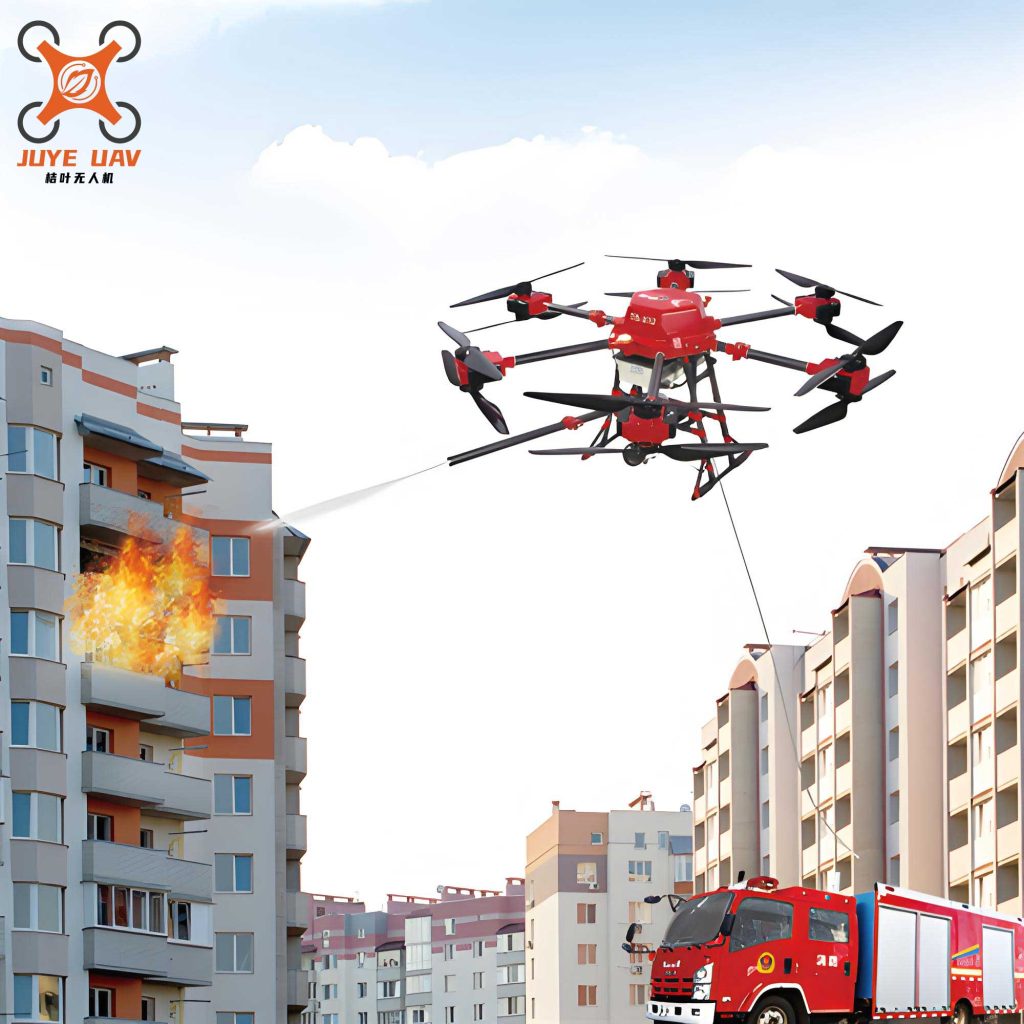
The design of this fire drone platform is fundamentally driven by the practical demands of firefighting operations. It aims to create a complete system for information gathering, processing, and presentation. The core functional requirements that guided the platform’s architecture are summarized in the table below.
| Requirement ID | Functional Requirement Description |
|---|---|
| R1 | Support multi-level architecture deployment on the fire command network, meeting needs from national to brigade levels, with data aggregation and reporting up the chain. |
| R2 | Manage fire drone pilots, comprehensively display flight records and specialties, and integrate with mission data for honor rankings. |
| R3 | Manage fire drone assets, maintain manufacturer information and status, and display resource analysis via charts and maps. |
| R4 | Interface with the fire service’s integrated image platform for data sharing, enabling real-time dispatch of video, control status, and location on command video systems. |
| R5 | Display real-time positions of fire drones and pilots on an electronic map during missions, enable real-time flight supervision, and support map-based interaction (e.g., marking points) for command. |
| R6 | Single-server support for ≥100 connected fire drones, ≥100 concurrent 1080P video streams, and synchronous recording of ≥16 1080P live streams. |
| R7 | Single-server support for receiving or forwarding ≥256 live streams, and management of pilot training courses, materials, and exams. |
System Architecture and Topology
The proposed platform adopts a hybrid, resilient communication architecture. It leverages advanced MESH ad-hoc networking technology, fused with public 4G/5G networks, satellite links, and LTE private wireless networks. This combination, integrated with a visual command and dispatch management platform, portable emergency communication command kits, radio systems, and the fire drones themselves, forms a comprehensive ecosystem. The system aligns with the cascaded deployment structure of the image comprehensive management platform, supporting both hierarchical deployment and the cascaded aggregation of data up to superior command levels.
The system topology illustrates how various nodes and communication media interconnect. Rescue personnel can associate their client software with a fire drone controller, sending control signals to the drone. The acquired image data is then transmitted back. Typically, this return link can be established via public networks or satellite, transmitting data through a secure network to the command center. Here, the fire drone management server distributes the various information streams to the integrated image management platform and video recording servers.
Platform Networking and Key Technical Pathways
Rapidly establishing an independent, reliable communication network in complex disaster environments is paramount. The platform facilitates this by deploying a fire drone management server and a video recording/broadcasting server within the command network. This creates the core of the integrated information management system, providing services for fire drone flight data aggregation, video/image接入, device management, flight operation management, recording/broadcast management, and training management. By interfacing with the fire image comprehensive platform, command video terminals can调度 fire drone video, control status, and geographical information based on a map.
The entire system is designed modularly, allowing for layered, scalable deployment based on operational scale. It supports multiple methods for aggregating data from fire drone devices, which can be configured with different payloads for varied missions. A dedicated pilot management platform is also provided, utilizing operational big data to monitor fire drone status, training duration, and frequency, thereby enhancing pilot proficiency.
The key technical pathways implemented in the system are as follows:
| Key Technology | Implementation Description |
|---|---|
| 1. Image Resource Aggregation | Aggregates audio-video resources from fire drones based on standard protocols (e.g., GB/T 28181). Defines standardized interaction workflows and data content standards for flight data aggregation. |
| 2. Flight Control Data Acquisition | Utilizes manufacturer APIs or SDKs to obtain real-time flight parameters. Supports multiple接入 methods (SDK, GB/T 28181, platform API). Ensures data integrity by retaining original datasets. |
| 3. Fire Drone Pilot Management | Pilots bind their info to a fire drone via a mobile App. The platform records flight parameters, generates trajectories, and provides statistical analysis of flight records to support training and evaluation. |
| 4. Integration with Image Platform | Uses communication protocols for digital integration with the fire image platform, enabling real-time sharing and display of fire drone data on command systems for tactical support. |
| 5. 2D/3D Mapping Fusion | Interfaces with drone mapping systems. Orthophoto or oblique imagery collected by fire drones is processed into 2D or 3D maps, which can be overlaid as layers on the command system’s map to present真实的 disaster scenes. |
From a system performance perspective, the management of video streams is critical. The relationship between image resolution, frame rate, and required bandwidth can be conceptually modeled. For a 1080P stream, the bitrate $B$ can be approximated based on factors like compression efficiency. The platform’s capacity to handle $N_v$ concurrent streams requires a total processing bandwidth $B_{total}$:
$$ B_{total} = \sum_{i=1}^{N_v} B_i $$
where $B_i$ is the bitrate for the $i$-th fire drone stream. The platform specification of supporting ≥100 concurrent 1080P streams and ≥256 live stream接收/forwarding channels defines its core capacity parameters.
Platform Design and Functional Modules
The Fire Drone Integrated Information Management System is built on a B/S (Browser/Server) architecture, compatible with mainstream web browsers. It comprises a complete suite of web-based subsystems offering the following core functionalities:
1. Flight Statistics and Analysis
This module supports conditional queries based on specific fire drone units or pilots. It enables retrieval of flight records and statistical analysis of flight duration and frequency per device or pilot, facilitating the management of routine training and operational sorties. A synchronized replay of flight轨迹 alongside the corresponding aerial imagery is a key feature. The interface allows for detailed date-based searches and presents aggregated data such as total flight count $C_f$, cumulative distance $D_{total}$, and cumulative flight time $T_{total}$ for any selected entity:
$$ T_{total} = \sum_{j=1}^{C_f} t_j $$
where $t_j$ is the duration of the $j$-th flight. This quantitative analysis is vital for assessing readiness and equipment utilization.
2. Device and Asset Management
This module provides comprehensive management of all fire drone assets. It maintains detailed records including manufacturer information,接入 methods, device types, and account credentials. To streamline data exchange with third-party systems, each fire drone is assigned a standardized code (e.g., based on national standards). Device binding is simplified through QR code scanning via the mobile App or web interface.
3. Role-Based Access Control
The user management system defines three primary roles: System Administrator, Command Officer (普通用户), and Fire Drone Pilot. Administrators have full system control, including creating other users, assigning functional permissions, and defining which fire drone assets a user can access. Pilots are primarily granted access to view their own flight records and replay their flight trajectories.
4. Trajectory Recording and Playback
The platform continuously records the flight path and operational process of every registered fire drone. This recorded trajectory, tagged with timestamped latitude $\phi(t)$, longitude $\lambda(t)$, and altitude $h(t)$ data, can be played back online:
$$ \text{Trajectory} = \{ (\phi(t_k), \lambda(t_k), h(t_k)) \, | \, k = 1, 2, …, N \} $$
This functionality is indispensable for mission debriefing, training, post-operation analysis, and evidentiary purposes.
Supporting Equipment and Communication Modeling
The effectiveness of the platform is contingent on a suite of robust hardware. Fire drones must operate in harsh environments and carry varied payloads (HD cameras, gas sensors, thermal imagers, communication relays). These drones interface with dedicated terminals and the visual platform, often integrating with communication command vehicles and existing satellite links to form a resilient, hybrid network enabling real-time interaction with the rear command center.
The communication link quality is paramount. A simplified model for received signal strength $P_r$ at the ground control station from a fire drone at distance $d$ can be expressed using the Friis transmission equation, considering path loss exponent $n$:
$$ P_r = P_t + G_t + G_r – 10n \log_{10}\left(\frac{4\pi d}{\lambda}\right) – L_{\text{other}} $$
where $P_t$ is transmit power, $G_t$ and $G_r$ are antenna gains, $\lambda$ is wavelength, and $L_{\text{other}}$ accounts for other losses. The platform’s multi-path (MESH, 4G/5G, Satellite) design ensures that if one link degrades (e.g., high $n$ in urban canyon), an alternative can maintain the connection, ensuring data flow from the fire drone.
| Item | Model (Example) | Key Specifications and Functions |
|---|---|---|
| 1. Fire Drone Management Server | AVCON AFS-7100 | Aggregates data via SDK/GB28181; Provides Web management (data services, map services, recording); Manages运维, data analysis, flight control; Supports ≥100 fire drones; Enables cascaded deployment & data aggregation. |
| 2. Video Recording/Broadcast Server | AVCON HRSS-7400 | Receives/forwards ≥256 live streams; Records ≥16 concurrent 1080P streams; Manages training courses & resources; Supports distributed/cluster deployment. |
| 3. Pilot Mobile Application | Client App | “My Flights”: Query personal flight records. “Flight Stats”: View cumulative data (counts, distance, duration). “Pilot Training”: Access online courses and exams. “No-Fly Zone Query”: Check restricted airspace. |
Conclusion and Broader Implications
In summary, the design and implementation of this integrated management and control platform represent a significant advancement in leveraging fire drone technology for emergency communications. The platform’s multi-level architecture, robust data aggregation capabilities, comprehensive pilot and device management, and seamless integration with existing command systems directly address the complex needs of modern firefighting and disaster response. By ensuring reliable, real-time situational awareness through fire drone fleets, it empowers commanders with critical data for informed decision-making. The mathematical modeling of resources, communication links, and flight data underscores the system’s engineering rigor. For instance, the platform’s resource allocation must efficiently handle $M$ concurrent missions with $N$ total fire drones, a constraint that can be framed as:
$$ \sum_{m=1}^{M} n_m \leq N, \quad \text{and} \quad \forall n_m \in \mathbb{Z}^+ $$
where $n_m$ is the number of fire drones assigned to mission $m$. This platform provides the tools to optimize such allocations.
The challenges of communication in complex environments like underground structures or dense urban areas highlight the necessity for such intelligent, diversified, and robust systems. The future evolution of this platform will likely involve deeper integration of AI for autonomous fire drone operations, predictive analytics for resource deployment, and enhanced interoperability with other emergency services, further solidifying the role of the fire drone as an indispensable asset in safeguarding life and property.
| Communication Mode | Typical Use Case | Advantages for Fire Drone Platform | Limitations / Considerations |
|---|---|---|---|
| MESH Ad-hoc | Frontline, line-of-sight operations, extending network range. | Self-forming, self-healing, no infrastructure needed; ideal for dynamic fire drone swarms. | Limited bandwidth over many hops; requires sufficient node density. |
| 4G/5G Public Network | Areas with intact cellular coverage; backhaul for video. | High bandwidth, wide coverage, reliable for high-quality fire drone video streaming. | Vulnerable to network congestion or destruction in disasters. |
| Satellite Link | Remote areas, total infrastructure loss, critical command backhaul. | Global coverage, highly reliable; ensures basic command & control for fire drone in any terrain. | High latency, potentially high cost, lower bandwidth compared to terrestrial networks. |
| LTE Private Network | Dedicated operations at large incident sites or permanent facilities. | Controlled, secure, high-capacity network dedicated to fire drone and responder communications. | Requires deployment of dedicated base station equipment. |