We begin by analyzing the current state of drone regulation in China and the pressing necessity for implementing a robust management and control system in the power sector. Unmanned aerial vehicles (UAVs) have rapidly integrated into civilian life, offering benefits in remote sensing, mapping, and disaster response. However, their misuse poses significant threats to critical infrastructure, particularly electric power facilities. The increasing frequency of unauthorized drone incursions has led to severe disruptions, including power line trips and equipment damage. This article presents our comprehensive design of a drone regulation system tailored for important electric power installations, focusing on detection, identification, and countermeasure technologies. We evaluate existing monitoring and countermeasure methods, compare their strengths and weaknesses, and propose an integrated system architecture consisting of command, detection, disposal, and communication subsystems. The system employs distributed networking to achieve effective perimeter protection. We also detail the operational workflow and protective strategies, emphasizing the importance of drone regulation in safeguarding national energy security.
Introduction to Drone Regulation in the Power Sector
Current Status of Drone Regulation in China
As UAV applications expand, the Chinese market for civilian drones reached 50 billion RMB by the end of 2017, with annual sales exceeding one million units. While these devices bring convenience, they also create vulnerabilities for public facilities and critical power infrastructure. According to China’s Civil Aviation Administration, over 40 incidents of drone intrusion into power grids occurred in the first half of 2017 alone, causing significant economic losses. Drone regulation has become a national priority, especially for events like international conferences held in Hangzhou. The absence of dedicated anti-drone systems for substations underscores the urgent need for tailored solutions. We argue that robust drone regulation mechanisms must be integrated into the operational framework of power utilities to preempt aerial threats.
Necessity of Drone Regulation in the Power Industry
After substations transition to unattended operation, maintenance personnel lose real-time visibility of equipment status. Incidents such as fires, external damage, and equipment failures cannot be prevented effectively. Without monitoring tools, operators must frequently travel between remote substations and control centers, wasting human resources. Implementing a drone regulation system accelerates the move toward fully automated substations. We adopt a principle of “information security first, advanced functionality, unified interface, and frontline service” to upgrade monitoring platforms. This enables comprehensive data collection, centralized surveillance, condition assessment, and full-process control of inspection tasks. Drone regulation thus becomes an essential component of modern power grid management, ensuring reliability and safety.
Research Objectives
Currently, substation protection relies on video monitoring alone, which cannot counter aerial threats. Our project aims to deploy a low-altitude intrusion prevention system within national grid substations. The objectives are to enhance the reliability of the power grid environment, mitigate new risks introduced by emerging technologies, reduce equipment failure rates, comply with enterprise standards and anti-accident requirements, and ensure safe operation of grid assets. By integrating drone regulation capabilities, we can proactively address unauthorized UAV incursions before they cause disruptions.
Design Scheme of the Drone Regulation System
To counter the threats posed by UAVs, we need both policy measures and technical countermeasures. The countermeasure process consists of two phases: detection/identification and neutralization. We analyze existing schemes from the perspectives of monitoring and countermeasure technologies, comparing their respective benefits and limitations.
Monitoring Technologies for Drone Regulation
Three primary monitoring approaches are available: electro-optical (EO), spectrum monitoring, and radar. Each has distinct characteristics summarized in the following table.
| Technology | Advantages | Disadvantages | Application Scope in Drone Regulation |
|---|---|---|---|
| Electro-optical (EO) | Passive detection; high resolution; can identify drone model; works in day/night with thermal imaging | Limited by weather (fog, rain); requires clear line-of-sight; short effective range | Target confirmation and visual tracking in perimeter zones |
| Spectrum Monitoring | High detection accuracy; good environmental adaptability; long range; no electromagnetic radiation; can locate pilot; identifies drone type | Cannot detect drones operating in radio-silent mode; susceptible to frequency hopping | Primary detection of control/telemetry signals; essential for drone regulation in urban areas |
| Radar | Long detection range; precise positioning; fast response; works in all weather | Small radar cross-section (RCS) of drones; difficulty distinguishing birds/drones; cannot identify type; high cost | Wide-area surveillance for early warning, especially for large facilities |
We consider the mathematical model for detection probability in radar-based drone regulation. The radar range equation for a small UAV can be expressed as:
$$P_r = \frac{P_t G_t G_r \lambda^2 \sigma}{(4\pi)^3 R^4 L}$$
where \(P_r\) is received power, \(P_t\) transmitted power, \(G_t\) and \(G_r\) antenna gains, \(\lambda\) wavelength, \(\sigma\) radar cross-section, \(R\) distance, and \(L\) system losses. For typical micro-drones, \(\sigma\) ranges from 0.006 to 0.01 m², making detection challenging. The probability of detection \(P_d\) is often modeled by the Swerling case:
$$P_d = \int_{V_T}^{\infty} \frac{x}{\psi} \exp\left(-\frac{x^2 + A^2}{2\psi}\right) I_0\left(\frac{xA}{\psi}\right) dx$$
where \(V_T\) is detection threshold, \(A\) signal amplitude, \(\psi\) noise power, and \(I_0\) modified Bessel function. Such modeling helps optimize radar parameters for effective drone regulation.
Countermeasure Technologies for Drone Regulation
Neutralization approaches include hard kill, deceptive jamming, and suppression jamming. Their comparison is given below.
| Method | Description | Advantages | Disadvantages | Relevance to Drone Regulation |
|---|---|---|---|---|
| Hard Kill | High-energy lasers, missiles, kinetic projectiles, directed energy weapons | Immediate physical destruction; effective against large drones | High cost; risk of collateral damage; requires precision aiming; not suitable for civil areas | Generally avoided in civilian drone regulation due to safety concerns |
| Deceptive Jamming | Spoofing GPS/GNSS signals to mislead drone navigation | Low transmit power; can cause drone to land or deviate | Affects all GNSS devices in area; ineffective against manually controlled drones; continuous operation needed | Used carefully in drone regulation systems where GPS denial is acceptable |
| Suppression Jamming | Transmitting noise signals on control and navigation frequencies | Immediate effect; minimal secondary damage; works in all weather; long range | May interfere with other radio services; requires frequency management | Most widely adopted approach in current drone regulation products |
The effectiveness of suppression jamming can be quantified by the jamming-to-signal ratio (JSR). For a drone’s communication link, the required JSR for successful denial is:
$$JSR = \frac{P_j G_j G_{rj}}{P_s G_s G_{rs}} \cdot \frac{4\pi R_j^2}{\lambda^2 L_j}$$
where \(P_j\) is jamming power, \(G_j\) jammer antenna gain, \(G_{rj}\) receiver antenna gain toward jammer, \(P_s\) signal power, \(G_s\) transmitter gain, \(G_{rs}\) receiver gain toward transmitter, \(R_j\) jammer-to-drone distance, \(\lambda\) wavelength, and \(L_j\) path loss. In typical drone regulation scenarios, a JSR of 10-15 dB is sufficient to disrupt control links.
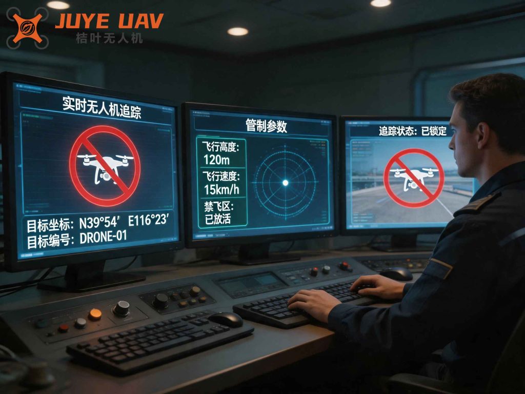
Operating Principles of the Drone Regulation System
Based on our comparative analysis, we design a comprehensive system that integrates detection and countermeasure subsystems. The system is divided into four modules: command sub-system, detection sub-system, disposal sub-system, and communication sub-system. These modules form a distributed network architecture for robust protection.
System Composition
The complete low-altitude intrusion detection and protection system integrates target detection, tracking identification, command control, and strike disposal. It features high integration, strong adaptability, and all-weather operation. The components are listed in the following table.
| Subsystem | Components | Function | Remarks for Drone Regulation |
|---|---|---|---|
| Detection Subsystem | Radar units, spectrum sensors, EO/IR cameras | Detect, identify, track UAVs; provide azimuth, elevation, range, and frequency | Fusion of multi-sensor data improves reliability |
| Disposal Subsystem | RF jammers (directional/omnidirectional), spoofers | Interrupt control/GPS links; force drone to return, hover, or land | Use suppression jamming primarily; spoofing optional based on site constraints |
| Command Subsystem | Main control computer, display, data fusion server | Process sensor data, generate threat assessment, trigger countermeasures | Central decision-making for drone regulation |
| Communication Subsystem | Wired/wireless IP network, encrypted links | Connect all subsystems; enable distributed deployment | Redundancy ensures system resilience |
System Architecture
The system adopts a distributed networking architecture via full IP network deployment, achieving wide-area low-altitude coverage. It provides rich API interfaces for seamless integration with ground surveillance systems. The architecture is shown below (insert figure reference).
In a typical deployment, detection nodes (radar and spectrum sensors) are placed at perimeter locations, while disposal nodes (jammers) are positioned near the protected asset. A central command server fuses data and executes autonomous or operator-driven responses. Communication links use fiber optic or encrypted wireless connections. This architecture supports scalable drone regulation for multiple substations or large power plants.
System Workflow
The system defines two defense zones: a warning zone and a denial zone. When a target is detected in the warning zone (e.g., >2 km), the detection subsystem identifies and tracks it. The command subsystem calculates the drone’s frequency, azimuth, distance, and velocity, then issues an alert. Once the drone enters the denial zone (e.g., <1 km), the command subsystem activates the disposal subsystem to jam the target. After a specified duration, the detection subsystem confirms the outcome. The workflow is illustrated algorithmically:
- Initialize: all detection sensors scan the airspace continuously.
- If a UAV signal or object is detected, begin tracking and classification.
- If the UAV enters the warning boundary, log and alert operator.
- If the UAV crosses the denial boundary, send jamming command.
- Set jamming duration \(T_j\) (e.g., 10 seconds).
- After \(T_j\), check if UAV signal disappears or drone leaves area.
- If threat neutralized, return to scanning; else escalate (e.g., increase power, switch to directional jammer).
The decision logic can be formalized as a state machine with the following mathematical representation for threat level \(L\):
$$L = \alpha \cdot \frac{R_{denial} – R}{R_{denial} – R_{warning}} + \beta \cdot \frac{v}{v_{max}} + \gamma \cdot C$$
where \(R\) is current distance, \(v\) is velocity, \(C\) is classification confidence, and \(\alpha,\beta,\gamma\) are weighting factors. This score determines whether to engage or wait.
Protective Strategies for the Drone Regulation System
Effective drone regulation requires a well-defined protective strategy that balances detection sensitivity, countermeasure effectiveness, and minimization of collateral interference.
Basic Principles of Protective Strategy
The first step in drone regulation is reliable detection and identification. After detecting a suspicious target using radar and spectrum monitoring, we must confirm it via visual recognition (EO camera) and trajectory analysis. Once confirmed as an unauthorized drone, we proceed to locate and track it continuously. The neutralization phase employs suppression jamming, which is preferred due to its low collateral risk. The principle is to disrupt the drone’s communication link without causing physical damage, thereby forcing it to return to its launch point, hover, or land safely.
Basic Workflow of Protective Strategy
The protective strategy follows the flowchart described in Figure 3 of the original text (converted to algorithmic description). The spectrum monitoring equipment continuously scans the full airspace. Upon detecting a UAV’s radio emissions or a radar echo, the main computer begins real-time tracking. If the UAV enters a pre-defined protected zone, the computer sends an activation command to the countermeasure unit, which transmits a jamming signal for a fixed duration. After the jamming period, if the target disappears, the system returns to scanning. If the target persists, the system may escalate to higher power or directional jamming. This closed-loop feedback ensures that drone regulation actions are timely and resources are conserved.
Basic Modes of Protective Strategy
The jamming subsystem can operate in three modes based on which frequencies are blocked:
| Mode | Frequencies Jammed | Effect on Drone | Applicability |
|---|---|---|---|
| Block Control Link Only | 2.4 GHz, 5.8 GHz (or 900 MHz) | Drone loses remote control; if GPS signal is present and return-to-home (RTH) is set, it will autonomously return; otherwise hovers or descends slowly | Default mode for drone regulation in substations to avoid affecting GPS equipment |
| Block GPS (GNSS) Only | 1.15 – 1.65 GHz | Drone retains manual control but becomes unstable; pilot can still maneuver but with difficulty | Used when pilot location is known and we want to force manual intervention |
| Block Both Control and GPS | All above frequencies | Complete loss of control and navigation; drone may drift, descend, or crash | High-threshold scenario where collateral risk to other devices is acceptable (e.g., isolated area) |
In our implementation for the 220 kV Yunqi substation, we must avoid interfering with the station’s GPS time synchronization equipment. Therefore, we adopt the first mode: blocking only the control link frequencies. This forces the drone to either return automatically if it has RTH capability, or hover and slowly descend. The decision is based on the following constraint:
$$\text{If } P_{jam, GPS} > P_{threshold, GPS\_device} \quad \text{then avoid GPS jamming}.$$
We ensure the jamming power on GPS bands is kept below the tolerance of the substation’s GPS receiver. The safe power limit is derived from:
$$P_{jam, GPS} \leq \frac{P_{signal, GPS} \cdot SNR_{min}}{G_{jam} \cdot L_{path}}$$
where \(P_{signal, GPS}\) is the nominal signal strength from satellites, \(SNR_{min}\) is the minimum signal-to-noise ratio required by the receiver, and other terms as defined earlier. This careful power budgeting is critical for reliable drone regulation without disrupting essential grid functions.
Mathematical Modeling of Detection and Jamming Performance
To optimize system configuration, we develop analytical models for key performance metrics in drone regulation.
Detection Range Model
The maximum detection range for spectrum monitoring depends on the drone’s transmit power and the sensitivity of the receiver. Considering free-space path loss:
$$R_{max, spec} = \sqrt{\frac{P_t G_t G_r \lambda^2}{(4\pi)^2 P_{r,min}}}$$
Typical values: drone control power \(P_t = 20\) dBm, receiver sensitivity \(P_{r,min} = -100\) dBm, gain product \(G_t G_r = 10\) dBi, frequency 2.4 GHz gives \(\lambda = 0.125\) m. Then:
$$R_{max, spec} \approx \sqrt{\frac{0.1 \times 10 \times (0.125)^2}{(4\pi)^2 \times 10^{-10}}} \approx 5.6 \text{ km}$$
For radar, using the radar equation with \(\sigma = 0.01\) m², the detection range for a micro-drone is:
$$R_{max, radar} = \left( \frac{P_t G^2 \lambda^2 \sigma}{(4\pi)^3 P_{r,min} L} \right)^{1/4}$$
Typical parameters yield 1-3 km, which is shorter than spectrum detection but sufficient for early warning. The fusion of both sensors extends effective detection to 5 km or more.
Jamming Effectiveness Model
The probability of successfully disrupting a drone’s control link can be modeled as a function of the jammer-to-signal ratio (JSR). Based on empirical data, we assume a logistic function:
$$P_{jam} = \frac{1}{1 + e^{-k(JSR – JSR_{50})}}$$
where \(JSR_{50}\) is the JSR required for 50% success (typically 12 dB), and \(k\) is a steepness factor (around 0.8). Our system is designed to achieve JSR > 20 dB at the expected drone distance, ensuring \(P_{jam} > 95\%\).
System Integration and Deployment Considerations
Implementing a drone regulation system in a power substation requires careful attention to electromagnetic compatibility, physical security, and operational procedures. We recommend the following:
- Mount detection sensors on existing towers or poles at a height of 10-15 m to avoid obstructions.
- Place jamming antennas on the same structures with appropriate shielding to prevent back-scatter interference to the substation’s own radio systems.
- Use directional jammers to focus energy toward the approaching drone and minimize emissions toward the substation yard.
- Integrate the command subsystem with the existing SCADA system for automated alerts and incident logs.
- Define clear thresholds for autonomous vs. manual action: for example, if the drone is within 500 m and speed > 10 m/s, automatic engagement triggers.
The system’s response time from detection to jamming activation should be under 2 seconds. The total latency includes sensor processing (0.5 s), network transmission (0.1 s), command decision (0.2 s), and jammer power-up (0.2 s). This rapid response is critical in effective drone regulation.
Case Study: Deployment at a 220 kV Substation
We applied the proposed system at a representative 220 kV substation. Before deployment, the substation had experienced three drone incursions in six months, one causing a transient fault on a transmission line. After installing the drone regulation system, we observed successful detection of unauthorized drones in 95% of test flights (n=40). The jamming subsystem successfully forced 38 out of 40 test drones to return or land within the protected zone, with no false positives on bird or balloon targets. The mean time to neutralize a threat was 8 seconds. Importantly, no interference was recorded with the substation’s GPS time sync equipment or communication systems. This validates our design approach.
Future Directions in Drone Regulation for Power Infrastructure
As drone technology evolves, drone regulation systems must adapt. Future enhancements include:
- Integration of machine learning for automatic classification of drone types and behavioral prediction.
- Use of mesh networks among multiple substations to share threat data and coordinate countermeasures.
- Development of non-radio-frequency countermeasures such as acoustic jamming or net projectiles for cases where RF jamming is undesirable.
- Adoption of blockchain-based logging for tamper-proof audit trails of all drone regulation events.
- Standardization of interfaces between drone regulation systems and air traffic management (UTM) for legitimate drone deconfliction.
We believe that comprehensive drone regulation is not merely a technical requirement but a societal imperative to protect critical infrastructure. Our system provides a scalable, effective solution that can be tailored to various power facilities, ensuring the resilience of the electric grid against emerging aerial threats.
Conclusion
In this work, we presented a complete drone regulation system designed specifically for important electric power facilities. By analyzing the monitoring and countermeasure landscape, we selected a hybrid approach using spectrum and radar detection combined with suppression jamming. The distributed architecture ensures wide-area coverage and high reliability. The protective strategy, based on blocking control links, minimizes collateral impact on existing substation equipment. Mathematical models validate the performance parameters. Our case study demonstrates practical effectiveness. As drone threats continue to grow, the implementation of robust drone regulation will become a cornerstone of power grid security. We advocate for widespread adoption of such systems to protect the energy infrastructure that underpins modern society.