
The proliferation of small, mini, and micro Unmanned Aerial Vehicles (UAVs), characterized by their low-altitude flight, slow speed, and small radar cross-section (RCS), has surged exponentially in recent years. While offering immense benefits across various sectors, this growth has introduced significant public safety and security challenges. Instances of unauthorized flights, breaches of restricted airspace, and the potential malicious use of drones for surveillance, smuggling, or even as weapon platforms have underscored the urgent need for effective countermeasures. This paper details the research and implementation of a holistic anti-drone system designed to detect, identify, track, and neutralize unauthorized UAV threats, while simultaneously providing a regulatory framework for cooperative drone operations.
Traditional air defense systems are ill-equipped to handle the unique “low, slow, and small” (LSS) threat profile of consumer and commercial drones. Radar detection is challenged by small RCS and ground clutter, visual identification is difficult at distance, and kinetic countermeasures are often disproportionate and risky in populated areas. Therefore, modern anti-drone solutions necessitate a multi-layered, integrated approach. The core challenge lies in creating a system that can reliably detect LSS targets, accurately classify them as threats, and apply a graduated, proportionate response with minimal collateral effect. Our implemented system addresses this by synergistically combining heterogeneous sensors with multiple countermeasure techniques under a unified command and control architecture.
System Architecture and Design Philosophy
The proposed anti-drone system is architected as a cohesive network of three primary functional subsystems: the Detection & Identification System, the Countermeasure Intervention System, and the Command & Control (C2) System. The design philosophy centers on sensor fusion for robustness, a multi-tiered response strategy for flexibility, and comprehensive data management for situational awareness and forensic analysis. The integrated architecture ensures that the system can operate in diverse environments, from protecting critical infrastructure to managing urban airspace.
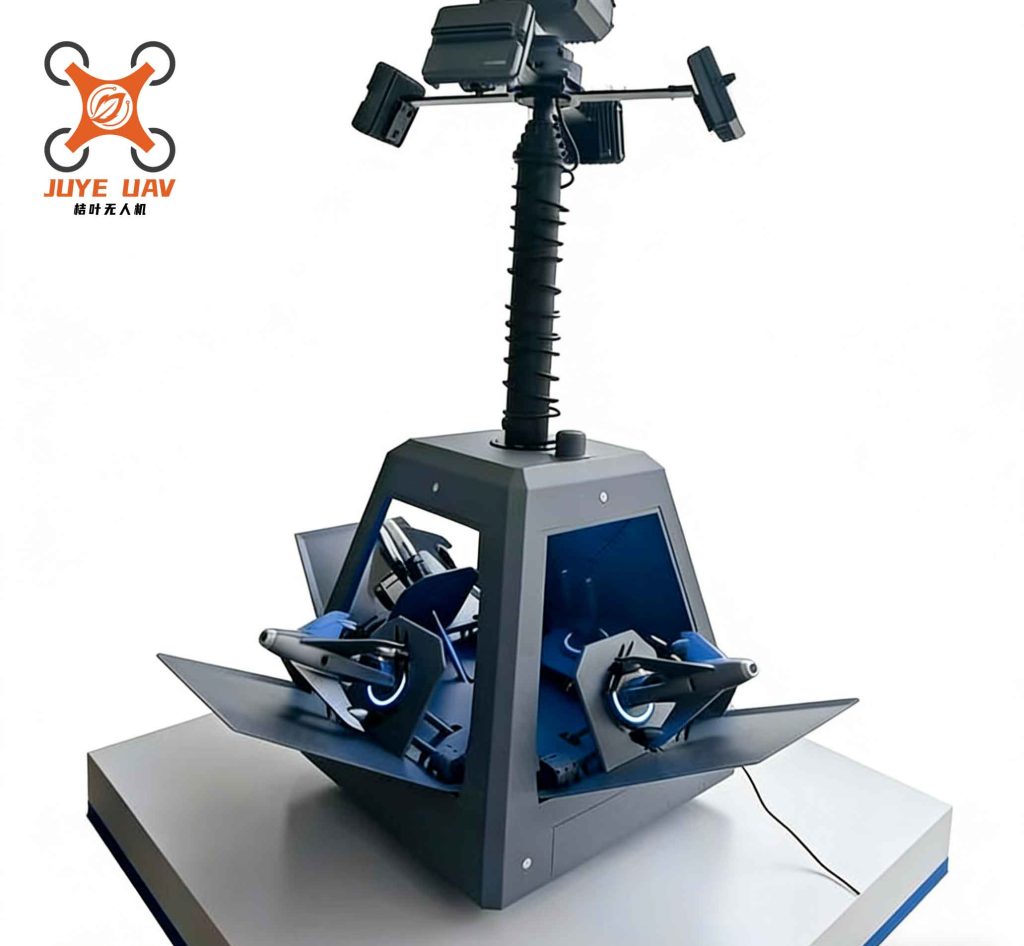
The operational flow of the anti-drone system follows a clear “Detect-Assess-Act” paradigm. The airspace is virtually divided into concentric zones: a wide-area Alert Zone, a closer Intervention Zone, and a core Protected Zone. This zoning strategy allows for escalating responses corresponding to the threat’s proximity to the vital asset. Upon detection in the Alert Zone, the system classifies the target and assesses its intent. If deemed a non-cooperative threat, it can be engaged with soft-kill measures like radio frequency (RF) jamming in the Intervention Zone. If it penetrates further, hard-kill measures like net capture may be deployed within the Protected Zone. All actions are coordinated, logged, and assessed by the central C2 system.
Detection and Identification Layer
Reliable detection is the foundational pillar of any effective anti-drone system. No single sensor modality is sufficient to guarantee coverage against all drone types in all conditions. Therefore, our system employs a multi-sensor fusion approach, integrating data from radar, electro-optical/infrared (EO/IR) cameras, and passive RF scanners to create a comprehensive air picture.
1. Radar Subsystem: Specifically designed for low-altitude surveillance, this radar provides 360-degree coverage, automatically detecting and tracking objects based on their kinematic features (range, azimuth, velocity, altitude). It is optimized to filter out ground clutter and birds while picking up the small RCS signatures typical of LSS drones. Its primary output is target track data, which is continuously fed to the fusion engine. The probability of detection $P_d$ for a small drone can be modeled as a function of its RCS ($\sigma$), range ($R$), and the signal-to-noise ratio (SNR):
$$P_d = f\left(\frac{\sigma}{R^4}, \text{SNR}\right)$$
Modern low-altitude radars use advanced waveform processing and Doppler filtering to maximize $P_d$ for small $\sigma$ at operationally relevant ranges $R$.
2. Electro-Optical/Infrared (EO/IR) Subsystem: This subsystem provides positive visual identification (PID). It consists of high-resolution daylight cameras and thermal infrared cameras for night/low-visibility operations. Upon being cued by the radar or RF sensor, the EO/IR system slews to the target’s coordinates, zooms in, and provides real-time video feed. This allows operators to visually confirm the target as a drone, discern its model, and observe its payload or behavior. Advanced systems incorporate automatic video tracking and image processing algorithms to classify the drone type.
3. Radio Frequency (RF) Scanning & Direction Finding (DF) Subsystem: This passive sensor listens for the RF emissions inherent to drone operation, primarily the command & control (C2) link between the drone and its pilot, and the video downlink. It scans predefined frequency bands used by common drone brands (e.g., 2.4 GHz, 5.8 GHz). Upon detecting a signature that matches a known drone protocol in its database, it triggers an alert. Crucially, it can also perform direction finding to estimate the location of both the drone (via its downlink) and, more importantly, the ground-based pilot (via the uplink). This capability is vital for locating and apprehending malicious operators.
The fusion of these sensor inputs occurs within the C2 system. A track correlation algorithm consolidates radar plots, RF detections, and EO/IR tracks pertaining to the same physical object. This fused track has a much higher confidence level and provides a richer set of attributes (kinematics, RF signature, visual appearance) for threat assessment. The table below summarizes the complementary characteristics of these detection layers:
| Sensor Type | Primary Strength | Key Limitation | Output Data |
|---|---|---|---|
| Low-Altitude Radar | Wide-area, all-weather, continuous range & bearing | Limited discrimination, susceptible to clutter | Track (Range, Azimuth, Velocity, Altitude) |
| EO/IR Camera | Positive visual identification, intent analysis | Limited field of view, affected by weather/light | Video Feed, Visual Classification |
| RF Scanner/DF | Passive detection, identifies model, locates pilot | Requires drone to be emitting; crowded spectrum | RF Signature, Direction of Arrival, Protocol ID |
Countermeasure Intervention Layer
Once a drone is confirmed as a hostile or unauthorized intruder, the anti-drone system must neutralize the threat. Our system employs a tiered set of countermeasures, escalating from non-destructive “soft-kill” to physical “hard-kill” options, allowing for a proportionate response based on the operational context and rules of engagement.
1. RF Jamming (Soft-Kill): This is the most common and versatile countermeasure. It involves transmitting high-power noise or protocol-specific denial signals on the frequencies used by the target drone.
- Control Link Jamming: Disrupts the communication between the pilot’s remote controller and the drone. This typically triggers a failsafe behavior in the drone, such as:
- Return-to-Home (RTH): The drone autonomously navigates back to its recorded take-off point and lands. This is effective for驱离 (driving away) the threat from a protected zone.
- Hover/Land-in-Place: The drone loses command input, enters a hover state, and descends vertically until it lands. This is used for迫降 (forced landing) within a contained area.
- GNSS Jamming/Spoofing: Disrupts or mimics Global Navigation Satellite System (GPS, GLONASS, Galileo, BeiDou) signals. This denies the drone its positional reference, causing navigational failure, often resulting in a hover or uncontrolled landing. Spoofing can potentially commandeer the drone by feeding it false location data.
The effectiveness of jamming $E_j$ depends on the jamming-to-signal ratio (JSR) at the drone’s receiver:
$$E_j \propto \text{JSR} = \frac{P_j G_j / L_j}{P_s G_s / L_s}$$
where $P_j$ and $P_s$ are jammer and signal power, $G_j$ and $G_s$ are antenna gains, and $L_j$ and $L_s$ are path losses. Directional jammers focus $G_j$ to increase JSR while minimizing collateral interference.
2. Net Capture (Hard-Kill): For scenarios where jamming is unsuitable (e.g., near airports due to spectrum restrictions) or when physical capture of the drone is required for forensic analysis, net-based systems are deployed. These can be:
- Stationary Net Launchers: Deploy a net from a fixed position to entangle an approaching drone.
- Interceptor Drones: A “good” drone, often larger, is equipped with a net and guided to intercept the threat drone mid-air. The net is launched or deployed via a tether, capturing the target, which is then transported to a safe location for recovery.
This method provides a controlled, physical negation with minimal risk of collateral damage from falling debris compared to kinetic methods.
The selection of countermeasure is a critical decision point managed by the C2 system. The table below outlines the application and considerations for each:
| Countermeasure | Type | Typical Effect | Advantages | Considerations |
|---|---|---|---|---|
| Control Link Jamming | Soft-Kill (Non-Kinetic) | Drone executes failsafe (RTH or Land) | Non-destructive, wide area effect | Can affect nearby friendly drones; dependent on drone’s failsafe logic |
| GNSS Jamming/Spoofing | Soft-Kill (Non-Kinetic) | Navigation loss, hover or land | Effective against autonomous drones | Significant collateral impact on all GNSS receivers in area; regulated |
| Net Capture (Interceptor) | Hard-Kill (Kinetic) | Physical entrapment and recovery | Precise, evidence capture, no RF emission | Requires engagement window; limited range; cost of interceptor asset |
Command, Control, and Integration Core
The true power of this anti-drone system lies in its integrated Command and Control (C2) software platform. This acts as the central nervous system, fusing data, presenting situational awareness, automating processes, and enabling informed human decision-making.
Key C2 Functions:
- Sensor Management & Data Fusion: Controls all sensor parameters, tasks them based on threat priority, and runs correlation algorithms to create a single, coherent air picture from all inputs.
- Situational Awareness Display: Presents the fused air picture on a digital map, showing tracks of all detected objects (cooperative and non-cooperative). Threat assessment algorithms color-code tracks based on parameters like speed, proximity to no-fly zones, and identification confidence. The system also integrates with national drone registries or UTM (UAS Traffic Management) systems to display identified, cooperative drones.
- Countermeasure Deployment: Provides the human operator with a decision support interface to select and activate countermeasures. It can automate engagement sequences based on pre-defined rules (e.g., “Auto-jam any unidentified drone within Zone B”).
- Flight Management & Regulatory Services: A critical dual-use function. For authorized operators, the system provides services like digital flight planning, airspace authorization requests, real-time weather data, and NOTAM (Notice to Airmen) alerts. This encourages compliance and integrates the anti-drone system into the broader ecosystem of safe drone operations.
- Forensic Logging and Reporting: Records all system data: raw sensor detections, fused tracks, operator actions, countermeasure deployments, and communication logs. This is essential for post-event analysis, legal proceedings, and system performance optimization.
The system’s overall effectiveness can be conceptualized as a function of its detection performance, decision speed, and countermeasure success rate. A simplified system-level effectiveness metric $E_{sys}$ could be modeled as:
$$E_{sys} = P_{detect} \times P_{identify} \times P_{decide} \times P_{neutralize}$$
where:
- $P_{detect}$ is the probability the system detects the intruding drone.
- $P_{identify}$ is the probability it correctly classifies it as a threat.
- $P_{decide}$ is the probability a correct engagement decision is made (manually or automatically).
- $P_{neutralize}$ is the probability the selected countermeasure successfully mitigates the threat.
The C2 system’s role is to maximize each of these probabilities through robust fusion, intuitive interfaces, and automated support.
Conclusion and Future Directions
The implemented integrated anti-drone system represents a comprehensive solution to the growing challenge of unauthorized and malicious UAV operations. By combining multi-layered detection (radar, EO/IR, RF), tiered countermeasures (RF jamming, net capture), and a powerful, unifying C2 platform, it achieves a high probability of successful threat mitigation. Its design for dual use—enabling safe operations for compliant users while decisively countering non-compliant ones—supports the healthy development of the drone industry while safeguarding public safety, national security, and critical infrastructure.
Future evolution of such anti-drone systems will focus on several key areas: the application of Artificial Intelligence and Machine Learning (AI/ML) for faster and more accurate target classification and intent prediction; the development of more sophisticated directed-energy weapons (e.g., high-power microwaves, lasers) for scalable, low-cost-per-engagement effects; and deeper integration with city-wide and national UTM systems for seamless airspace management. Furthermore, the challenge of swarms of drones operating cohesively will drive research into networked anti-drone systems capable of distributed detection and coordinated counter-swarm tactics. The continuous cycle of threat evolution and countermeasure development will ensure that anti-drone technology remains a dynamic and critical field of research and implementation for the foreseeable future.