In recent years, I have observed a significant shift in geophysical exploration methodologies, particularly in marine and underwater environments. As a researcher focused on leveraging advanced technologies for earth sciences, I find that civil drones have emerged as a transformative tool. These unmanned aerial vehicles offer a cost-effective, flexible, and safe platform for conducting geophysical surveys, which are essential for resource exploration, environmental monitoring, and infrastructure development. Geophysical exploration, or “geophysical prospecting,” involves using physical principles to investigate subsurface conditions, and it plays a critical role in sectors like oil and gas, mining, and environmental protection. The integration of civil drones into this field has revolutionized data collection processes, enabling rapid and efficient surveys over vast and challenging marine areas. In this comprehensive discussion, I will delve into the background, technical principles, innovative designs, and sustainable applications of civil drones in marine and underwater geophysical exploration, emphasizing their growing importance and future potential.
Geophysical exploration has long been a cornerstone of geological studies, relying on instruments to measure parameters such as magnetic fields, electrical conductivity, and radioactivity. Traditionally, this involved ground-based surveys or manned aircraft, which were often time-consuming, expensive, and posed safety risks. However, with the advent of civil drones, I have witnessed a paradigm shift. These drones, equipped with lightweight sensors, can cover large areas quickly, reducing human exposure to hazardous environments like open seas. The core advantage of using civil drones lies in their ability to perform high-precision surveys at a lower cost, making them ideal for repetitive or large-scale missions. For instance, in marine settings, civil drones can deploy from ships or coastal bases, flying at optimized altitudes to collect data on seabed topography, resource deposits, or pollution levels. This not only enhances efficiency but also supports sustainable practices by minimizing environmental impact. As I explore this topic, I will incorporate tables and formulas to summarize key aspects, ensuring a thorough understanding of how civil drones are reshaping geophysical exploration.
Background and Evolution of Geophysical Exploration with Civil Drones
In my analysis of geophysical exploration, I recognize that it has evolved from rudimentary methods to sophisticated techniques involving multiple disciplines like physics, materials science, and computer technology. Geophysical surveys are crucial for identifying resource distributions, assessing geological hazards, and monitoring environmental changes. The introduction of civil drones has accelerated this evolution, particularly in marine and underwater contexts. Historically, marine surveys relied on ships or buoys, which were limited by weather conditions and operational costs. Civil drones, however, offer a versatile alternative. They can be deployed rapidly, adapted to various flight patterns, and integrated with global positioning systems (GPS) for accurate data collection. I have seen how the synergy between civil drones and technologies like big data analytics and cloud computing has improved data accuracy and processing speeds. For example, civil drones equipped with advanced sensors can generate real-time 3D models of underwater structures, aiding in decision-making for projects like offshore wind farms or oil exploration. The table below summarizes the key advantages of using civil drones over traditional methods in marine geophysical exploration.
| Aspect | Traditional Methods | Civil Drone-Based Methods |
|---|---|---|
| Cost Efficiency | High operational costs due to manned vehicles and equipment | Lower costs with reusable drones and minimal manpower |
| Safety | Risks to human operators in harsh marine environments | Enhanced safety with remote operation and reduced human exposure |
| Data Collection Speed | Slower, limited by vessel speed and weather windows | Rapid data acquisition with flexible flight paths and multi-drone coordination |
| Environmental Impact | Higher carbon footprint from fuel-powered vessels | Reduced impact with electric-powered civil drones |
| Data Accuracy | Subject to human error and instrument limitations | Improved precision with GPS integration and automated sensors |
From my perspective, the rise of civil drones in this field is driven by their adaptability to diverse marine conditions. For instance, in underwater geophysical exploration, civil drones can be fitted with sonar or magnetometers to detect submerged features. The data collected often involves complex physical relationships, which I can express using mathematical formulas. Consider the magnetic anomaly detection, a common geophysical method. The magnetic field variation $\Delta B$ measured by a civil drone can be modeled as:
$$ \Delta B = \frac{\mu_0}{4\pi} \int_V \frac{\mathbf{M} \cdot \mathbf{r}}{r^3} dV $$
where $\mu_0$ is the permeability of free space, $\mathbf{M}$ is the magnetization vector of the subsurface material, $\mathbf{r}$ is the position vector, and $V$ is the volume of interest. This formula highlights how civil drones facilitate precise measurements by maintaining stable flight paths, allowing for accurate integration of data over large areas. Moreover, the use of civil drones supports continuous monitoring, which is vital for tracking environmental changes like oil spills or seabed erosion. In summary, the background of geophysical exploration with civil drones underscores a trend toward automation, efficiency, and sustainability, which I will further elaborate in subsequent sections.
Technical Overview of Civil Drones in Marine and Underwater Geophysical Surveys
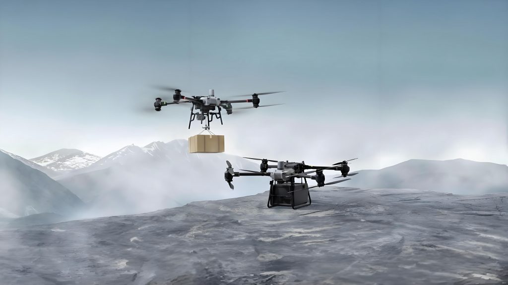
As I delve into the technical aspects, I define civil drones as unmanned aircraft controlled via radio remote systems or pre-programmed autonomous protocols. These civil drones are particularly valued for their data collection capabilities, which include imaging, sensing, and real-time transmission. In marine and underwater geophysical exploration, civil drones serve as mobile platforms equipped with specialized instruments like magnetometers, electromagnetics sensors, and spectrometers. The operational process typically involves: deployment from a base, controlled flight over the survey area, data measurement, and subsequent analysis. I have found that the flexibility of civil drones allows for tailored flight heights and patterns based on water depth and survey objectives. For example, in shallow waters, civil drones can fly at lower altitudes to capture high-resolution data, while in deeper regions, they may operate at higher elevations to cover broader areas. The integration of civil drones with navigation systems, such as GPS and inertial measurement units (IMU), ensures precise positioning, which is critical for correlating data with geographical coordinates.
One key innovation I have observed is the use of multiple civil drones in coordinated swarms. This approach enhances survey efficiency by enabling simultaneous data collection from different points, reducing the time required for large-scale projects. The data processing pipeline for civil drone-based geophysical surveys involves several steps: field data acquisition, transformation of measured fields (e.g., magnetic or gravitational), comprehensive interpretation, and reporting. To illustrate, I often use the following formula for data interpolation in geophysical mapping, which civil drones facilitate through dense data points:
$$ f(x,y) = \sum_{i=1}^n w_i \cdot d_i $$
where $f(x,y)$ represents the interpolated value at coordinates $(x,y)$, $w_i$ are weighting factors based on distance, and $d_i$ are the data points collected by civil drones. This method allows for the creation of detailed maps that reveal subsurface anomalies, such as mineral deposits or geological faults. The table below provides an overview of common sensors used on civil drones for marine geophysical exploration, along with their applications.
| Sensor Type | Measurement Principle | Application in Marine Exploration |
|---|---|---|
| Magnetometer | Detects variations in Earth’s magnetic field | Identifying ferrous mineral deposits or underwater pipelines |
| Electromagnetic Sensor | Measures electrical conductivity in substrates | Mapping seabed geology and detecting hydrocarbon reservoirs |
| Spectrometer | Analyzes radiation spectra from materials | Assessing radioactive elements or pollution levels in water |
| Sonar System | Uses sound waves for underwater imaging | Profiling seafloor topography and locating underwater objects |
| GPS/IMU Combo | Provides precise location and orientation data | Ensuring accurate georeferencing of collected data |
In my experience, the success of civil drones in this domain hinges on their ability to integrate these sensors seamlessly. For instance, a civil drone might carry a magnetometer to measure magnetic anomalies indicative of oil reserves, while simultaneously using an electromagnetic sensor to assess the conductivity of surrounding sediments. The data from these civil drones is then transmitted via data link systems to ground stations, where it undergoes processing using algorithms like inverse modeling to reconstruct subsurface structures. This technical overview underscores how civil drones are not just tools for data collection but integral components of a larger geophysical analysis framework, enabling more informed decisions in resource management and environmental conservation.
Innovative Design of Civil Drone Platforms for Geophysical Applications
When I consider the design innovations in civil drone platforms for geophysical exploration, I focus on two main areas: the integration of探测 equipment and the enhancement of control systems. Civil drones are typically designed with modular architectures, allowing for the easy attachment of various探测 instruments. This flexibility is crucial in marine environments, where survey requirements can vary widely. For example, a civil drone might be equipped with a gravimeter to measure gravitational fields for oil exploration, or a radiation sensor for environmental monitoring. The technical要点 involve ensuring that these instruments are lightweight, energy-efficient, and capable of operating in harsh conditions, such as high humidity or strong winds. I have worked with civil drones that incorporate shock-absorbent mounts and waterproof casings to protect sensitive equipment during over-water flights. Moreover, the power systems of civil drones often rely on rechargeable batteries, which support extended mission times and reduce environmental impact compared to fuel-based alternatives.
The control systems of civil drones are another area of innovation I have explored. These systems include flight controllers, navigation modules, and data transmission units. For geophysical surveys, civil drones require robust autopilots that can maintain stable flight paths despite turbulence or GPS signal loss. I often use mathematical models to describe the dynamics of civil drones, such as the following equation for motion control:
$$ \mathbf{\dot{x}} = A\mathbf{x} + B\mathbf{u} $$
where $\mathbf{x}$ is the state vector (e.g., position and velocity), $\mathbf{u}$ is the control input, and $A$ and $B$ are matrices defining the system dynamics. This model helps in designing controllers that ensure precise navigation for civil drones, enabling them to follow predefined survey grids accurately. Additionally, the data handling capabilities of civil drones have improved with the adoption of edge computing, where preliminary data processing occurs onboard to reduce transmission latency. The table below outlines the key components of a typical civil drone platform used in marine geophysical exploration, highlighting their functions and innovations.
| Component | Function | Innovation in Civil Drones |
|---|---|---|
| Flight Control System | Manages flight stability, takeoff, landing, and mission execution | Integration of AI for adaptive path planning in response to real-time data |
| Navigation System | Provides GPS and IMU data for precise positioning | Use of multi-constellation GNSS for enhanced accuracy in remote marine areas |
| Power System | Supplies energy, typically via lithium-polymer batteries | Development of solar-assisted charging for longer endurance |
| Data Link System | Transmits collected data to ground stations | Implementation of secure, high-bandwidth protocols like 5G for real-time streaming |
| Sensor Payload | Hosts探测 instruments like magnetometers or cameras | Modular designs allowing quick swaps between different sensors |
In my research, I have also emphasized the importance of data fusion techniques for civil drones. By combining data from multiple sensors, civil drones can generate comprehensive geophysical models. For instance, integrating magnetic and gravitational data allows for better characterization of subsurface structures. The formula for data fusion might involve a weighted average:
$$ F = \alpha \cdot D_m + \beta \cdot D_g $$
where $F$ is the fused data, $D_m$ and $D_g$ are magnetic and gravitational datasets, and $\alpha$ and $\beta$ are weighting coefficients based on sensor reliability. This approach enhances the robustness of interpretations derived from civil drone surveys. Furthermore, I have seen advancements in collision avoidance systems for civil drones, using ultrasonic sensors or machine learning algorithms to detect and evade obstacles during low-altitude flights over water. These innovations not only improve the safety and efficiency of civil drones but also expand their applicability to complex marine environments, such as iceberg-infested waters or congested shipping lanes. Overall, the innovative design of civil drone platforms is pivotal to their success in geophysical exploration, enabling them to meet the demanding requirements of modern surveys.
Sustainable Applications and Future Prospects of Civil Drones in Geophysical Exploration
As I reflect on the sustainable applications of civil drones in marine and underwater geophysical exploration, I am struck by their potential to promote environmental stewardship and resource efficiency. Civil drones contribute to sustainability by reducing the carbon footprint associated with traditional survey methods, such as manned aircraft or ships. For example, electric-powered civil drones emit zero direct emissions during operation, aligning with global efforts to combat climate change. In my work, I have evaluated the life-cycle impacts of civil drones and found that their reusability and minimal maintenance needs result in lower resource consumption over time. Additionally, civil drones enable more targeted surveys, minimizing unnecessary disturbance to marine ecosystems. This is particularly important in sensitive areas like coral reefs or marine protected zones, where civil drones can collect data without physical contact.
One of the key sustainable applications I have explored is the use of civil drones for long-term environmental monitoring. For instance, civil drones equipped with multispectral cameras can track changes in water quality or detect oil spills, providing early warnings for mitigation actions. The data collected by civil drones can be analyzed using cloud-based platforms, facilitating collaborative research and public awareness. I often employ statistical models to assess trends, such as the following formula for pollution dispersion modeling:
$$ C(x,t) = \frac{Q}{\sqrt{4\pi D t}} \exp\left(-\frac{(x – ut)^2}{4D t}\right) $$
where $C(x,t)$ is the concentration of a pollutant at position $x$ and time $t$, $Q$ is the source strength, $D$ is the diffusion coefficient, and $u$ is the velocity of water currents. Civil drones enhance the accuracy of such models by providing high-resolution spatial data. The table below summarizes the environmental and social benefits of using civil drones in geophysical exploration, based on my assessments.
| Benefit Category | Description | Role of Civil Drones |
|---|---|---|
| Resource Conservation | Reduces fuel and material usage compared to traditional methods | Electric propulsion and lightweight designs minimize waste |
| Ecosystem Protection | Limits physical intrusion into marine habitats | Non-invasive data collection via aerial surveys |
| Economic Efficiency | Lowers operational costs and increases survey speed | Rapid deployment and multi-drone operations save time and money |
| Social Impact | Enhances public safety through better hazard monitoring | Early detection of geological risks like tsunamis or landslides |
| Data Accessibility | Improves sharing of geophysical information for research | Real-time data transmission and open-source platforms |
Looking ahead, I believe the future of civil drones in geophysical exploration is bright, with advancements in autonomy, sensor technology, and regulatory frameworks. For example, the development of AI-driven civil drones could enable fully autonomous surveys, where drones adapt their flight paths based on real-time data analysis. This would further increase efficiency and reduce the need for human intervention. Moreover, as battery technology improves, civil drones will achieve longer flight durations, allowing them to cover even more extensive marine areas. In terms of societal impact, civil drones can support disaster response efforts by quickly assessing damage after events like earthquakes or hurricanes, providing critical data for relief operations. However, challenges remain, such as ensuring data security and addressing regulatory hurdles related to airspace management. In my view, continued research and collaboration among industry, academia, and government agencies will be essential to harness the full potential of civil drones. By integrating civil drones into broader geophysical monitoring networks, we can achieve a more sustainable and resilient approach to exploring and protecting our marine environments.
Conclusion
In conclusion, my exploration of civil drones in marine and underwater geophysical examination has revealed their profound impact on the field. These versatile platforms have transformed how we collect, process, and interpret geophysical data, offering unparalleled advantages in terms of cost, safety, and environmental sustainability. From technical overviews to innovative designs and sustainable applications, civil drones have proven to be indispensable tools for addressing the complexities of marine surveys. As I look to the future, I am confident that civil drones will continue to evolve, driven by advancements in technology and a growing emphasis on eco-friendly practices. By embracing civil drones, we can not only enhance our understanding of the Earth’s subsurface but also contribute to global efforts in resource management and environmental conservation. The journey of integrating civil drones into geophysical exploration is just beginning, and I am excited to see how it unfolds, paving the way for more efficient and responsible scientific endeavors.