
As someone deeply involved in the field of urban greening and plant protection, I have witnessed a transformative shift in how we approach landscape maintenance, particularly with the advent of agricultural UAVs. These unmanned aerial vehicles, designed for precision tasks in agriculture, forestry, and landscaping, offer a promising solution to many challenges faced in modern urban ecosystems. In this article, I will explore the development, current applications, and future potential of agricultural UAVs, with a focus on the unique context of Chongqing, a mountainous city where traditional methods often fall short. My aim is to provide a comprehensive overview that highlights the efficiency, adaptability, and environmental benefits of these technologies, while addressing the hurdles that must be overcome for widespread adoption.
The journey of agricultural UAVs began decades ago, with Japan pioneering their use in the 1970s to address labor shortages in farming. I recall how, by the 1990s, models like the Yamaha R-50 became the first commercially available UAVs for spraying, setting a precedent for global adoption. In the United States, agricultural UAVs have since become integral, with thousands of units deployed for crop monitoring and chemical application. Reflecting on this history, it is clear that agricultural UAVs have evolved from niche tools to essential components of precision agriculture. In China, research accelerated in the early 2000s, supported by national initiatives like the “863 Plan,” which funded projects on low-altitude spraying technology. Today, with over 10,000 agricultural UAVs in operation across China, the technology is rapidly advancing, driven by policy support and innovation. This growth underscores the global recognition of agricultural UAVs as key to sustainable land management.
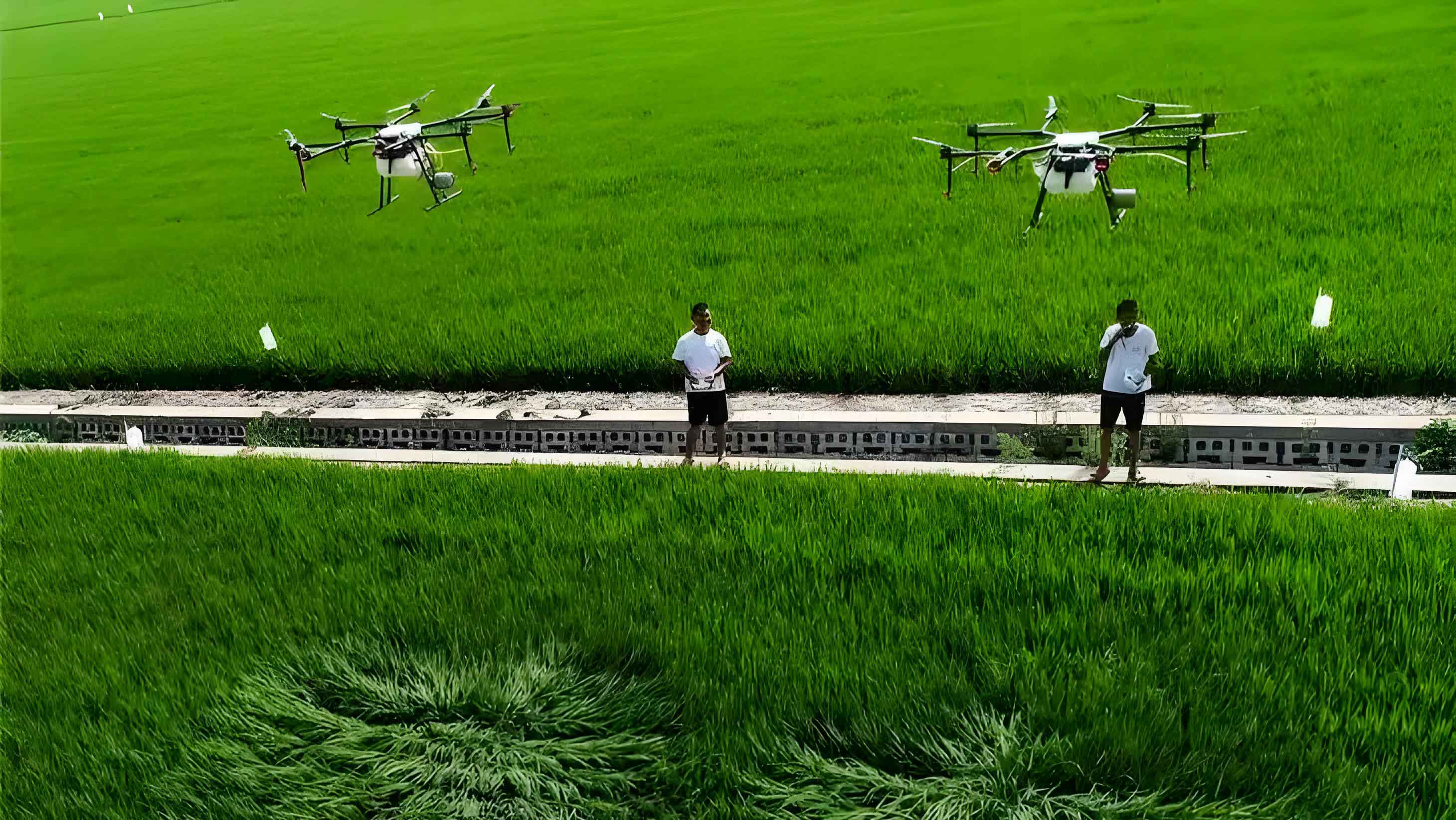
In assessing the current state of agricultural UAV applications, I find it useful to categorize them into agriculture, forestry, and landscaping. Each domain presents unique opportunities and challenges for agricultural UAVs, which I will summarize through tables and formulas to illustrate their impact. Let me start with agriculture, where agricultural UAVs have revolutionized pest monitoring and spraying. For instance, in crops like corn and rice, UAVs equipped with sensors can detect disease outbreaks early, allowing for targeted interventions. The efficiency of agricultural UAVs in spraying can be modeled using a simple formula for coverage area: $$ A = v \times t \times w $$ where \( A \) is the area covered (in hectares), \( v \) is the飞行 speed (in m/s), \( t \) is the flight time (in seconds), and \( w \) is the spray width (in meters). This formula highlights how agricultural UAVs optimize resource use, often reducing water and chemical consumption by up to 50% compared to ground-based methods.
To provide a clearer comparison, I have compiled a table summarizing the applications of agricultural UAVs in different sectors:
| Sector | Primary Use | Advantages of Agricultural UAVs | Challenges |
|---|---|---|---|
| Agriculture | Pest monitoring, fertilizer spraying, crop health assessment | High efficiency, reduced labor, precise application | Weather dependency, need for specialized operators |
| Forestry | Forest resource surveys, pest control, fire monitoring | Access to rugged terrain, large-area coverage, minimal disturbance | Limited payload capacity, regulatory restrictions |
| Landscaping | Tall tree spraying, park maintenance, slope greening | Adaptability to complex landscapes, time-saving, eco-friendly | Urban airspace constraints, high initial cost |
From my experience, agricultural UAVs excel in forestry applications, where they monitor insect infestations over vast areas. The use of remote sensing with agricultural UAVs allows for real-time data collection, which can be analyzed to predict pest outbreaks. For example, the spatial distribution of pests can be modeled using semi-variogram functions: $$ \gamma(h) = \frac{1}{2N(h)} \sum_{i=1}^{N(h)} [z(x_i) – z(x_i + h)]^2 $$ where \( \gamma(h) \) is the semi-variance at lag distance \( h \), \( N(h) \) is the number of sample pairs, and \( z(x_i) \) represents pest density at location \( x_i \). This mathematical approach, facilitated by agricultural UAVs, enhances the accuracy of pest management strategies in forests.
In the landscaping sector, agricultural UAVs have gained traction in cities like Nanjing and Xiamen, where they are used to maintain tall trees and expansive parks. I have observed that agricultural UAVs can spray pesticides on trees up to 15 meters tall in just minutes, a task that would take hours with conventional equipment. The effectiveness of agricultural UAVs in such settings can be quantified by the deposition efficiency of spray droplets, which depends on factors like altitude and wind speed. A formula for droplet deposition density \( D \) (in droplets/cm²) is: $$ D = \frac{Q \times \eta}{A \times \rho} $$ where \( Q \) is the flow rate (in L/min), \( \eta \) is the nozzle efficiency, \( A \) is the target area (in m²), and \( \rho \) is the droplet density (in droplets/L). Agricultural UAVs often achieve higher \( D \) values due to their ability to generate downward airflow, ensuring even coverage on plant surfaces.
Now, turning to Chongqing, I see immense potential for agricultural UAVs in its landscape maintenance. The city’s mountainous terrain, with its slopes, cliffs, and urban forests, poses significant challenges for traditional ground-based methods. From my perspective, agricultural UAVs offer several advantages here. First, their vertical take-off and landing capability allows them to access difficult areas, such as hillside parks or wetland zones, where human operators cannot easily reach. Second, agricultural UAVs can cover large areas quickly, which is crucial for timely pest control in Chongqing’s diverse green spaces. To illustrate this, consider the efficiency gain: if a traditional sprayer covers 0.5 hectares per hour, an agricultural UAV can cover 2-3 hectares in the same time, representing a four to sixfold increase. This efficiency can be expressed as: $$ E_{UAV} = \frac{A_{UAV}}{A_{traditional}} \times 100\% $$ where \( E_{UAV} \) is the relative efficiency (often exceeding 300% for agricultural UAVs), \( A_{UAV} \) is the area covered by the agricultural UAV, and \( A_{traditional} \) is the area covered by traditional methods.
However, I must acknowledge the limitations of agricultural UAVs in urban settings like Chongqing. One major issue is the requirement for skilled operators; flying an agricultural UAV demands certification and training, which can be a barrier for widespread adoption. Additionally, urban airspace is crowded with buildings and power lines, restricting flight paths. I have compiled another table to summarize these pros and cons specifically for Chongqing:
| Aspect | Pros | Cons |
|---|---|---|
| Terrain Adaptability | Can operate on slopes and in wetlands without ground access | May struggle in narrow streets with limited clearance |
| Efficiency | High-speed spraying reduces labor and time costs | Payload limits require frequent refills, reducing continuous operation |
| Environmental Impact | Reduces pesticide use by 30-50%, minimizing pollution | Noise and visual intrusion in residential areas |
| Safety | Keeps operators away from hazardous chemicals and heights | Risk of collisions in dense urban environments |
| Cost | Long-term savings on labor and materials | High initial investment for equipment and training |
Despite these challenges, I believe that agricultural UAVs can be optimized for Chongqing’s needs. For example, by developing specialized flight paths that avoid congested areas and scheduling operations during off-peak hours, we can mitigate urban constraints. Moreover, the integration of infrared cameras with agricultural UAVs enables precise monitoring of plant health, allowing for targeted interventions. The data collected can be analyzed using algorithms for disease prediction, such as: $$ P(d) = \frac{1}{1 + e^{-( \beta_0 + \beta_1 x_1 + \cdots + \beta_n x_n )}} $$ where \( P(d) \) is the probability of disease occurrence, \( \beta_i \) are coefficients, and \( x_i \) are variables like temperature or humidity measured by agricultural UAVs. This predictive capability enhances the proactive management of landscape health.
Looking ahead, I am optimistic about the future of agricultural UAVs in Chongqing. The city’s commitment to green initiatives and smart city development aligns perfectly with the precision offered by agricultural UAVs. From my observations, pilot projects in mountain parks could demonstrate the cost-effectiveness of agricultural UAVs, potentially leading to broader adoption. To quantify this, consider the return on investment (ROI) for an agricultural UAV system: $$ ROI = \frac{Net Benefits}{Initial Cost} \times 100\% $$ where Net Benefits include savings on labor, pesticides, and water, as well as improved plant health. With typical payback periods of 1-2 years, agricultural UAVs represent a sound investment for municipal authorities.
In conclusion, agricultural UAVs are poised to revolutionize landscape maintenance in Chongqing by addressing the unique challenges of its mountainous terrain. Through continued innovation in technology, operator training, and regulatory frameworks, I am confident that agricultural UAVs will become a staple in urban greening efforts. As we move towards more sustainable cities, the role of agricultural UAVs in reducing environmental impact while enhancing efficiency cannot be overstated. I encourage stakeholders to embrace this technology, for it holds the key to a greener, healthier urban future.