
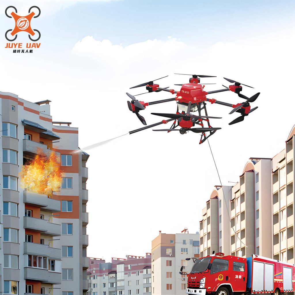
In the critical domain of firefighting emergency communications, rotary-wing Unmanned Aerial Vehicle (UAV) systems have emerged as indispensable “aerial communication nodes.” Their agility, rapid response capability, and environmental adaptability are key to enhancing rescue efficiency and ensuring robust communication links. The application of a dedicated fire UAV system not only significantly improves disaster response but also lays the groundwork for a future integrated “air-space-ground” emergency communication network. With breakthroughs in Artificial Intelligence (AI) and energy technologies, these systems are evolving towards full autonomy and enhanced intelligence. This article details a comprehensive system design from a first-person perspective, emphasizing its architecture, key technologies, and practical applications.
Operational Advantages of the Fire UAV Communication System
The superiority of a rotary-wing fire UAV system in emergency scenarios is multifaceted, providing tangible benefits over traditional methods.
- Rapid Response and Deployment: The vertical take-off and landing (VTOL) capability allows the fire UAV to quickly reach disaster sites, even in complex terrain, enabling real-time monitoring and preliminary damage assessment to support timely decision-making.
- Flexible Mobility and High-Efficiency Operation: Their compact size and light weight enable navigation through obstacles, providing extensive area coverage that is often inaccessible to ground teams or larger aircraft.
- Low Operational Cost and Ease of Maintenance: Compared to manned aviation assets, fire UAV systems have lower running costs, simpler mechanical structures, and do not require dedicated runways, simplifying logistics and field maintenance.
- Enhanced Safety and System Compatibility: Integrated obstacle avoidance systems and stable flight control technologies mitigate operational risks. Furthermore, the fire UAV platform can be designed to interoperate seamlessly with other rescue equipment, such as life detectors or environmental sensors, creating a synergistic effect that boosts overall mission efficiency.
System Design Framework for the Fire UAV
The proposed fire UAV communication system is architected on a unified “Perception-Transmission-Decision” paradigm, structured into four distinct layers to ensure modularity and scalability.
| Layer | Name & Primary Role | Key Components & Devices |
|---|---|---|
| Layer 1 | Perception Layer (UAV End) Environmental data acquisition and telemetry. |
Multispectral Sensors, RTK Positioning Module, Obstacle Avoidance Radar, Gas Detectors, Thermal Imaging Camera. |
| Layer 2 | Transmission Layer (Communication Relay) Constructing an air-ground integrated network. |
Mesh Mobile Ad-hoc Network (MANET) Radio, LTE/5G Portable Base Station, Satellite Communication Terminal. |
| Layer 3 | Network Layer (Edge Computing) Data pre-processing and AI analysis at the edge. |
Edge Computing Node (e.g., NVIDIA Jetson AGX Orin) for fire recognition, path planning, and data reduction. |
| Layer 4 | Application Layer (Command Center) Situational awareness visualization and command dispatch. |
GIS-Integrated AR Command System for 3D visualization, multi-source data fusion, and rescue instruction issuance. |
Core Enabling Technologies
The performance of the fire UAV system hinges on several advanced technologies that ensure reliable communication, autonomous operation, and intelligent processing.
1. Multi-Modal Communication Payload Technology
To ensure connectivity in diverse and degraded environments, the fire UAV employs a fusion of communication modes: LTE/5G for high-bandwidth local coverage, satellite communication (e.g., BeiDou Short Message) for beyond-line-of-sight command links, and microwave relay for point-to-point extension. Anti-jamming designs are critical. Frequency Hopping (FH) and Direct-Sequence Spread Spectrum (DSSS) techniques are implemented to maintain stable transmission in complex electromagnetic environments. The effective data rate $R$ under interference can be modeled as a function of the spreading gain $G_p$ and the signal-to-interference-plus-noise ratio (SINR):
$$ R \leq B \cdot \log_2\left(1 + G_p \cdot \text{SINR}\right) $$
where $B$ is the bandwidth. A high $G_p$ from DSSS significantly improves robustness.
2. Autonomous Flight and Obstacle Avoidance
AI-driven navigation is paramount. By combining Simultaneous Localization and Mapping (SLAM) with deep learning-based path planning algorithms, the fire UAV can achieve autonomous obstacle avoidance, allowing stable flight in dense smoke or urban canyons. The SLAM process often involves solving for the robot’s pose $x_t$ and the map $m$ given observations $z_{1:t}$ and controls $u_{1:t}$:
$$ P(x_t, m | z_{1:t}, u_{1:t}) $$
Long-endurance is addressed by moving beyond traditional lithium batteries. Hybrid power systems using hydrogen fuel cells or solar-assisted charging are integrated, currently achieving flight times exceeding 2 hours. The total available energy $E_{total}$ can be expressed as:
$$ E_{total} = E_{battery} + \int_{0}^{T} P_{fuel\_cell}(t) \,dt + \int_{0}^{T} \eta \cdot A \cdot I_{solar}(t) \,dt $$
where $\eta$ is solar panel efficiency, $A$ is area, and $I_{solar}$ is solar irradiance.
3. Onboard Edge Computing Capability
Equipping the fire UAV with a powerful edge computing module enables local processing of high-bandwidth sensor data, particularly video streams. This reduces the bandwidth required for uplink transmission and drastically cuts latency for critical decisions like immediate fire detection. The reduction in required uplink bandwidth $\Delta B_{uplink}$ for video can be approximated by the ratio of raw video data rate $R_{video}$ to the rate of extracted metadata $R_{meta}$ after edge processing:
$$ \Delta B_{uplink} \approx R_{video} – R_{meta} $$
Hardware Subsystem Design
1. UAV Platform Selection and Modification
The fire UAV platform must meet stringent requirements for payload, endurance, and stability. The selection and customization criteria are summarized below:
| Requirement | Target Specification | Selected Platform/Solution | Achieved Performance |
|---|---|---|---|
| Payload Capacity | Support ≥ 3kg communication/sensor payload | DJI Matrice 300 RTK (Hexacopter) | Max Takeoff Weight: 9kg |
| Flight Endurance | ≥ 40 mins (Hybrid Power) | T-Motor 6010S Motor + Fuel Engine Hybrid System | 65 mins total (30 min battery + 35 min fuel extender) |
| Positioning/Hovering Accuracy | High precision for mapping/station keeping | Integrated RTK Module | Hovering Accuracy: ±0.1 m |
| Wind Resistance | Operate in ≥ Level 7 wind (13.8 m/s) | Custom aerodynamic design & reinforced frame | Stable hover in winds ≤ 20 m/s |
Key structural modifications include a modular payload bay with quick-release mechanisms and composite vibration-damping mounts (silicone + spring) to protect sensitive electronics. An active thermal management system combining side vents, turbo fans, and heat pipe technology ensures reliable operation in ambient temperatures up to 50°C.
2. Communication Module Hardware Design
The communication payload is the core of the fire UAV‘s relay functionality, comprising several integrated subsystems.
| Module | Primary Function | Hardware Selection & Key Features |
|---|---|---|
| Portable LTE/5G Base Station | Provide temporary cellular network coverage for rescue teams and victims. | Module: Huawei MH5000. Integrated Massive MIMO antenna (128 elements). Dynamic bandwidth adjustment (5-20 MHz) via USB 3.1 interface with flight controller. |
| Mesh MANET Radio | Enable multi-hop, self-forming, self-healing networks between multiple UAVs and ground nodes. | Radio: Siklu Ethereal 600. Dual-band (2.4/5.8 GHz), throughput up to 1 Gbps. Features independent RF front-end with AGC and fast hopping (1000 hops/sec) for interference avoidance. |
| Satellite Communication Terminal | Ensure wide-area, beyond-line-of-sight connectivity to remote command centers. | Terminal: HwaCreate HGS-6800. Compatible with BeiDou Short Message (BD3) and Inmarsat BGAN. Uses a flat-panel phased array antenna (Gain ≥ 10 dBi). |
RF Front-end Optimization: A composite antenna design combines a folded dipole (2.4/5.8 GHz) with a helical antenna (4G LTE), dynamically switched via an RF switch (e.g., Skyworks SKY13322). Electromagnetic interference (EMI) is minimized through a copper foil and conductive foam shielded equipment bay, and the use of shielded coaxial cables (RG-316) with grounding resistance ≤ 0.1 Ω.
Software Subsystem and Protocol Design
1. Core Software Modules
The intelligence of the fire UAV system is realized through specialized software modules running on both the edge node and the command center.
- Communication Relay Management Module: Dynamically assigns roles (router/terminal) to Mesh nodes. Utilizes the Ad-hoc On-Demand Distance Vector (AODV) routing protocol managed by a Software-Defined Networking (SDN) controller (e.g., ONOS) for flexible topology control.
- AI Data Analysis Module: Performs real-time fire recognition, path planning, and gas concentration prediction. Employs a fusion of a lightweight YOLOv5 model for object detection and Long Short-Term Memory (LSTM) networks for time-series prediction of fire spread and gas hazards.
- Security and Encryption Module: Ensures data integrity and confidentiality using AES-256 encryption. A Quantum Key Distribution (QKD) mechanism is reserved as a backup for ultra-high-security scenarios.
- Multi-UAV Cooperative Control Module: Manages swarm task allocation and deconfliction using an improved Artificial Bee Colony (ABC) algorithm combined with Spatio-Temporal Conflict Avoidance (STCA) rules.
2. Communication Protocol Stack and Data Flow
A tailored protocol stack ensures efficient, prioritized, and reliable data flow for the fire UAV network.
| Protocol Layer | Protocol/Technology Used | Purpose & Benefit |
|---|---|---|
| Physical Layer | 2.4 GHz / 5.8 GHz Dual-band, OFDM Modulation, MIMO | Robust, high-throughput, anti-interference transmission. |
| MAC Layer | Dynamic TDMA + CSMA/CA Hybrid Scheduling | Provides Quality of Service (QoS) prioritization (Voice > Video > Data). |
| Network Layer | IPv6 over Mesh, SDN-based Dynamic Routing | Enables scalable addressing and adaptive topology adjustment. |
| Application Layer | MQTT (for telemetry) + WebRTC (for real-time video) | Facilitates lightweight data publishing/subscribing and low-latency multi-terminal data fusion. |
Data Flow Design:
- Uplink (UAV → Command Center): Sensor data (temperature, gas concentration), video streams, and equipment status flow from the fire UAV through the Mesh network, then via satellite or public internet to the edge computing node for AI analysis, before final presentation on the command center dashboard.
$$ \text{UAV Sensor} \rightarrow \text{Mesh Net} \rightarrow \text{Sat/Internet} \rightarrow \text{Edge AI} \rightarrow \text{Command Screen} $$ - Downlink (Command Center → UAV): Augmented Reality (AR) instructions, Building Information Modeling (BIM) overlays, and updated flight paths are sent via satellite link, relayed through the Mesh network, and decoded/executed by the fire UAV.
$$ \text{AR/BIM Cmd} \rightarrow \text{Sat Link} \rightarrow \text{Mesh Relay} \rightarrow \text{UAV Execution} $$
3. Implementation of Core Functions
a) Communication Relay & Dynamic Networking: An adaptive routing algorithm improves the standard AODV protocol by incorporating a Link Quality Prediction (LQP) model to dynamically select the optimal path. Dual-band binding allows dynamic switching between 2.4 GHz (wider coverage) and 5.8 GHz (higher speed) bands, boosting aggregate throughput to ~1.5 Gbps. An anti-jamming mechanism uses spectrum sensing powered by an LSTM-based model to predict and avoid congested frequency bands, scanning at a rate of 1000 times per second.
b) Edge AI Analysis:
- Fire Identification & Localization: An optimized YOLOv5 model, accelerated with TensorRT, achieves an inference speed ≥ 30 fps on 1080P video streams directly on the fire UAV. The confidence score $P_{fire}$ for a detected region is given by the model’s output:
$$ P_{fire} = \text{YOLOv5}(I_t) $$
where $I_t$ is the video frame at time $t$. - Thermal Analysis & Spread Prediction: FLIR thermal imaging data feeds into an LSTM network to predict the direction of firefront propagation with an error margin of less than 5 meters.
- Gas Concentration Forecasting: Another LSTM model analyzes historical gas sensor readings to predict trends in CO/H₂S concentration, enabling early warnings approximately 30 seconds in advance.
Field Testing and Performance Validation
The fire UAV system was rigorously tested in simulated high-stakes scenarios: a 30-story high-rise fire (testing penetration through smoke) and an earthquake zone with destroyed base stations (testing Mesh network robustness). The results, compared against industry benchmarks, are summarized below:
| Performance Indicator | Industry Standard / Target | Measured Result |
|---|---|---|
| Maximum Communication Coverage Radius (Single Node) | ≥ 5 km | 8.5 km |
| End-to-End Latency (Video Stream) | ≤ 1 s | 480 ms |
| End-to-End Latency (Sensor Data) | N/A (Lower is better) | 200 ms |
| Wind Resistance (Stable Hover) | Level 7 Wind (13.8 m/s) | Level 12 Wind Scale |
| Continuous Operational Time (Hybrid Mode) | ≥ 40 minutes | 65 minutes |
The tests confirmed that the system not only meets but exceeds critical industry standards, validating its readiness for real-world deployment.
Concrete Applications in Firefighting and Rescue
The versatility of the fire UAV communication system makes it a powerful tool across the entire disaster management cycle.
1. On-Scene Emergency Communication Relay
When disasters destroy terrestrial infrastructure, the fire UAV acts as an instant aerial cell tower. Deploying a portable LTE/5G base station (like the Huawei MH5000) provides immediate voice, video, and data services for firefighters and trapped civilians. In large-scale incidents, multiple fire UAV units can form a dynamic Mesh network, using protocols like AODV and OFDMA to extend coverage and automatically route around obstructions, ensuring a resilient communication grid.
2. 3D Fireground Situational Awareness
In conditions of thick smoke and intense heat, the fire UAV becomes the eyes of the command team. By fusing data from thermal imagers, visual cameras, and multi-gas detectors, it constructs a real-time 3D model of the hazard. Edge AI performs immediate fire recognition, while LSTM networks analyze thermal data to predict spread vectors. This information can be overlaid onto BIM models and viewed through AR glasses by incident commanders, providing unprecedented insight into the fire’s behavior.
3. Cross-Area Coordinated Command and Dispatch
For large-scale events like forest fires or major earthquakes, a coordinated fire UAV swarm is essential. A swarm can be task-organized: scout UAVs conduct reconnaissance, relay UAVs form the communication backbone, and command UAVs project visual information to ground teams. Swarm intelligence algorithms manage task allocation and deconflict flight paths. Satellite backhaul (e.g., via Inmarsat BGAN) maintains a vital link between the forward swarm and the remote command center, enabling expert support from structural engineers or medical personnel who can guide operations via live video feed.
4. Rescue Personnel Safety Assurance
The fire UAV system enhances firefighter safety through constant monitoring. By linking with wearable biometric sensors on firefighters, it tracks vital signs and location (using UWB for cm-accuracy). The onboard environmental sensors simultaneously monitor for toxic gas leaks. If a firefighter’s vitals become abnormal or a dangerous gas concentration is detected, the system triggers an immediate alert, guiding a timely evacuation. At night or in obscured conditions, the fire UAV uses its thermal camera and AI to search for survivors by detecting life signs like body heat or subtle movement.
5. Post-Disaster Assessment and Reconstruction Planning
After the emergency phase, the fire UAV transitions to a mapping and assessment role. Equipped with high-resolution倾斜摄影 cameras, it rapidly captures imagery of the affected area to generate centimeter-accurate 3D models. These models are invaluable for quantifying damage (e.g., calculating collapsed building volume), planning logistics routes, and conducting virtual “replay” exercises to refine future response strategies.
Technical Challenges and Mitigation Strategies
Despite its capabilities, deploying a fire UAV system in extreme environments presents ongoing challenges.
| Scenario & Challenge | Proposed Mitigation Strategy |
|---|---|
| High-Rise Fire Communication: Severe signal attenuation due to building blockage. | Use millimeter-wave (e.g., 60 GHz) relay links capable of penetrating glass幕墙, or deploy a multi-hop UAV ladder. |
| Dense Urban Monitoring: Multipath interference degrading positioning accuracy. | Implement sensor fusion of RTK-GNSS with high-grade Inertial Measurement Units (IMUs) for dynamic error correction. |
| Long-Endurance Demand: Weight penalty from hybrid power systems. | Transition to lighter, higher energy-density hydrogen fuel cells (currently in lab testing phase). |
| Extreme Weather Operations: Stability loss in heavy rain or strong winds. | Employ aerodynamic optimization and redundant, independently controlled motor/ propeller systems for fault tolerance. |
Conclusion and Future Outlook
In conclusion, the rotary-wing fire UAV communication system has evolved from an auxiliary tool to a core infrastructure component in firefighting and emergency response. Its value is particularly irreplaceable in “triple-cut” scenarios where networks, roads, and power are severed. The system design presented here, based on a “modular hardware + intelligent software” philosophy, has demonstrated rapid deployability and effective multi-role synergy. Field validation confirms its high performance in communication relay, real-time situational awareness, and coordinated command and control. Looking forward, the full potential of the fire UAV ecosystem will be unlocked through deeper integration of 5G-Advanced/6G networks, more sophisticated embodied AI, and sustainable energy solutions. Concurrently, the development of supportive regulatory frameworks for low-altitude airspace management is crucial to enable the safe and widespread adoption of these life-saving systems in disaster response operations globally.