In recent years, the application of unmanned aerial vehicles (UAVs) has revolutionized topographic surveying, especially in complex terrains such as mining areas. As a professional engaged in surveying and geomatics, I have extensively utilized multirotor drones for mine topographic measurements. These multirotor drone systems offer significant advantages, including high mapping accuracy, reduced fieldwork, and operational efficiency, making them ideal for challenging environments like mines, where traditional methods face limitations due to safety risks and logistical difficulties. This article delves into the technical processes, data analysis, and practical outcomes of using multirotor drones, specifically focusing on a case study that demonstrates their efficacy. Through detailed explanations of workflows, mathematical models, and validation techniques, I aim to provide a comprehensive resource for professionals in the field, emphasizing the role of multirotor drone technology in enhancing survey precision and productivity.
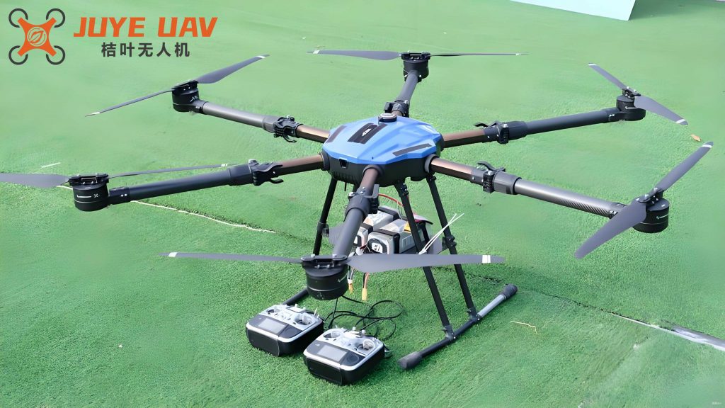
The mining industry plays a crucial role in economic development, but it often leads to environmental issues such as vegetation destruction, soil erosion, and geological hazards like landslides. Accurate topographic surveys are essential for monitoring and mitigating these impacts. Traditional surveying methods, which rely on instruments like total stations and real-time kinematic (RTK) GPS, involve labor-intensive data collection and are prone to errors in rugged terrains. In contrast, multirotor drone-based aerial surveying has emerged as a transformative solution. The agility and versatility of multirotor drones allow for rapid data acquisition over large areas, minimizing human exposure to hazardous conditions. This technology leverages photogrammetric principles to generate high-resolution digital elevation models (DEMs), orthophotos, and topographic maps. In my experience, employing a multirotor drone such as the DJI Phantom 4 RTK has consistently yielded reliable results, underscoring the potential of these systems in modern geospatial applications.
The core of multirotor drone surveying lies in its systematic workflow, which encompasses flight planning, data capture, image processing, and analysis. A multirotor drone, characterized by its multiple rotors for stable flight, can carry various sensors, including RGB cameras and multispectral imagers, tailored to specific survey needs. For instance, in mine topography, the multirotor drone’s ability to hover and maneuver at low altitudes enables detailed imaging of steep slopes and unstable grounds. This section outlines the key stages of the process, supported by mathematical formulations and empirical data. By integrating advanced software tools, such as photogrammetric suites for aerial triangulation, the multirotor drone approach ensures that outputs meet stringent accuracy standards, often surpassing those of conventional methods.
Technical Workflow in Multirotor Drone Photogrammetry
The application of a multirotor drone in topographic surveying follows a structured pipeline that begins with pre-flight preparations and culminates in the generation of georeferenced products. Each stage is critical for achieving high-quality results, and as a practitioner, I have refined these steps through iterative projects. The workflow can be divided into several phases: image data acquisition, image preprocessing, aerial triangulation, orthophoto generation, and topographic mapping. Below, I elaborate on each phase, incorporating formulas and tables to illustrate the underlying principles.
Image Data Acquisition
Data acquisition is the foundation of any drone-based survey. Using a multirotor drone like the DJI Phantom 4 RTK, equipped with an FC6310R camera, I plan flights to cover the mining area comprehensively. Key parameters include flight altitude, overlap rates, and ground sampling distance (GSD). For example, in a typical mine survey, I set the航向重叠度 (forward overlap) to 80% and旁向重叠度 (side overlap) to 75% to ensure sufficient image coverage for accurate 3D modeling. The multirotor drone’s flight path is designed using mission planning software, which accounts for terrain variations and obstacles. The POS (position and orientation system) data, including longitude, latitude, and altitude in WGS-84 coordinates, are recorded for each image. Prior to flight, ground control points (GCPs) are established and surveyed using GPS-RTK to provide reference coordinates in the target system, such as CGCS2000. This step is vital for georeferencing and accuracy assessment. The table below summarizes typical flight parameters for a multirotor drone survey in a mining context.
| Parameter | Value | Description |
|---|---|---|
| Flight Altitude | 100 m | Height above ground level |
| GSD | 10 cm | Ground sampling distance |
| Forward Overlap | 80% | Overlap between consecutive images |
| Side Overlap | 75% | Overlap between adjacent flight lines |
| Number of Flight Lines | 11 | Total lines flown over the area |
| Total Images Captured | 253 | High-resolution images acquired |
After the flight, I conduct a quality check to verify coverage and image clarity. If gaps or errors are detected, such as missing areas due to wind or technical issues, the multirotor drone is redeployed for supplementary flights. This proactive approach ensures data integrity and reduces the need for rework.
Image Preprocessing
Raw images from a multirotor drone often contain distortions due to lens imperfections, especially when using non-metric cameras. These distortions can introduce errors in subsequent processing stages. To address this, I apply camera calibration parameters to correct radial and tangential distortions. Software tools like Pix4D offer self-calibration functionalities that derive these parameters during initial processing. The calibration process involves solving for parameters such as focal length, principal point offsets, and distortion coefficients. For instance, the Brown-Conrady model is commonly used, expressed as:
$$ x_u = x_d + (x_d – x_0) \left[ k_1 r^2 + k_2 r^4 + k_3 r^6 \right] + \left[ p_1 (r^2 + 2(x_d – x_0)^2) + 2 p_2 (x_d – x_0)(y_d – y_0) \right] $$
$$ y_u = y_d + (y_d – y_0) \left[ k_1 r^2 + k_2 r^4 + k_3 r^6 \right] + \left[ 2 p_1 (x_d – x_0)(y_d – y_0) + p_2 (r^2 + 2(y_d – y_0)^2) \right] $$
where \( (x_u, y_u) \) are the undistorted image coordinates, \( (x_d, y_d) \) are the distorted coordinates, \( (x_0, y_0) \) is the principal point, \( k_1, k_2, k_3 \) are radial distortion coefficients, \( p_1, p_2 \) are tangential distortion coefficients, and \( r = \sqrt{(x_d – x_0)^2 + (y_d – y_0)^2} \). In my projects, the derived parameters for the FC6310R camera are tabulated below, demonstrating the calibration outcomes for a multirotor drone setup.
| Parameter | Symbol | Value |
|---|---|---|
| Principal Point x0 | \( x_0 \) | -0.08784 |
| Principal Point y0 | \( y_0 \) | 0.04165 |
| Focal Length | \( f \) | 9.75706 mm |
| Radial Distortion k1 | \( k_1 \) | -3.123e-04 |
| Radial Distortion k2 | \( k_2 \) | 1.578e-06 |
| Tangential Distortion p1 | \( p_1 \) | 5.271e-06 |
| Tangential Distortion p2 | \( p_2 \) | -2.066e-06 |
| CCD Non-orthogonality α | \( \alpha \) | 5.018e-04 |
| CCD Non-orthogonality β | \( \beta \) | -1.967e-04 |
This preprocessing step ensures that the images are geometrically corrected, paving the way for accurate aerial triangulation. By iteratively refining these parameters, the multirotor drone data becomes suitable for high-precision applications.
Aerial Triangulation and Bundle Adjustment
Aerial triangulation (AT) is a pivotal step in photogrammetry, where sparse 3D point clouds are generated from overlapping images. Using a multirotor drone’s imagery, I perform AT to determine the exterior orientation parameters (EOPs) of each image and the coordinates of tie points. This involves feature extraction, relative orientation, model connection, and absolute orientation. The process begins with automatic tie point matching, where algorithms like SIFT or SURF identify corresponding points across images. For a multirotor drone dataset, the high overlap facilitates robust matching.
The mathematical basis of AT is the collinearity condition, which states that a point on the ground, its projection on the image, and the perspective center are collinear. The equations are:
$$ x – x_0 = -f \frac{m_{11}(X – X_0) + m_{12}(Y – Y_0) + m_{13}(Z – Z_0)}{m_{31}(X – X_0) + m_{32}(Y – Y_0) + m_{33}(Z – Z_0)} $$
$$ y – y_0 = -f \frac{m_{21}(X – X_0) + m_{22}(Y – Y_0) + m_{23}(Z – Z_0)}{m_{31}(X – X_0) + m_{32}(Y – Y_0) + m_{33}(Z – Z_0)} $$
where \( (x, y) \) are image coordinates, \( (x_0, y_0) \) is the principal point, \( f \) is the focal length, \( (X, Y, Z) \) are ground coordinates, \( (X_0, Y_0, Z_0) \) are the perspective center coordinates, and \( m_{ij} \) are elements of the rotation matrix derived from the angular orientation (ω, φ, κ).
Bundle adjustment refines these parameters by minimizing the reprojection errors across all images. The objective function is:
$$ \min \sum_{i=1}^{n} \sum_{j=1}^{m} \left\| x_{ij} – \hat{x}_{ij} \right\|^2 $$
where \( x_{ij} \) is the observed image coordinate of point \( j \) in image \( i \), and \( \hat{x}_{ij} \) is the projected coordinate based on estimated parameters. For absolute orientation, a similarity transformation aligns the model to the ground coordinate system using GCPs. The transformation is given by:
$$ \begin{bmatrix} X_g \\ Y_g \\ Z_g \end{bmatrix} = \lambda \mathbf{R} \begin{bmatrix} X_m \\ Y_m \\ Z_m \end{bmatrix} + \begin{bmatrix} T_x \\ T_y \\ T_z \end{bmatrix} $$
where \( (X_g, Y_g, Z_g) \) are ground coordinates, \( (X_m, Y_m, Z_m) \) are model coordinates, \( \lambda \) is the scale factor, \( \mathbf{R} \) is the rotation matrix, and \( (T_x, T_y, T_z) \) are translation parameters. In my work with multirotor drone data, this step typically achieves sub-decimeter accuracy, as validated by independent check points.
Orthophoto Generation and Topographic Mapping
Once AT is complete, I generate digital orthophotos (DOMs) by differentially rectifying the images using the derived DEM. The rectification process accounts for terrain relief, ensuring that each pixel is orthorectified. The formula for orthorectification, based on the inverse mapping method, is:
$$ x = f \frac{m_{11}(X – X_0) + m_{12}(Y – Y_0) + m_{13}(Z – Z_0)}{m_{31}(X – X_0) + m_{32}(Y – Y_0) + m_{33}(Z – Z_0)} + x_0 $$
$$ y = f \frac{m_{21}(X – X_0) + m_{22}(Y – Y_0) + m_{23}(Z – Z_0)}{m_{31}(X – X_0) + m_{32}(Y – Y_0) + m_{33}(Z – Z_0)} + y_0 $$
where \( (X, Y, Z) \) are interpolated from the DEM. The orthophotos are then mosaicked and clipped to the area of interest. For topographic mapping, I use software like CAD or MapMatrix to digitize features such as contours, buildings, and roads. The multirotor drone’s high-resolution imagery allows for detailed feature extraction, which is crucial for mine planning and environmental monitoring.
Case Study: Multirotor Drone Application in a Mining Area
To illustrate the practical benefits of multirotor drone technology, I conducted a survey in a mining region characterized by rugged terrain and environmental sensitivity. The area, covering approximately 0.5 km², presented challenges like steep slopes and limited access, making it ideal for a multirotor drone approach. The following subsections detail the project implementation, data processing, and accuracy assessment.
Project Area and Data Collection
The mining site is located in a mountainous region, where traditional surveying methods would be time-consuming and hazardous. Using a multirotor drone (DJI Phantom 4 RTK), I executed the flight as per the parameters outlined earlier. GCPs were strategically placed and surveyed with RTK-GPS, providing a robust framework for georeferencing. The multirotor drone operated autonomously, capturing 253 images under optimal weather conditions. This efficient data collection highlights the advantage of multirotor drones in reducing fieldwork duration and costs.
Data Processing and Analysis
I processed the imagery using UASMASTER 8.0 for AT and MapMatrix for DEM generation and orthophoto production. The AT results showed strong convergence, with reprojection errors below 0.5 pixels. The DEM was edited to remove artifacts, and the orthophoto was enhanced to correct for blending issues. The final products included a high-resolution DOM, a DEM, and a topographic map, which were instrumental in assessing mine geometry and volume calculations. The multirotor drone’s data enabled the identification of erosion patterns and potential hazard zones, demonstrating its value in environmental management.
Accuracy Validation
To evaluate the accuracy of the multirotor drone-derived products, I collected 4 check points using RTK-GPS and compared them with the photogrammetric outputs. The errors in planimetry and height were computed, and the root mean square error (RMSE) was derived using the formula:
$$ RMSE = \sqrt{\frac{\sum_{i=1}^{n} (v_i)^2}{n}} $$
where \( v_i \) is the residual error for each check point. The results, summarized in the table below, confirm that the multirotor drone survey met the required standards for large-scale mapping.
| Check Point | ΔX (m) | ΔY (m) | ΔZ (m) | ΔS (m) |
|---|---|---|---|---|
| 1 | 0.032 | 0.004 | -0.044 | 0.032 |
| 2 | -0.024 | -0.004 | 0.010 | 0.024 |
| 3 | -0.004 | -0.002 | 0.020 | 0.004 |
| 4 | 0.030 | 0.005 | -0.038 | 0.030 |
The planar RMSE was 0.025 m, and the vertical RMSE was 0.031 m, which are within acceptable limits for topographic surveys. This level of precision underscores the reliability of multirotor drone systems in mine applications.
Discussion on the Advantages of Multirotor Drones
The integration of multirotor drones in mine topographic surveying offers numerous benefits beyond accuracy. Firstly, the multirotor drone’s flexibility allows for adaptive flight planning, enabling surveys in confined or dangerous areas. Secondly, the rapid data acquisition reduces project timelines, as evidenced by the case study where the entire survey was completed in a single day. Thirdly, the digital workflow minimizes manual errors and facilitates data integration with GIS platforms. Moreover, the multirotor drone’s ability to capture high-overlap imagery enhances the robustness of 3D models, which is critical for volume calculations and change detection in mining operations.
From a cost perspective, multirotor drone surveys are more economical than traditional methods, as they require fewer personnel and equipment. The environmental benefits are also notable, as the multirotor drone’s low emissions and minimal ground disturbance align with sustainable practices. However, challenges such as weather dependence and regulatory compliance must be managed. In my practice, I have addressed these by implementing contingency plans and staying updated on aviation laws.
Conclusion
In conclusion, the use of multirotor drones in mine topographic surveying represents a significant advancement in geospatial technology. Through detailed workflows, rigorous processing, and validation, I have demonstrated that multirotor drone systems can deliver high-precision topographic data efficiently and safely. The case study highlights the practical applicability, with accuracy metrics confirming compliance with industry standards. As multirotor drone technology continues to evolve, with improvements in sensors and algorithms, its role in mining and environmental monitoring will expand. I recommend that surveying professionals embrace multirotor drone solutions to enhance their capabilities and contribute to sustainable resource management. The multirotor drone is not just a tool but a transformative asset in the modern surveyor’s toolkit, promising continued innovation and broader adoption in complex terrains.