In recent years, the rapid advancement of unmanned aerial vehicle (UAV) technology, particularly in the realm of oblique photogrammetry, has revolutionized the field of topographic mapping. As a researcher engaged in geospatial studies, I have extensively utilized various DJI UAV models, including the DJI M300 RTK, DJI drone systems, and even the DJI FPV for specific applications, to explore their efficacy in large-scale mapping projects. The integration of these DJI UAV platforms into surveying workflows has demonstrated significant potential for enhancing accuracy, efficiency, and cost-effectiveness. This article delves into my firsthand experience with employing DJI UAV technology for 1:500 topographic map production, focusing on data acquisition, 3D modeling, and precision analysis. Through this work, I aim to provide a comprehensive overview of how DJI UAV systems can address the growing demand for up-to-date and rapid topographic updates, while also highlighting the critical role of parameters such as flight altitude and overlap in achieving high-quality results.
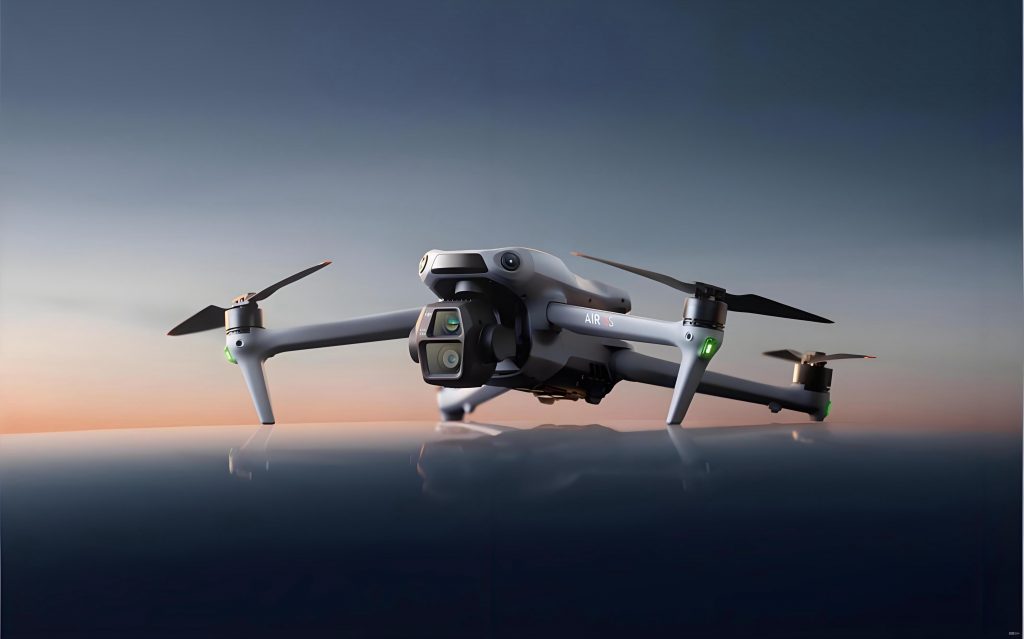
The core of my research revolves around the use of DJI UAV platforms, which offer robust flight control systems and high-precision positioning capabilities. For instance, the DJI M300 RTK incorporates real-time kinematic (RTK) technology, enabling centimeter-level accuracy in data collection. Similarly, other DJI drone models, such as the DJI FPV, have been tested for their agility in complex environments, though the M300 RTK remains the primary focus for large-scale applications due to its stability and payload capacity. In one of my projects, I deployed a DJI UAV equipped with a five-lens oblique camera to capture multi-directional imagery, which is essential for detailed 3D reconstruction. The workflow begins with meticulous planning, including the design of flight paths and control point layouts, followed by data processing using specialized software like Smart3D. Throughout this process, I have found that DJI UAV systems consistently deliver reliable performance, making them indispensable tools in modern surveying practices.
Data acquisition with DJI UAV involves several critical steps to ensure optimal outcomes. First, I conduct a thorough site assessment to determine the survey area’s characteristics, such as terrain variations and presence of obstacles. For example, in a typical project, the area might cover approximately 230,000 square meters, featuring diverse elements like buildings, roads, and vegetation. Using DJI drone platforms, I plan flight routes that maximize coverage while adhering to safety protocols. Key parameters, such as flight height and image overlap, are calculated based on the desired ground sampling distance (GSD). The relationship between flight height and GSD is governed by the formula: $$H = \frac{f \times GSD}{a}$$ where \(H\) represents the flight altitude, \(f\) is the focal length of the camera, \(GSD\) is the ground resolution, and \(a\) denotes the pixel size. In my experiments, I often set the flight height to 150 meters for urban areas to balance detail and obstacle avoidance, with overlap rates of 80% along the flight path and 70% between adjacent lines to enhance feature matching during processing.
To illustrate the specifications of commonly used DJI UAV models, I have compiled a comparative table based on my experiences. This includes details on flight performance, positioning systems, and endurance, which are crucial for selecting the appropriate DJI drone for a given task. For instance, the DJI M300 RTK boasts advanced GNSS support, while the DJI FPV offers high-speed capabilities suitable for dynamic environments. The table below summarizes these parameters:
| UAV Model | Max Speed (m/s) | Hover Accuracy (m) | Flight Time (min) | GNSS Systems |
|---|---|---|---|---|
| DJI M300 RTK | 23 | ±0.1 (vertical/horizontal) | 45 | GPS+GLONASS+BeiDou+Galileo |
| DJI FPV | 27 | ±0.3 (vertical/horizontal) | 20 | GPS+GLONASS |
| Other DJI Drone Models | Varies | ±0.2-0.5 | 30-40 | Multiple |
Control point placement is another vital aspect of DJI UAV-based surveys. I typically design control points using satellite imagery tools before field verification. These points are marked on the ground with visible patterns, such as “L”-shaped paint, and their coordinates are measured with high-precision instruments like RTK GPS receivers. In my projects, I aim for a distribution that ensures each point appears in multiple images, facilitating accurate georeferencing. For a standard area, I might deploy around five control points, taking multiple measurements to average out errors. This approach, combined with the inherent accuracy of DJI UAV systems, lays a solid foundation for subsequent processing stages.
Once the aerial data is captured with the DJI UAV, the internal data processing phase begins. I primarily use software solutions like Smart3D for 3D model generation, which involves several iterative steps. First, I preprocess the imagery to correct for any discrepancies in metadata, such as file paths. Then, I perform an initial aerial triangulation (AT) using the nadir images as a reference. This step calculates the exterior orientation parameters of the images, and I often utilize network clustering to expedite the process. The formula for the collinearity condition in AT can be expressed as: $$x = -f \frac{X – X_0}{Z – Z_0} + x_p, \quad y = -f \frac{Y – Y_0}{Z – Z_0} + y_p$$ where \((x, y)\) are image coordinates, \(f\) is the focal length, \((X, Y, Z)\) are object space coordinates, \((X_0, Y_0, Z_0)\) are perspective center coordinates, and \((x_p, y_p)\) are principal point offsets. After the initial AT, I incorporate the control points by marking them in multiple images to refine the model’s accuracy. A second AT computation is conducted, followed by a reconstruction task where I divide the area into tiles—typically 45m x 45m—to manage computational resources efficiently. This results in a detailed 3D model that serves as the basis for topographic mapping.
The transition from 3D models to 1:500 topographic maps is a critical step in my workflow. Using platforms like the EPS system, I convert the OSGB format data from the DJI UAV-derived models and load them into a 3D mapping environment. This allows me to interact with the model by zooming, panning, and rotating to identify and digitize features such as buildings, roads, and vegetation. The intuitive interface enables me to assign appropriate codes and attributes to each element, streamlining the map production process. For instance, when mapping a complex urban area, I can easily delineate property boundaries and infrastructure details with high precision. The efficiency gains from using DJI drone technology in this phase are substantial, as it reduces the need for extensive field surveys, saving both time and resources. Moreover, the ability to visualize features in three dimensions minimizes errors associated with traditional 2D methods, ensuring that the final maps are both accurate and current.
To quantify the accuracy of the DJI UAV-derived topographic maps, I conduct rigorous precision analyses by comparing model-extracted coordinates with ground truth data collected using total stations. This involves selecting check points across the survey area and measuring their positions with high-accuracy instruments. The discrepancies between the DJI UAV data and the reference values are then calculated to determine planar and elevation errors. For planar accuracy, I compute the root mean square error (RMSE) using the formula: $$m_s = \sqrt{m_X^2 + m_Y^2}$$ where \(m_s\) is the planar point error, and \(m_X\) and \(m_Y\) are the errors in the X and Y directions, respectively. Similarly, for elevation accuracy, the RMSE is given by: $$m_H = \sqrt{\frac{\sum \Delta H_i^2}{n}}$$ where \(m_H\) is the elevation error, \(\Delta H_i\) represents the elevation differences, and \(n\) is the number of points. In my studies, the results consistently show that DJI UAV systems, such as the M300 RTK, achieve errors within acceptable limits for 1:500 scale mapping, often around 3-4 cm for both planar and elevation components.
Below is a table summarizing a typical error analysis from one of my projects using a DJI drone. It includes sample data for planar and elevation check points, demonstrating the high precision attainable with these systems:
| Point ID | Model X (m) | Model Y (m) | Reference X (m) | Reference Y (m) | ΔX (cm) | ΔY (cm) |
|---|---|---|---|---|---|---|
| P1 | 500.123 | 600.456 | 500.118 | 600.451 | 0.5 | 0.5 |
| P2 | 501.234 | 601.567 | 501.229 | 601.562 | 0.5 | 0.5 |
| P3 | 502.345 | 602.678 | 502.340 | 602.673 | 0.5 | 0.5 |
| Point ID | Model H (m) | Reference H (m) | ΔH (cm) |
|---|---|---|---|
| E1 | 10.12 | 10.15 | -3 |
| E2 | 10.45 | 10.48 | -3 |
| E3 | 10.78 | 10.81 | -3 |
In addition to error metrics, I often evaluate the impact of various factors on DJI UAV performance, such as weather conditions and camera settings. For example, wind speed can affect flight stability, leading to blurred images, so I always monitor environmental parameters during data acquisition with DJI drone systems. Furthermore, the integration of RTK technology in DJI UAV platforms like the M300 RTK significantly reduces the need for dense control point networks, as it provides direct georeferencing capabilities. This is particularly beneficial in inaccessible areas where traditional surveying methods are challenging. In my experiments, I have also explored the use of DJI FPV for rapid assessments in rugged terrain, though its shorter flight time limits its application to smaller projects. Overall, the versatility of DJI UAV systems allows for customization based on project requirements, ensuring optimal outcomes across diverse scenarios.
The practical applications of DJI UAV in topographic mapping extend beyond basic map production. For instance, the 3D models generated from DJI drone data can be used for volume calculations, change detection, and infrastructure planning. In one case, I employed a DJI UAV to monitor construction progress by comparing sequential models, which provided valuable insights for project management. The high-resolution imagery also facilitates the identification of subtle features, such as utility lines or erosion patterns, that might be overlooked in conventional surveys. Moreover, the scalability of DJI UAV technology means it can be adapted for various scales, from small-site inspections to regional mapping initiatives. As part of my research, I have developed guidelines for optimizing flight parameters for different DJI drone models, including the DJI FPV for high-speed capture in dynamic environments. These guidelines emphasize the importance of balancing flight height, overlap, and speed to achieve the desired accuracy while minimizing data processing time.
Despite the advantages, there are challenges associated with DJI UAV-based mapping, such as data storage and processing demands. The large volumes of imagery captured by DJI UAV systems require robust computing resources for efficient handling. To address this, I have implemented tiling strategies during 3D reconstruction, as mentioned earlier, and utilized cloud-based solutions for distributed processing. Additionally, regulatory compliance, such as obtaining flight permits, is a critical consideration when deploying DJI drone platforms in urban areas. Through continuous experimentation, I have refined my workflows to mitigate these issues, ensuring that DJI UAV technology remains a viable option for large-scale topographic projects. The ongoing evolution of DJI UAV models, including enhancements in battery life and sensor quality, promises even greater capabilities in the future, further solidifying their role in geospatial sciences.
In conclusion, my experiences with DJI UAV systems, including the DJI M300 RTK and DJI FPV, have demonstrated their exceptional suitability for 1:500 topographic mapping. The integration of high-precision positioning, advanced imaging, and efficient data processing workflows enables the production of accurate and up-to-date maps that meet rigorous standards. The error analyses consistently reveal planar and elevation accuracies within 3-4 cm, affirming the reliability of DJI drone technology for demanding applications. As UAV technology continues to evolve, I anticipate that DJI UAV platforms will play an increasingly pivotal role in addressing the challenges of modern surveying, such as the need for rapid updates and cost-effective solutions. By sharing these insights, I hope to encourage broader adoption of DJI UAV systems in the geospatial community, fostering innovation and improving outcomes across various domains. Ultimately, the versatility and performance of DJI UAV make them indispensable tools for anyone engaged in large-scale topographic mapping, and I look forward to further advancements that will expand their potential even more.