The rapid proliferation of consumer-grade unmanned aerial vehicles (UAVs) has brought unprecedented convenience to daily life, while simultaneously posing severe threats to public safety, national security, and personal privacy. Incidents involving drone black flights near airports, government facilities, and crowded public events have underscored the urgent need for robust drone regulation frameworks. To address these challenges, I have developed a comprehensive civilian UAV management and control system that integrates reconnaissance, countermeasure, command, and training modules. This system ensures effective drone regulation by enabling authorities to “see, track, and neutralize” non-cooperative UAVs in real time. The entire design is modular, scalable, and adaptable to diverse operational environments, providing a blueprint for future drone regulation implementations worldwide.
System Overview
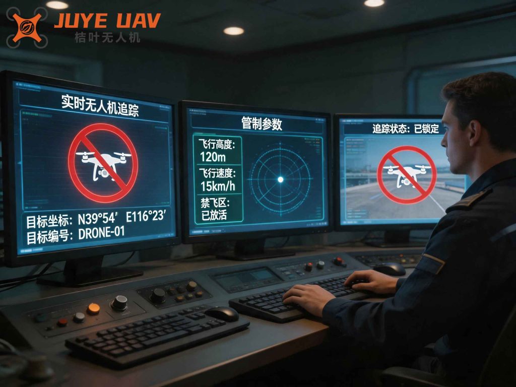
The proposed system consists of four primary subsystems: reconnaissance and early warning, control and countermeasure, command center, and training support. The reconnaissance subsystem detects and identifies UAVs using passive radio frequency (RF) sensing and radar, while the control subsystem employs jamming and spoofing techniques to force unauthorized drones to land or return. The command center aggregates data from all sensors, provides situational awareness through an intuitive geographic information system (GIS), and automates countermeasure decisions. The training subsystem enables operators to simulate real-world scenarios for improved response accuracy. The following figure illustrates the conceptual architecture of the system (an actual deployment site for unmanned traffic management is shown).
This holistic approach to drone regulation ensures that all phases — detection, identification, tracking, and neutralization — are tightly coordinated, minimizing human error and response time.
Reconnaissance and Early Warning Subsystem
The reconnaissance and early warning subsystem is the eyes of the overall drone regulation system. It comprises passive radio frequency detectors, radar modules, acoustic sensors, and optoelectronic tracking units. Among these, the passive RF detector is particularly critical because it does not emit any electromagnetic waves, thereby avoiding interference with the surrounding electromagnetic environment. It continuously scans the frequency bands commonly used by consumer drones: 433 MHz, 915 MHz, 2.4 GHz, and 5.8 GHz. By analyzing the uplink telemetry and downlink video signals — which employ frequency hopping spread spectrum (FHSS) and fixed-frequency burst modulations — the system can identify the drone model, extract its unique ID, estimate its position, altitude, velocity, and even locate the remote controller.
A typical signal analysis flow for a drone telemetry link is as follows:
- Wideband receiver captures raw RF data over an 80 MHz instantaneous bandwidth.
- Fast Fourier transform (FFT) and cyclostationary analysis identify hopping patterns with a minimum dwell time of 500 μs.
- Direction of arrival (DOA) estimation using a coherent interferometer array resolves azimuth and elevation angles.
- Correlation with a known drone signature database confirms the target type.
The free-space path loss (FSPL) between the drone and the ground sensor is given by:
$$
L_{bf} = 32.45 + 20\log_{10}(f_{MHz}) + 20\log_{10}(d_{km})
$$
where $$f_{MHz}$$ is the carrier frequency in megahertz and $$d_{km}$$ is the slant range in kilometers. For a typical drone operating at 2.4 GHz and 1 km distance, the FSPL is approximately 100 dB. This loss must be accounted for in the receiver sensitivity budget to achieve reliable detection.
| Parameter | Value |
|---|---|
| Frequency bands | 433 MHz, 915 MHz, 2.4 GHz, 5.8 GHz |
| Instantaneous bandwidth | 80 MHz |
| Minimum burst duration | 500 μs |
| Maximum hop rate | 2000 hops/s |
| Direction finding accuracy | < 2° RMS |
| Detection range (2.4 GHz) | Up to 8 km (with line-of-sight) |
The optoelectronic camera, which can be panned-tilt-zoomed (PTZ), is slaved to the RF direction finder to visually confirm the target. High-definition video is streamed to the command center for forensic evidence gathering, an essential component of modern drone regulation.
Control and Countermeasure Subsystem
Once a non-cooperative drone is identified and its behavior deemed threatening, the control and countermeasure subsystem is activated. This subsystem includes fixed-site jammers, portable jammers, handheld disruptors, and “clean-air” devices that create a protective no-fly zone. The primary principle is to inject high-power noise or deceptive signals into the drone’s communication links — GPS, uplink control, and downlink video — to force it to land, return to home, or crash safely.
The effective jamming power requirement can be estimated using the following link budget. Consider a drone at altitude 100 m above a ground jammer with antenna gain 0 dBi. The GPS receiver on the drone has an antenna gain of −40 dBi toward the ground (due to its upward-pointing patch) and −120 dBm sensitivity. The required received jamming power at the drone’s GPS antenna port is $$P_r \ge -83 \text{dBm}$$ to achieve a 20 dB jamming-to-signal ratio (J/S). The free-space loss at GPS frequency (1.575 GHz) over 100 m is:
$$
L_{bf} = 32.45 + 20\log_{10}(1575) + 20\log_{10}(0.1) \approx 56.4\text{ dB}
$$
Neglecting spreading gain (assumed 20 dB processing gain in the GPS receiver), the required transmitted power from the jammer is:
$$
P_t = P_r + L_{bf} – G_t = -83 + 56.4 – 0 = -26.6\text{ dBm} \;(0.002\text{ mW})
$$
In practice, due to noise figure and margin, a jammer with 0.01 W (10 dBm) power can effectively suppress GPS reception at 100 m. However, for uplink control jamming (2.4 GHz FHSS), wider band coverage is needed, and the required power rises significantly. The following table summarizes estimated jamming power for different links at a standoff distance of 1 km:
| Target Link | Frequency (GHz) | Receiver Sensitivity (dBm) | Required Jamming Power (W) |
|---|---|---|---|
| GPS L1 | 1.575 | −120 | 0.01 |
| Uplink (2.4 GHz FHSS) | 2.400–2.483 | −95 | 100 |
| Downlink video (5.8 GHz) | 5.725–5.850 | −90 | 150 |
To avoid collateral interference with legitimate wireless services, the jamming signal is precisely steered in time, frequency, and space under the guidance of the reconnaissance subsystem. The response time from detection to jamming activation is typically under 10 seconds — a critical factor for effective drone regulation in time-sensitive scenarios.
Command Center System
The command center is the brain of the entire drone regulation system. It collects data from distributed sensors and jammers, processes them through a real-time data bus, and presents a unified picture on an AreoGIS (Aeronautical Geographic Information System) platform. The command center is structured in three tiers:
- Client tier: Operator consoles with interactive dashboards showing real-time drone tracks, alarm indicators, and manual override options.
- Server tier: Central processing unit that handles data routing, fusion, persistence, user authentication, and equipment management.
- Data bus tier: A publish-subscribe messaging system that transports raw and processed data between sensors, servers, and clients over local or wide area networks.
| Component | Function |
|---|---|
| AreoGIS | Offline maps (satellite, terrain, street) with geofencing, aircraft symbolization |
| Real‑time Data Bus | Topic‑based publish/subscribe for sensor data (radar, RF, video) |
| Data Fusion Engine | Kalman filtering, track association, and multi‑sensor correlation |
| Alarm Manager | Rule‑based alert generation (geofence violation, altitude exceedance) |
| Command Logger | Audit trail of all operator actions and system events |
The command center also maintains a database of registered (white‑listed) drones, allowing automatic filtering of cooperative flights. When an unknown drone enters a protected zone, an audible and visual alert is triggered, and the operator can immediately deploy the appropriate countermeasures. The graphical user interface includes real‑time video feeds from the optoelectronic cameras, a track history replay tool, and a system status panel. This centralized command capability greatly enhances situational awareness and ensures that drone regulation is both proactive and reactive.
Deployment Strategy
Field deployment of the drone regulation system follows a concentric ring model to provide layered defense. The protection zone is divided into three rings:
- Core zone (radius 1.5 km): Fixed jammers, portable jammers, and optoelectronic trackers provide high‑confidence neutralization. A clean‑air device (broadband noise) is kept on standby for emergencies.
- Control zone (radius 2.5 km): Passive RF detectors and acoustic sensors monitor the perimeter; radar may be added if line‑of‑sight is obstructed.
- Recognition zone (radius 5 km – 8 km): Wide‑area RF scanning and long‑range radar detect incoming drones well before they threaten the core.
| Ring | Radius (km) | Primary Sensors | Primary Effectors |
|---|---|---|---|
| Core | 0 – 1.5 | Optoelectronic, radar | Fixed/portable jammers, clean‑air device |
| Control | 1.5 – 2.5 | Passive RF, acoustic | Portable jammers (optional) |
| Recognition | 5 – 8 | Passive RF, long‑range radar | None (early warning only) |
The entire network can be connected via wireless, wired Ethernet, or a hybrid topology, with a gateway providing secure access to national security networks. This flexibility allows the system to be rapidly deployed for temporary events such as international summits or permanently installed at critical infrastructure. The successful implementation of this architecture at a major international conference venue demonstrated its reliability and effectiveness in real‑world drone regulation.
System Advantages
The proposed drone regulation system offers several distinct benefits over conventional standalone countermeasure devices:
- 24/7 Fully Automatic Operation: The system can run unattended, with automatic detection, tracking, and engagement. Alarms are raised only when human intervention is required, greatly reducing operator fatigue.
- Cross‑Regional Management: The cloud‑based command center supports multiple geographically distributed sub‑centers, enabling centralized oversight of vast areas. Synchronization across data centers ensures consistent access to real‑time and historical data.
- Easy Scalability: The modular architecture uses open standards and non‑proprietary interfaces. New sensors or effectors can be integrated without major re‑engineering. Customization for specific client needs is straightforward.
- Forensic Evidentiary Capability: High‑resolution video and RF signatures are recorded for post‑event analysis, supporting legal actions against violators — a crucial aspect of drone regulation enforcement.
Additionally, the system’s passive detection mode ensures that it does not reveal its own presence, a tactical advantage in sensitive environments. All these features combine to make the system a versatile tool for modern drone regulation.
Conclusion
In response to the escalating threats posed by unauthorized drone flights, I have designed and implemented a comprehensive civilian UAV management and control system that effectively integrates detection, tracking, command, and neutralization capabilities. The system has been successfully field‑tested at a high‑profile international venue, where it ensured completely uninterrupted proceedings during the entire conference period. By providing a reliable, scalable, and automated solution, this work contributes a significant milestone to the field of drone regulation. Phase II of the project is already underway, focusing on further miniaturization of portable units and enhanced machine‑learning algorithms for drone classification. I believe that such systems will become an indispensable component of public safety infrastructure in the coming years, fostering a safe and responsible drone ecosystem while safeguarding society against malicious misuse.