In recent years, the demand for efficient, flexible, and high-resolution data acquisition tools has surged across numerous sectors, including ecological monitoring, disaster response, precision agriculture, and infrastructure inspection. Traditional satellite and manned aerial platforms, while invaluable, often face limitations in terms of revisit frequency, spatial resolution under cloud cover, and operational cost. Unmanned Aerial Vehicles (UAVs), or drones, have emerged as a disruptive technology addressing these gaps. Among them, Vertical Take-Off and Landing (VTOL) UAVs hold a particularly critical position due to their unique operational advantages. This analysis, from my perspective as an observer of the aerospace and geospatial technology landscape, delves into the current status, technical underpinnings, market dynamics, and future trajectories of VTOL UAVs specifically tailored for remote sensing missions. The ability to operate without prepared runways and to conduct precise, low-altitude surveys makes the VTOL UAV an indispensable tool in the modern remote sensing arsenal.
The core value proposition of a VTOL UAV lies in its hybrid operational capability. It combines the logistical simplicity and site independence of a rotorcraft for launch and recovery with the aerodynamic efficiency and endurance of a fixed-wing aircraft for the main survey mission. This synergy is described by the fundamental mission profile: a VTOL phase (takeoff, transition, landing) and a cruise phase. The total mission endurance, a key performance metric, is a function of the energy consumed during these distinct phases. A simplified model for battery-electric VTOL UAVs can be expressed as:
$$ E_{total} = P_{hover} \cdot t_{hover} + P_{cruise} \cdot t_{cruise} $$
$$ t_{total} = \frac{E_{battery}}{P_{hover} \cdot \frac{t_{hover}}{t_{total}} + P_{cruise} \cdot (1 – \frac{t_{hover}}{t_{total}})} $$
where \( E_{total} \) is the total energy consumed, \( P_{hover} \) and \( P_{cruise} \) are the power requirements for hovering and cruise flight respectively, and \( t_{hover} \) and \( t_{cruise} \) are the respective time durations. Maximizing \( t_{total} \) involves minimizing \( P_{hover} \) and the ratio \( t_{hover}/t_{total} \), highlighting the engineering challenge of efficient transition and high cruise efficiency.
Technical Classification and Performance Characteristics of VTOL UAVs
The VTOL UAV ecosystem for remote sensing is primarily composed of three distinct architectures, each with its own set of physical principles, advantages, and trade-offs. The choice of platform is dictated by the specific mission requirements regarding payload weight, coverage area, flight duration, and operational environment.
| Architecture | Lift Generation Principle | Key Advantages | Inherent Limitations | Typical Remote Sensing Role |
|---|---|---|---|---|
| Multi-Rotor | Multiple fixed-pitch propellers; lift variation via differential rotor speed. | Mechanical simplicity, exceptional hovering stability, ease of control, low cost. | Low aerodynamic efficiency, limited endurance and speed, limited payload capacity. | Small-area, high-detail inspection; photogrammetry over limited sites; real-time video surveillance. |
| Unmanned Helicopter | Single main rotor with complex swashplate for cyclic/collective pitch control; tail rotor or NOTAR for anti-torque. | Highest hover efficiency (large disk area), good payload capacity, moderate speed. | High mechanical complexity, significant maintenance, high vibration, requires skilled piloting. | Heavy sensor payloads (e.g., LiDAR, hyperspectral); operations requiring longer hover times. |
| VTOL Fixed-Wing (e.g., Tilt-rotor, Tail-sitter) | Dedicated rotors for VTOL, fixed wing for cruise. Rotors may tilt or the entire airframe reorients. | Combines VTOL convenience with fixed-wing endurance, speed, and large area coverage. | Design complexity, “dead weight” of VTOL system during cruise, challenging transition flight dynamics. | Large-scale mapping, linear infrastructure inspection (pipelines, power lines), regional environmental monitoring. |
Multi-Rotor UAVs: The dynamics of a standard quadcopter, the most common configuration, can be modeled using Newton-Euler equations. The thrust \( T_i \) generated by each rotor is approximately proportional to the square of its rotational speed \( \omega_i \):
$$ T_i = k_T \cdot \omega_i^2 $$
where \( k_T \) is the thrust constant. The total lift is the sum of the thrusts from all rotors. Control moments (roll, pitch, yaw) are achieved by creating imbalances in these thrusts. While this system is elegantly simple, its inefficiency stems from the high induced power required to generate lift solely through rotor momentum. The power required for hover, \( P_{hover} \), is significantly higher than for a helicopter of equivalent weight due to the smaller total disk area.
Unmanned Helicopters: The helicopter’s figure of merit (FM) is a key metric of its hover efficiency, comparing the ideal power required to generate lift to the actual power consumed:
$$ FM = \frac{P_{ideal}}{P_{actual}} = \frac{T^{3/2} / \sqrt{2 \rho A}}{P_{actual}} $$
where \( T \) is thrust, \( \rho \) is air density, and \( A \) is total rotor disk area. Helicopters typically achieve a higher FM (0.6-0.75) than multi-rotors, explaining their superior payload and endurance for their size. However, their forward flight is limited by retreating blade stall and advancing blade compressibility effects, capping maximum speed.
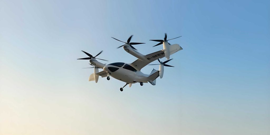
VTOL Fixed-Wing UAVs: This category represents the most active frontier in VTOL UAV development for remote sensing. The fundamental design challenge is optimizing the trade-off between vertical lift and cruise performance. The lift during cruise is generated by the wing:
$$ L = \frac{1}{2} \rho V^2 S C_L $$
where \( L \) is lift, \( V \) is airspeed, \( S \) is wing area, and \( C_L \) is the lift coefficient. The VTOL system, necessary only for takeoff and landing, adds non-productive mass and drag during cruise. The benefit is the dramatic increase in range and endurance compared to pure rotary-wing craft. The Breguet endurance equation for propeller-driven aircraft highlights this:
$$ E = \frac{1}{c} \frac{C_L}{C_D} \ln \left( \frac{W_{initial}}{W_{final}} \right) $$
where \( c \) is the specific fuel consumption, \( C_L/C_D \) is the lift-to-drag ratio, and \( W \) represents weight. A VTOL fixed-wing UAV aims for a high \( C_L/C_D \) during cruise, enabling long \( E \) for large-area coverage.
Market Segmentation and Application-Specific Analysis
The adoption of VTOL UAVs is not uniform; it is driven by specific operational needs and economic feasibility across different sectors. The following table synthesizes core remote sensing applications, their requirements, and the typical VTOL UAV platform best suited for the task.
| Application Sector | Primary Sensing Needs | Key Mission Requirements | Dominant VTOL Platform | Technical Rationale |
|---|---|---|---|---|
| Precision Agriculture & Forestry | Multispectral, hyperspectral, thermal imagery; NDVI maps. | Frequent, low-altitude flights over fields; ability to fly under canopy; precise geotagging. | Multi-Rotor, VTOL Fixed-Wing | Multi-rotors for small, sensitive plots; VTOL fixed-wing for large-scale, efficient field scanning. |
| Surveying & Mapping | High-resolution RGB imagery for photogrammetry; LiDAR for DSM/DTM. | High spatial accuracy, large area coverage, efficient flight patterns (e.g., lawnmower). | VTOL Fixed-Wing | Superior endurance and speed make VTOL fixed-wing ideal for covering square kilometers per flight. |
| Infrastructure Inspection (Power lines, Pipelines, Cell Towers) | High-res RGB, thermal (for hotspots), LiDAR for clearance analysis. | Ability to hover for close inspection, follow linear routes, operate in confined spaces. | Multi-Rotor, VTOL Fixed-Wing | Multi-rotor for pinpoint, hovering inspection; VTOL fixed-wing for long-distance corridor mapping. |
| Disaster Response & Emergency Mapping (Flood, Earthquake, Fire) | Rapid acquisition of post-event imagery, change detection, damage assessment. | Rapid deployment, operation from unprepared sites, fast area coverage. | VTOL Fixed-Wing | The VTOL capability allows launch near disaster zones, while fixed-wing efficiency provides quick situational overview. |
| Environmental Monitoring (Coastal, Wildlife, Pollution) | Multispectral, thermal, gas sensors, high-resolution video. | Long endurance for patrols, ability to carry specialized sensors, operation over sensitive/remote terrain. | VTOL Fixed-Wing, Helicopter | VTOL fixed-wing for large-area patrols; helicopters for heavier sensor suites requiring stable hover. |
Market analysis based on a broad survey of commercially available systems reveals a clear dominance of VTOL architectures. In a sampled pool of over 760 UAV models marketed for remote sensing and related applications, a staggering majority (over 80%) featured VTOL capability. Within this VTOL segment, multi-rotors command the largest share, a testament to their accessibility and maturity. However, the most significant growth trend is observed in the VTOL fixed-wing category, which is rapidly evolving from a niche concept to a mainstream solution for professional mapping and inspection, gradually encroaching on applications traditionally served by multi-rotors for larger projects.
| UAV Type | Estimated Market Share (%) | Primary Driver | Growth Trend |
|---|---|---|---|
| VTOL Total | >80% | Operational flexibility, site independence. | Stable, mature. |
| – Multi-Rotor | ~60-65% | Ease of use, low cost, stability. | High volume, but slowing in professional sectors. |
| – VTOL Fixed-Wing | ~12-18% | Superior range/endurance for area coverage. | Very High (from a smaller base). |
| – Unmanned Helicopter | ~3-7% | Heavy-lift and high-hover-efficiency niche. | Slow, specialized. |
| Non-VTOL (e.g., Hand-launch, Rail-launch) | <20% | Lower cost, maximum endurance for pure fixed-wing. | Declining relative to VTOL for most applications. |
Sensor Integration and Data Acquisition Payloads
The value of a VTOL UAV is realized only through its integrated payload. The choice of sensor directly dictates the type of remote sensing product. Key constraints are payload weight, power consumption, and physical size, which must be compatible with the VTOL UAV’s capacity. The trade-off is formalized by the basic weight breakdown equation:
$$ W_{MTOW} = W_{airframe} + W_{propulsion} + W_{avionics} + W_{payload} + W_{energy} $$
where \( W_{MTOW} \) is the maximum takeoff weight. For a given airframe, increasing \( W_{payload} \) often necessitates a reduction in \( W_{energy} \), thus impacting endurance. Therefore, sensor miniaturization has been a critical enabler for VTOL UAV-based remote sensing.
| Sensor Type | Primary Data Output | Typical Applications | Weight/Power Consideration | Compatible VTOL Platform |
|---|---|---|---|---|
| RGB Camera | High-resolution geotagged photographs. | Photogrammetry, 3D modeling, visual inspection, general mapping. | Low weight, low power. Standard on most VTOL UAVs. | All (Multi-rotor, Helicopter, VTOL Fixed-wing). |
| Multispectral Sensor | Reflectance in discrete bands (e.g., Red, Green, Red Edge, NIR). | Vegetation health (NDVI), crop monitoring, land use classification. | Moderate weight and power. Often requires precise calibration. | VTOL Fixed-wing (large fields), Multi-rotor (small plots). |
| LiDAR Scanner | 3D point cloud of surfaces; accurate Digital Terrain/Elevation Models. | Forestry inventory, topographic mapping, volumetric calculations, infrastructure modeling. | High weight, high power consumption, high cost. | Primarily VTOL Fixed-wing and Helicopters for endurance and stability. |
| Thermal Infrared Camera | Surface temperature maps. | Search & rescue, building heat loss inspection, electrical fault detection, wildlife surveys. | Moderate weight and power. Affected by ambient conditions. | All platforms, commonly multi-rotor for inspection and VTOL fixed-wing for area scans. |
| Hyperspectral Imager | Continuous reflectance spectrum across many narrow bands. | Mineralogy, detailed vegetation stress analysis, water quality. | Very high weight/power/data volume. Niche, advanced application. | Larger VTOL Fixed-wing and Helicopters only. |
Future Technology Trends and Development Vectors
The evolution of the VTOL UAV for remote sensing is being shaped by several converging technological and market forces. The future platform will be more capable, intelligent, and integrated into larger data ecosystems.
1. Powertrain Diversification and Hybridization: The quest for longer endurance is driving innovation beyond pure battery-electric systems. Hybrid-electric systems, combining a small internal combustion engine (ICE) as a generator with electric motors for thrust, offer a compelling solution. The endurance equation transforms:
$$ E_{hybrid} = \frac{E_{battery} + (P_{gen} \cdot t_{mission} \cdot \eta)}{P_{avg}} $$
where \( P_{gen} \) is the generator power, and \( \eta \) is the overall efficiency. This can extend flight times from ~1-2 hours to 4-8 hours or more. Hydrogen fuel cells are another promising avenue for clean, long-endurance missions.
2. Advanced Airframe Configurations and Aerodynamic Integration: Moving beyond conventional tilting multi-rotor designs, new configurations are emerging. These include tail-sitters, where the entire aircraft sits on its tail for VTOL and transitions to horizontal flight; lift+cruise designs with dedicated vertical and forward thrust systems; and blended-wing-body (BWB) VTOL concepts that offer superior aerodynamic efficiency and internal volume for payloads. The design optimization problem involves multi-disciplinary constraints:
$$ \text{Minimize: } W_{empty} \text{ subject to: } C_{L_{cruise}}, V_{stall}, P_{hover_{available}} > P_{hover_{required}}, \text{Stability derivatives} $$
This is typically solved using numerical optimization tools.
3. Autonomy and Swarm Intelligence: The next leap involves moving from remotely piloted or pre-programmed VTOL UAVs to fully autonomous systems capable of complex decision-making. This includes real-time path re-planning based on weather or obstacles, automated sensor tasking for optimal data collection, and collaborative swarming. A swarm of VTOL UAVs could cover a massive disaster area concurrently, with their actions coordinated by algorithms that maximize coverage while avoiding collisions. This requires advances in onboard processing, secure communication (e.g., mesh networks), and collective AI.
4. Miniaturization and Regulatory Compliance: There is a strong push for smaller, lighter, yet capable VTOL UAVs that fall into regulatory categories with simpler operational approvals (e.g., sub-25kg or sub-250g classes). This drives innovation in micro-electromechanical systems (MEMS) for sensors, compact avionics, and high-energy-density batteries. The power-density of the propulsion system, \( \Psi \), becomes critical:
$$ \Psi = \frac{T_{max}}{W_{motor} + W_{ESC} + W_{prop}} $$
where higher \( \Psi \) enables a smaller, lighter VTOL UAV to carry a meaningful payload.
| Trend | Technical Focus | Expected Impact | Key Challenges |
|---|---|---|---|
| Hybrid-Electric Propulsion | ICE-generator + electric motors; power management systems. | 2-4x increase in endurance, enabling full-day operations. | System complexity, vibration, fuel logistics, emissions. |
| Advanced Autonomy | Onboard AI, computer vision (CV) for navigation & inspection, swarm algorithms. | Reduced need for expert pilots, more efficient data collection, complex collaborative missions. | Computational power, safety assurance, regulatory acceptance for BVLOS swarms. |
| Airframe Innovation | Novel VTOL configurations (lift+cruise, tail-sitter, BWB), advanced composite materials. | Higher cruise L/D, lower empty weight, better payload integration. | Control complexity during transition, certification of novel designs. |
| Sensor/Data Fusion | Lightweight multi-sensor pods (LiDAR+RGB+Thermal), real-time onboard processing/compression. | Richer, co-registered datasets from a single flight; reduced data downlink needs. | Inter-sensor calibration, data volume management, power/weight budgets. |
Conclusion
The VTOL UAV has firmly established itself as a cornerstone technology for modern remote sensing. Its unique ability to provide on-demand, high-resolution geospatial data from virtually any location bridges a critical gap between satellites and ground surveys. The current market is dominated by versatile multi-rotors, but the clear trajectory points toward the ascendancy of VTOL fixed-wing platforms for large-scale, efficiency-critical applications like mapping and linear inspection, while unmanned helicopters retain their niche in heavy-lift scenarios. The future of the VTOL UAV is being written at the intersection of several powerful trends: hybrid powertrains for endurance, intelligent autonomy for operational simplicity, innovative airframes for performance, and ever-smaller, more powerful sensors. As these technologies mature and converge, the VTOL UAV will evolve from a specialized data collection tool into an intelligent, networked component of a larger geospatial intelligence infrastructure, capable of autonomous decision-making and collaborative operation. The ongoing challenge for developers and regulators alike is to harness this potential responsibly, ensuring safety, security, and privacy while unlocking the immense value that VTOL UAVs offer for understanding and managing our planet.