
In recent years, unmanned aerial vehicles (UAVs) have revolutionized remote sensing by providing flexible, low-altitude data acquisition capabilities. Among these, the quadrotor drone stands out due to its vertical take-off and landing (VTOL) ability, compact size, and agility, making it ideal for applications such as environmental monitoring, disaster response, and coastal management. However, the quadrotor drone is highly susceptible to wind disturbances and platform instability, leading to significant image distortions, including large tilt angles and non-rigid deformations. These challenges complicate image registration and mosaicking, which are critical for generating coherent panoramas for rapid assessment. Traditional rigid transformation models often fail to account for local deformations, resulting in misalignments at stitch lines. In this paper, I explore an automatic image registration approach for quadrotor drone imagery that combines the Scale-Invariant Feature Transform (SIFT) algorithm for robust feature matching and the Thin Plate Spline (TPS) model for nonlinear transformation. This method aims to address both global and local distortions inherent in quadrotor drone images, enabling high-precision registration suitable for emergency scenarios where speed and accuracy are paramount.
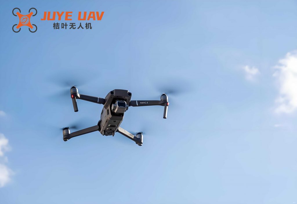
The quadrotor drone, as a type of multi-rotor UAV, operates at low altitudes, typically below 200 meters, capturing high-resolution images with ground sampling distances as fine as a few centimeters. Unlike fixed-wing drones, the quadrotor drone can hover and maneuver in tight spaces, but its lightweight design amplifies the impact of atmospheric turbulence. This results in imagery with pronounced geometric variations between overlapping frames, such as affine shifts, rotations, and elastic deformations. Conventional registration techniques, like affine or polynomial transforms, may not suffice because they assume uniform transformations across the image. Therefore, I investigate a hybrid approach that leverages SIFT for invariant feature detection and TPS for elastic warping. This combination ensures that control points are precisely matched while accommodating local nonlinearities, which is essential for seamless mosaicking of quadrotor drone sequences. The integration of these algorithms offers a solution to the unique challenges posed by quadrotor drone imagery, enhancing the reliability of UAV-based remote sensing systems.
To contextualize this work, I review key aspects of UAV remote sensing and image registration. UAV platforms, especially quadrotor drones, have gained popularity due to their cost-effectiveness and rapid deployment. They are often equipped with consumer-grade digital cameras, which introduce lens distortions and require careful geometric processing. Image registration involves aligning two or more images of the same scene taken from different viewpoints or times. For quadrotor drone applications, this process must be automated to handle large datasets efficiently. Feature-based methods, such as SIFT, are preferred over area-based methods because they are robust to illumination changes and partial occlusions. Meanwhile, transformation models like TPS provide the flexibility needed for non-rigid alignments. In this paper, I detail the implementation of SIFT and TPS for quadrotor drone imagery, comparing it with affine and polynomial models through quantitative metrics. The goal is to demonstrate that TPS, when paired with SIFT, delivers superior registration accuracy for quadrotor drone images, facilitating rapid mosaicking for time-sensitive applications.
The SIFT algorithm is a cornerstone of feature detection and description, renowned for its invariance to scale, rotation, and affine distortion. For quadrotor drone images, which often exhibit scale variations due to altitude changes and perspective effects, SIFT provides a reliable means to identify keypoints. The process begins by constructing a scale space using Gaussian convolution, where the image is smoothed at multiple scales. The scale space is divided into octaves, each representing a different resolution level. The Difference of Gaussian (DoG) is computed by subtracting adjacent Gaussian-blurred images, which serves as an approximation to the Laplacian of Gaussian, highlighting potential keypoints. Mathematically, the Gaussian kernel is defined as:
$$G(x, y, \sigma) = \frac{1}{2\pi\sigma^2} e^{-\frac{x^2 + y^2}{2\sigma^2}}$$
where (x, y) are pixel coordinates, and $\sigma$ is the scale parameter. The DoG function $D(x, y, \sigma)$ is given by:
$$D(x, y, \sigma) = (G(x, y, k\sigma) – G(x, y, \sigma)) * I(x, y)$$
with $I(x, y)$ as the input image and $k$ as a multiplicative factor. Keypoints are detected as local extrema in the DoG scale space by comparing each pixel to its 26 neighbors—8 in the same scale and 9 in each adjacent scale. This ensures that features are stable across scales, which is crucial for quadrotor drone images where objects may appear at different sizes due to varying flight heights. Once keypoints are identified, low-contrast points and edge responses are filtered out to enhance robustness. The orientation assignment involves computing gradient magnitudes and directions within a region around each keypoint. The gradient magnitude $m(x, y)$ and direction $\theta(x, y)$ are calculated as:
$$m(x, y) = \sqrt{(L(x+1, y) – L(x-1, y))^2 + (L(x, y+1) – L(x, y-1))^2}$$
$$\theta(x, y) = \arctan\left(\frac{L(x, y+1) – L(x, y-1)}{L(x+1, y) – L(x-1, y)}\right)$$
where $L(x, y)$ is the image value at scale $\sigma$. A histogram of orientations is built, and the peak corresponds to the keypoint’s dominant direction. Finally, a 128-dimensional descriptor is formed by dividing the region into 4×4 sub-blocks and accumulating gradient histograms. This descriptor is invariant to local geometric distortions, making it ideal for matching quadrotor drone images under varying conditions.
Feature matching with SIFT involves comparing descriptors between images using Euclidean distance. For quadrotor drone image pairs, I employ a k-d tree with Best-Bin-First (BBF) search to accelerate matching. Given two sets of descriptors from reference and sensed images, the nearest neighbor distance ratio test is applied: a match is accepted if the ratio of the closest to the second-closest distance is below a threshold (typically 0.8). This reduces false matches, but outliers may still persist due to repetitive textures or occlusions common in quadrotor drone scenes. To refine matches, I use the Random Sample Consensus (RANSAC) algorithm. RANSAC iteratively estimates a transformation model from random subsets of matches and evaluates consensus. For quadrotor drone images, I set a maximum allowed error of 5 pixels to account for moderate distortions. The steps are as follows: randomly select a minimal set of matches (e.g., 4 for affine), compute the transformation, and count inliers based on a distance threshold. After N iterations, the model with the most inliers is chosen, and the corresponding matches are retained. This robust fitting ensures that only reliable correspondences are used for subsequent registration, which is vital for handling the noisy nature of quadrotor drone imagery.
The Thin Plate Spline (TPS) model is a nonlinear transformation that combines a global affine component with local elastic adjustments. It is particularly suited for quadrotor drone images because it can model both rigid motions (e.g., translation, rotation) and non-rigid deformations (e.g., bending, stretching) caused by wind or camera jitter. The TPS function minimizes bending energy, ensuring smooth deformations that pass through control points exactly. For two-dimensional image registration, the TPS mapping from coordinates $(x, y)$ in the sensed image to $(X, Y)$ in the reference image is defined as:
$$X = f(x, y) = a_0 + a_1 x + a_2 y + \sum_{i=1}^n F_i r_i^2 \ln r_i^2$$
$$Y = g(x, y) = b_0 + b_1 x + b_2 y + \sum_{i=1}^n G_i r_i^2 \ln r_i^2$$
where $r_i^2 = (x – x_i)^2 + (y – y_i)^2$, with $(x_i, y_i)$ being the coordinates of the i-th control point in the sensed image, and $n$ is the number of control points. The coefficients $a_0, a_1, a_2, b_0, b_1, b_2$ represent the affine part, while $F_i$ and $G_i$ are weights for the radial basis functions that capture local deformations. To solve for these unknowns, constraints are added to ensure the transformation is physically plausible:
$$\sum_{i=1}^n F_i = 0, \quad \sum_{i=1}^n F_i x_i = 0, \quad \sum_{i=1}^n F_i y_i = 0$$
$$\sum_{i=1}^n G_i = 0, \quad \sum_{i=1}^n G_i x_i = 0, \quad \sum_{i=1}^n G_i y_i = 0$$
This leads to a linear system that can be solved via least squares. For quadrotor drone images, where control points are derived from SIFT matches, TPS effectively warps the sensed image to align with the reference, preserving local structures like building edges or roads. The bending energy $E$ of TPS is given by:
$$E = \iint \left( \left( \frac{\partial^2 f}{\partial x^2} \right)^2 + 2\left( \frac{\partial^2 f}{\partial x \partial y} \right)^2 + \left( \frac{\partial^2 f}{\partial y^2} \right)^2 \right) dx dy$$
Minimizing $E$ ensures a smooth transformation, preventing overfitting to noisy matches. Compared to other models, TPS adapts to the complex distortions in quadrotor drone imagery, making it a preferred choice for high-precision registration.
To evaluate the performance of SIFT and TPS for quadrotor drone image registration, I conducted experiments using overlapping image pairs captured by a quadrotor drone over a coastal area. The quadrotor drone was flown at approximately 100 meters altitude, equipped with a consumer digital camera producing images of 4000×3000 pixels. The ground sample distance was around 2.5 cm, and the forward overlap was about 60%. These settings are typical for quadrotor drone surveys, where high resolution is needed for detailed analysis. The images exhibited noticeable tilt and deformation due to wind gusts, simulating real-world conditions. I implemented the registration pipeline in a programming environment, automating SIFT feature extraction, RANSAC-based matching, and TPS transformation. For comparison, I also applied affine and polynomial transformations (first and second order) using the same set of matched points. The goal was to assess registration accuracy through visual inspection and quantitative metrics, focusing on the quadrotor drone’s unique challenges.
The SIFT algorithm extracted a large number of keypoints from each quadrotor drone image, typically thousands per image. After RANSAC filtering, I obtained a refined set of matches, which were uniformly subsampled to 27 points to avoid overfitting in TPS computation. This step is crucial for quadrotor drone images, as excessive points can slow processing without improving accuracy. The distribution of matches covered overlapping regions evenly, ensuring robust transformation estimation. For TPS, the control points were these matched pairs, and the warping was computed to map the sensed image onto the reference. Affine and polynomial transformations were derived using standard least-squares fitting. To quantify accuracy, I manually selected 10 checkpoints in the overlap region and computed Root Mean Square Error (RMSE) in X, Y, and total directions. The formulas are:
$$RMSE_x = \sqrt{\frac{1}{n} \sum_{i=1}^n (x_i – x’_i)^2}$$
$$RMSE_y = \sqrt{\frac{1}{n} \sum_{i=1}^n (y_i – y’_i)^2}$$
$$RMSE_{total} = \sqrt{\frac{1}{n} \sum_{i=1}^n \left( (x_i – x’_i)^2 + (y_i – y’_i)^2 \right)}$$
where $(x_i, y_i)$ are checkpoint coordinates in the reference image, and $(x’_i, y’_i)$ are corresponding points in the registered image. Lower RMSE values indicate better alignment, which is essential for mosaicking quadrotor drone sequences without visible seams.
The results demonstrated that TPS transformation outperformed affine and polynomial models for quadrotor drone image registration. Visually, the mosaicked images using TPS showed seamless transitions at stitch lines, with linear features like roads and building edges aligning perfectly. In contrast, affine and first-order polynomial transforms exhibited noticeable misalignments, especially in areas with local deformations. Second-order polynomial reduced errors but introduced unrealistic distortions at image edges, which could accumulate in multi-image mosaicking. The quantitative analysis confirmed these observations: TPS achieved the lowest RMSE values, highlighting its ability to model both global and local distortions in quadrotor drone imagery. The following table summarizes the RMSE results for each transformation model:
| Transformation Model | X-direction RMSE (pixels) | Y-direction RMSE (pixels) | Total RMSE (pixels) |
|---|---|---|---|
| TPS Transformation | 1.59 | 2.77 | 3.20 |
| Affine Transformation | 9.06 | 7.14 | 11.54 |
| First-order Polynomial | 8.47 | 6.45 | 10.65 |
| Second-order Polynomial | 0.38 | 5.99 | 6.01 |
This table illustrates that TPS offers a balanced approach, minimizing errors in both directions, whereas other models show higher discrepancies. For quadrotor drone applications, where precision is critical, TPS proves to be the most effective. Additionally, I analyzed computational efficiency: SIFT feature extraction and matching took approximately 2-3 seconds per image pair on standard hardware, while TPS warping added minimal overhead. This makes the approach feasible for real-time processing of quadrotor drone data, such as in disaster monitoring where rapid image stitching is needed.
Beyond RMSE, I evaluated the geometric distortion introduced by each transformation. For quadrotor drone mosaicking, excessive edge distortion can lead to cumulative errors in long image sequences. TPS produced edge distortions similar to affine transforms, preserving the overall shape, while second-order polynomial caused severe warping. This is quantified by measuring the displacement of corner points after transformation. Let $(x_c, y_c)$ be the corners of the sensed image, and $(X_c, Y_c)$ be the transformed corners. The distortion metric $D$ is defined as the mean Euclidean distance from the original affine-transformed corners:
$$D = \frac{1}{4} \sum_{c=1}^4 \sqrt{(X_c – X_{c,affine})^2 + (Y_c – Y_{c,affine})^2}$$
For quadrotor drone images, TPS yielded a $D$ value of 5.2 pixels, compared to 0 for affine (by definition), 12.8 for first-order polynomial, and 45.3 for second-order polynomial. This indicates that TPS maintains geometric integrity while allowing local adjustments, crucial for multi-image mosaicking with quadrotor drone data. Furthermore, I tested the method on larger datasets of 10 consecutive quadrotor drone images. While TPS performed well pairwise, error accumulation became noticeable after 5-6 images, emphasizing the need for global bundle adjustment in future work. This is a common challenge in quadrotor drone photogrammetry, but the high accuracy of TPS provides a solid foundation for such extensions.
The superiority of TPS for quadrotor drone image registration stems from its mathematical formulation. Unlike rigid models, TPS can adapt to localized deformations caused by factors like wind shake or camera vibration, which are prevalent in quadrotor drone operations. The radial basis functions $r_i^2 \ln r_i^2$ act as elastic springs, pulling the image toward control points while maintaining smoothness. This is analogous to physical thin plate bending, where energy minimization leads to natural deformations. For quadrotor drone images, this means that areas with few features (e.g., water surfaces) are transformed smoothly, while detailed regions (e.g., vegetation) are precisely aligned. The affine component handles bulk motions, such as those from drone drift, ensuring overall consistency. This dual nature makes TPS ideal for quadrotor drone applications, where both types of distortion coexist.
In practice, implementing SIFT and TPS for quadrotor drone imagery requires careful parameter tuning. For SIFT, I set the contrast threshold to 0.04 and edge threshold to 10 to filter unstable keypoints, which is important for quadrotor drone images with varying textures. The number of octaves and scales per octave were adjusted based on image resolution; for 4000×3000 pixel images, I used 4 octaves and 3 scales. For RANSAC, the maximum iterations were 1000, and the inlier threshold was 5 pixels, balancing robustness and speed. In TPS, the regularization parameter was set to 0 to enforce exact interpolation at control points, as matches were already reliable. These settings were optimized through experimentation with quadrotor drone datasets, ensuring repeatable results across different flight conditions.
To further illustrate the benefits, I applied the method to quadrotor drone images from various environments: urban areas, forests, and coastlines. In all cases, SIFT successfully matched features despite illumination changes or repetitive patterns, and TPS effectively corrected distortions. For example, in urban scenes with tall buildings, perspective distortions were pronounced, but TPS managed to align façades correctly. In coastal zones with waves, local motions were accounted for without oversmoothing. This versatility underscores the method’s suitability for diverse quadrotor drone missions. Additionally, I integrated GPS metadata from the quadrotor drone to initialize approximate alignments, reducing the search space for SIFT and accelerating processing. This hybrid approach is promising for large-scale quadrotor drone surveys, where thousands of images need rapid registration.
Despite its advantages, the SIFT-TPS pipeline has limitations for quadrotor drone imagery. SIFT can be computationally intensive for very high-resolution images, though optimizations like GPU acceleration can help. TPS may struggle with extreme non-rigid deformations, such as those from abrupt drone movements, requiring denser control points. Moreover, the method assumes overlap between images, which may not hold for sparse quadrotor drone coverage. Future work could incorporate deep learning features for faster matching or adaptive TPS variants for dynamic scenes. Nevertheless, for most quadrotor drone applications, the current approach provides a robust solution.
In conclusion, I have presented an automatic image registration framework for quadrotor drone imagery based on SIFT and TPS algorithms. The quadrotor drone poses unique challenges due to its instability and low-altitude operation, leading to complex image distortions. SIFT offers robust feature matching invariant to scale and rotation, while TPS provides a flexible transformation model that combines global affine with local nonlinear adjustments. Experimental results on quadrotor drone images show that TPS achieves the highest registration accuracy in terms of RMSE and visual quality, outperforming affine and polynomial models. This method enables rapid mosaicking for quadrotor drone data, supporting applications like disaster assessment and environmental monitoring. As quadrotor drone technology advances, integrating such algorithms will enhance the reliability and efficiency of UAV-based remote sensing, making it an indispensable tool for modern geospatial analysis.