
As a professional deeply engaged in the field of modern emergency response, I have witnessed firsthand the transformative impact of technology. The integration of information and communication technologies, artificial intelligence, and big data with traditional industries has ushered in unprecedented opportunities. Among these technological advancements, Unmanned Aerial Vehicles, specifically designed and deployed for firefighting and rescue—what we term fire UAVs—have emerged as a pivotal force. They are fundamentally altering the landscape of disaster management, offering solutions to age-old challenges in efficiency, safety, and situational awareness.
Traditional firefighting and rescue operations are often hampered by inaccessible terrain, rapidly evolving hazardous conditions, and the imperative to protect responder lives. The deployment of personnel for reconnaissance in unstable structures, toxic atmospheres, or expansive disaster zones involves significant risk and can be time-consuming. Fire UAVs address these limitations directly. Their flexibility, rapid deployment capability, and ability to carry diverse payloads provide commanders with critical, real-time data, forming the backbone of informed decision-making in high-pressure scenarios. This article explores the technical foundations, classifications, and multifaceted applications of fire UAV technology, underpinning the discussion with analytical models and comparative data.
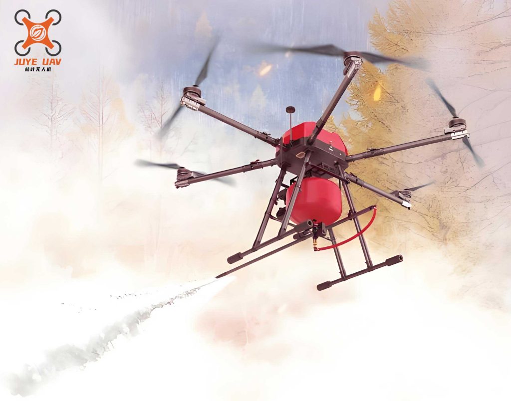
The core value proposition of a fire UAV lies in its suite of integrated technologies. It is not merely a flying camera but a sophisticated data acquisition and delivery platform. Key enabling technologies include autonomous flight control and navigation (often leveraging GPS, BeiDou, GLONASS, or Galileo systems), long-range high-definition and thermal imaging, remote sensing and measurement (LiDAR, multispectral sensors), and robust data transmission links. These components work in concert to execute precise tasks. For instance, in mapping a disaster area, a fire UAV follows a pre-programmed or manually controlled flight path, capturing geotagged imagery. This data is then processed using photogrammetric principles.
The process of generating 3D models or orthomosaics from fire UAV imagery relies on structure-from-motion (SfM) algorithms. The fundamental principle involves identifying common points (keypoints) in overlapping images. The camera position and orientation for each image are solved by minimizing the reprojection error. This can be conceptualized by the collinearity equations, which state that a point on the ground (object point), its projection on the image, and the camera’s perspective center are collinear. For a point \(i\) in image \(j\), the equations are:
$$ x_{ij} – x_p = -f \frac{m_{11}(X_i – X_{0j}) + m_{12}(Y_i – Y_{0j}) + m_{13}(Z_i – Z_{0j})}{m_{31}(X_i – X_{0j}) + m_{32}(Y_i – Y_{0j}) + m_{33}(Z_i – Z_{0j})} $$
$$ y_{ij} – y_p = -f \frac{m_{21}(X_i – X_{0j}) + m_{22}(Y_i – Y_{0j}) + m_{23}(Z_i – Z_{0j})}{m_{31}(X_i – X_{0j}) + m_{32}(Y_i – Y_{0j}) + m_{33}(Z_i – Z_{0j})} $$
where \((x_{ij}, y_{ij})\) are the image coordinates, \((x_p, y_p, f)\) are the camera’s interior orientation parameters, \((X_i, Y_i, Z_i)\) are the object space coordinates, \((X_{0j}, Y_{0j}, Z_{0j})\) are the camera’s exterior orientation parameters for image \(j\), and \(m_{11}…m_{33}\) are the elements of the 3D rotation matrix. Solving for all unknown parameters across thousands of points allows for the reconstruction of dense 3D point clouds, enabling centimeter-level accuracy in modeling disaster zones.
The operational characteristics of fire UAVs can be broadly categorized, and the choice of platform is crucial for mission success. The primary classification is based on aerodynamics and propulsion, each with distinct advantages for fire and rescue work.
| UAV Type | Propulsion | Key Advantages | Typical Limitations | Best Suited for Fire/Rescue Applications |
|---|---|---|---|---|
| Fixed-Wing | Gasoline / Electric | Long endurance (2+ hours), High speed, Large area coverage | Requires launch/recovery area, Limited hovering capability, Generally higher cost | Rapid assessment of large-scale wildfires, post-earthquake regional mapping, pipeline patrol. |
| Single-Rotor Helicopter | Gasoline | Heavy payload capacity, Long endurance (gas), Ability to execute precise maneuvers | Complex mechanics, Higher maintenance, Significant safety concerns (large rotor) | Heavy-lift missions: delivering substantial emergency supplies, deploying large equipment. |
| Multi-Rotor (Quadcopter, Hexacopter, Octocopter) | Electric (Li-Po) | Vertical Take-off and Landing (VTOL), Exceptional hovering stability, High maneuverability in confined spaces, Lower acoustic signature | Short flight time (20-60 mins), Limited payload compared to gas engines | Close-quarters inspection of structures, urban search and rescue (USAR), real-time incident command support, precision payload delivery. |
| Hybrid VTOL (Fixed-wing + Multi-rotor) | Electric / Gasoline | Combines VTOL convenience with fixed-wing range and efficiency | Higher complexity and cost | Operations requiring both long transit and detailed loitering (e.g., remote forest fire with specific hotspot investigation). |
The choice between electric and gasoline propulsion is a critical trade-off analysis. Electric fire UAVs, predominantly multi-rotors, offer superior reliability, simplicity, and immediate readiness. Their flight time \(T_{flight}\) is a function of battery capacity \(C\) (in mAh), battery voltage \(V\), the average power draw of the system \(P_{avg}\) (in Watts), and a safety factor \(k\) (typically 0.8):
$$ T_{flight} = k \cdot \frac{C \cdot V}{1000 \cdot P_{avg}} \text{ hours} $$
Gasoline-powered fire UAVs, often single-rotor or large fixed-wing, provide significantly longer endurance, crucial for large-area missions. However, they introduce complexities like fuel management, vibration, and emissions.
The effectiveness of a fire UAV is also governed by its payload capacity. The maximum useful payload \(Payload_{max}\) is determined by the thrust-to-weight ratio of the motors and the total system weight:
$$ Payload_{max} = \frac{Total Thrust}{g} – (Weight_{UAV_{empty}} + Weight_{battery}) $$
where \(g\) is gravitational acceleration. For a multi-rotor, total thrust is the sum of the maximum thrust of all motors. Mission planners must balance sensor payload weight against flight time, as a heavier payload increases \(P_{avg}\), reducing \(T_{flight}\).
The application of fire UAV technology in灭火救援 is multi-dimensional, moving beyond simple aerial observation to become an integrated tool for sensing, analysis, communication, and direct intervention.
1. Situational Awareness and Reconnaissance: This is the foundational application. A fire UAV provides a rapid, overhead perspective unobtainable by ground teams. In structural fires, it can identify fire spread paths, locate trapped individuals via thermal imaging, and assess structural integrity. In hazmat incidents, it can safely sample atmospheres or visualize plume dispersion. The key metric here is the Area Coverage Rate \(A_{rate}\):
$$ A_{rate} = v \cdot w \cdot \frac{O}{100} $$
where \(v\) is the UAV’s ground speed, \(w\) is the sensor’s swath width (a function of altitude and field of view), and \(O\) is the percentage of sidelap/overlap required for processing (e.g., 70%). A fire UAV equipped with a dual sensor (RGB + thermal) provides simultaneous visual and heat data, crucial for identifying hidden hot spots. The thermal sensor detects radiation based on Planck’s Law, differentiating temperatures that are invisible to the naked eye.
2. Real-Time Monitoring and Persistent Surveillance: For long-duration incidents like wildfires or major urban fires, a fire UAV can maintain a constant vigil. This allows command to monitor the effectiveness of tactical operations, observe changing weather conditions, and provide early warning of flare-ups or structural collapses. The advent of tethered fire UAV systems has been a game-changer for this role. A tethered UAV is physically connected to a ground-based power supply and often a fiber-optic data link. Its operational time is theoretically unlimited, and it provides a stable, persistent aerial platform for cameras and communication relays at heights typically between 50-150 meters. The stability of the platform is essential for high-quality, continuous video feeds used for live broadcasting to command centers.
3. Direct Intervention and Support: Fire UAVs are evolving from passive observers to active participants. Payloads are becoming more sophisticated, enabling direct action:
- Communication Relay and Aerial Cell-on-Wings (CoW): In large-scale disasters where terrestrial communication infrastructure is damaged, a fire UAV, especially a tethered one, can act as a temporary cell tower or mesh network node. The communication coverage area \(A_{coverage}\) from an altitude \(h\) can be approximated for line-of-sight propagation:
$$ A_{coverage} \approx \pi \cdot ( \sqrt{2 \cdot R_e \cdot h + h^2} )^2 $$
where \(R_e\) is the effective Earth radius (∼8500 km for standard radio refraction). This capability restores critical command-and-control and situational reporting links for ground teams. - Precision Delivery: Fire UAVs can deliver essential payloads with precision. This includes dropping personal flotation devices (PFDs) to flood victims, delivering medical supplies (defibrillators, epinephrine) to inaccessible locations, or providing communication radios to isolated firefighting teams. The release mechanism must account for wind drift, a critical factor modeled by ballistic equations.
- Active Fire Suppression: Specialized fire UAVs are being developed to carry and discharge fire retardants, water, or explosive charges for controlled avalanche triggering. While payload capacity limits the volume, their ability to access difficult spots (e.g., high-rise façades, wildland-urban interface zones) makes them a unique tool for targeted application.
4. Post-Incident Analysis and Mapping: After an event, fire UAVs are invaluable for damage assessment, forensic investigation, and planning reconstruction. Using LiDAR or photogrammetry, they create highly accurate 3D models of the disaster scene. These models can be used to calculate burned area, measure structural deformations, or plan the safest routes for debris removal. The data forms a permanent, geospatially accurate record for future analysis and training.
The future trajectory of fire UAV technology is inextricably linked to advancements in adjacent fields. The rollout of 5G networks promises ultra-reliable low-latency communication (URLLC), which will enable more responsive real-time control of fire UAV swarms and instantaneous transmission of ultra-high-definition video and sensor data. Artificial Intelligence and Machine Learning are being integrated for automated flight planning, real-time object detection (e.g., spotting victims in rubble or identifying fire fronts), and predictive analytics for fire behavior modeling.
However, the full integration of fire UAVs into standard operating procedures faces challenges. These include regulatory airspace integration, ensuring cybersecurity of command links, developing standardized protocols for data sharing between agencies, and continued improvement in platform endurance and robustness in extreme environments (high winds, heavy precipitation, intense heat).
| Application Scenario | Primary UAV Type | Key Payloads | Data/Output Delivered | Impact on Decision-Making |
|---|---|---|---|---|
| Urban Structure Fire | Multi-rotor | Zoom Camera, Thermal Imaging (FLIR), Gas Sensor | Live HD video, Heat maps, Toxic gas readings, Roof integrity assessment | Identifies rescue priorities, guides hose line placement, warns of potential flashover or backdraft, ensures crew safety. |
| Wildland Fire | Fixed-wing / Hybrid VTOL | Multispectral Sensor, High-Res Camera, Thermal Imager | Fire perimeter mapping, rate of spread calculation, hotspot identification, fuel type classification. | Enables strategic resource allocation, predicts fire behavior, assesses containment line effectiveness, plans burnout operations. |
| Search & Rescue (Flood/Mountain) | Multi-rotor (Long-Range) | Zoom Camera, Thermal Imager, Spotlight, Loudspeaker | GPS coordinates of victims, real-time visual confirmation, two-way communication initiation. | Dramatically reduces search time, pinpoints location for extraction teams, provides comfort and instructions to victims. |
| Hazardous Materials Incident | Multi-rotor (Explosion-Proof if needed) | Chemical, Biological, Radiological (CBRN) Sensors, Meteorological Sensor | Plume mapping, substance identification, concentration levels, local wind data. | Defines hot/warm/cold zones, determines evacuation perimeters, guides decontamination setup, protects first responders. |
| Major Disaster (Earthquake) | Multiple Types (Swarm) | LiDAR, Optical Camera, Communication Relay | High-resolution 3D damage model, collapsed structure analysis, temporary communication network. | Prioritizes search areas, identifies accessible routes, coordinates multi-agency response, restores command network. |
In conclusion, from my perspective, the fire UAV has evolved from a novel gadget to an indispensable component of the modern firefighting and rescue toolkit. Its value proposition is clear: it enhances operational effectiveness, dramatically improves responder safety, and provides a data-driven foundation for command decisions that was previously unimaginable. The technology’s progression—from basic remote-controlled aircraft to intelligent, connected, multi-role platforms—mirrors the broader digitization of emergency services. The continued maturation of autonomy, sensor miniaturization, and communication networks will only deepen the integration of fire UAVs. The future lies in interoperable systems where fire UAVs operate seamlessly alongside ground crews, manned aircraft, and command software, creating a cohesive, information-rich environment for managing crises. The ultimate goal is to leverage this technology to save more lives, protect property more effectively, and enhance the safety of the brave individuals who respond to emergencies. The fire UAV is not a replacement for human expertise and courage, but a powerful force multiplier that extends our senses, reach, and understanding in the face of disaster.