
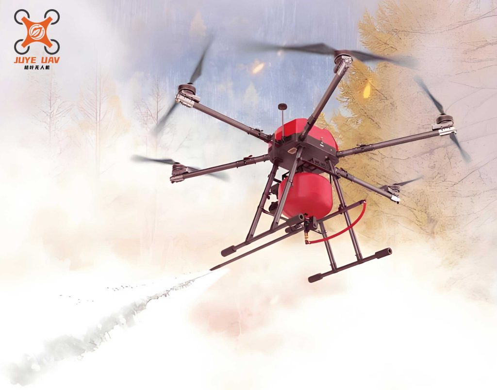
The increasing severity and frequency of forest fires pose a significant threat to ecosystems, property, and human life. These fires are characterized by their unpredictability and rapid evolution within complex terrain, making traditional ground-based monitoring and firefighting efforts both inefficient and perilous. In this context, Unmanned Aerial Vehicles (fire UAVs) have emerged as a transformative tool for fire management. Their ability to provide an aerial vantage point enables comprehensive reconnaissance of fire scenes and continuous tracking of dynamic fire fronts. However, many existing fire UAV systems primarily function as mobile cameras, streaming video to ground stations for delayed analysis. This approach lacks real-time, on-board intelligence regarding fire behavior—such as spread direction, velocity, and intensity—which is critical for timely decision-making and ensuring the safety of ground crews.
To address this gap, we present a dedicated edge computing system for real-time forest fire monitoring using fire UAVs. The core innovation of our system is an Adaptive Wavelet-based Fire Analysis (AWFA) algorithm, deployed directly on a Field-Programmable Gate Array (FPGA) carried by the fire UAV. This algorithm dynamically extracts fire perimeter information to assess fire behavior. Complemented by a stereo vision module for geolocation and a robust wireless communication link, the system forms an intelligent Internet of Things (IoT) edge node. It processes video in real-time to extract actionable intelligence—fire location, spread direction, and speed—and immediately transmits this data to command centers and firefighters on the ground.
1. The Adaptive Wavelet-Based Fire Monitoring Algorithm
Effective fire monitoring requires analyzing both chromatic information (to confirm the presence of fire) and dynamic information (to understand its behavior). The fire perimeter, or edge, is a crucial component of dynamic information, encoding the fire’s growth pattern. Traditional edge detectors (e.g., Sobel, Canny) often struggle with the noisy, unstructured nature of wildfire imagery, producing discontinuous edges or being susceptible to false alarms from non-fire moving objects. Wavelet transform offers a superior multi-resolution framework for edge detection, capable of balancing detail preservation at fine scales with noise suppression at coarse scales.
1.1 Adaptive Lifting Wavelet for Fire Edge Extraction
We employ the lifting scheme implementation of the 5/3 wavelet transform for its computational efficiency, which is vital for FPGA deployment. The forward transform for a 1D signal \(x[n]\) is performed in three steps: split, predict, and update.
First, the signal is split into even and odd indexed samples:
$$ \text{even}_k = x[2k], \quad \text{odd}_k = x[2k+1] $$
The prediction step uses the even samples to predict the odd ones, generating the high-frequency detail coefficients \(d[n]\):
$$ d[n] = \text{odd}_n – \left\lfloor \frac{\text{even}_n + \text{even}_{n+1}}{2} \right\rfloor $$
The update step then uses these details to update the even samples, producing the low-frequency approximation coefficients \(c[n]\):
$$ c[n] = \text{even}_n + \left\lfloor \frac{d[n-1] + d[n] + 2}{4} \right\rfloor $$
This process is applied separably to images to obtain horizontal, vertical, and diagonal detail subbands at multiple decomposition levels \(i\).
The key to our AWFA algorithm is an adaptive thresholding mechanism applied to these detail coefficients. A fixed global threshold is inadequate due to varying local contrast and noise levels across a wildfire image. Our adaptive threshold \(T_{ij}\) for a block within subband \(j\) (H, V, or D) at level \(i\) is calculated as:
$$ T_{ij} = \frac{\lambda_{ij} \cdot N_{ij}}{2^{i-1}} $$
where:
- \(i\) is the decomposition level. Higher levels correspond to coarser scales.
- \(N_{ij}\) is the median of the absolute values of the detail coefficients in the block, serving as a robust estimate of local activity/noise.
- \(\lambda_{ij}\) is the local contrast coefficient, defined as \(\lambda_{ij} = \frac{\sigma_{ij}}{\mu_{ij}}\), where \(\mu_{ij}\) and \(\sigma_{ij}\) are the mean and standard deviation of the coefficient magnitudes in the block, respectively.
This model allows the threshold to adapt dynamically: it increases in high-contrast or noisy regions (large \(\lambda_{ij}\) or \(N_{ij}\)) to suppress clutter, and decreases in low-contrast regions to preserve subtle fire edge details. The \(2^{i-1}\) term ensures that thresholds are generally larger at coarser scales, prioritizing noise immunity over detail.
1.2 Fire Behavior Analysis from Dynamic Edge Information
Extracting the fire edge is only the first step. Our system analyzes its spatiotemporal evolution to quantify fire behavior.
Fire Geolocation: Before analyzing spread, the fire’s geographical position must be determined. We employ a binocular stereo vision system on the fire UAV. For a world point \(P\) with coordinates \((X, Y, Z)\), its projections \((u_L, v_L)\) and \((u_R, v_R)\) on the left and right image planes are given by:
$$ Z_{L}^c \begin{bmatrix} u_L \\ v_L \\ 1 \end{bmatrix} = M_L \begin{bmatrix} X \\ Y \\ Z \\ 1 \end{bmatrix}, \quad Z_{R}^c \begin{bmatrix} u_R \\ v_R \\ 1 \end{bmatrix} = M_R \begin{bmatrix} X \\ Y \\ Z \\ 1 \end{bmatrix} $$
where \(M_L\) and \(M_R\) are the \(3 \times 4\) projection matrices for the left and right cameras, respectively. By matching the apex or a distinct feature of the fire edge between the two synchronized images, we can solve for the 3D coordinates \((X, Y, Z)\) of that point, providing real-time geolocation of the fire front.
Spread Direction and Speed: To analyze dynamics, the image is divided into \(m \times n\) blocks. Using frame difference on the binary edge maps produced by AWFA, a motion vector field is calculated. The predominant direction of edge pixel movement across blocks indicates the primary fire spread direction (e.g., North-East). The instantaneous fire spread speed \(V\) is calculated by tracking a prominent point on the fire edge (e.g., the farthest point in the dominant direction) between two frames at times \(t_1\) and \(t_2\):
$$ V = \frac{\sqrt{(x_2 – x_1)^2 + (y_2 – y_1)^2}}{t_2 – t_1} $$
where \((x_1, y_1)\) and \((x_2, y_2)\) are the real-world coordinates of the tracked point, derived from the stereo system. Based on \(V\), a fire severity level \(S\) is assigned:
$$ S = \begin{cases}
\text{Low}, & \text{if } V < 0.15 \text{ m/s} \\
\text{Medium}, & \text{if } 0.15 \leq V < 0.5 \text{ m/s} \\
\text{High}, & \text{if } V \geq 0.5 \text{ m/s}
\end{cases} $$
This information, combined with known positions of ground personnel, allows the system to generate targeted alerts to firefighters in the projected path of a rapidly advancing fire.
2. Design of the FPGA-Based Fire UAV Monitoring System
The proposed algorithms are implemented on a hardware edge system centered on a Xilinx FPGA. This design moves computation from a remote server to the fire UAV itself, enabling real-time analysis and minimizing latency in data delivery. The system architecture is depicted in the data flow below and comprises several key modules.
2.1 Video Acquisition and Processing Pipeline
The FPGA manages the entire video processing chain. An SDI industrial camera, configured via I²C, streams video in BT.1120 format. The processing pipeline is as follows:
- Capture & Storage: Valid pixel data is extracted based on timing signals and buffered in external DDR memory.
- Color Space Conversion: The RGB data is converted to the YCbCr color space. The luminance (Y) channel is primarily used for the wavelet-based edge detection, while chrominance can be used for initial fire-color verification.
- AWFA Module: This core module reads frames from DDR, performs the 2D adaptive lifting wavelet transform, applies the adaptive threshold to extract the fire edge, and outputs a binary edge map.
- Behavior Analysis & Geolocation Module: This module processes consecutive edge maps to compute motion vectors, spread speed \(V\), and severity level \(S\). Simultaneously, it processes synchronized frames from the stereo camera pair to perform triangulation and compute the real-world coordinates of the fire front.
The pipeline is highly parallelized on the FPGA, allowing it to process high-definition video streams at frame rates sufficient for real-time fire monitoring.
2.2 System Integration and Communication Protocol
The FPGA acts as the system controller, interfacing with all peripherals: the camera(s), the wireless module, and sensors (e.g., GPS, IMU). Processed fire data is packaged and transmitted via a Long-Range (LoRa) radio link, chosen for its ability to maintain communication over several kilometers in forested terrain, a critical feature for operational fire UAVs.
A compact and efficient data protocol ensures reliable communication with the ground station. Two frame types are defined, as summarized in the table below.
| Frame Type | Header (4 bytes) | Data Payload | Fault Code (1 byte) |
|---|---|---|---|
| Type I (UAV → Ground) | 0x55, 0xAA, 0x00, [UAV ID] | Longitude (10B), Latitude (8B), Battery Voltage (1B), Fire Severity S (4B), Spread Direction (8B) | 0x00: Normal, 0x01: Critical Altitude Loss |
| Type II (Ground → UAV) | 0x55, 0xAA, 0x01, [UAV ID] | Control Command (e.g., Return-to-Home, Change Orbit) | 0x00: Normal, 0x02: Execute Emergency Landing |
The Type I frame encapsulates all vital fire intelligence—location, severity, and spread vector—along with UAV telemetry. The fault code allows the fire UAV to signal critical status, triggering emergency procedures at the ground station.
3. Experimental Results and Analysis
We validated the complete system using aerial video of simulated forest fires. The experiment processed sequential frames to demonstrate the end-to-end workflow: video acquisition, edge extraction, coordinate calculation, and behavior analysis.
3.1 Fire Edge Extraction and Localization
The AWFA algorithm successfully generated clear, contiguous contours of the fire perimeter. Compared to standard Canny or Sobel operators applied to the same frames, AWFA produced edges that were more coherent in smoky regions and less fragmented, effectively isolating the primary fire front from background clutter. Following edge extraction, key points on the fire perimeter (e.g., the easternmost apex) were identified. Their pixel coordinates in the left and right stereo images were used in the triangulation equations to calculate their real-world \((X, Y)\) coordinates, effectively geolocating the fire front’s leading edge.
3.2 Fire Behavior Monitoring Output
By analyzing the displacement of these geolocated edge points between frames, the system computed the instantaneous spread velocity \(V\) and the dominant direction. For instance, tracking the eastern apex over a 2-second interval yielded a displacement of 0.82 meters, resulting in \(V = 0.41 \text{ m/s}\). According to our criteria, this corresponds to a Medium severity level (\(S\)). The system correctly identified the spread direction as predominantly eastward. When simulated firefighter coordinates were included in the system’s database, it successfully flagged those positioned east of the fire front as being in the potential path, demonstrating the proactive alert functionality.
The performance of different edge detection methods on our fire UAV video dataset is quantitatively compared in the following table, using metrics of edge connectivity (a higher number indicates more fragmented edges) and consistency across frames (measured by the Hausdorff distance between edge maps of the same fire front).
| Method | Average Number of Edge Contours | Edge Consistency (Hausdorff Distance) | Processing Latency per Frame (ms) on FPGA | Suitability for Real-Time Fire UAV Analysis |
|---|---|---|---|---|
| Sobel | High (~120) | Poor (25.7 px) | ~2.1 | Low (Fragmented edges) |
| Canny | Medium (~65) | Medium (18.3 px) | ~8.5 | Medium (Parameter sensitive) |
| Fixed-Threshold Wavelet | Low-Medium (~40) | Good (12.1 px) | ~15.2 | Medium (Poor adaptability) |
| Proposed AWFA | Low (~28) | Best (8.6 px) | ~18.7 | High (Robust, informative edges) |
3.3 System Latency and Communication
The FPGA implementation ensured that the total processing latency from image capture to the generation of fire data (location, S, direction) was under 50 milliseconds for 1080p video. The LoRa module reliably transmitted the compact data packets (Type I frame) over distances exceeding 3 km in open-field tests, with packet loss below 1%. This validates the system’s capability for real-time, long-range fire monitoring.
4. Discussion and Conclusion
This work presents a holistic edge-computing solution for intelligent forest fire monitoring using fire UAVs. The proposed Adaptive Wavelet-based Fire Analysis (AWFA) algorithm addresses a key limitation of traditional vision-based methods by providing robust, multi-scale fire edge detection that adapts to local image content. When integrated with stereo vision for geolocation and implemented on an efficient FPGA-based hardware platform, it enables a fire UAV to function as an autonomous sensing and analysis node.
The primary advantages of this system are threefold. First, it provides real-time, actionable intelligence (spread rate, direction, severity) directly on the fire UAV, eliminating the delay and bandwidth cost of streaming full video for remote analysis. Second, the adaptive nature of the AWFA algorithm makes it robust to the varying illumination, smoke occlusion, and complex textures encountered in real forest fire environments. Third, the FPGA implementation and LoRa communication create a low-latency, long-range, and power-efficient edge system suitable for deployment on resource-constrained fire UAV platforms.
Future work will focus on integrating thermal infrared imagery to enable 24/7 and through-smoke fire detection, enhancing the stereo vision algorithm for more robust 3D fire mapping, and developing multi-fire UAV coordination protocols for distributed monitoring of large-scale wildfires. The system marks a significant step towards fully autonomous, intelligent fire UAV fleets that can provide firefighters with the critical, timely information needed to combat forest fires more effectively and safely.