From my perspective as a practitioner deeply embedded in the field of emergency response, the integration of Unmanned Aerial Vehicles (UAVs), specifically fire UAV systems, has triggered a fundamental paradigm shift. This technology is no longer a novelty but a critical operational asset, redefining the boundaries of safety, efficiency, and data-driven decision-making. The journey from basic aerial reconnaissance to sophisticated, sensor-laden platforms forming an integral part of the command ecosystem represents a significant technological evolution. This article details my analysis of the operational framework, technical specifications, and future trajectory of fire UAV systems, leveraging empirical observations and systematic breakdowns to outline their transformative role.
The operational efficacy of a fire UAV is not a function of a single component but the seamless integration of several subsystems. We can model the core utility of a fire UAV as a function of its key performance parameters:
$$U_{UAV} = f(A_{sensor}, T_{endurance}, R_{comms}, P_{payload}, R_{robust})$$
Where:
- $U_{UAV}$ is the overall Utility.
- $A_{sensor}$ represents the aggregate Sensor Array capability.
- $T_{endurance}$ is the total operational Endurance (flight time).
- $R_{comms}$ denotes the reliability and range of the Communication link.
- $P_{payload}$ is the Payload capacity and flexibility.
- $R_{robust}$ signifies the Robustness against environmental stressors (wind, water, heat).
A mature fire UAV program must strategically balance these variables based on mission profiles. The hardware foundation is critical, typically categorized as follows:
| Platform Type | Typical Configuration | Key Advantages | Operational Limitations | Primary Use Case |
|---|---|---|---|---|
| Multi-Rotor (Quad/Hexa/Octo) | Electric, 4-8 rotors, VTOL capable | High maneuverability, stable hover, compact size for rapid deployment. | Limited endurance (20-40 mins), susceptibility to strong winds. | Immediate scene assessment, tactical payload delivery, close-range inspection. |
| Fixed-Wing | Electric or hybrid, wing-borne lift | Long endurance (1-4+ hours), high speed, large area coverage. | Requires runway or launcher, cannot hover, complex recovery. | Large-scale disaster mapping (wildfires, floods), extended perimeter patrols. |
| Hybrid VTOL | Combines rotors for VTOL with wings for cruise | Vertical takeoff/landing with fixed-wing endurance and range. | Higher cost, mechanical complexity, larger footprint. | Long-range missions requiring detailed inspection at destination (remote infrastructure). |
The physical platform is merely the carrier. The true intelligence of a modern fire UAV lies in its modular payload suite. The mission capability $C_{mission}$ can be expressed as a sum of discrete module functionalities:
$$C_{mission} = \sum_{i=1}^{n} M_i \cdot w_i$$
Where $M_i$ is the capability metric of module $i$ (e.g., resolution, detection range, payload mass), and $w_i$ is a mission-specific weighting factor. Standardized modules transform a basic fire UAV into a multi-role tool:
| Module Type | Technical Specifications | Quantifiable Output / Metric | Tactical Application |
|---|---|---|---|
| EO/IR Gimbal | 4K visible-light camera; 640×512 px thermal (7.5-13.5μm) with ±2% or 2°C accuracy. | Real-time video stream; Temperature heatmaps; Isothermal overlays. | Primary scene recon, fire spread tracking, hotspot identification, search & rescue (SAR) via thermal signature. |
| Gas Detection | PID (Volatile Organics), NDIR (CO2, Methane), Electrochemical (CO, H2S, O2). | Concentration readings (ppm/ppb) geotagged on live map; Time-series plume data. | HAZMAT incident assessment, toxic plume mapping, defining hot/warm/cold zones, pre-entry safety checks. |
| LiDAR & Photogrammetry | Multi-spectral cameras; RTK-GPS for cm-level positioning; Laser scanners. | Georeferenced 3D point clouds; Orthomosaic maps; Digital Surface Models (DSM). | Collapse zone analysis, structural integrity assessment, volume calculation of debris/chemical spills, pre-incident planning. |
| Payload Delivery | Motorized release mechanism; Capacity: 3-10 kg. | Precision drop coordinates; Confirmation of release. | Deployment of life vests, radios, medicines to trapped persons; Delivering sampling equipment. |
| Communication Relay | Software-defined radio; LTE/5G picocell; Mesh network node. | Extended radio range (e.g., 5x ground range); Restored data bandwidth. | Overcoming signal blockage in urban canyons or remote areas; Ensuring C2 continuity when terrestrial networks fail. |
The raw data collected by a fire UAV must be processed into actionable intelligence. This data pipeline is a critical multiplier of the system’s value. The information yield $I_{yield}$ from a sortie can be modeled as:
$$I_{yield} = D_{raw} \times \eta_{proc} \times \tau_{latency}^{-1}$$
Where $D_{raw}$ is the volume of raw data, $\eta_{proc}$ is the processing efficiency (0 to 1), and $\tau_{latency}$ is the time delay from acquisition to decision-maker access. For instance, photogrammetric 3D modeling involves capturing hundreds of overlapping images. The approximate processing time $T_{model}$ for a scene of area $A$ with a desired ground sampling distance (GSD) $G$ can be estimated if the image capture rate $R$ is known:
$$N_{images} \approx \frac{A \cdot \alpha}{G^2}$$
$$T_{model} \approx \frac{N_{images}}{R} + \beta \cdot N_{images}$$
Here, $\alpha$ is an overlap factor (typically >1.5), and $\beta$ is a per-image processing constant dependent on computing power. The output is not just a visual model but a measurable data environment where commanders can query distances, heights, and volumes directly, transforming qualitative assessment into quantitative analysis.
The ultimate power of the fire UAV is realized through system integration into the broader Command, Control, Communications, Computers, and Intelligence (C4I) architecture. A standalone drone is a sensor; an integrated fire UAV network is a sensing and distribution organ for the command brain. The integration follows a layered model:
| Integration Layer | Components & Protocols | Function & Output |
|---|---|---|
| Data Link & Control | Secure digital datalinks (e.g., AES-256); C2 over 900 MHz, 2.4 GHz, 5.8 GHz; Telemetry streaming. | Real-time piloting & payload control; Redundant link failover; Secure, jam-resistant control. |
| Live Data Fusion | Video Management System (VMS); GIS platforms (e.g., Cesium, ArcGIS); Common Operational Picture (COP) software. | UAV video feed PIP on maps; Geotagged sensor data (temp, gas) as map layers; Shared situational awareness across all units. |
| Analytical & Planning | Cloud processing for modeling; AI algorithms for automatic damage/change detection; Pre-plan database. | Automated change detection between pre/post-incident models; Predictive fire spread modeling; Resource tracking overlay. |
This integration allows for complex coordinated missions. For example, a tethered fire UAV can act as a persistent communications hub. The effective coverage radius $R_{cov}$ of such an aerial relay at altitude $h$ can be estimated, neglecting terrain, by:
$$R_{cov} \approx \sqrt{(R_e + h)^2 – R_e^2} \approx \sqrt{2 R_e h}$$
where $R_e$ is the Earth’s radius (~6371 km). For $h = 100$ m, $R_{cov} \approx \sqrt{2 \times 6371000 \times 100} \approx 35.7$ km, dramatically extending the operational network of ground teams.
Despite the clear advantages, the path to a fully optimized fire UAV program is fraught with systemic challenges that require deliberate policy and procedural solutions. My experience highlights several key friction points:
| Challenge Category | Specific Issues | Proposed Mitigation Framework |
|---|---|---|
| Technical & Environmental | Limited battery life in cold/extreme heat; Sensor performance degradation in smoke/rain; Lack of standardized, ruggedized “fire-proof” platforms. | Investment in R&D for hardened platforms; Mandating IP-rated components; Developing rapid battery warming/cooling systems; Utilizing tethered systems for持久 operations. |
| Human & Operational | Skill fade among certified pilots; High turnover leading to knowledge loss; Risk aversion due to liability concerns; Lack of standardized tactics and training curricula. | Institutionalize recurrent proficiency training (e.g., mandatory monthly flight hours). Establish dedicated UAV operator roles within units. Develop and drill Standard Operating Procedures (SOPs) for every major incident type. |
| Regulatory & Airspace | Complex and varying national/ local airspace regulations; Slow processes for emergency airspace deconfliction or Temporary Flight Restriction (TFR) overrides. | Establish permanent Memoranda of Understanding (MoUs) with aviation authorities for pre-approved emergency protocols. Integrate with UTM (UAS Traffic Management) systems for dynamic deconfliction. Maintain a roster of pre-coordinated “green zone” takeoff sites. |
| Economic & Logistical | High upfront and maintenance costs; Rapid technological obsolescence; Complex supply chain for parts and batteries; Lack of total cost-of-ownership models. | Adopt “Payload as a Service” or “Mission as a Service” models alongside owned assets. Implement centralized lifecycle management and bulk procurement. Develop detailed TCO models to justify sustained investment. |
The future trajectory of the fire UAV is pointed towards greater autonomy, interoperability, and specialized functionality. The next-generation fire UAV will not just be a tool but a collaborative agent. Key research and development vectors include:
- Swarm Intelligence: Coordinated fleets of heterogeneous UAVs. One could map gas plumes while another performs structural inspection, all sharing a single hive-mind command. The efficiency of a swarm of $n$ drones for area search can be modeled against a single drone as a factor of parallelization and communication overhead $C_{ov}$: $$E_{swarm} = \frac{n \cdot A_{rate}}{1 + C_{ov}(n)}$$ where $A_{rate}$ is the area coverage rate per drone.
- Advanced Onboard AI: Moving from data collection to real-time analysis onboard the fire UAV. Algorithms for automatic victim detection in rubble, real-time crack propagation analysis on failing structures, or immediate identification of chemical containers from labels.
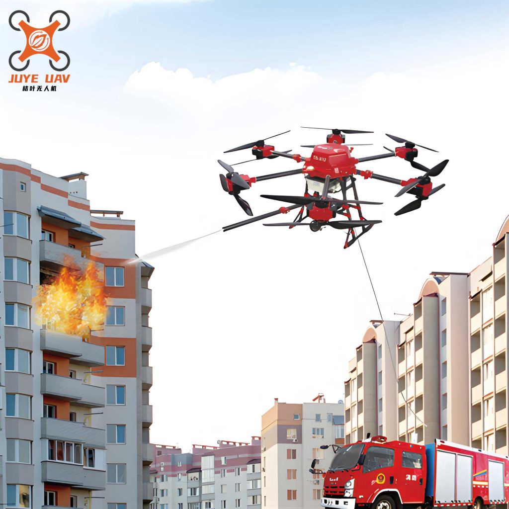
- Direct Intervention Capabilities: Beyond sensing, future fire UAV platforms may carry micro-deluge systems for targeted suppression in inaccessible areas, or focused acoustic disruptors for breaking windows in controlled-entry scenarios.
- Seamless C4I Integration: The fire UAV will become a node in an Internet of Emergency Things (IoET), where data from ground sensors, wearables, and UAVs fuse automatically to generate predictive risk models, perhaps even guiding autonomous firefighting equipment.
In conclusion, the evolution of the fire UAV from a simple flying camera to a cornerstone of modern emergency response illustrates a broader shift towards technology-augmented public safety. The measurable benefits in operational safety, situational awareness, and post-incident analysis are unequivocal. However, maximizing the return on this technological investment requires moving beyond ad-hoc acquisition. It demands a systematic framework encompassing rigorous, scenario-based training, robust and standardized technical platforms, proactive regulatory engagement, and deep integration into decision-support systems. The fire UAV is not merely an asset we deploy; it is a capability we must cultivate, integrate, and strategically evolve to meet the increasingly complex challenges of the future emergency landscape.