
The integration of unmanned aerial vehicle (UAV) technology with remote sensing (RS) principles has revolutionized environmental monitoring. In the critical domain of forest resource management, these systems, often termed fire drones when equipped for thermal and multispectral analysis, offer an unprecedented combination of flexibility, high spatial resolution, and operational efficiency. This article delves into the technical characteristics, processing workflows, and multifaceted applications of UAV-based remote sensing, with a particular emphasis on the role of advanced fire drones in sustainable forestry practices. The ability to deploy these systems rapidly for tasks ranging from detailed biomass estimation to real-time wildfire detection underscores their transformative potential.
At its core, a UAV remote sensing system for forestry comprises two main components: the aerial platform and the ground control station. The platform’s capabilities are defined by its airframe, propulsion, navigation, and sensor payload. For large-scale forest surveys, fixed-wing UAVs are predominantly used due to their superior endurance and speed, covering longer transects efficiently. The sensor suite is the heart of the system. While high-resolution RGB cameras are common for photogrammetry, modern fire drones are increasingly equipped with multispectral, thermal infrared, and Light Detection and Ranging (LiDAR) sensors to capture data beyond the visible spectrum.
The operational workflow is a structured sequence of pre-flight planning, data acquisition, and post-processing. Mission planning software is used to design the flight path, ensuring sufficient forward and side overlap (typically 70-80%) between consecutive images for accurate 3D model reconstruction. During flight, the fire drone autonomously follows the planned route while the sensor collects data. Post-flight, the collected images or point clouds are processed using specialized software to generate orthomosaics, digital surface models (DSMs), and other derived products.
| UAV Type | Typical Endurance | Key Advantage | Primary Forestry Use Case |
|---|---|---|---|
| Fixed-Wing | 60-120 minutes | Large area coverage | Regional forest inventory, canopy health mapping |
| Multirotor (e.g., Quadcopter) | 20-40 minutes | Vertical take-off/landing, high stability | Targeted plot monitoring, under-canopy inspection, post-fire assessment |
| Hybrid VTOL | 45-90 minutes | Combines endurance of fixed-wing with vertical take-off | Operations in complex terrain without runway |
Extracting Forest Structural Parameters
One of the most significant contributions of UAV technology is the high-resolution, on-demand derivation of forest structural parameters. From the generated high-density point clouds and orthomosaics, detailed metrics can be extracted automatically or semi-automatically.
Canopy Height Model (CHM) and Tree Height: A fundamental product is the Digital Terrain Model (DTM), representing the ground surface, and the Digital Surface Model (DSM), representing the top of the canopy. The CHM is derived by subtracting the DTM from the DSM: $$CHM(x,y) = DSM(x,y) – DTM(x,y)$$. Individual tree heights can then be extracted by locating local maxima within the CHM. The accuracy is exceptionally high in open and moderately dense forests.
Crown Delineation and Density: Using object-based image analysis (OBIA) or marker-controlled watershed segmentation on the CHM or orthomosaic, individual tree crowns can be delineated. Crown area (\(A_c\)) is a critical parameter strongly correlated with stem diameter at breast height (DBH) and tree vigor. Stand-level metrics like crown cover or canopy closure (\(C\)) can be calculated as: $$C = \frac{\sum_{i=1}^{n} A_{c_i}}{A_{total}} \times 100\%$$ where \(n\) is the number of trees in the plot and \(A_{total}\) is the total ground area.
| Parameter | Extraction Method | Typical UAV Sensor | Key Formula/Process |
|---|---|---|---|
| Tree Height | Local max search in CHM | RGB (Photogrammetry) or LiDAR | \(H_{tree} = \max(CHM_{within\_crown})\) |
| Crown Diameter/Area | OBIA Segmentation | RGB | \(A_c = \pi \times (r_{eff})^2\); \(r_{eff}\) from fitted polygon |
| Stem Density | Individual Tree Detection (ITD) | RGB or LiDAR | \(D = N / A_{plot}\) (stems per hectare) |
| Basal Area | From DBH estimated via crown area allometry | RGB | \(BA = \sum \pi \times (DBH_i/2)^2\) |
Biomass Estimation and Carbon Stock Assessment
Quantifying forest biomass is vital for ecological studies and carbon credit markets. UAVs bridge the gap between labor-intensive field plots and coarse-resolution satellite data. The process often involves a two-step allometric approach. First, tree-level attributes (height, crown area) from UAV data are used to estimate DBH using species-specific or generalized allometric models: $$DBH_{est} = \alpha \times (A_c)^\beta + \epsilon$$. Second, the estimated DBH is fed into established biomass equations to calculate above-ground biomass (AGB): $$AGB_{tree} = a \times (DBH_{est})^b$$. For broader areas, vegetation indices (VIs) derived from multispectral sensors on fire drones can be correlated with field-measured biomass to create continuous prediction maps. Indices like the Normalized Difference Vegetation Index (NDVI) or the Visible-band Difference Vegetation Index (VDVI) are common: $$VDVI = \frac{(2 \times G_{\text{reen}} – R_{\text{ed}} – B_{\text{lue}})}{(2 \times G_{\text{reen}} + R_{\text{ed}} + B_{\text{lue}})}$$.
Forest Health and Pest/Disease Monitoring
Early detection of forest stress is crucial for effective management. The high spectral and spatial resolution of UAV sensors makes them ideal for detecting subtle changes in canopy physiology often associated with pest outbreaks, fungal diseases, or drought stress. A fire drone equipped with a multispectral sensor can identify areas of reduced photosynthetic activity before they become visible to the naked eye.
By analyzing specific spectral bands, stress indices can be computed. For instance, the Normalized Difference Red Edge Index (NDRE) is sensitive to chlorophyll content in mature leaves and can indicate nitrogen deficiency or early-stage disease: $$NDRE = \frac{(NIR – RedEdge)}{(NIR + RedEdge)}$$. Supervised or unsupervised classification algorithms can then be applied to the mosaic of stress indices to map the spatial extent and severity of infestation. This allows for targeted intervention, minimizing chemical use and protecting non-affected areas.
Wildfire Management: The Pivotal Role of Fire Drones
Perhaps the most dramatic application is in wildfire management, where the term fire drone finds its most direct relevance. These systems are deployed across the wildfire cycle: prevention, active response, and post-fire assessment.
Pre-Fire Risk Assessment: UAVs equipped with LiDAR can create detailed 3D maps of fuel load (density of underbrush, ladder fuels) and canopy structure, which are critical inputs for fire behavior models. This helps in planning fuel reduction treatments.
Active Fire Detection and Monitoring: This is a critical real-time application. Thermal infrared cameras on fire drones can detect hotspots through smoke, day or night. Advanced algorithms process the thermal video stream to automatically identify pixel clusters with anomalously high temperatures. A simple thresholding algorithm can be expressed as: $$FirePixel(T(x,y)) = \begin{cases} 1 & \text{if } T(x,y) > T_{background} + \Delta T_{threshold}\\ 0 & \text{otherwise} \end{cases}$$ where \(T(x,y)\) is the temperature of a pixel, and \(T_{background}\) is the estimated ambient temperature of non-burning vegetation. The geolocated coordinates of these fire pixels are relayed to incident command in real-time, providing crucial intelligence on fire perimeter, spread direction, and spot fires.
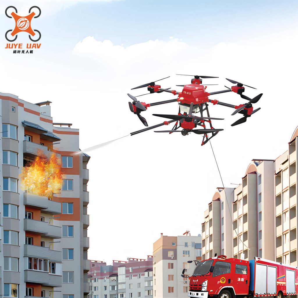
Post-Fire Burn Severity Mapping: After a fire, multispectral fire drones are used to map burn severity. The difference in vegetation indices (like dNBR – differenced Normalized Burn Ratio) pre- and post-fire quantifies the ecological impact, guiding rehabilitation efforts. $$NBR = \frac{(NIR – SWIR)}{(NIR + SWIR)}; \quad dNBR = NBR_{prefire} – NBR_{postfire}$$.
| Fire Phase | UAV Sensor | Key Data Product | Decision Support Output |
|---|---|---|---|
| Pre-Fire (Risk) | LiDAR, Multispectral | 3D Fuel Model, Moisture Maps | Priority zones for controlled burns or clearance |
| During Fire (Response) | Thermal, RGB | Real-time Hotspot Map, Fire Perimeter, Spread Vector | Tactical deployment of ground crews, aerial tankers |
| Post-Fire (Assessment) | Multispectral, RGB | Burn Severity Index Map (e.g., dNBR) | Rehabilitation planning, erosion control, carbon loss audit |
Operational Advantages and Integration with Geospatial Technology
The advantages of UAVs over traditional methods are manifold. They provide data with centimeter-level resolution at a fraction of the cost and time of manned aircraft surveys. Their operational flexibility is unmatched; a fire drone can be launched within minutes in response to a wildfire report, unlike satellites which are constrained by overpass schedules. They also eliminate the safety risks associated with manned flights in smoky, turbulent fire environments or over difficult terrain.
True power is realized through the integration of UAVs with the broader geospatial technology stack—the “3S” integration of Remote Sensing (RS), Global Navigation Satellite System (GNSS like GPS), and Geographic Information Systems (GIS). The UAV platform is the RS data collector, precisely geotagged using GNSS. This data is then processed and analyzed within a GIS, where it can be combined with other spatial layers (topography, ownership, infrastructure) for comprehensive analysis and decision-making. This synergy enables, for example, predicting fire spread by combining a UAV-derived fuel map with slope and wind data in a GIS-based fire model.
Future Directions and Conclusion
The future of UAVs in forestry is oriented towards greater autonomy, enhanced sensor fusion, and improved data processing throughput. Swarm robotics, where multiple fire drones coordinate to cover vast areas simultaneously, is an emerging frontier. The miniaturization of sensors like hyperspectral imagers and solid-state LiDAR will unlock even more detailed biochemical and structural analyses. Furthermore, the direct integration of real-time processing algorithms onboard the UAV—so-called “edge computing”—will enable the instantaneous transformation of raw sensor data into actionable alerts, such as immediate fire detection or pest outbreak warnings.
In conclusion, UAV remote sensing, and specifically the advanced capabilities of modern fire drones, represents a paradigm shift in forest resource monitoring. By providing frequent, high-resolution, and multi-dimensional data on forest structure, health, and threats, these systems empower managers with precise information for conservation, sustainable utilization, and climate change mitigation. As technology continues to advance, the role of the intelligent fire drone will undoubtedly expand, becoming an indispensable tool in the global effort to protect and manage our vital forest ecosystems.